|
(“Thank you” #coronavirus for making me #stayathome and giving me time to finally prepare this blog! Thank you also for reminding me how awful you are and how good we used to have it! We all look forward to you being gone!) When one of our old friends from flight school announced he would get married in the Bahamas in February of 2020, my husband and I immediately agreed that we would fly GA there. It was too good of an excuse to pass up. We had flown to the Bahamas in 2016 and LOVED it. We were excited to do it once again and visit different islands. That 2016 trip was summarized in the "Island Hopping in the Bahamas” blog (https://airtrails.weebly.com/bahamas/island-hopping-in-the-bahamas2676638). While the main focus of the trip was attending the wedding, we also wanted to make it a vacation by visiting a couple of other islands, visiting the groom and bride in Pompano Beach where they live, and, why not, working a little by teaching a Rusty Pilots seminar for AOPA in Plant City on the way down. The timing could not have worked better! Trip preparation was not quite as exhaustive as it was for the first time around. We already knew what to expect and we had most of the things we needed from last time. So, to learn more about trip preparation, refer to the first Bahamas blog. However, I can tell you everything was much easier this time. Here are some reasons why and some other thoughts from the trip:
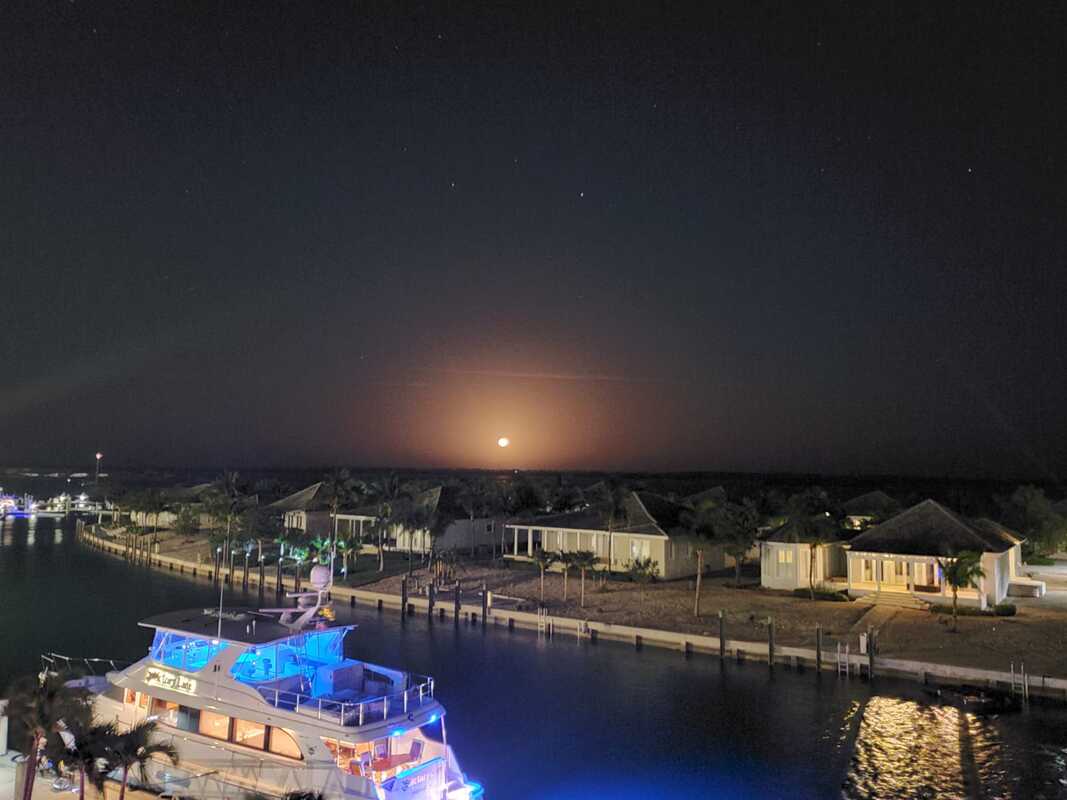
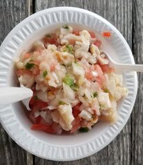
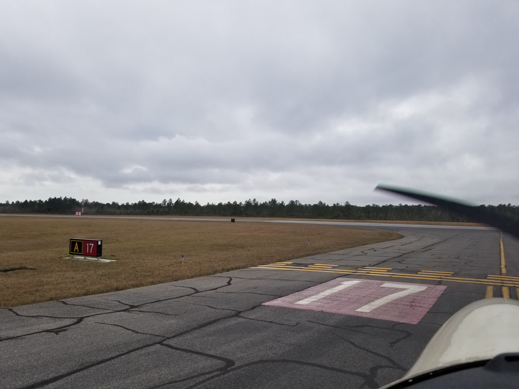
Our initial plan was to visit the Abaco’s before arriving in Eleuthera, but Hurricane Dorian had different plans. Since the Abaco’s were destroyed by the Hurricane, we changed plans to visit Bimini and Great Harbour Cay on the way to Governor’s Harbour. Not booking lodging until the day before arriving has its down sides. While Bimini has a big Hilton with plenty of availability (and we could use points!), Great Harbour does not have many hotels and the only AirBnb we found was more expensive than we wanted it to, so we decided to visit more of Eleuthera instead. With the original plan, we would have only visited the middle section of the island. With this new plan, we would visit it in its entirety and the southern tip of the island actually sounded perfect for us: remote, wild, and with beautiful beaches and other things to explore (such as caves). Deal! Here is an overview, in ForeFlight, of the route we ended up flying and our happy faces: 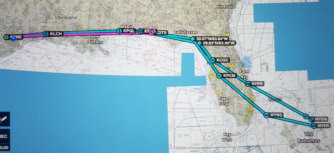  The weather and winds aloft (sometimes giving us a ground speed of 150-160 knots) to the final destination (MYEM – Governor’s Harbour) were awesome as you can see by our times in the summary table below! We weren’t quite as lucky on the return, with headwinds, low ceilings, fog, and rain cells the entire way back from Fort Pierce on… 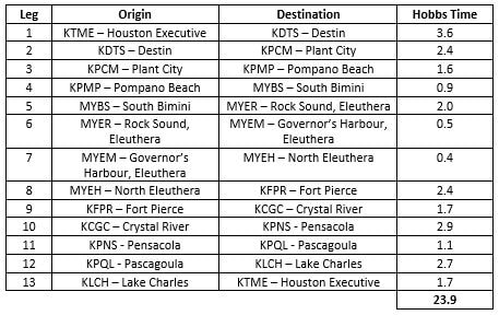 Leg 1: Houston, TX (KTME) to Destin, FL (KDTS) Hubby and I are always happy to stop in Destin and, this time, it was a great first stop based on trip planning and rumbling stomachs. The “seafood diet” started right away… with a yummy lunch on the beach.  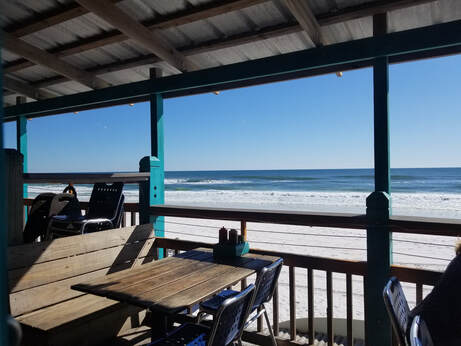 Leg 2: Destin, FL (KDTS) to Plant City, FL (KPCM)
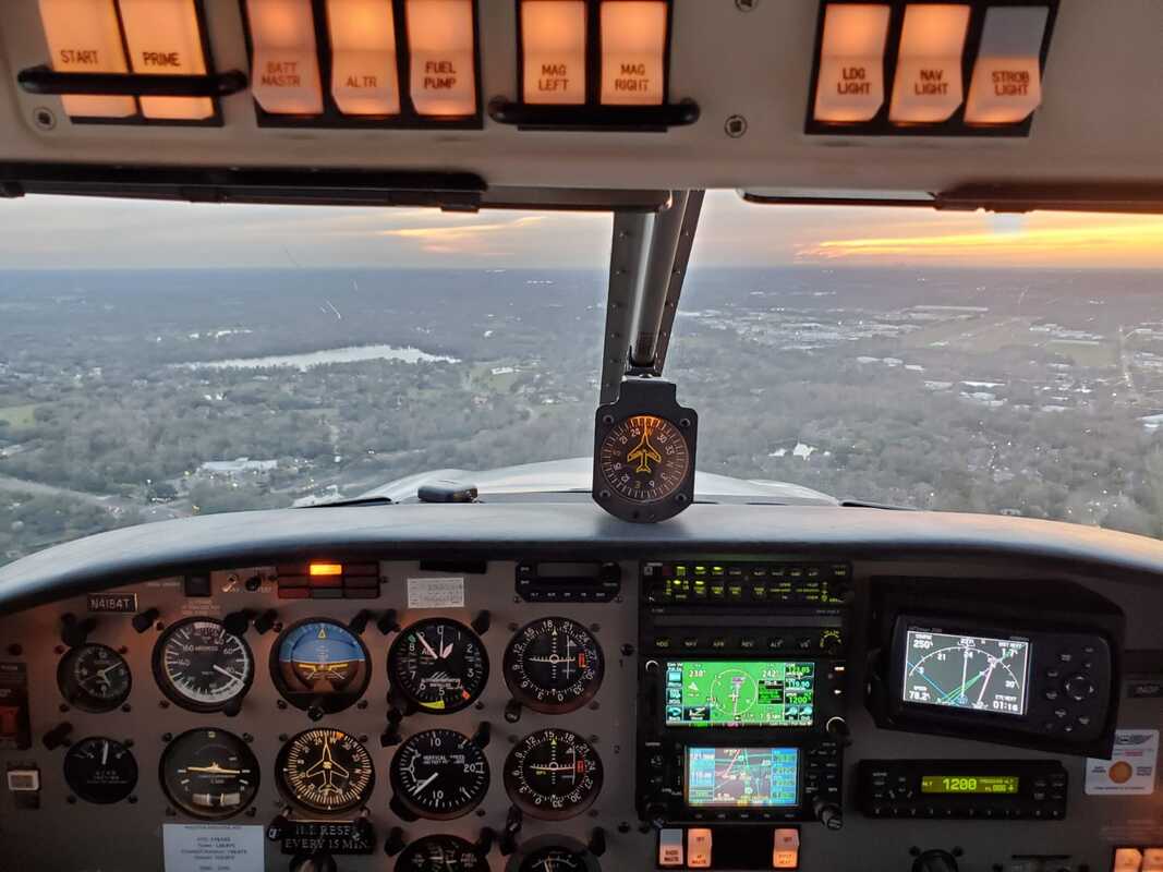
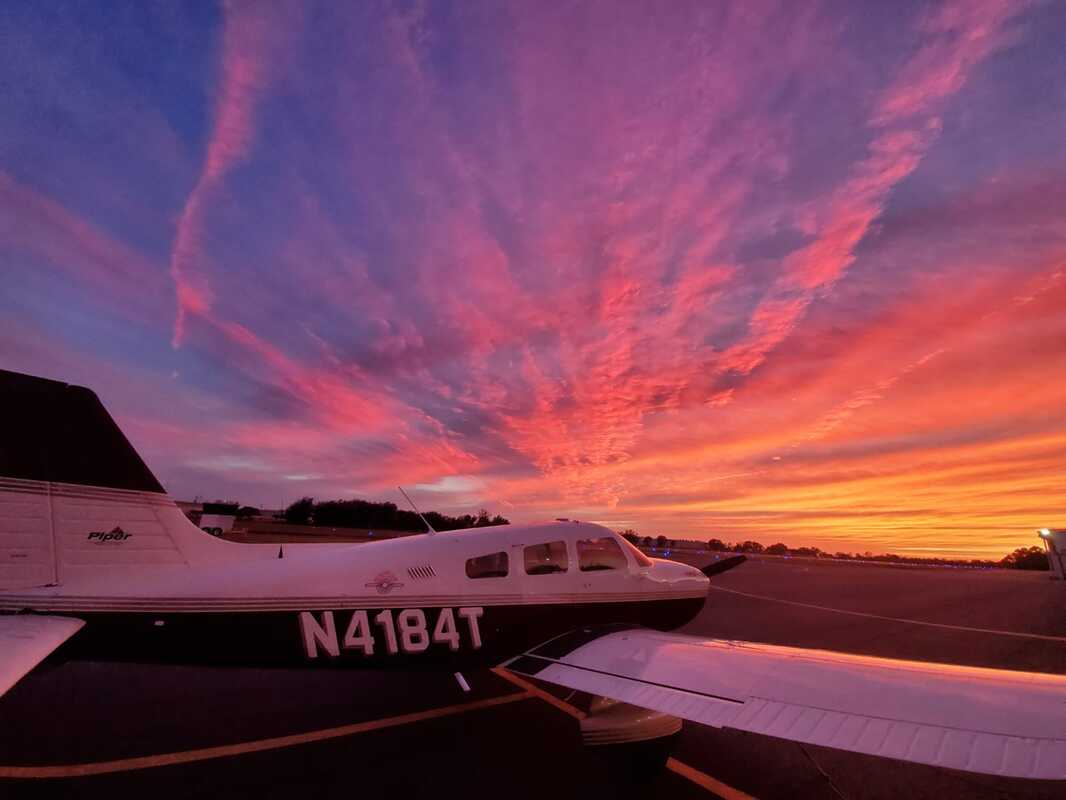
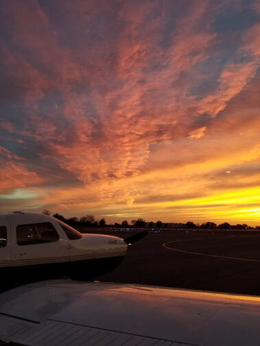
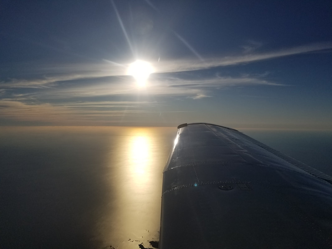
The sunsets on the way to and upon arrival at Plant City (known for its strawberry festival) were the absolute best of the trip. While these pictures are pretty good, just imagine what it had to be like in person! On one side... ...and on the other...
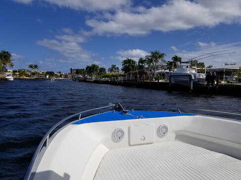
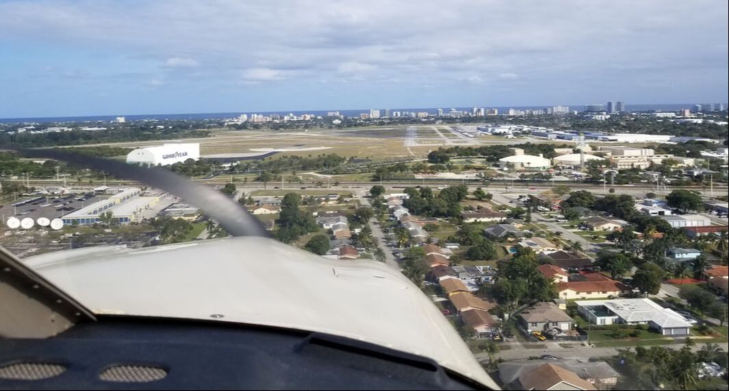
   Leg 3: Plant City, FL (KPCM) to Pompano Beach, FL (KPMP) After a successful Rusty Pilots seminar in Plant City with our 25 attendees, we were enroute to Pompano Beach for two fun days of sun, boating, wedding prepping, good meals and, mostly, great company. 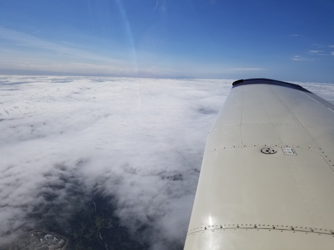
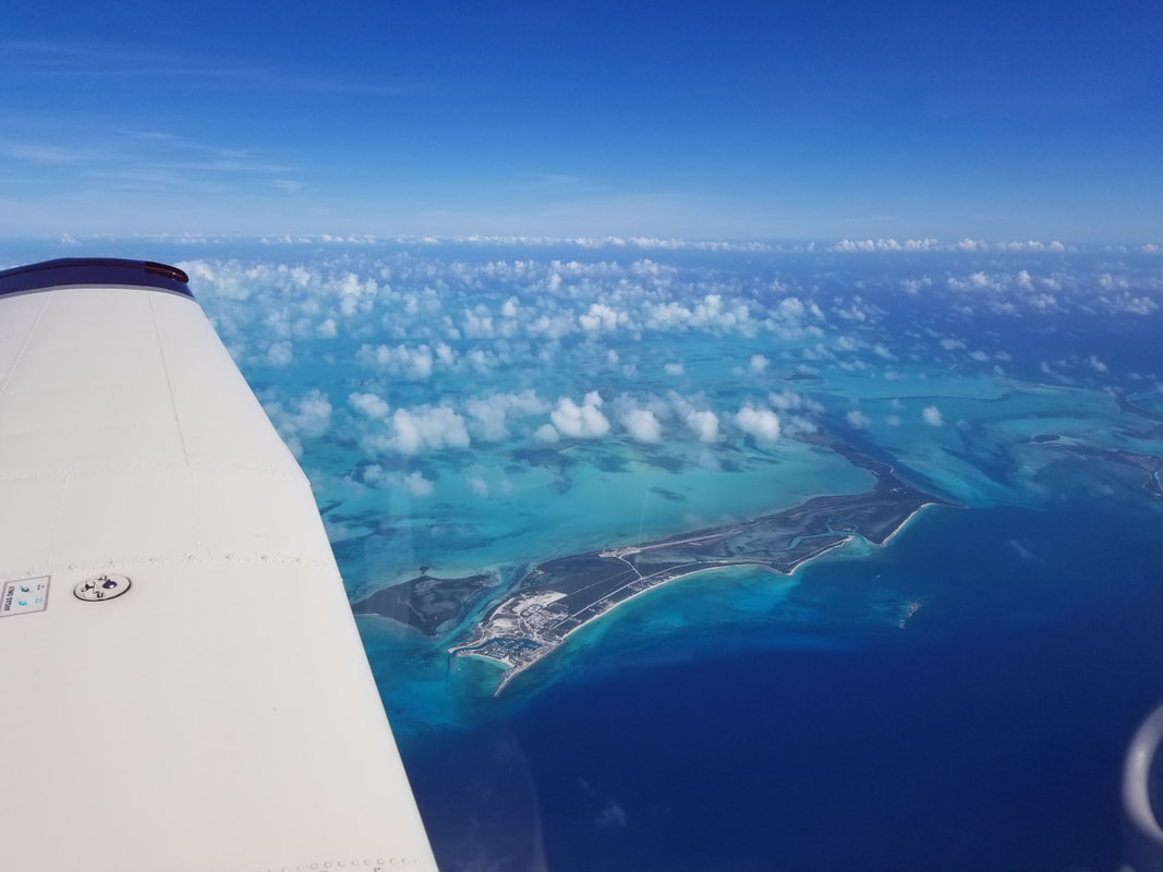
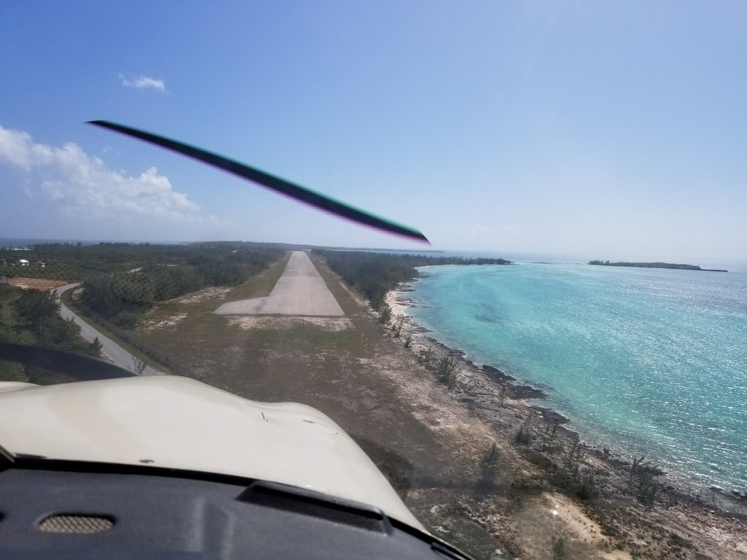
 Leg 4: Pompano Beach, FL (KPMP) to South Bimini, Bahamas (MYBS) And the international crossing arrived… Bimini offers the quickest, shortest jump from the Florida coast. Because of that, it also attracts a lot of personal boats. The flight was 67 NM long for us, “door to door.” We spent more time climbing and descending than at the filed altitude of 7,000 feet. 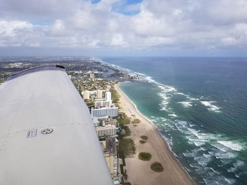 Approaching Bimini below: 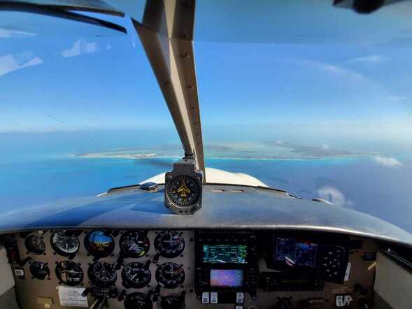 Long base to final after checking out the island: 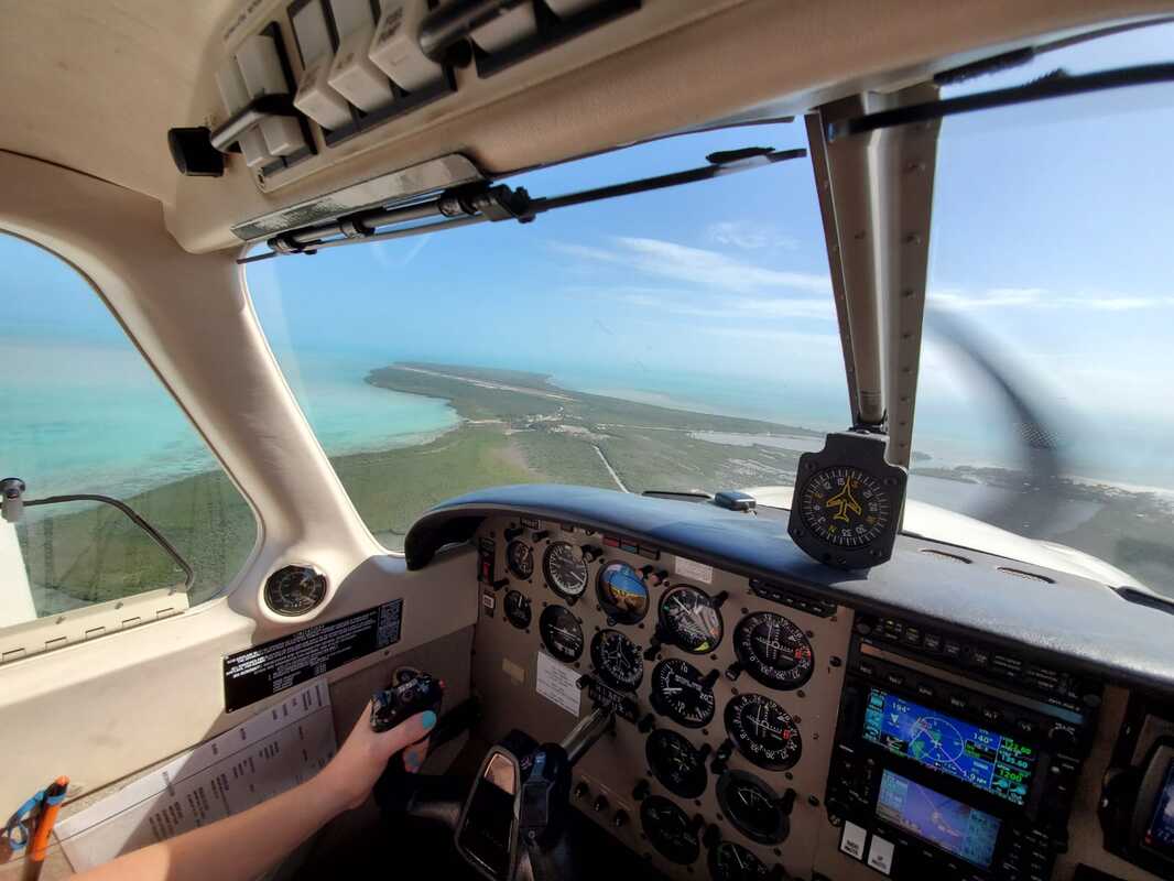 The normal condition of runways in the Bahamas: 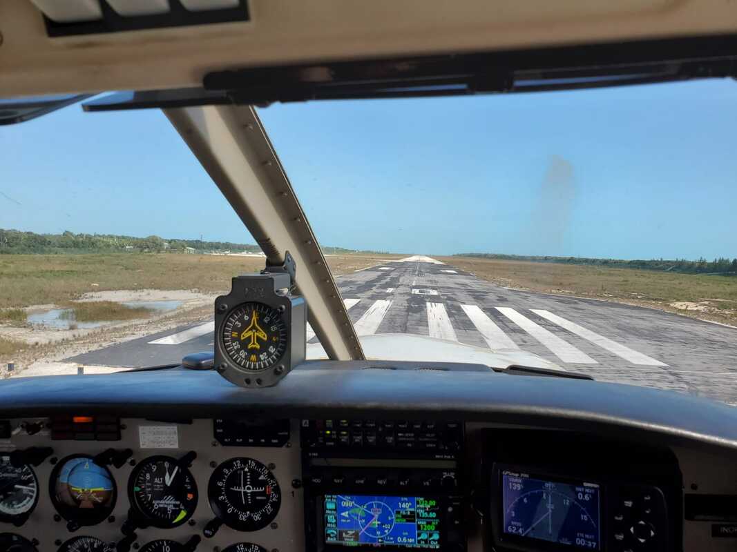 Clearing Customs and immigration, paying the $50 inbound fee, and obtaining our ferry permit in Bimini was easy. They did not charge us any landing, parking, or security fees and they don’t sell fuel. Bimini is divided into two islands. The Airport is on the southern island while most everything else is on the northern island, from Alice Town to the Hilton resort. It cost us $8/person to get from the Airport to the Hilton ($3 for the ferry and $5 for the taxi). Once we dropped off the luggage, we rented bicycles to get around the island. The areas to visit are not big and the island is almost completely flat so it’s easy to get around with bicycles although golf carts appeared to be more popular among tourists. Radio Beach is said to be the best beach they have but the Hilton’s beach is just as good and it’s more secluded. We also saw multiple stingrays in its water. I particularly enjoyed the rocky around by Radio Beach. It was absolutely beautiful and it was shaded! 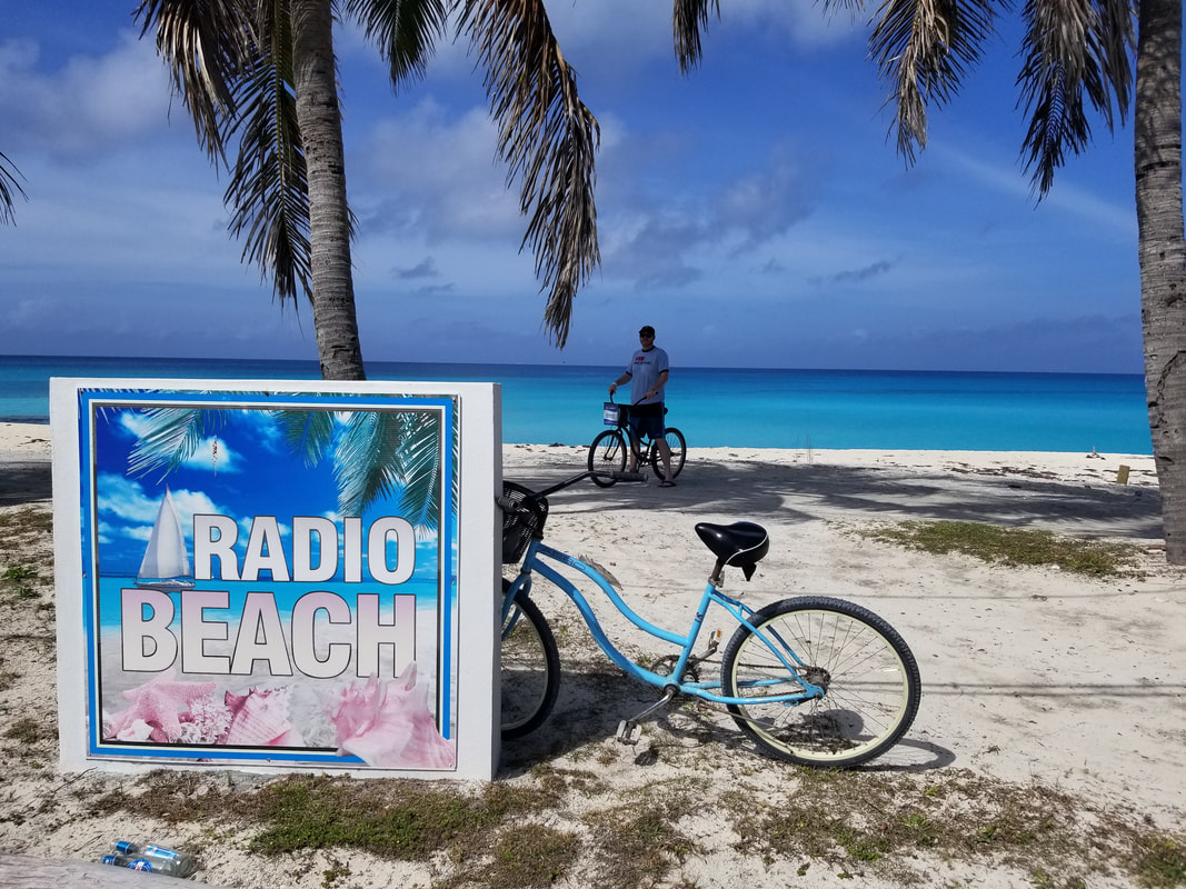 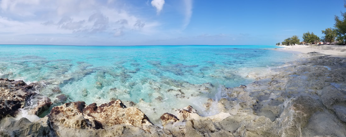
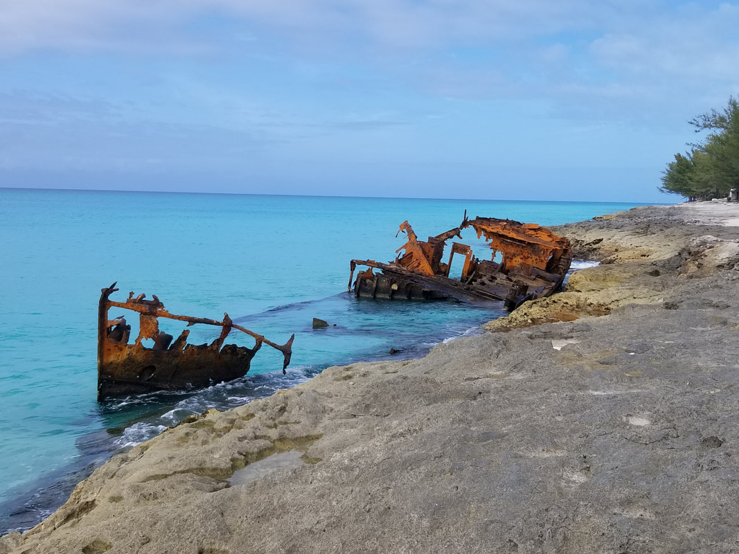
We also enjoyed going to the southern tip where we knew we would see one shipwreck although, in fact, we saw two. The one we were expecting plus a boat that would become another shipwreck in a matter of days. Oops! A fishing boat ran into a sandbar and was noticeably sinking.
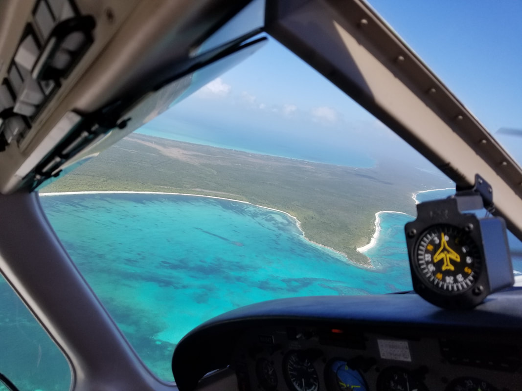
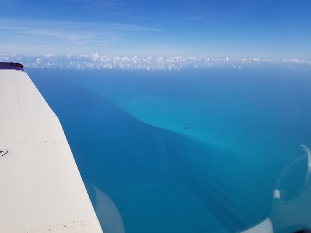
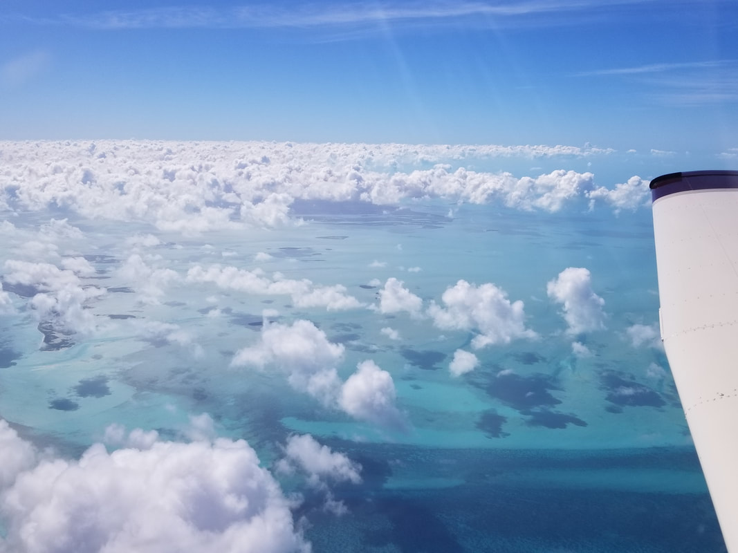
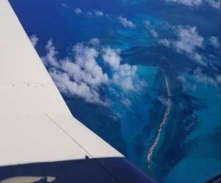
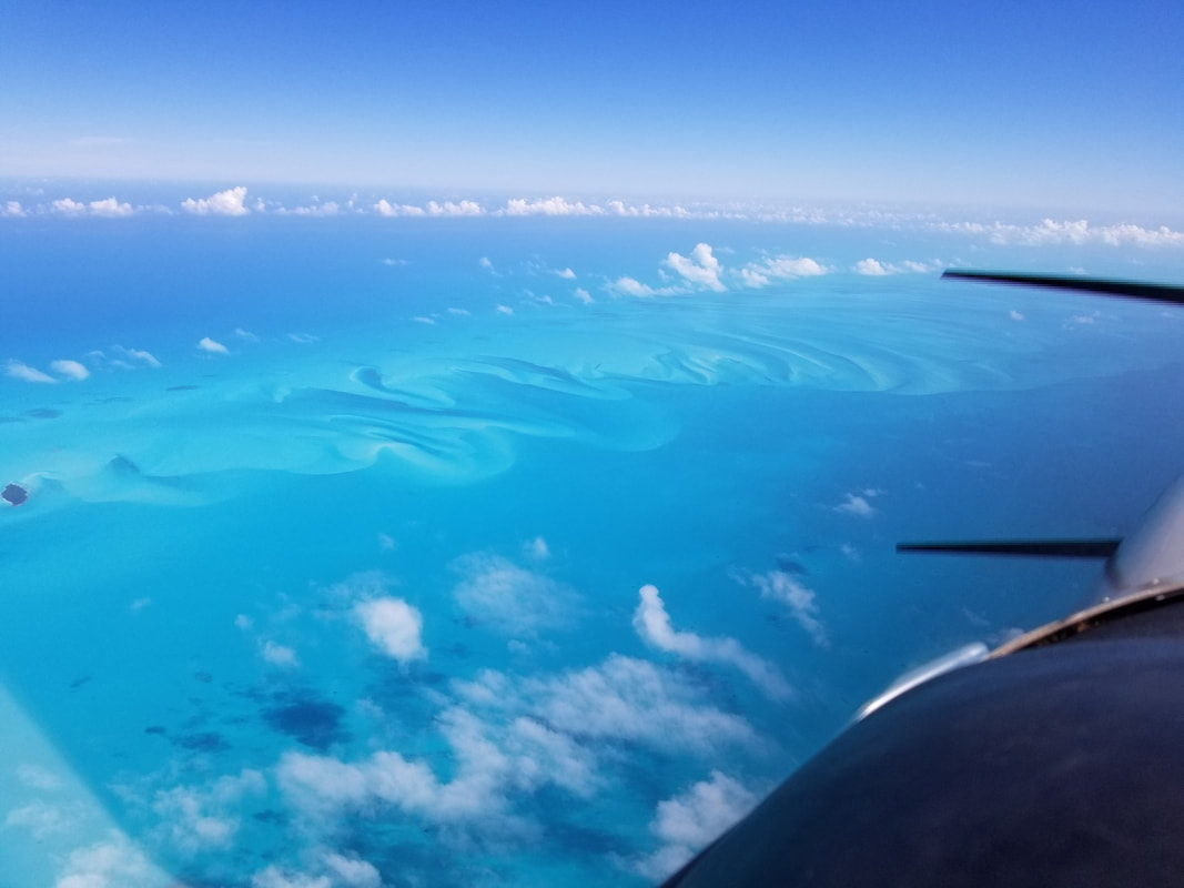
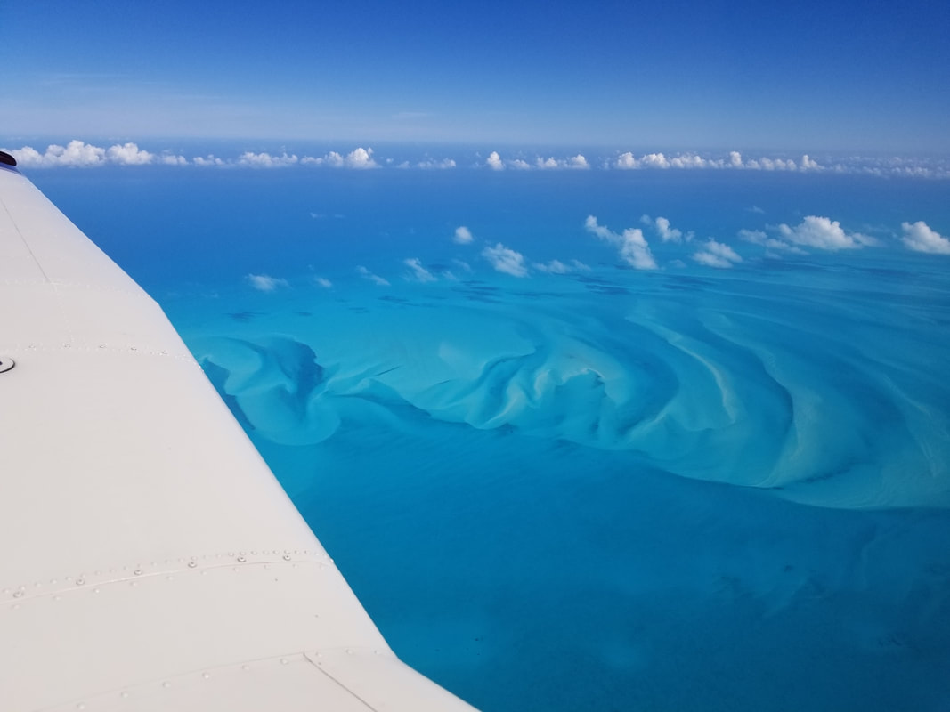
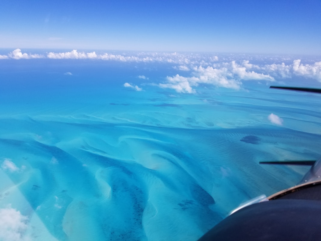
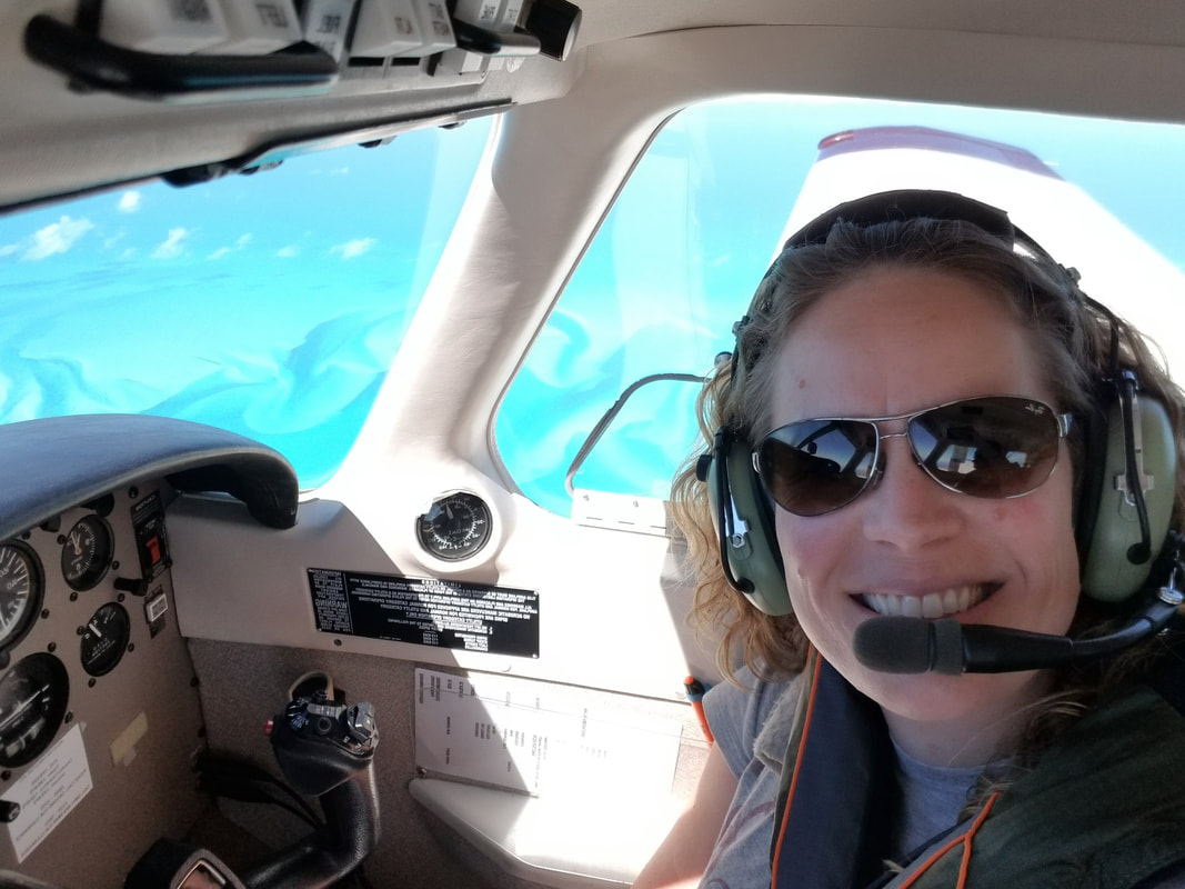
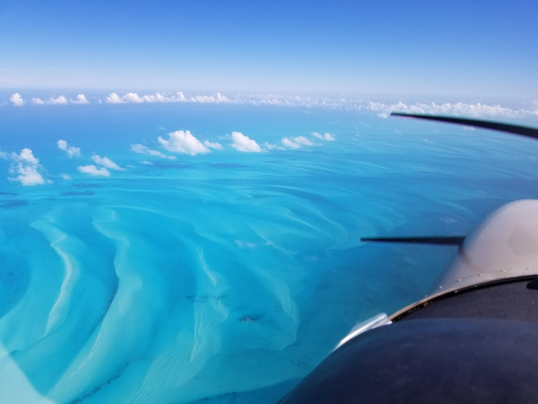
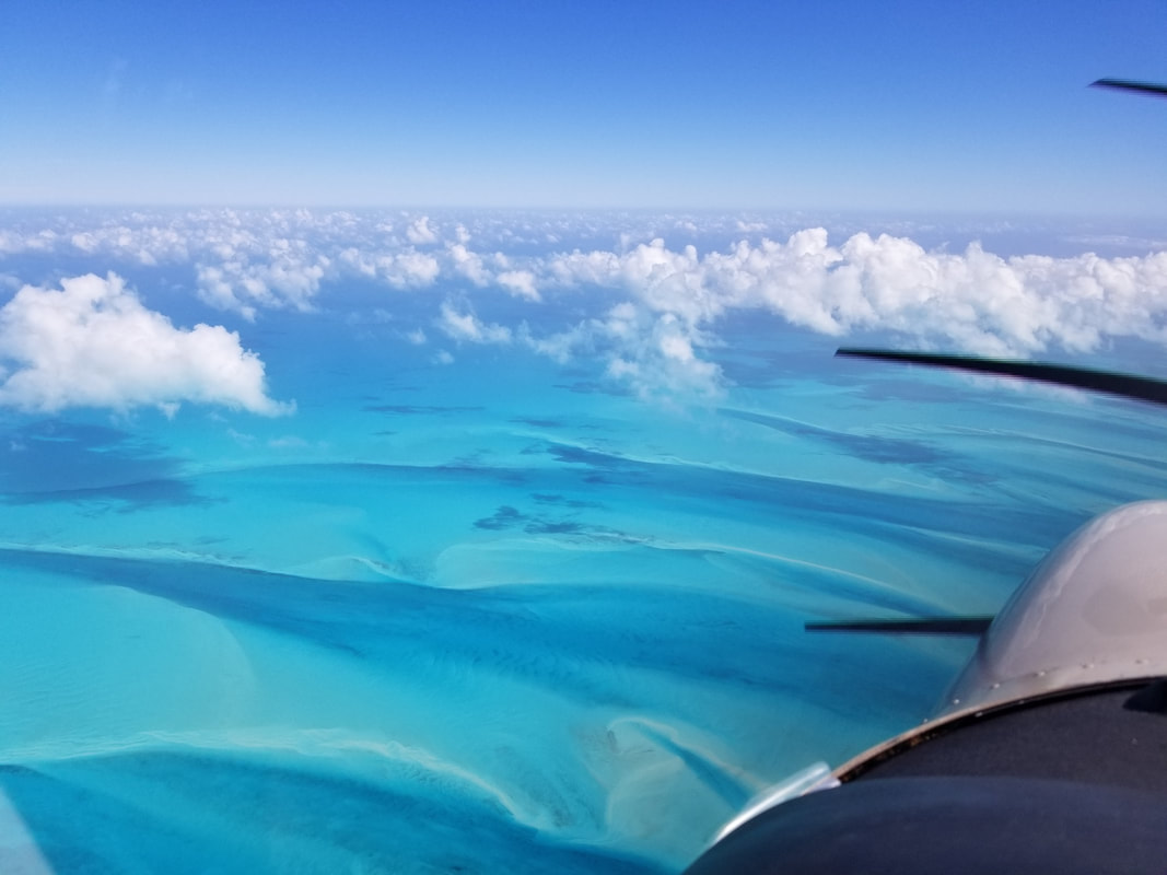
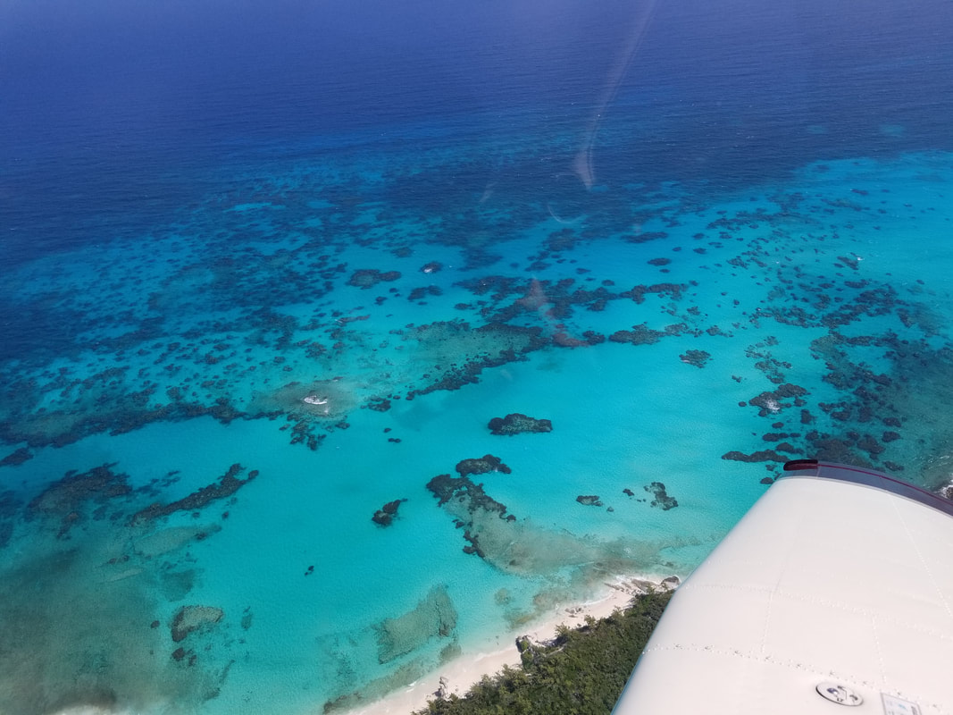
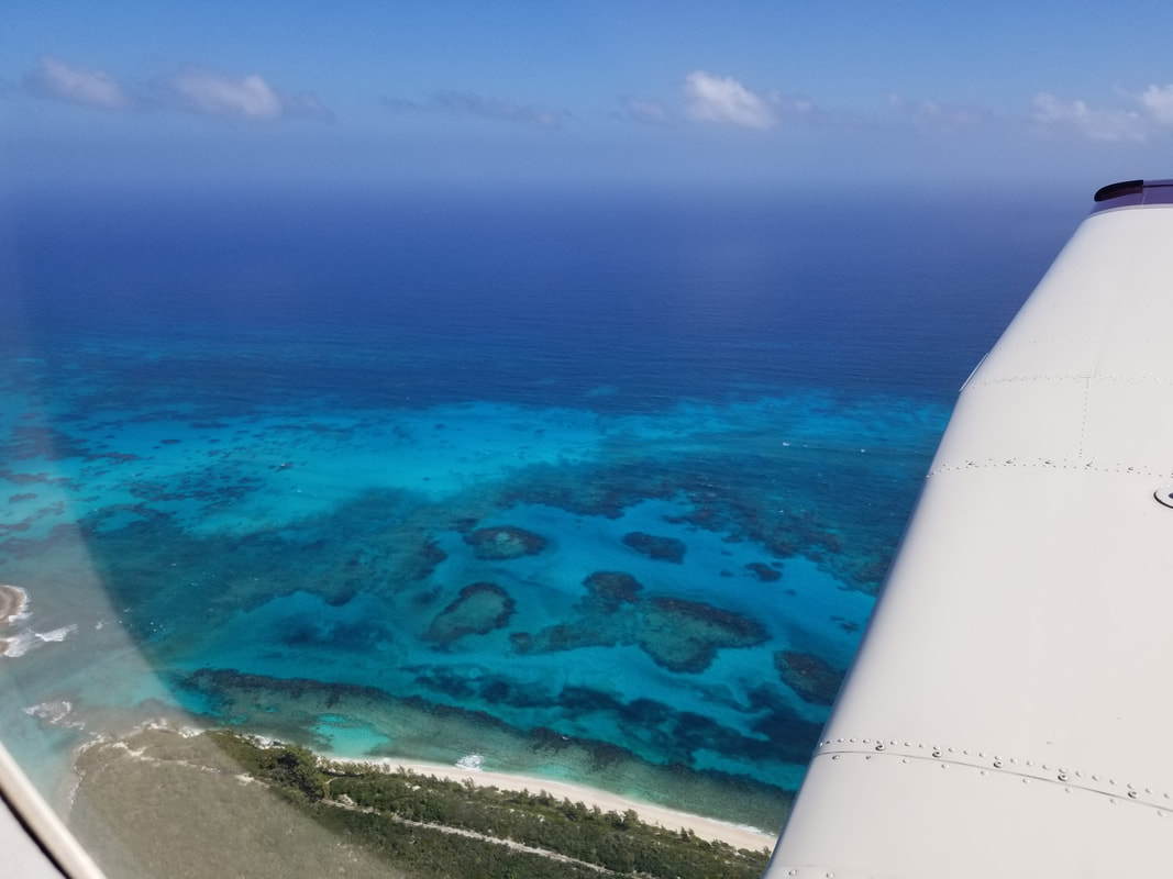
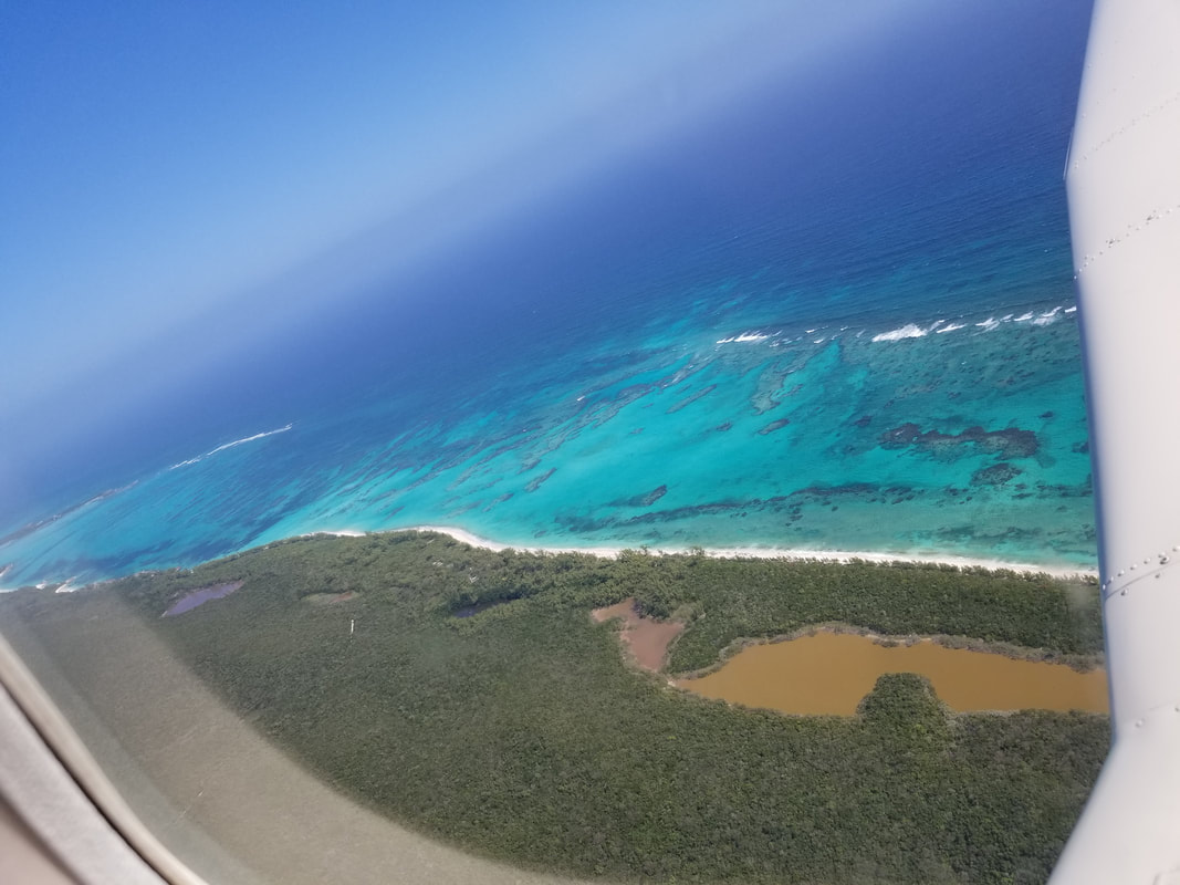
Leg 5: South Bimini (MYBS) to Rock Sound, Eleuthera (MYER) Some of the things we get to see from the air are just simply spectacular. Nature is truly stunning and unbelievable. Here are some examples:
Seeing Chub Cay, Big Whale Cay, and Little Whale Cay on our left side. All private but good alternates.
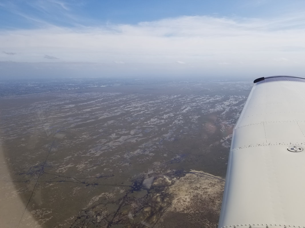
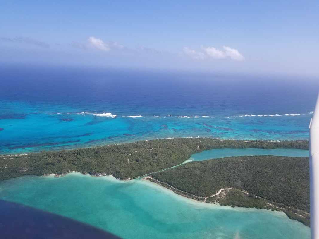
And, then, as we approached South Eleuthera, we started to see the most beautiful and unexpected “sand art.”
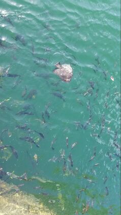
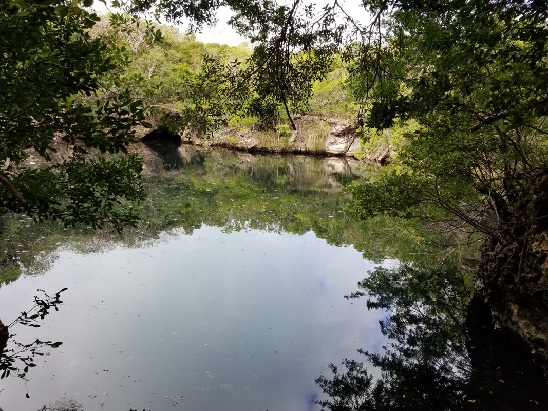
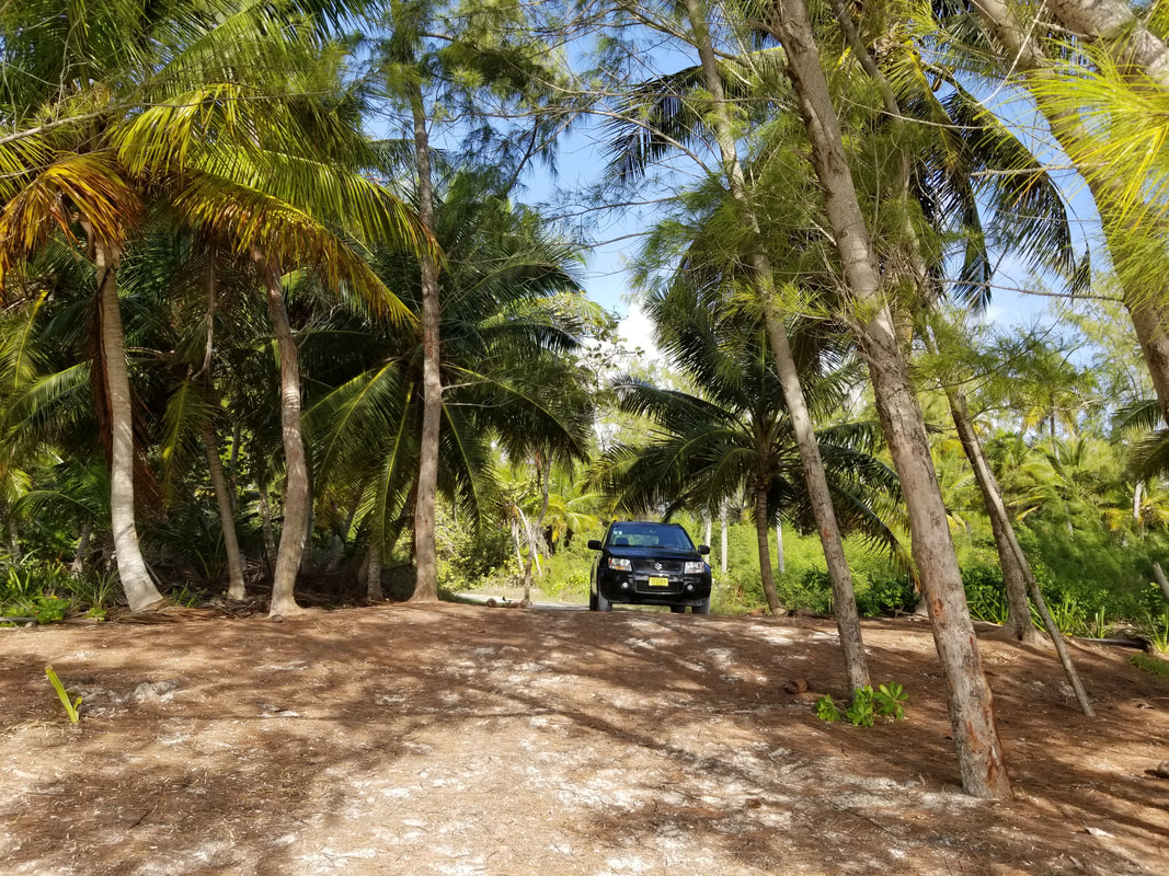
Everything is really spread out in Eleuthera so renting a car is the way to go. And, yes, you end up driving American cars from the left side of the road sometimes. You think flying there is hard!? Try driving once there, ha! We rented a nice AirBnb right in Rock Sound! It was within walking distance from the Ocean Hole, one of Eleuthera’s many blue holes. This one is more than 600 feet deep and, because of its somewhat salty water with high mineral and Sulphur content, it is believed to have healing powers. It also has a rich fish life. We did not swim or snorkel with them but we did feed them some bread and they seemed appreciative. 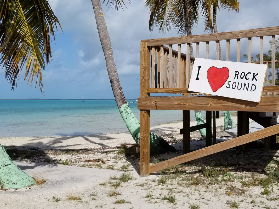 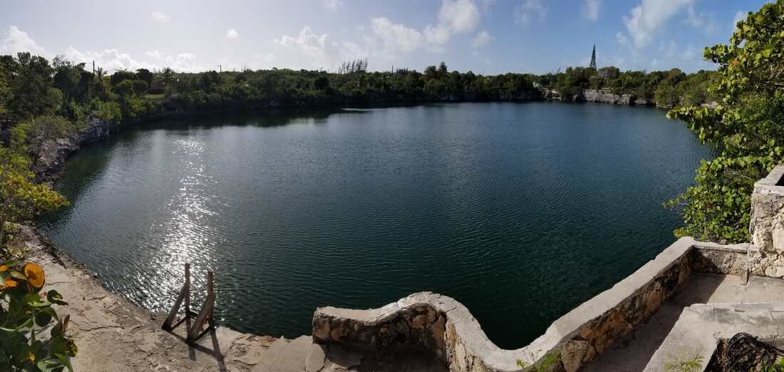
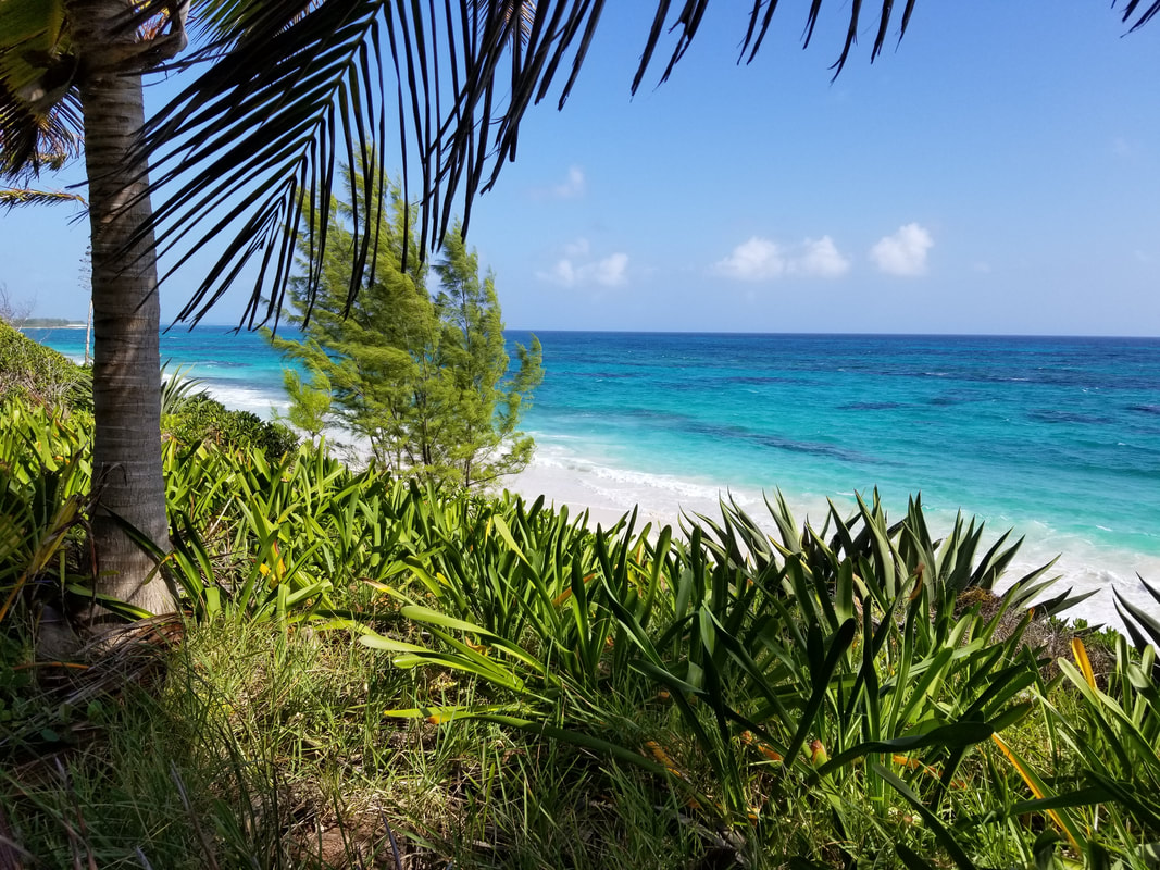
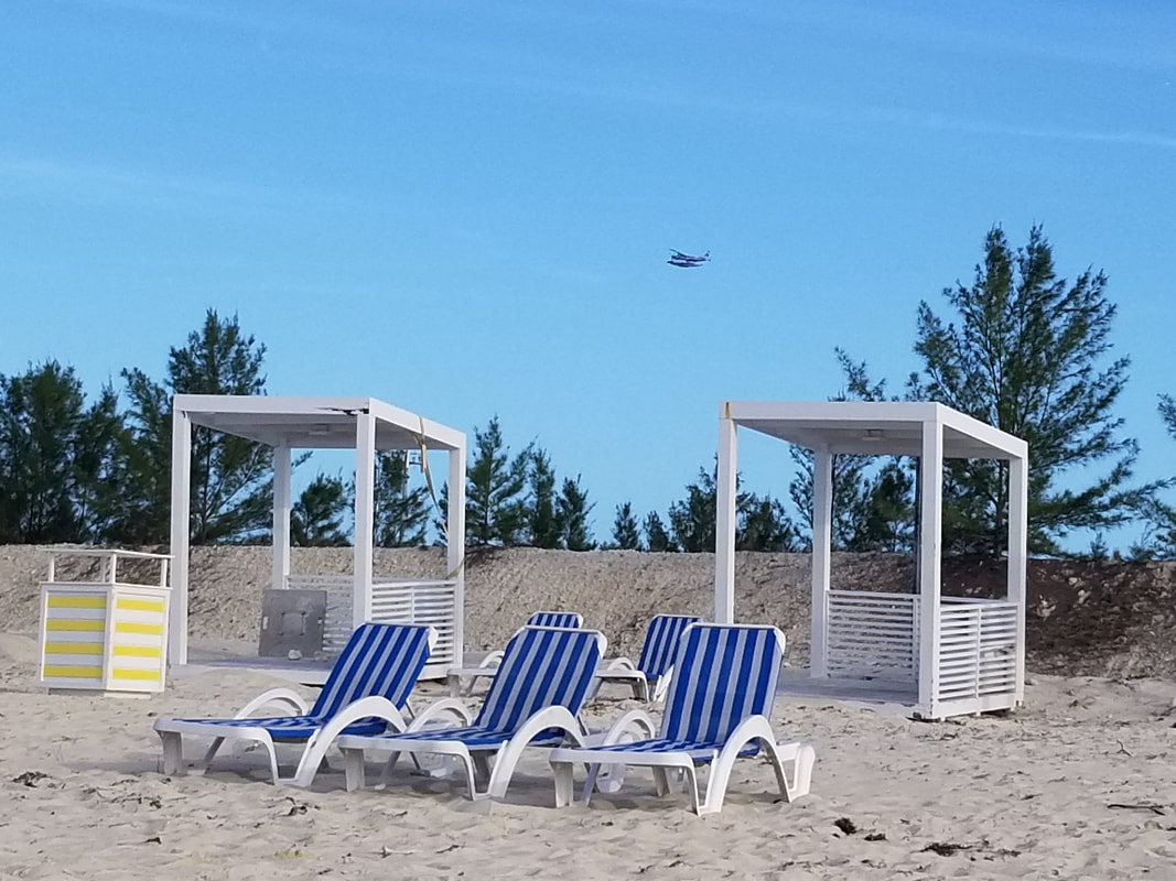
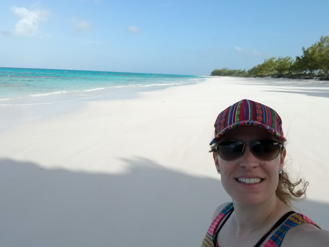
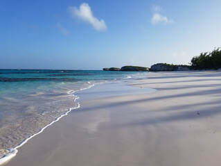
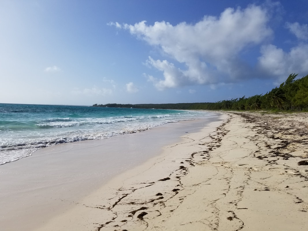
Friends recommended visiting Lighthouse Point. They said it had some of the best beaches in the Bahamas and they weren’t wrong. Take a look for yourself and you should also know that getting there was half the fun!
 Be aware, we joined a Gulfstream owned by Disney on the Airport’s ramp. Disney Cruise Lines is going to build a resort down there. You better get to Lighthouse Point before they do: https://lighthousepointbahamas.com/! We already saw a cruise liner in the distance while there but we knew we were safe because there was no place for them to dock. 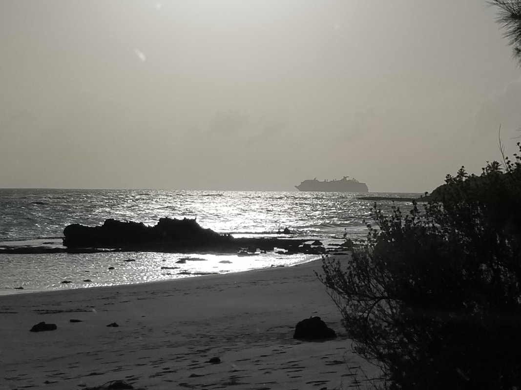 We also enjoyed visiting the Boiling Hole, another blue hole that connects with the sea through a network of underground caves and, therefore, bubbles and churns with the movement of ocean tides.
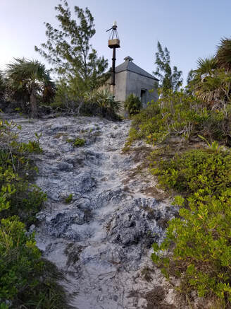
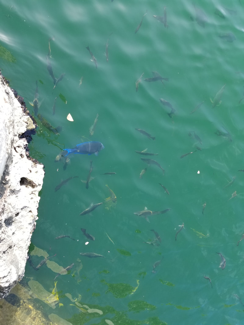
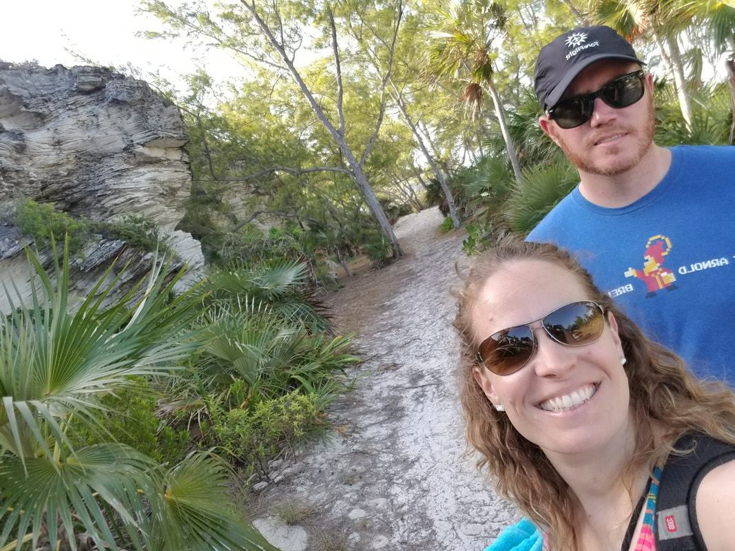
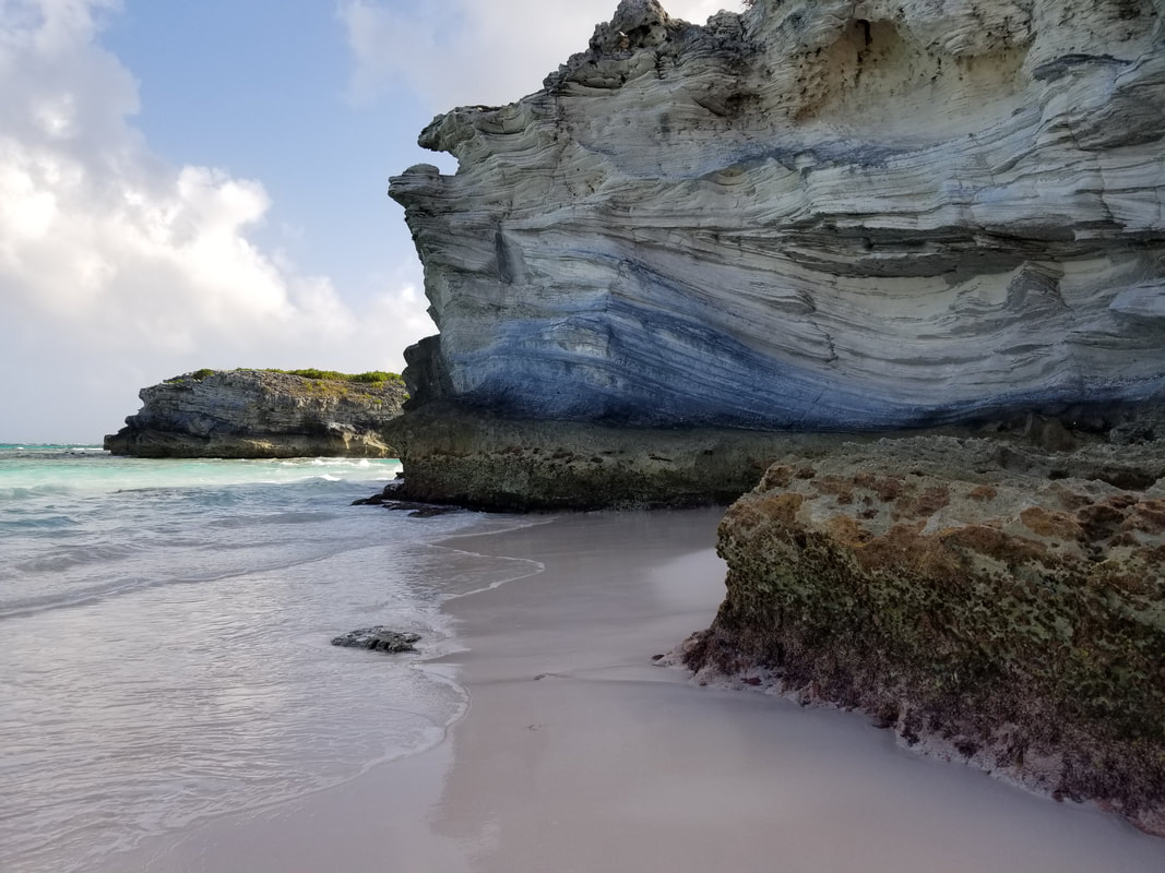
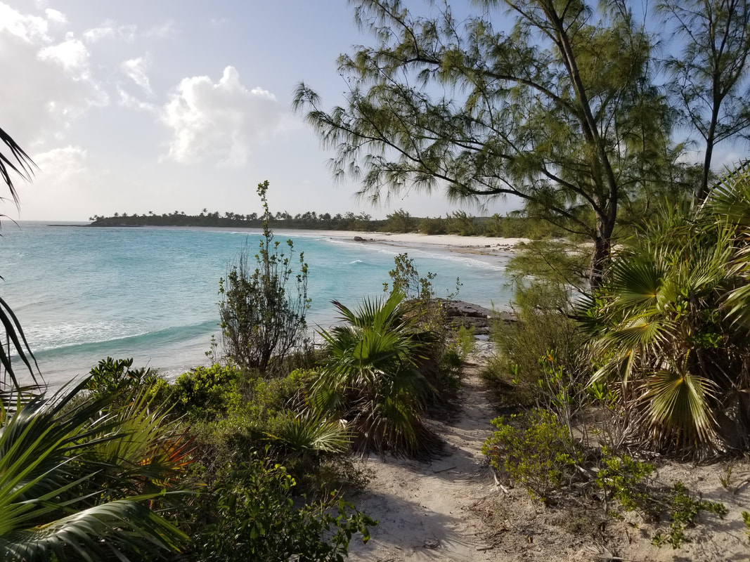
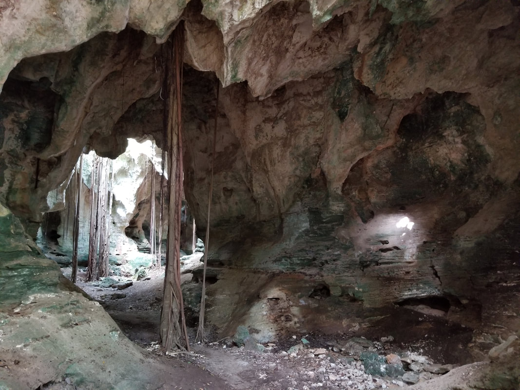
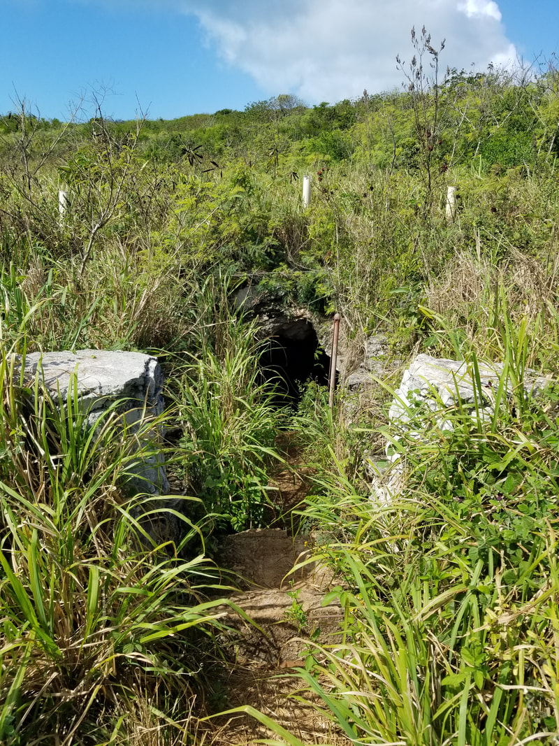
We really did enjoy Rock Sound’s remoteness. We enjoyed exploring places that did not have signs, businesses, or people. Here are some examples:
 We did not have to pay any fees at MYER and they don’t have fuel but they have the friendliest of the people. They were great letting us in and out and helped us get a rental car. Leg 6: Rock Sound, Eleuthera (MYER) to Governor’s Harbour, Eleuthera (MYEM) 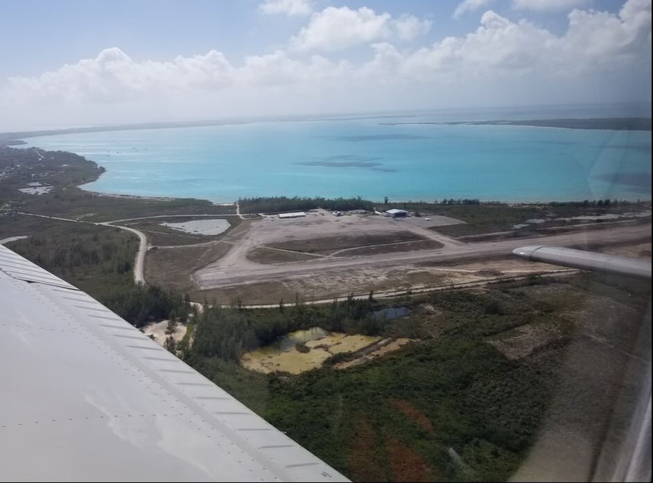 What was supposed to be the trip’s shortest leg (25 NM) also had some of the most beautiful sights… In addition to seeing the “sand art” again, we also saw lots of reefs.
 The Governor’s Harbour Airport was fairly busy when we got close it considering it only has a single runway without a parallel taxiway. We landed in between business jets. 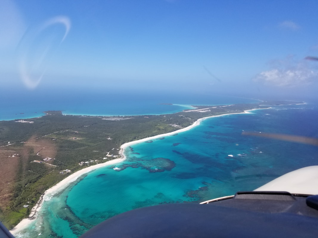 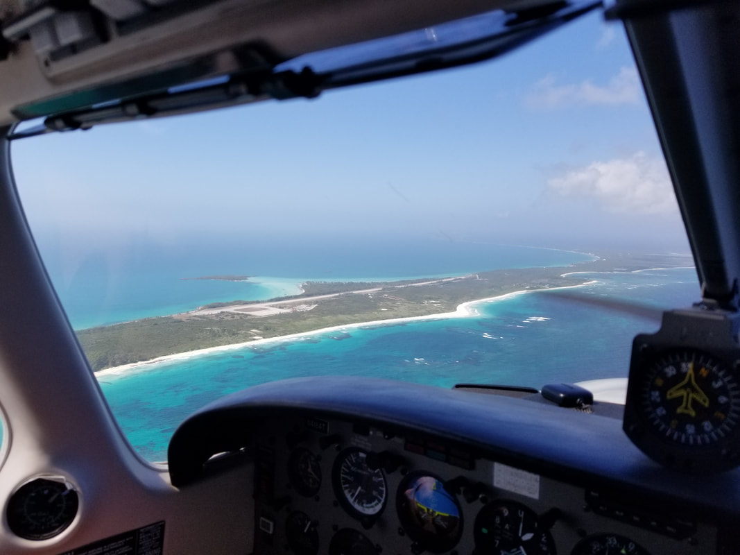
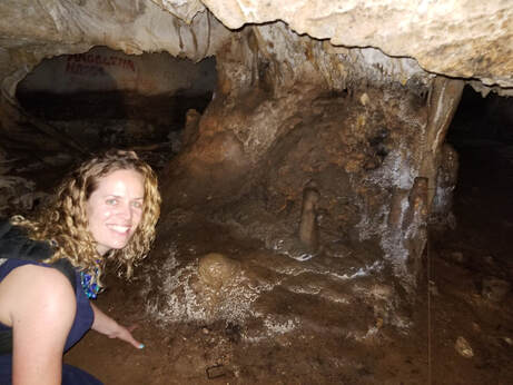
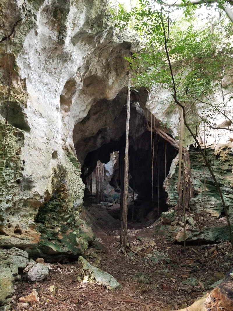
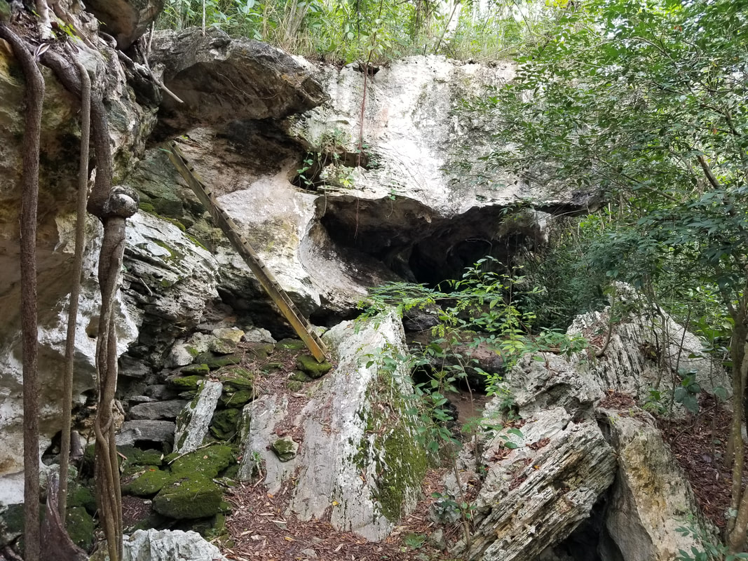
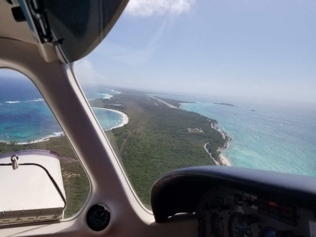
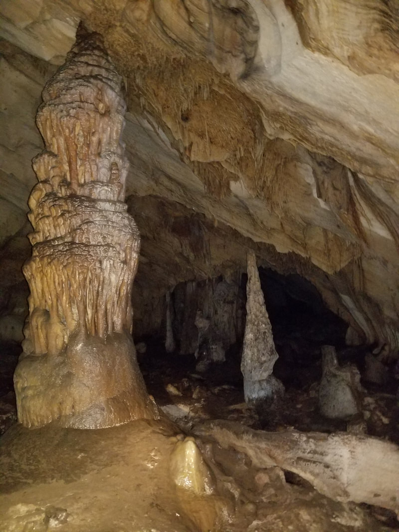
The biggest surprise of the trip came when I asked for a “top off” and the line service guy told me they didn’t have avgas. I had specifically called them just a few days before to make sure they had avgas. They told me they had both avgas and JetA but… oh well, they said they weren’t expecting a shipment until early March. Thankfully, we planned correctly and we had enough gas to make it to North Eleuthera (another 25 NM or so flight) to fill up. The wedding was at the Cocodimama Charming Resort, and charming it was. We had the best time and the resort (except for its terrible sand flies) definitely helped make it so. 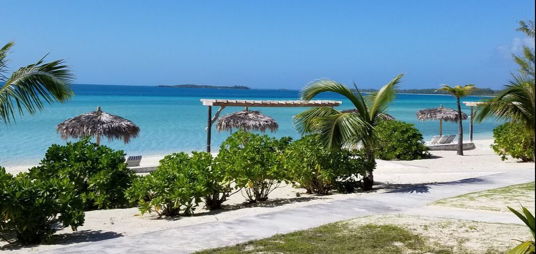 We also had a bit of extra time to explore some more of the island. We had lunch in Governor’s Harbour, visited the Hidden Beach, Hatchet Bay Cave, and the Glass Window Bridge (although… we got the best view of it from the aircraft), and experienced the island’s Friday Fish Fry. 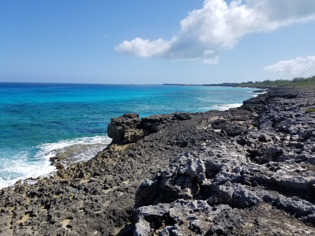
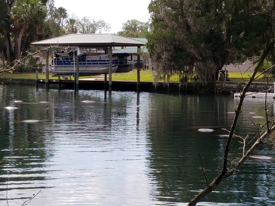
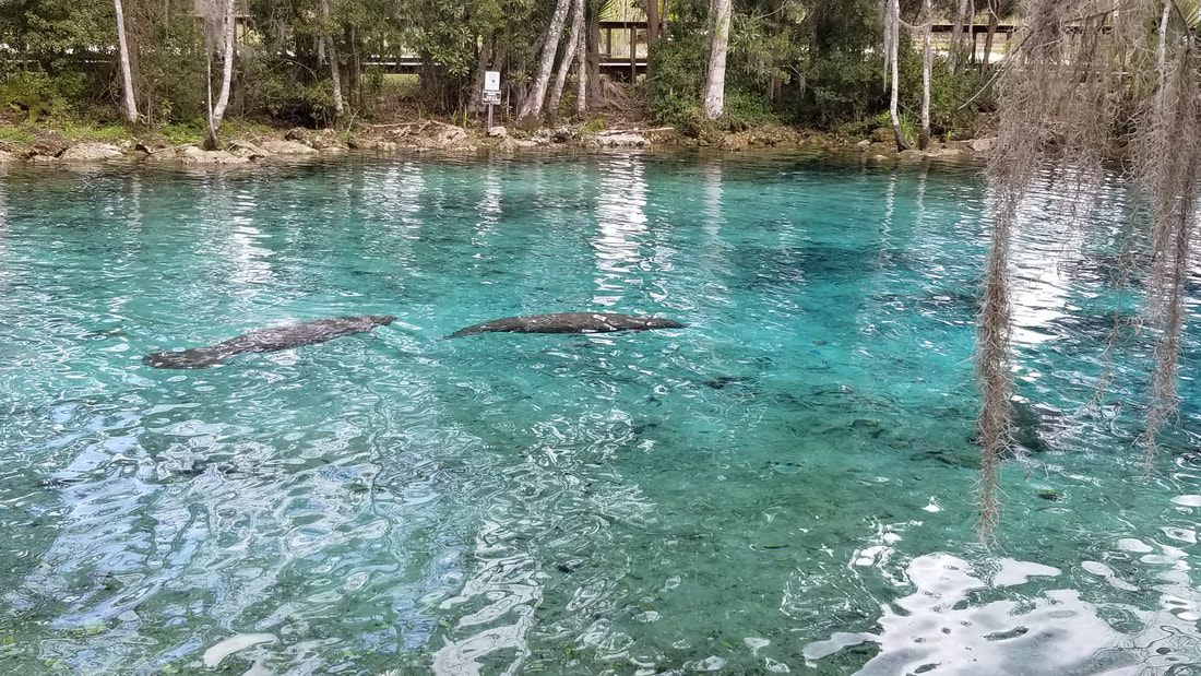
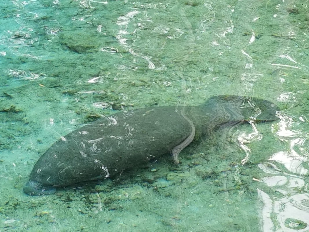
 Oh yeah and some of us dove with sharks (reef and nurse although anything could have appeared) that were as big as us (if not bigger)! 😊 The ground school prior to the actual diving was, honestly, the scariest ground school I’ve ever attended. I’m used to training scenarios where I mostly have control (engine failures and other systems failures, for example) but sharks… who can control sharks but themselves? Thank goodness the diving was not scary at all. In fact, I was very relaxed once in the water, I equalized very well, the visibility was incredible, and I moved very gracefully, with my hands against my chest most of the time to avoid “exploratory bites” as our dive master called them. 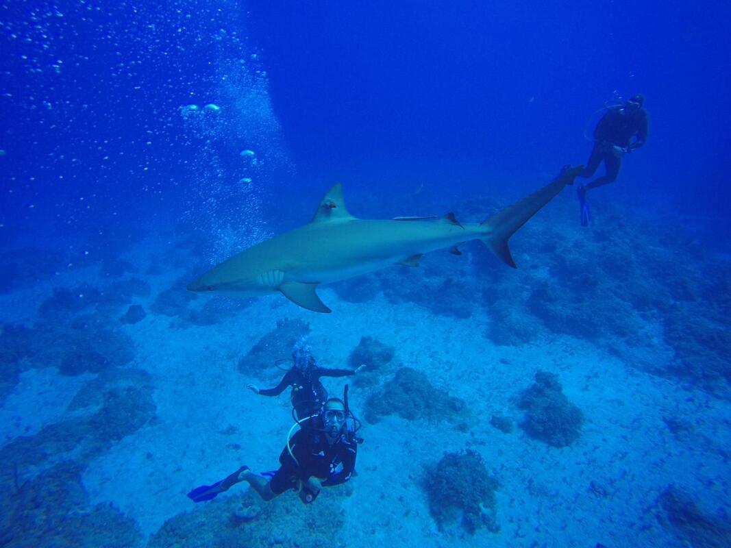 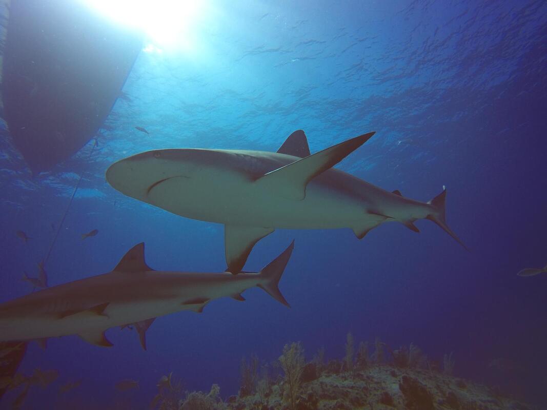 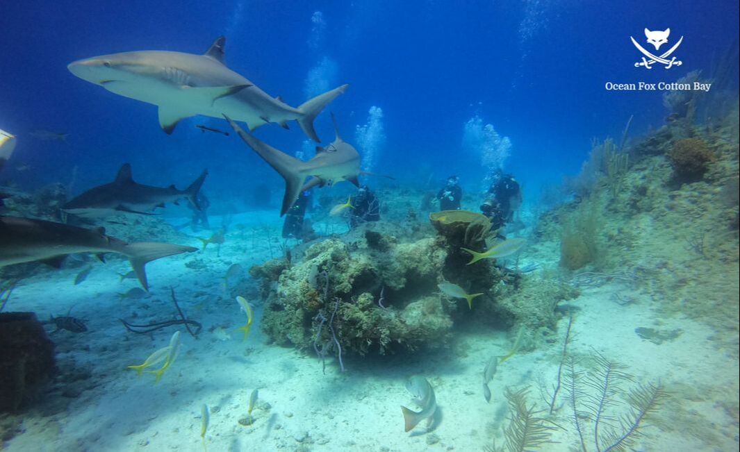 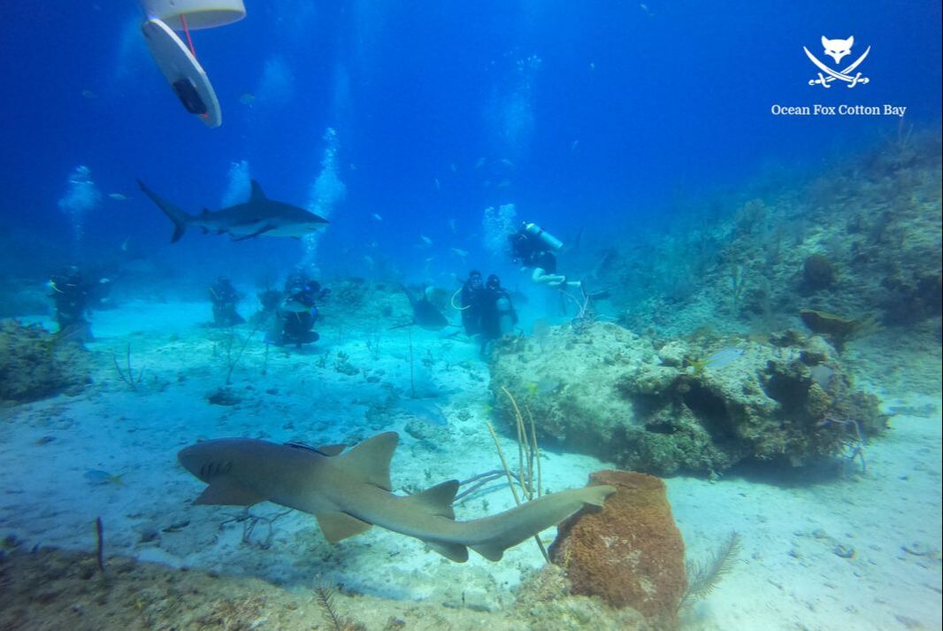 Leg 7: Governor’s Harbour, Eleuthera (MYEM) to North Eleuthera (MYEH) The resort we stayed at was just south of the Airport so we flew a celebratory/goodbye flyby before heading north to MYEH to drop off a friend and get gas. 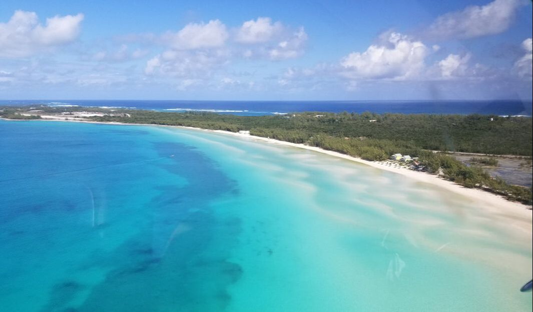  What a sight of the Glass Window Bridge, the narrowest point on the island and one of the few places on earth where you can compare the rich blue waters of the Atlantic Ocean on one side of the road and the calm Bight of Eleuthera (often incorrectly called the Caribbean Sea) on the other side, separated by a strip of rock just 30 feet wide. 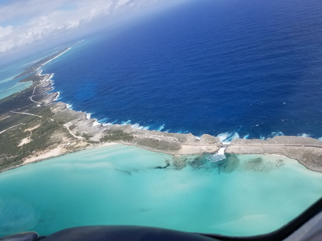 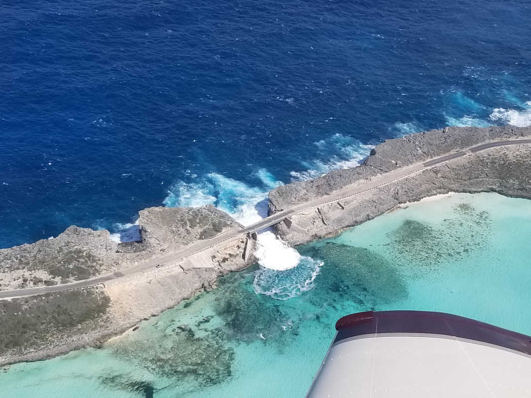 We also got a good view of the Harbour Island’s pink sand beaches although I still favor the ones in Bermuda. 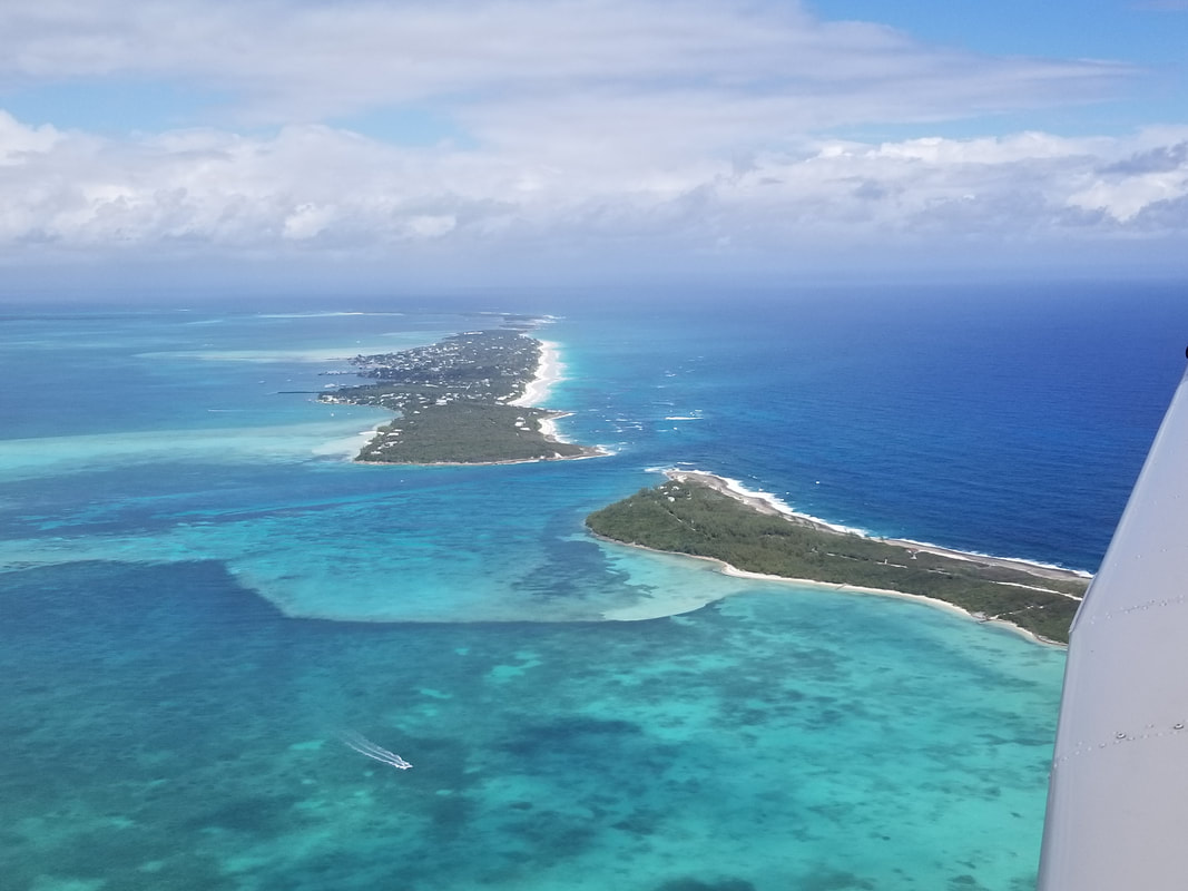 The biggest upset came from our visit to North Eleuthera. Turns out… this Airport was very busy as you can see in the picture of the ramp and it receives airline service from the States. An American Eagle landed just before us but we ended up parking before they did. The FBO parked us on the NE end of their ramp. The American Eagle regional jet was just on the other side and, because of prevailing winds, they turned their aircraft away from us for parking. Well, they used more power than necessary (more than breakaway, for sure) and it pushed our passenger back into the aircraft (as he was getting out of it) while my husband, the line service guy, and I were literally holding the aircraft down (especially the ailerons) so it wouldn’t blow away. It literally lifted the aircraft from the ground and pushed it towards the business jet to our left (to its pilots’ surprise who were watching from the FBO). It was a wild and unnecessary ride. The FBO filed a complaint and we filed a complaint to both the Airport and to American. My husband (as a fellow airline pilot) also talked with the Captain and he was completely oblivious and aware of his surroundings. Apparently, this happens about once a week. Hopefully, they can work on their procedures, train their pilots better, and develop additional ramp space to prevent this from happening in the future. 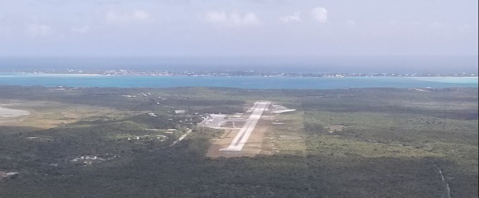 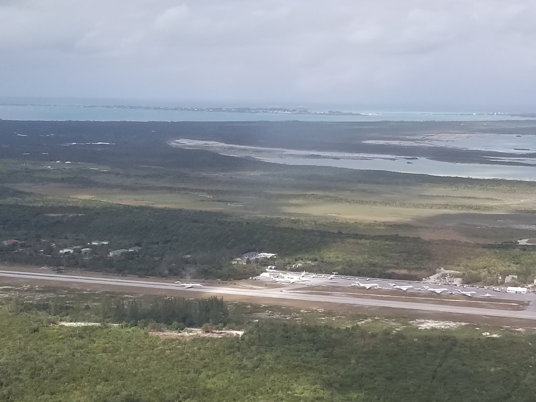 Paying the $29/person departure fee and stamping our ferry permit for the last time was easy. 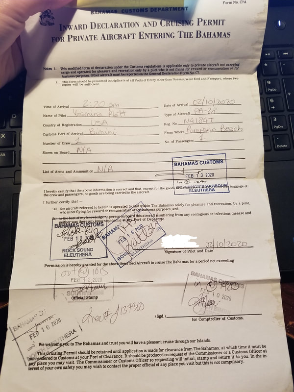 Leg 8: North Eleuthera (MYEH) to Fort Pierce, FL (KFPR) And, with this, we had now visited all three airports in Eleuthera! This return leg had us flying over water the most amount of time. It was uneventful although not with much sightseeing due to cloud layers. 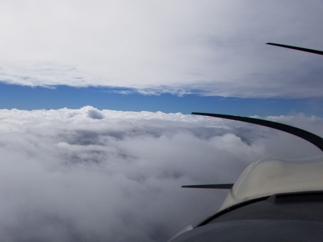 Jared took a nice little nap and I flew. Benefits of having a pilot wife 😉 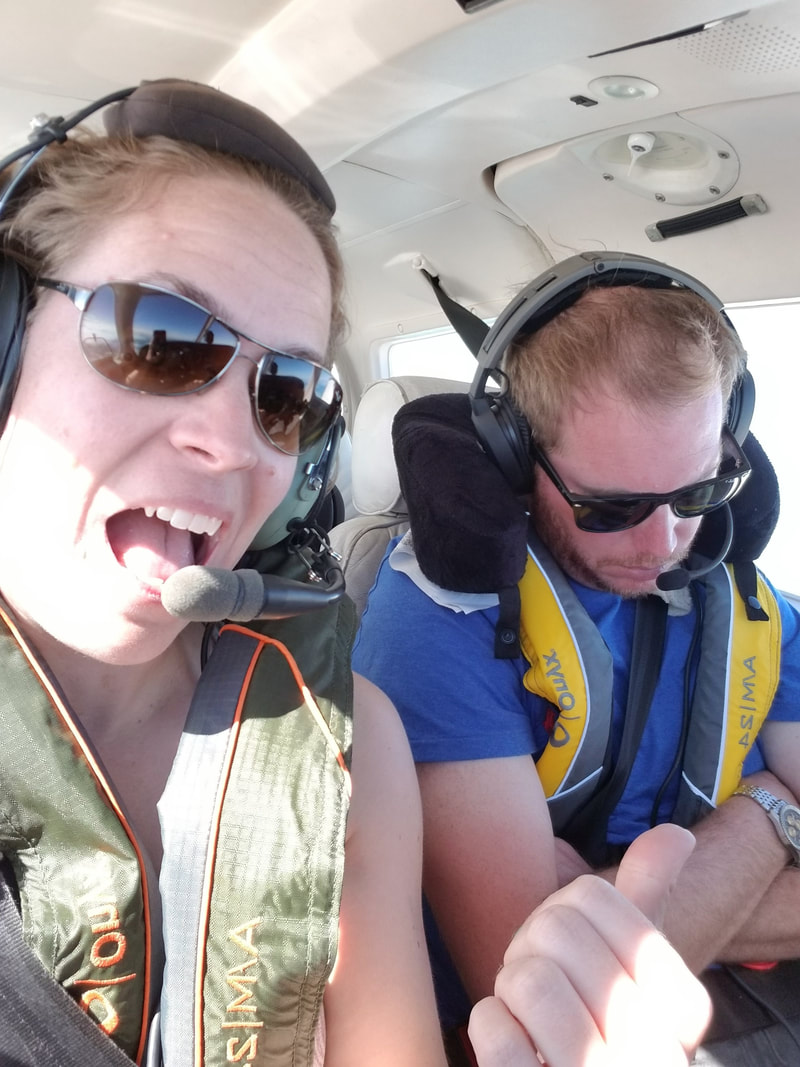 I already covered clearing Customs at KFPR earlier. After lunch (but not at Airport Tiki because it was closed) and fuel… we kept heading towards home. We would have kept going towards Pensacola, for example, but the weather had other plans for us so we decided to stop at Crystal River. The weather had been very foggy in the mornings and until about 2 pm every day so continuing on early the next day was probably not going to happen. We had been wanting to visit the manatees for a while and this was a good time of the year to do it (best between mid-November and late March). So, on to Crystal River… at least we could still enjoy our vacation while waiting for the weather to clear. 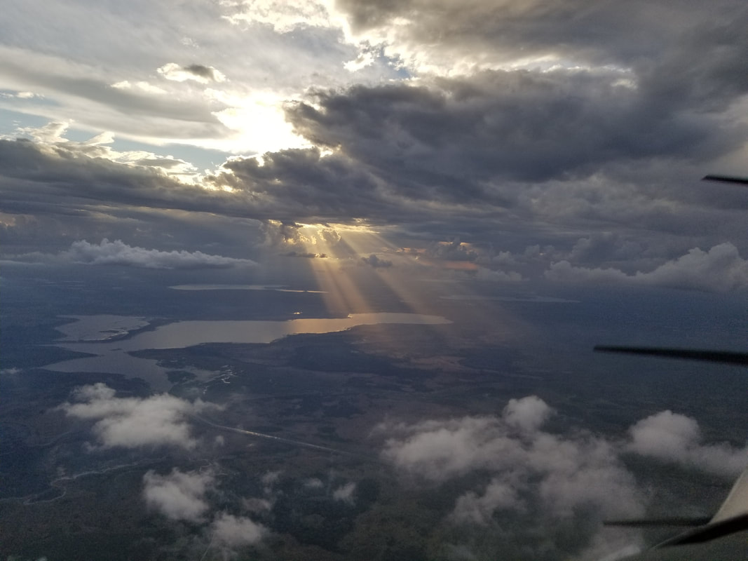 Leg 9: Fort Pierce, FL (KFPR) to Crystal River, FL (KCGC) Great unexpected stop! In the morning, we visited Three Sisters Springs, not too far from the Airport. It was full of Florida’s gentle giants. They like it here in the winter because the spring water temperature is about 72-74 Fahrenheit year-round and the water is very oxygenated. They do not like temperatures below 68F for extended periods of time. And, in a single day, up to 20 million gallons of water gush from these springs! 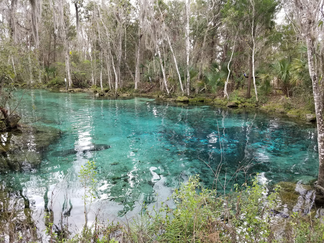
 We’ll be back with more time so we can get in the water with them. This should definitely be at least a day trip for anybody without a 2-hour flight from it.
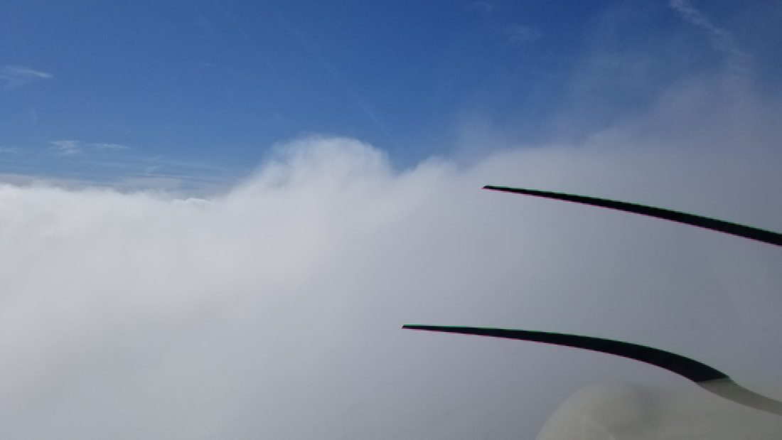
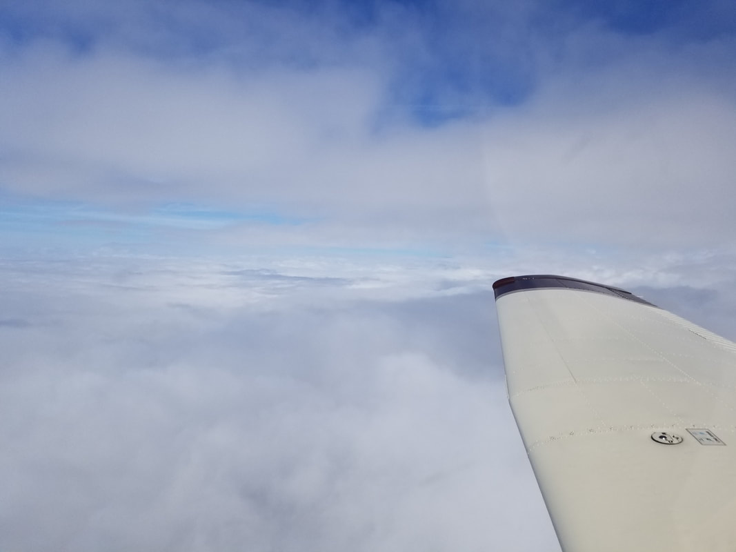
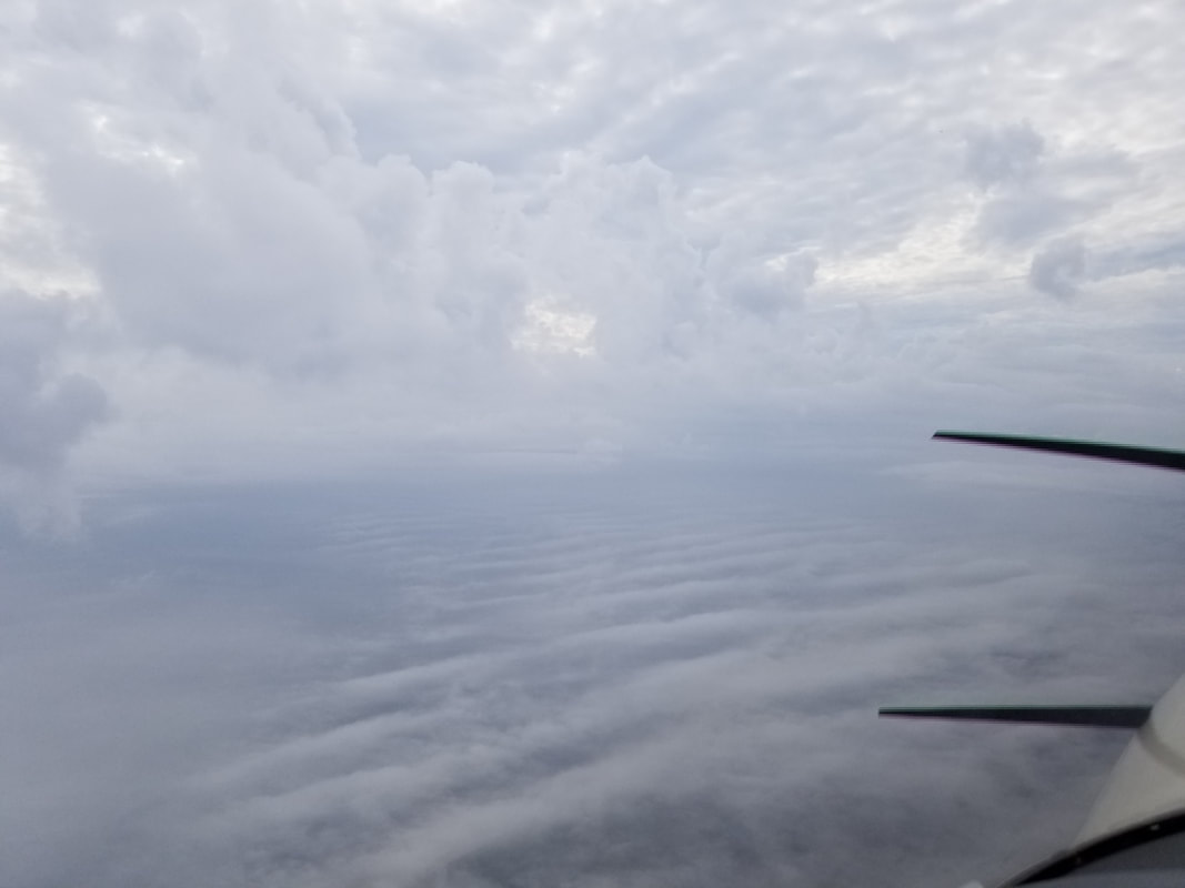
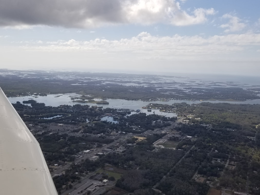 Leg 10: Crystal River, FL (KCGC) to Pensacola, FL (KPNS) At least 80% of this leg and all subsequent legs were in Instrument Meteorological Conditions (IMC) but there's something magical about that as well.
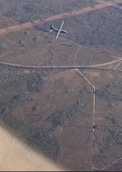
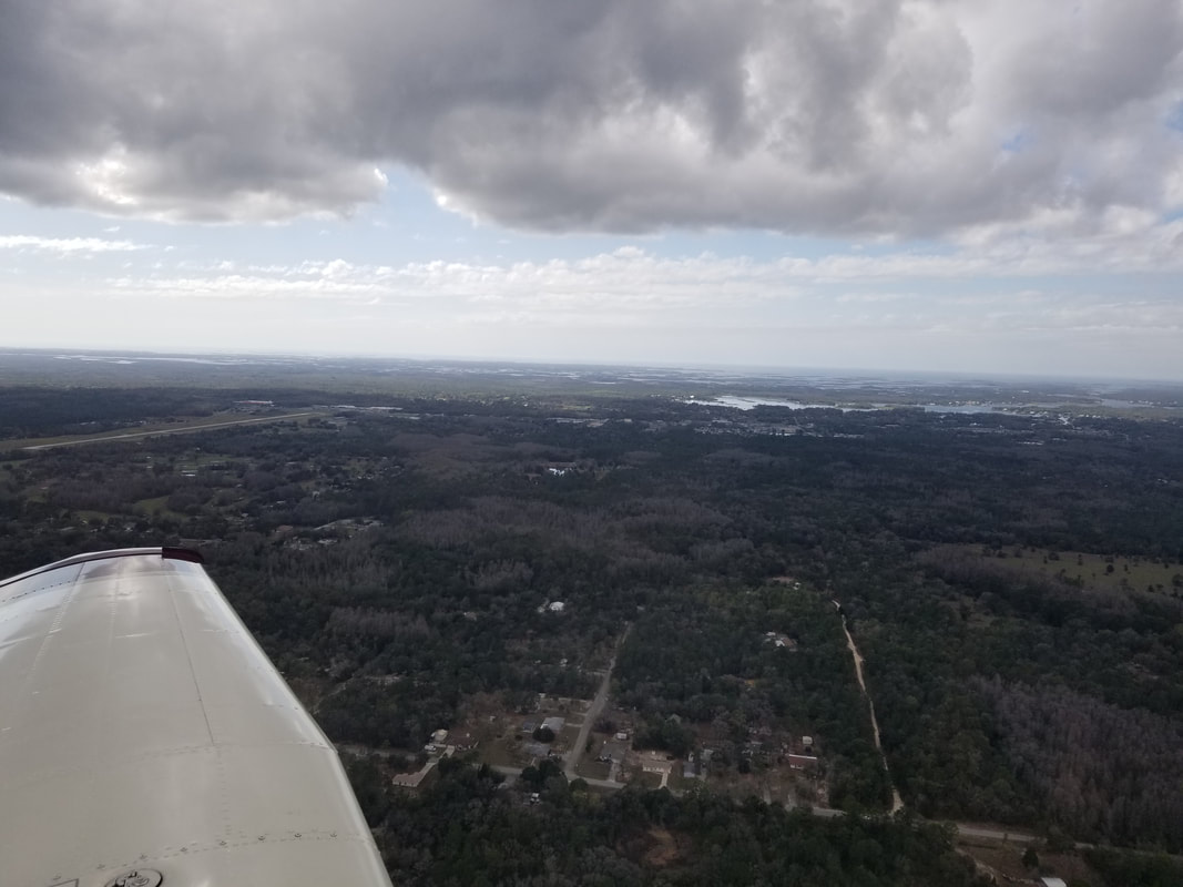
 As a helicopter pilot, one of the highlights of the flying portion of the trip came from seeing the Spencer Naval Outlying Field (KNRQ) from the air. I had read about it, but I had never seen it for myself. We were lucky to see it this time in between few to scattered layers of clouds while performing an approach into KPNS. KNRQ is part of the Naval Air Station Whiting Field, home of Training Air Wing Five. It has eight runways and multiple square and triangle areas. Fellow pilots tell me it is still used to train new U.S. Navy, Coast Guard, and Marine Corps chopper pilots in any wind direction/condition (especially crosswinds). The outer areas are apparently used for autorotation training. As a non-towered field, it can also support the training of many helicopters (a couple of people said up to 14) at the same time with less radio coordination. Some also say this field was used for taildragger training back in the day. 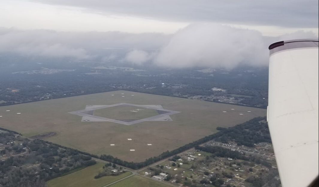 We only stopped at KPNS for fuel (due to bad headwinds) and to check weather again. Leg 11: Pensacola, FL (KPNS) to Pascagoula, AL (KPQL) Well, the airplane track from this flight is an interesting one to show. Unfortunately, an airplane went down right by St Elmo Airport (2R5) right before we flew by it on our way to KPQL. The controller asked us if we could hear an Emergency Locator Transmitter (ELT) on 121.5. We sure could. We offered to go see if we could see anything. He gladly accepted but, unfortunately, we did not see a downed aircraft. The weather did not make it easy either. 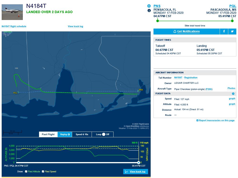 We honestly did not know what to expect from Pascagoula. We hadn’t even heard the name of the town before BUT, continuing on with our “seafood diet”… Oh my! We had a feast for dinner at Bozo’s Too. 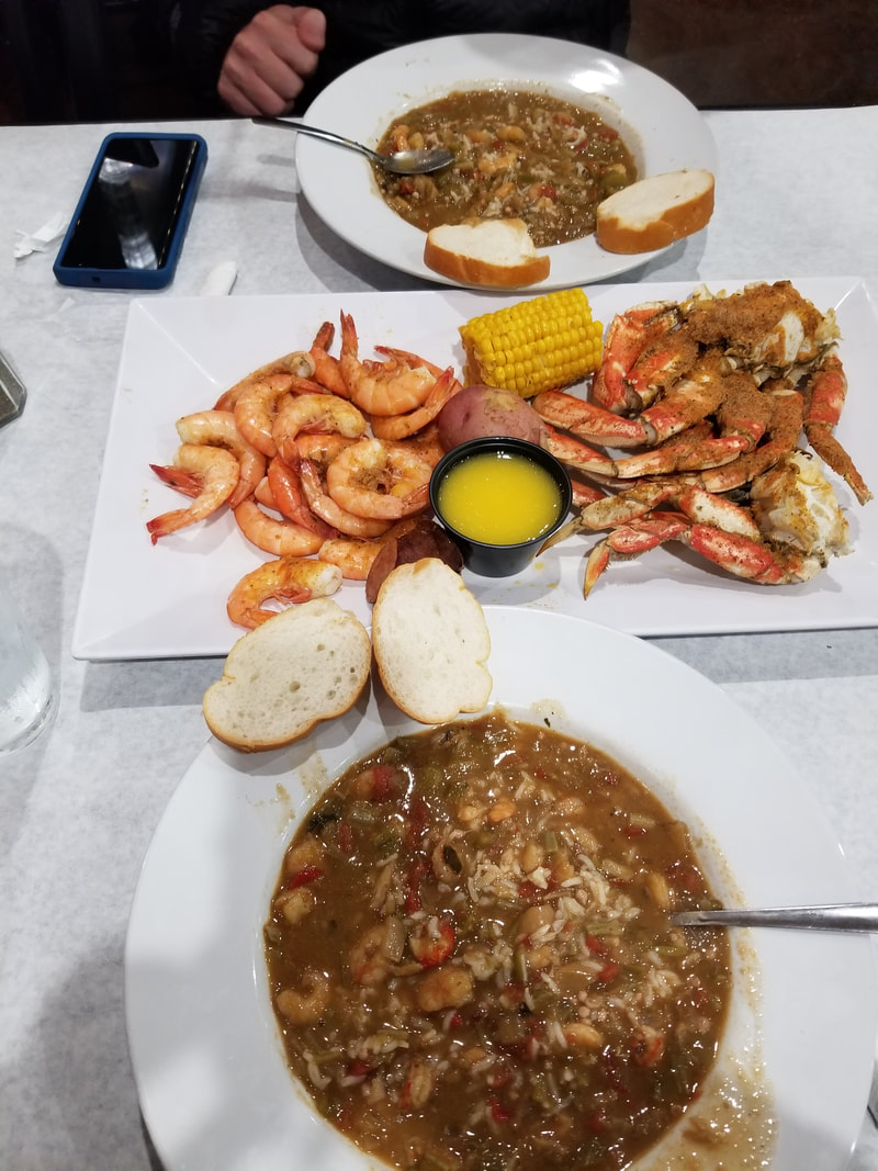 Leg 12: Pascagoula, AL (KPQL) to Lake Charles, LA (KLCH) “Get home” day! But not until the afternoon, after the log lifted again.
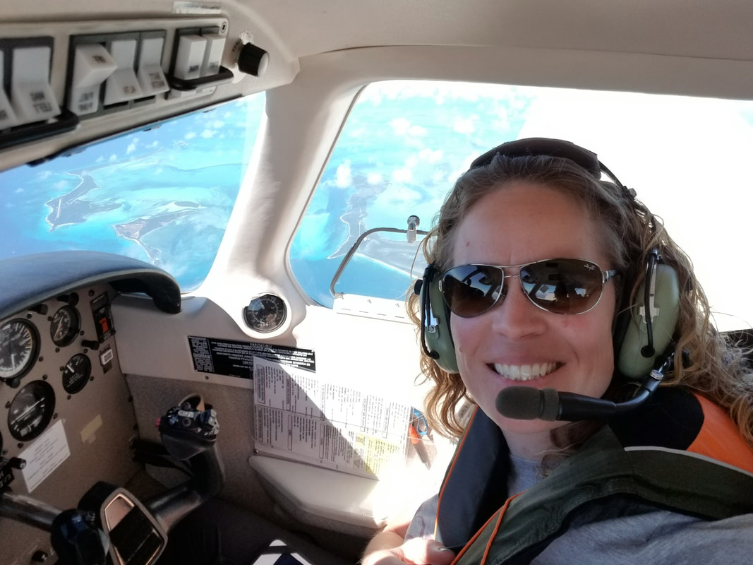
Like in Pensacola, we only stopped here for fuel (due to bad headwinds) and to check weather again. Leg 13: Lake Charles, LA (KLCH) to Houston, TX (KTME) Andddd we made it home… but not without some more excitement! A cold front started to blow through right as we were about 7 NM outside of KTME that forced the TWR to flip the airport (from southbound to northbound) and rocked our wings all the way down to the ground.   I said last time and I say it again… we (pilots) sure are privileged! This trip would not have been possible without GA so go fly and experience all this on your own! Not much else is better…
1 Comment
|
BLOGS ON THIS PAGEAuthorYasmina Platt ArchivesCategories |
 RSS Feed
