|
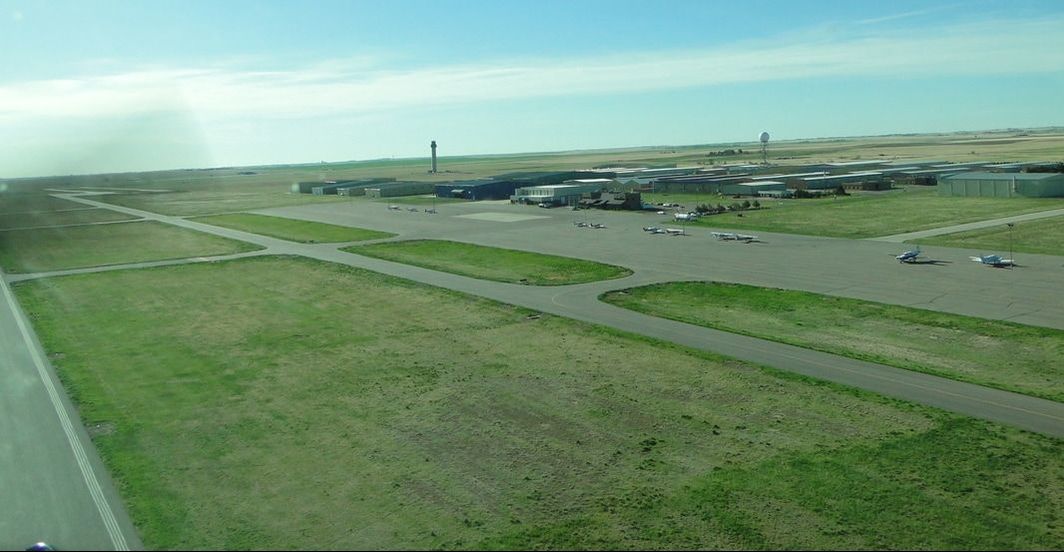
Flying the Colorado Rockies, with 53 mountain peaks exceeding 14,000 feet and more than a dozen interesting airport choices, can be a thrilling experience but it is certainly a challenging one as well and one that can pose hazards and risks for unexperienced pilots (those without extensive mountain or local Rockies experience). Mountain flying training by a highly experienced and knowledgeable local CFI is truly a must. The majestic Rocky Mountains challenge density altitude, test aircraft and body performance, and have unpredictable weather which can change rapidly. As with other highland climates, the climate changes with increasing altitude. In general, the Rockies have mild summers, cold winters and a lot of precipitation. In the winter there is deep snow, high winds, and sudden blizzards are common. So, April 15 to October 15 is the best mountain flying season. A recent temporary work assignment to the Denver area was the perfect time for me to give it a try. I have flown in the mountains of California, Arizona, New Mexico, Arkansas, and Switzerland before but the Colorado mountains was a completely different animal for me. Actually, I would venture to say that a combination of narrow and sloping runways, one-way airports, very high density altitudes, and unpredictable and abrupt weather changes will put any pilot’s abilities and skills to the test. I took a one-on-one mountain flying course (ground school and actual flying) with Tim Sale (pictured below) through the Front Range Flight School at, you guessed it, the Front Range Airport (KFTG). 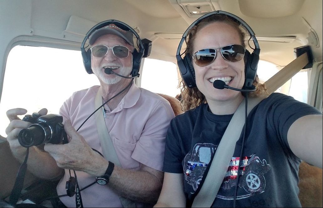 Ground School The ground school was four hours and covered:
Flying The route: Front Range Airport (KFTG) – via Rollins Pass – Granby-Grand County Airport (KGNB) – Kremmling VOR (RLG) – Snow VOR (SXW) – Glenwood Springs Airport (KGWS) – via Hagerman Pass – Lake County Airport (KLXV) in Leadville – back to KTFG. The following file shows our actual flight track (location, altitude, speed, etc on the Google Maps platform). Following the ground school, I put together a one-pager with handy route information that I could have on my kneeboard, such as weather frequencies, altitudes, pass information, Remote Communication Outlet (RCO) frequencies, etc. It came particularly handy when in turbulence. The day arrived! :) Now to put all the wonderful theories to practice. Before starting up, I used an oxygen meter I always have with me when I fly at high elevations (and that you can buy at any pharmacy) to see what my “normal” oxygen level on the ground was. Turns out I was at 98%, which at I’ll take at 5,512 feet. The idea was to continually compare it to my oxygen levels up at altitude throughout the flight. My husband Jared and I had the opportunity to experience hypoxia in NASA’s high altitude chamber in Houston and learned that we really could not identify our symptoms before completely passing out. You can read more about it here: NASA’s Physiological Training. I figure trend information in an oxygen meter is the only real way I have to try to stop myself from actually experiencing hypoxia. I will go ahead and mention here that my oxygen levels fluctuated a bit and even got below 90% at one point but I drank a little bit of water and did fine. No headache, no light headiness, no tunnel vision, no apparent skill loss, etc. Front Range to Glenwood Springs via Granby The first leg (KFTG – via Rollins Pass – KGNB – RLG – SXW – KGWS) included a full stop, taxi back, and takeoff at KGNB. But, first things first… a good run-up and a short-field takeoff at KFTG to see the airplane’s capabilities given the conditions. So, I’d say the most important things to note are:
 KFTG is just southeast of Denver International Airport (KDEN) so a departure to the south was necessary to avoid KDEN’s airspace. From there, we flew west just south of I-70, obtained a transition through Buckley Air Force Base (KBKF) airspace, flew just south of downtown, and up southwest/west of the Rocky Mountain Metro Airport (KBJC). Flying so close to downtown was pretty cool. We got to see the Capitol and Civic Center Park, all the office and residential (mostly high rises and lofts) buildings, the Platte River, Cherry Creek, the amusement park, and all the sports stadiums. 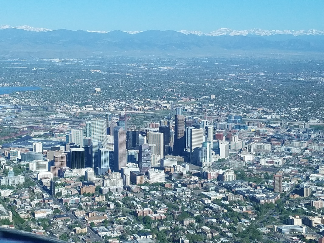 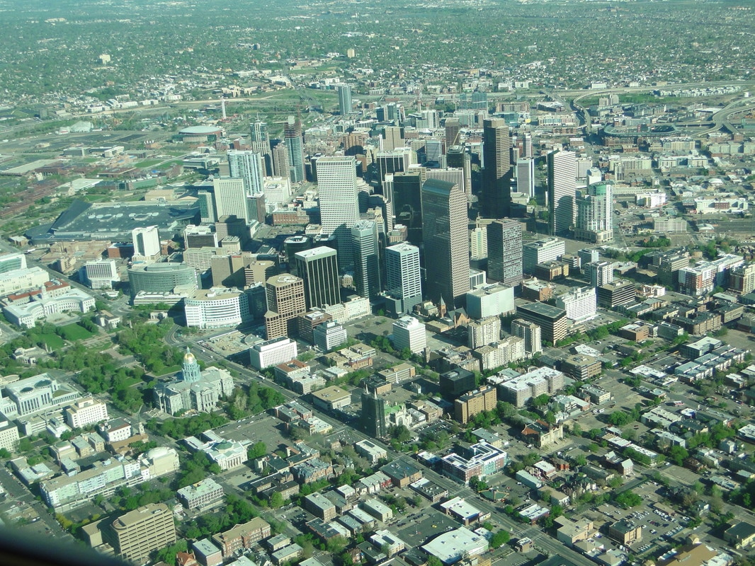 Leaving the beautiful Boulder Flatirons (pictured below) on the right wing, we started our journey through and over the Rockies, quickly putting my “new” knowledge to work, finding some thermals, and doing a couple of 360s to gain some altitude. 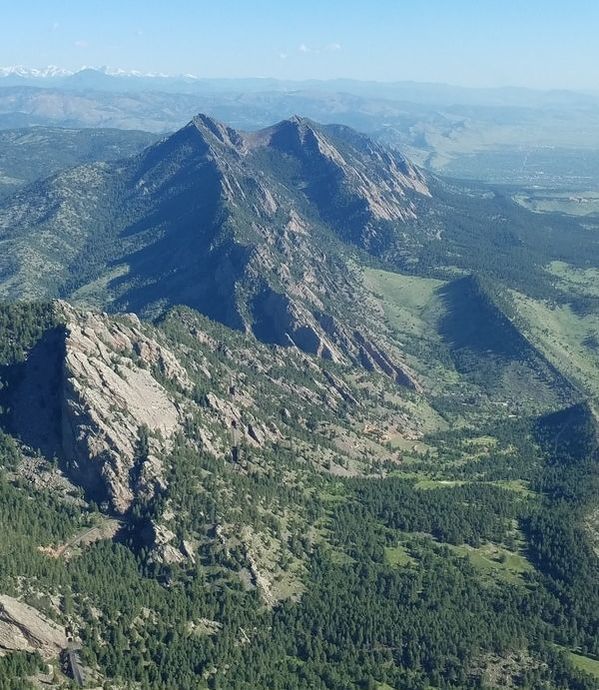 The scenery was spectacular throughout the entire trip: lakes (frozen and not), snowcapped peaks, completely snow covered mountains, ski resorts, a few 14ers (mountains with peaks at least 14,000 feet high), red rocks, cute little towns, mountain passes, rivers, and canyons among other geological features. And, as an outdoors lover, it was a great opportunity to scout out future (ground based) adventures, such as Jeep trails, hiking trails, rafting, train rides (such as the California Zephyr that runs from Chicago to California), etc. 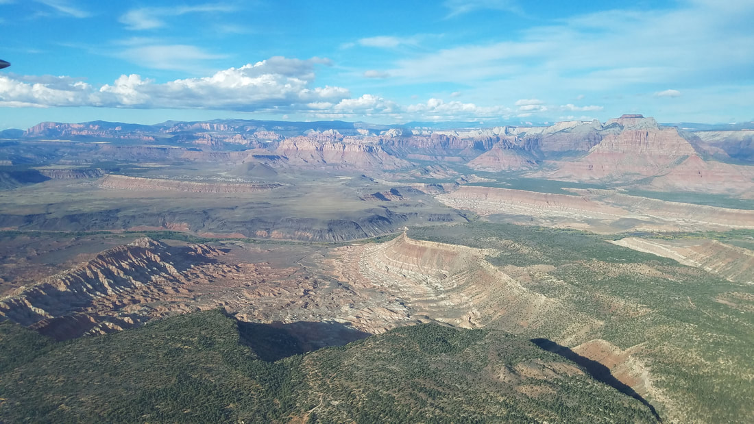 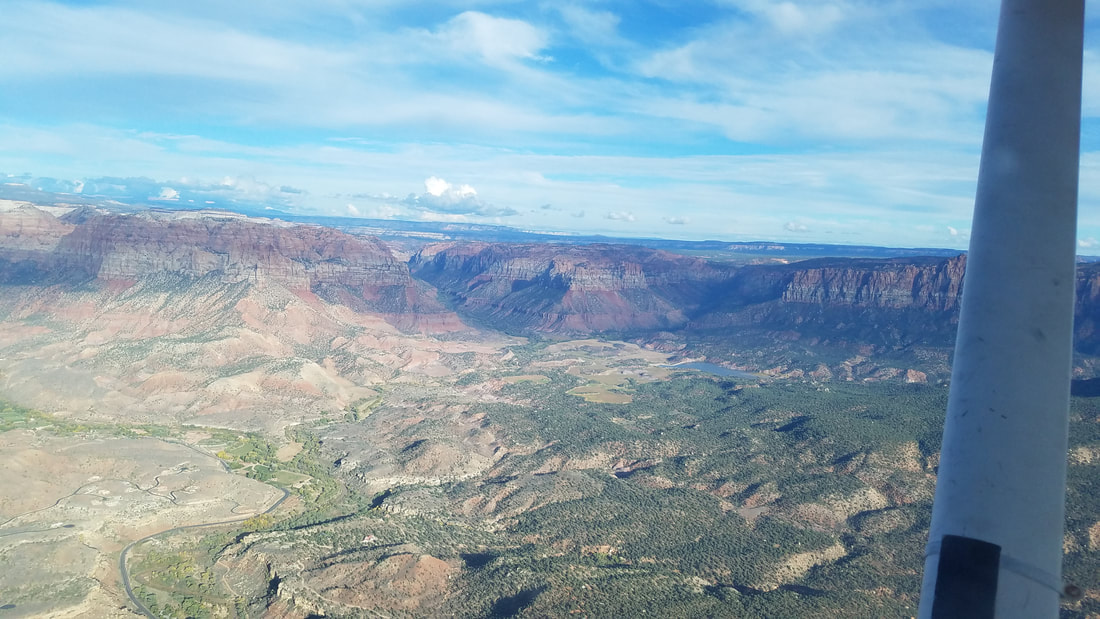 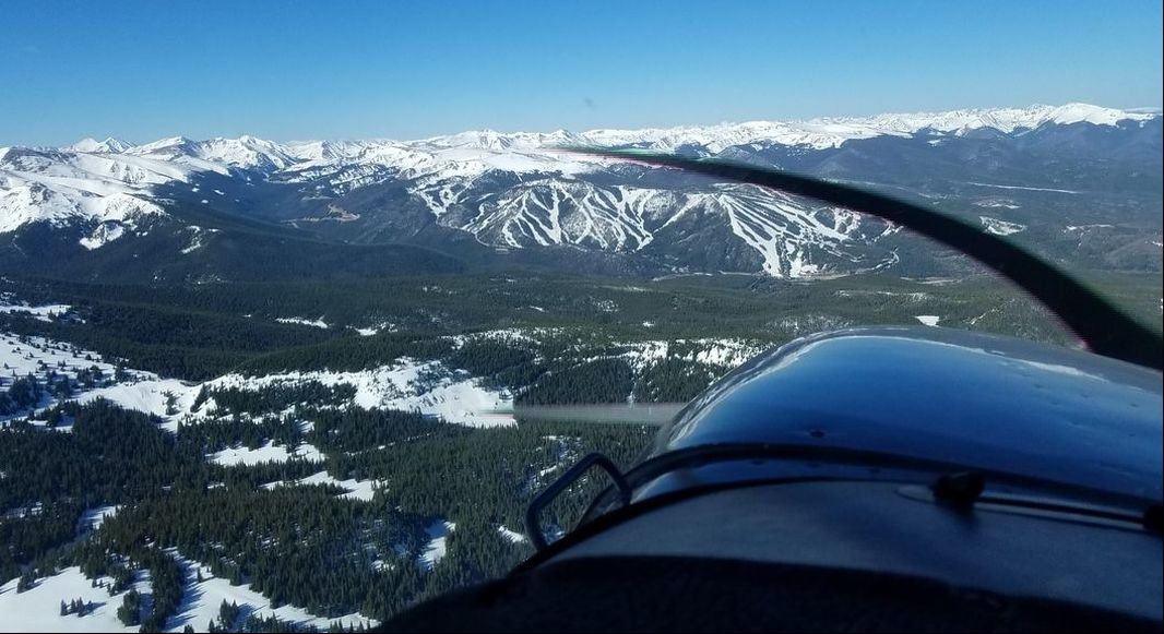 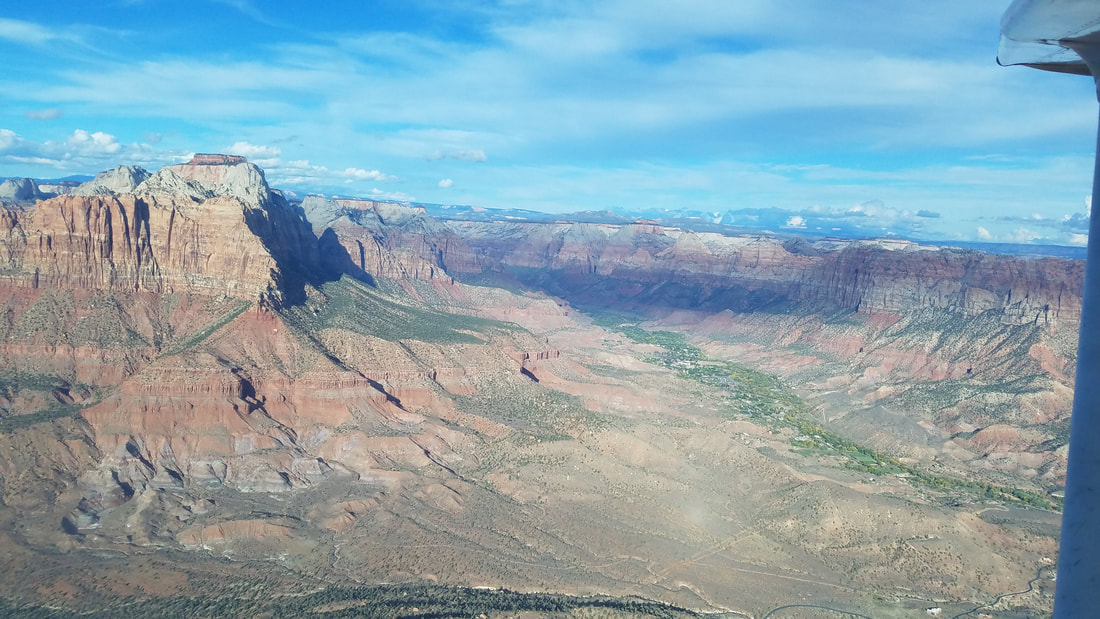 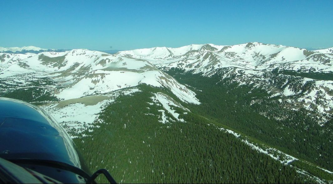 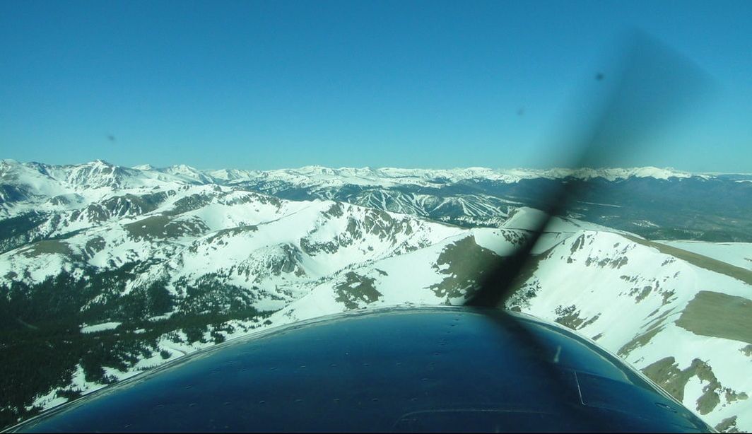 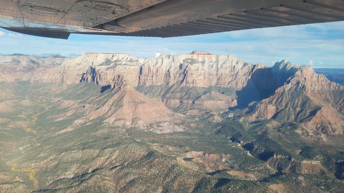 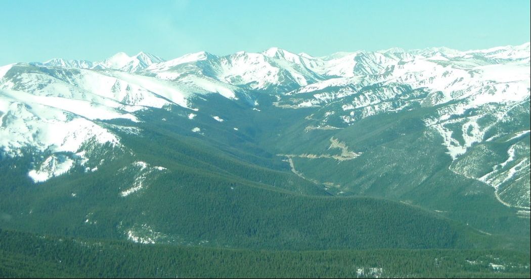 And, before we know it, we were in Granby at 8,207 feet. I joined a left downwind for runway 9. To our surprise, what looked like a Piper (Cherokee, Archer or Saratoga maybe?) to us had gone down the hill at the end of Runway 27 but, thankfully, it looked like minimal damage for what it could have been. Since the wind was calm and they do not recommend flying east due to rising terrain (that we verified was still there when we flew in ;)), I taxied off to Runway 27 for departure the opposite direction, which also has: - 525’+ terrain 6,000’ from threshold, 1,400’ left of centerline - 52’+ terrain 1,200’ from threshold on extended centerline - 40’+ powerline 965’ from threshold, 260’ left of centerline  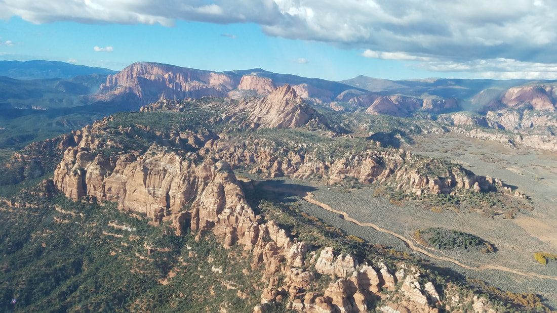 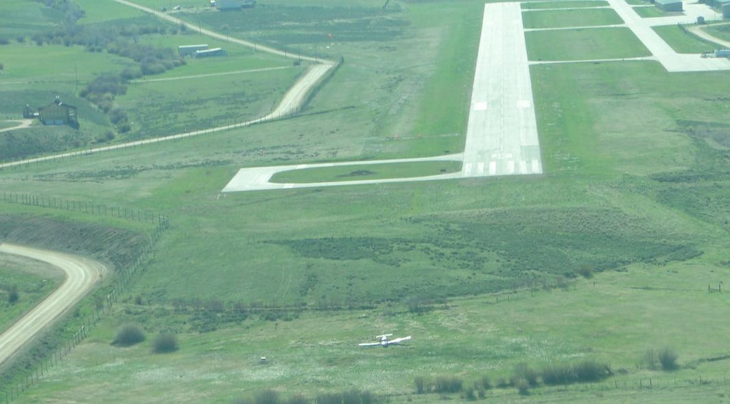 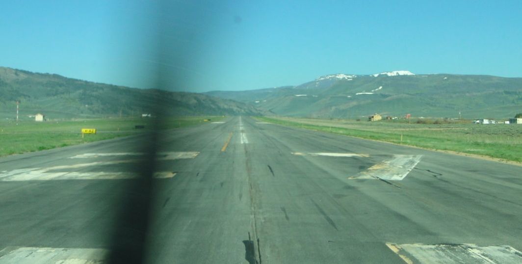 Granby was a good, easy first airport to visit. No major challenges besides the elevation. We did not stop at Kremmling-McElroy Airfield (20V) but we did fly close to it. If you use Runway 27, it looks like you need to make a decision since it’s right traffic and there is a pretty good size hill/mountain just northeast of the runway, as shown in the picture below. 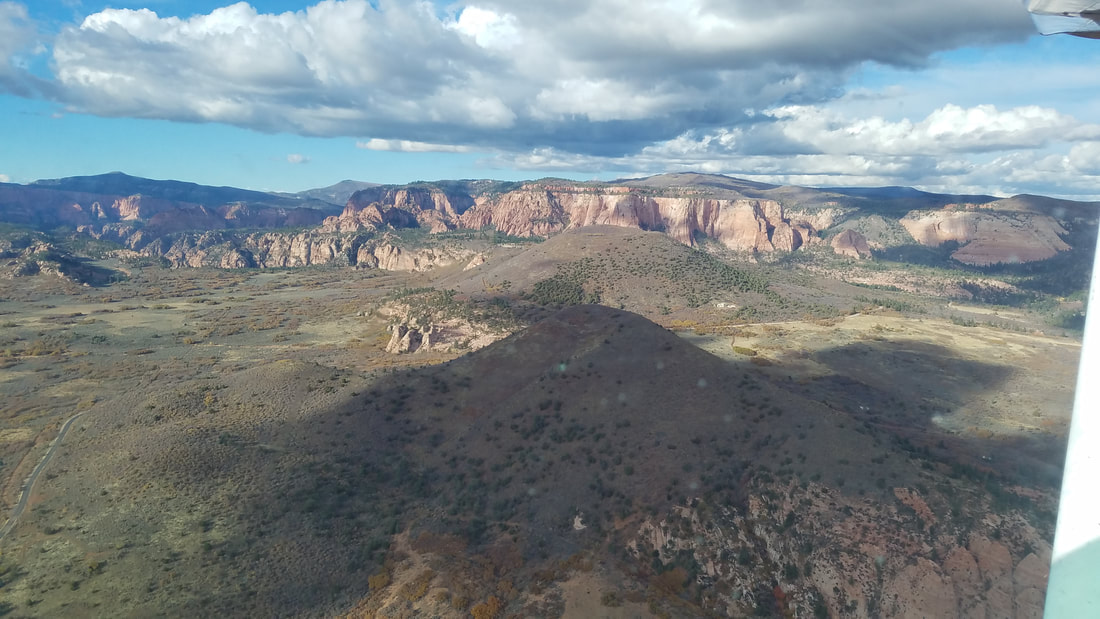 We also saw the Kremmling (RLG) VOR in the distance, on top of a mountain. I apologize; the picture is a little blurry. We then followed a canyon adjacent to the VOR. It was pretty cool seeing it directly below us. 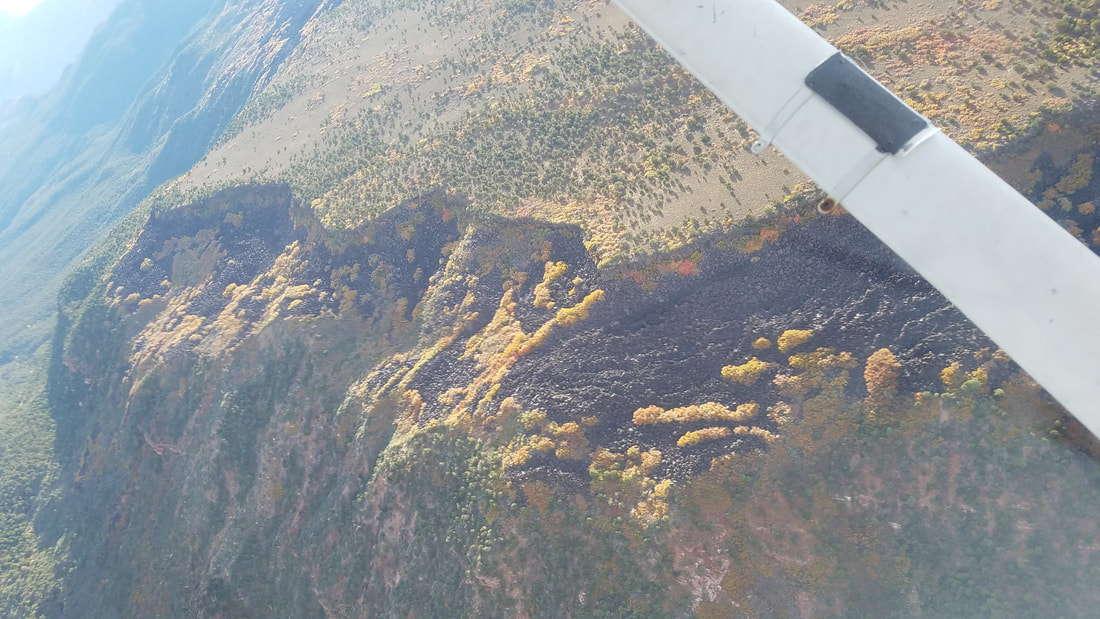 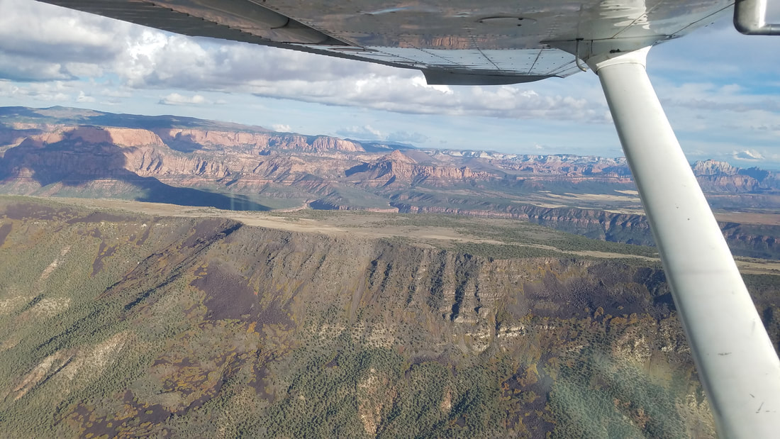 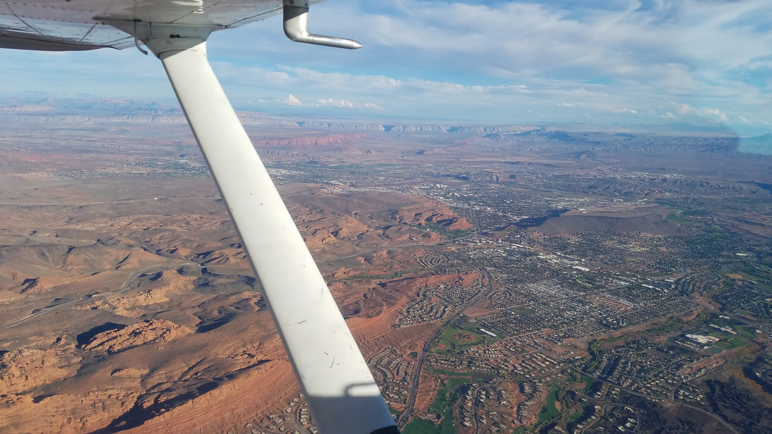 The route took us over Eagle County Regional Airport (KEGE) where the tower controller asked us to do a 360 (turn) to allow for a Learjet to depart. It probably wasn’t necessary but we, of course, complied and enjoyed the scenery that much longer. 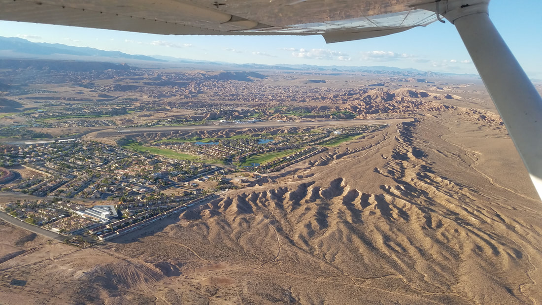 And… my favorite Colorado (to date) airport, ladies and gentlemen – Glenwood Springs Municipal Airport (KGWS)! With a whopping 3,300’x50’ runway (I’m told the shortest in the great state of Colorado), at 5,916 feet MSL, and surrounded by close-in mountains and hills, this is a sporty choice. But you have to find it, first. When flying from the east, the mountains block the views of the Airport until you are almost right over it so I had to trust the GPS (and my instructor who knew exactly where it was) and head over the top of it. Once closer, another pilot called a left downwind for 32. I saw her before the Airport. We followed as #2 for landing. 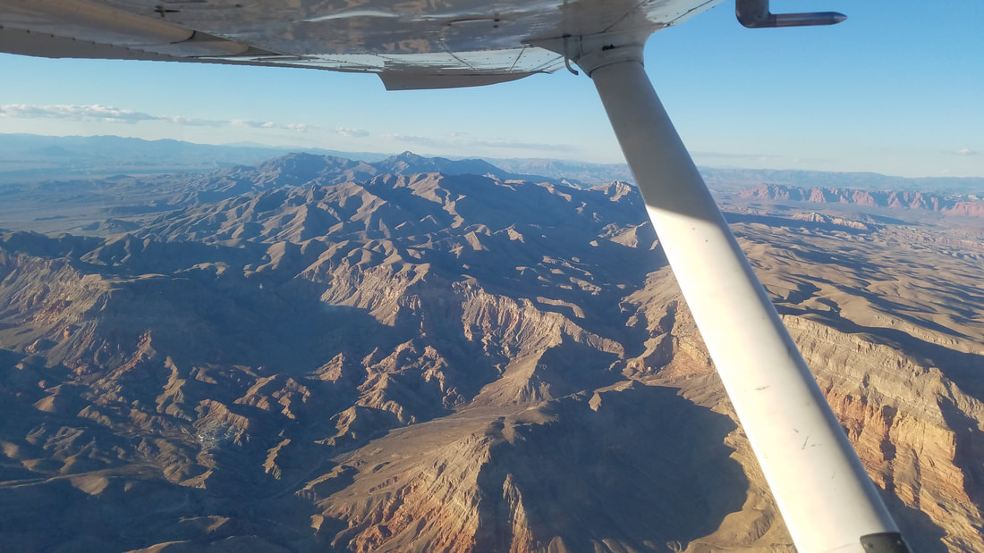 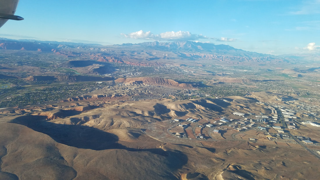 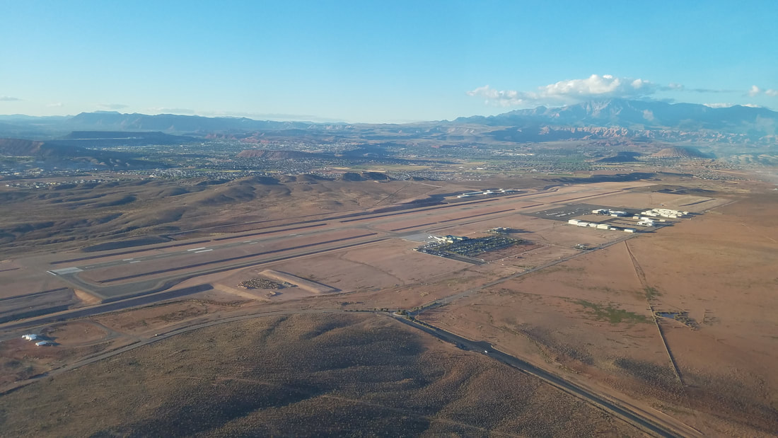 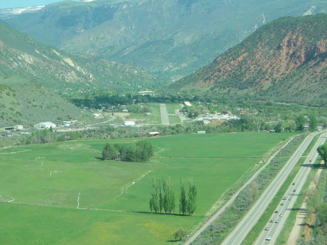 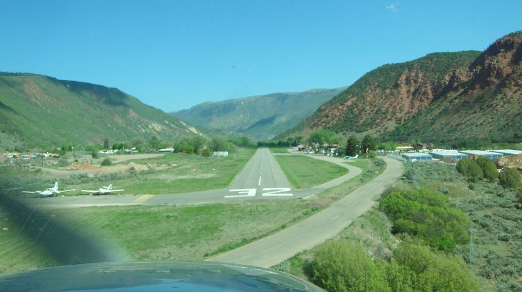 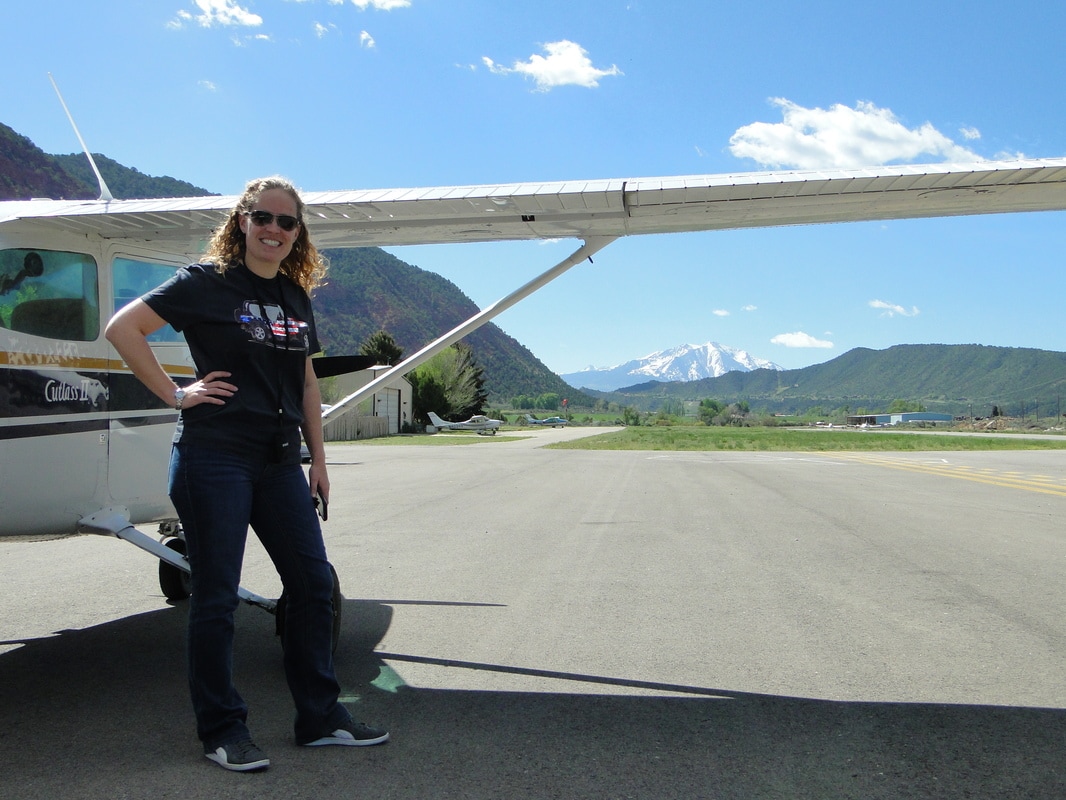  Glenwood Springs to Leadville While the Airport requests Rwy 32 for arrivals and Rwy 14 for departures, when wind and weather permit, to try to prevent aircraft from flying over town, the winds were definitely favoring 32 so everybody was using 32 for both arrivals and departures. So, upon departure, that meant flying just west/to the left of town, hugging the mountains/canyon on that side while gaining enough altitude and turning radius to turn around, fly by Glenwood Springs again, and head southeast towards Leadville. 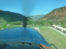 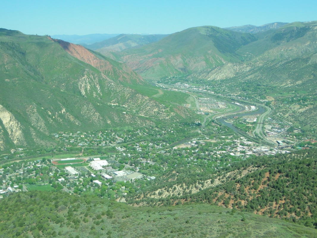 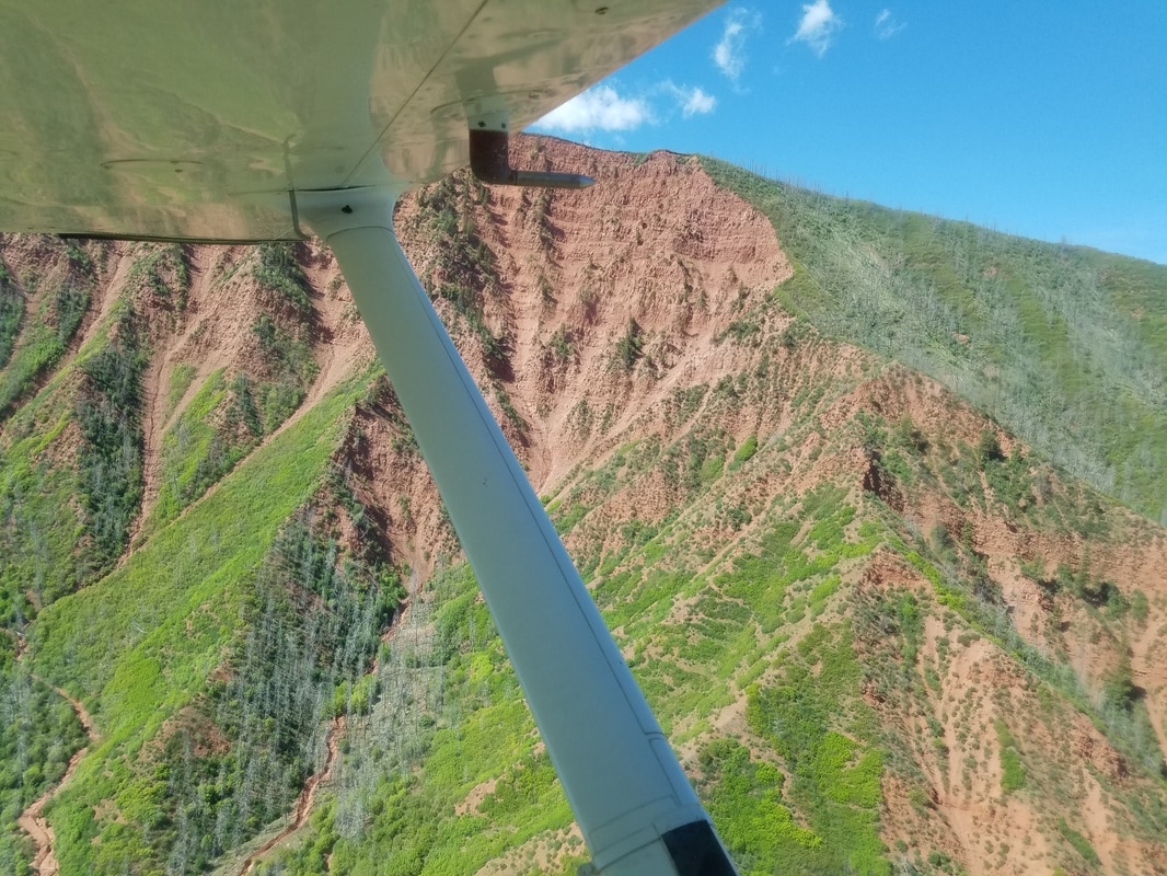 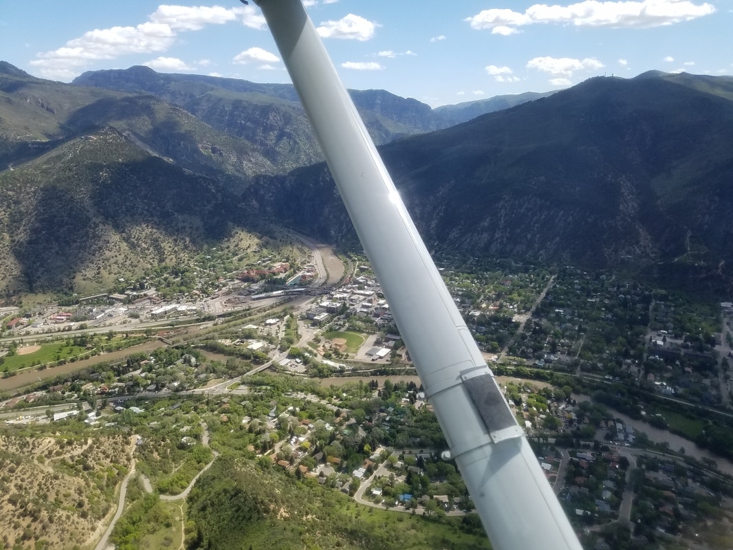 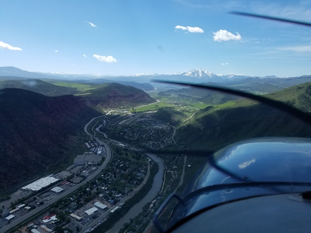 The route between these two towns also took us through some beautiful scenery and around/between some high peaks. We started by flying over Highway 82 to Basalt via Carbondale, then following the Fryingpan River (as shown on the picture below), flying just north of the Ruedi Reservoir (pictured below) and going over Hagerman Pass and Turquoise Lake (also pictured below) at which point we got KLVX in sight. The approximate trail elevation on Hagerman Pass is 11,960’ MSL. This pass is visible to the weather reporting station at Leadville. Elevation, terrain features, and weather often favor this pass over Independence Pass. 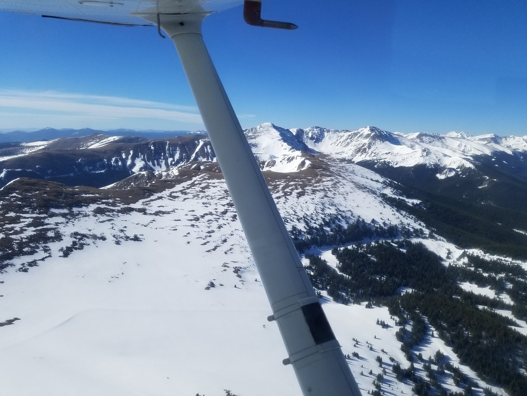 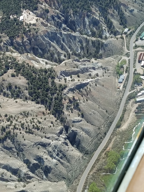 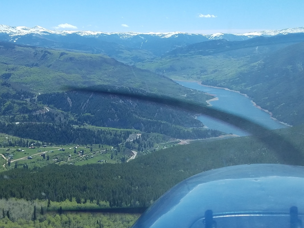 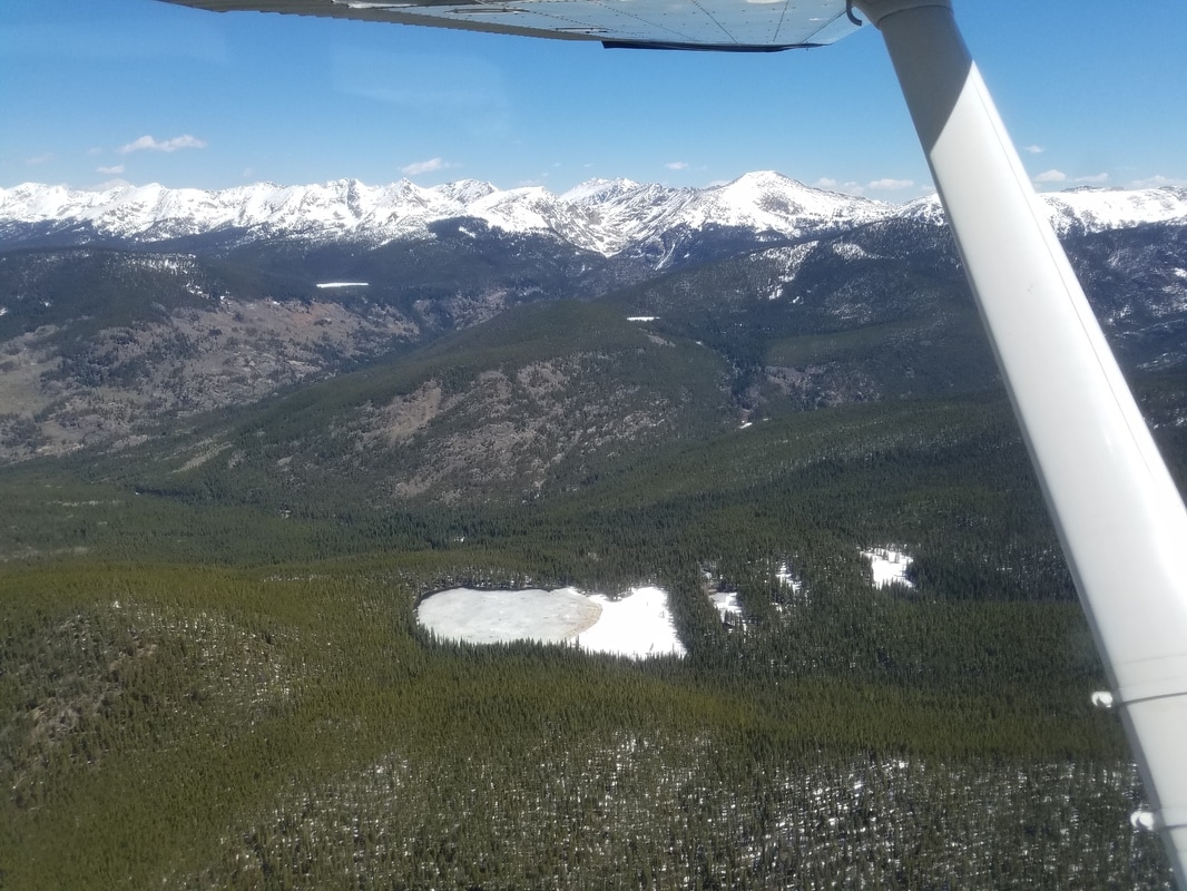 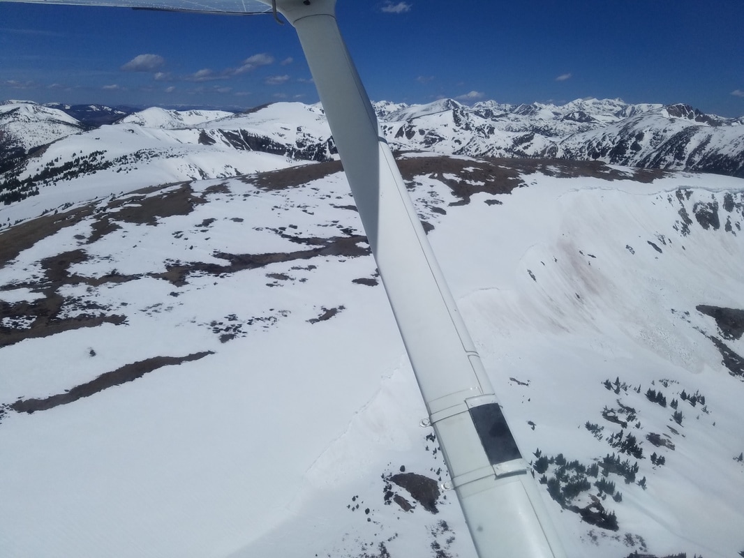 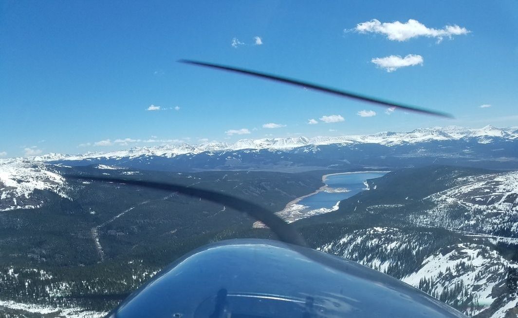 You know!? Everybody gets excited about flying into Leadville and getting the famous certificate (and maybe a T-shirt or a hat) since it’s the highest elevation airport in North America at an impressive 9,934 feet but I personally did not think it was as cool as Glenwood Springs. Why!? It’s in a pretty open valley so, aside from the density altitude challenges, there are no obstacle challenges. Its runway is also almost double its length (6,400’). 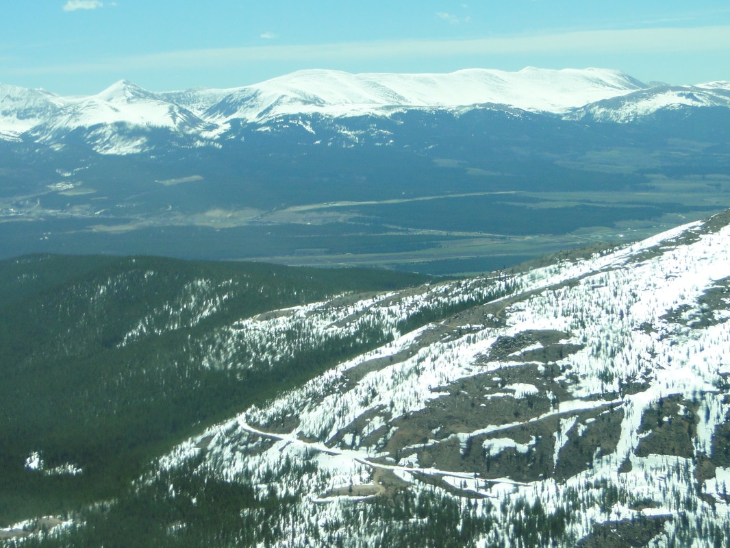 We did a right pattern for runway 16 and my approach and landing was at a much faster airspeed than normal because my true airspeed (TAS) was much more than my indicated airspeed (IAS) but, of course, I had to go by the IAS because that’s all I have in the aircraft to rely on. So, it goes without saying that I floated for a bit over that runway before touching down. It was quite weird. 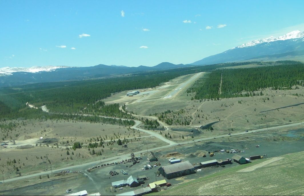 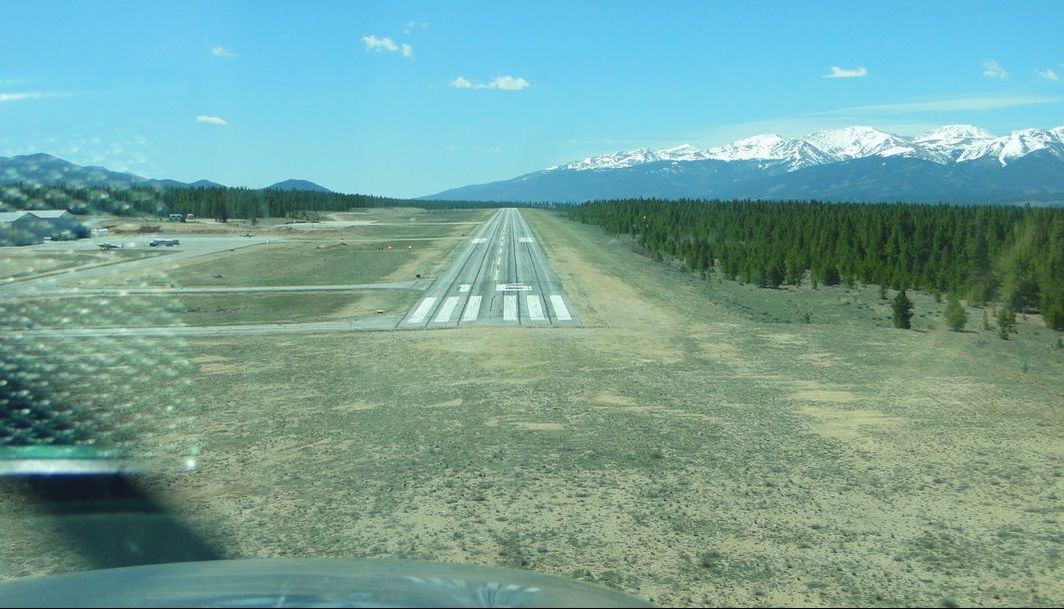 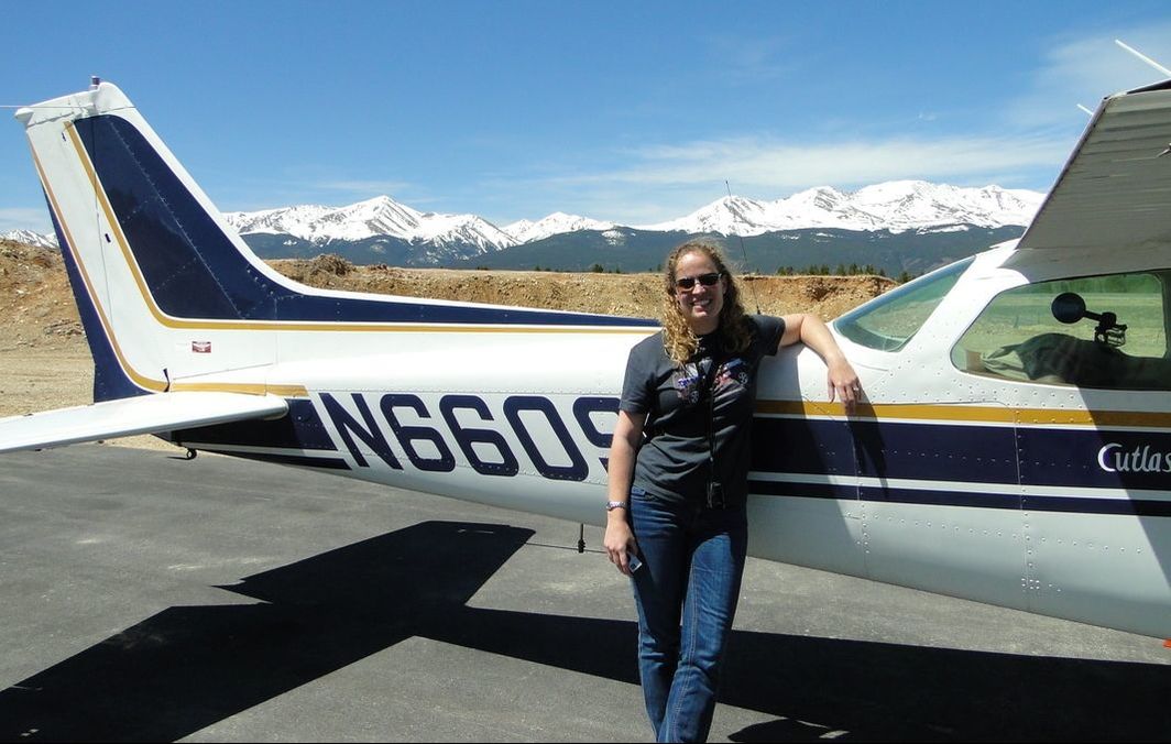 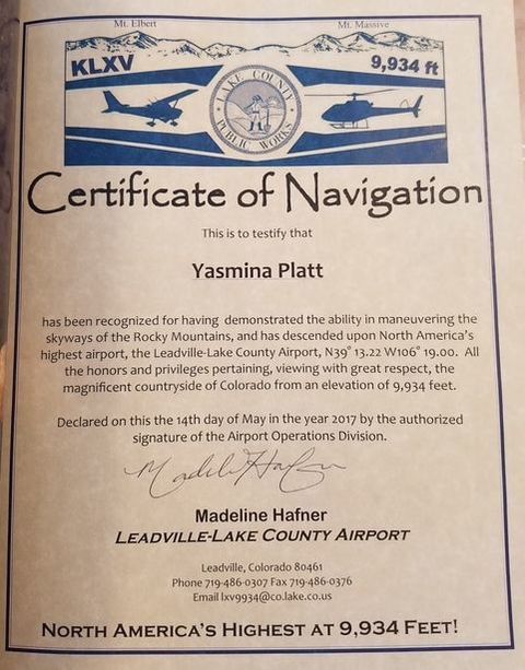 Leadville back to Denver/Front Range The last leg was probably the easiest of the three, which was intentionally designed that way by my instructor to test my new knowledge and skills. In the actual track map, you may see that I may have taken the safest way back but that was mostly because the winds were starting to pick up (per the forecast) and I didn’t want us or the aircraft to get beat up by turbulence close to the mountains. Been there, than that and it’s not too pleasant after a while. Seeing the Twin Lakes just west of our route was probably my favorite sight. They were absolutely gorgeous and postcard perfect! 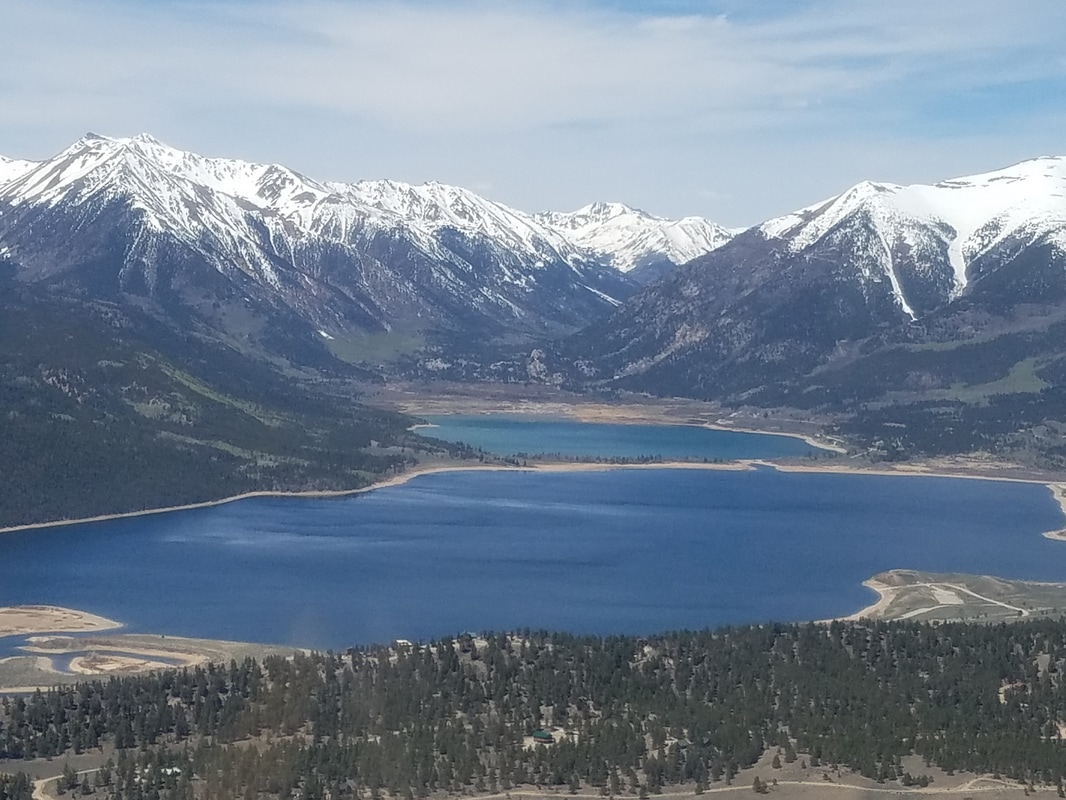 We were often pretty close to mountains (on their “right” side based on winds to take advantage of their uplifting capabilities) but we always thought about our outs in case of emergency, downdrafts, etc. In the picture below, for example, our out was clearly to turn right and go down to the valley. 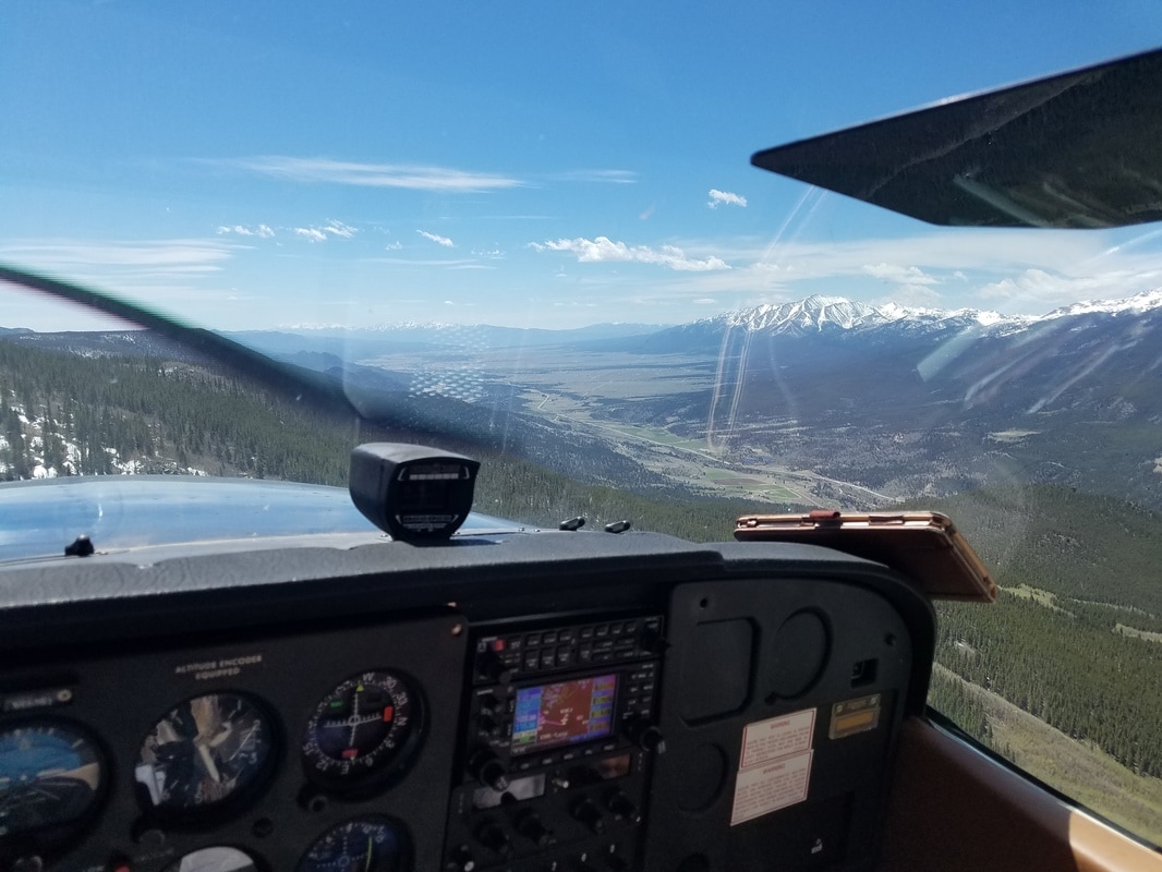 While the track may look like we turned around on the southern edge of the route, we didn’t. I don’t know why it shows that way. I can’t remember what we were doing, maybe testing things, seeing what the winds were like, gaining some more altitude… I really don’t remember us doing that. Maybe I was hypoxic and that’s why I can’t remember? Haha The landscape changed quite a bit southwest of points A and B on our actual track. It was a more arid, red rock type landscape. It was particularly beautiful due to the contrast with the snow peaks alpine mountains in the background. 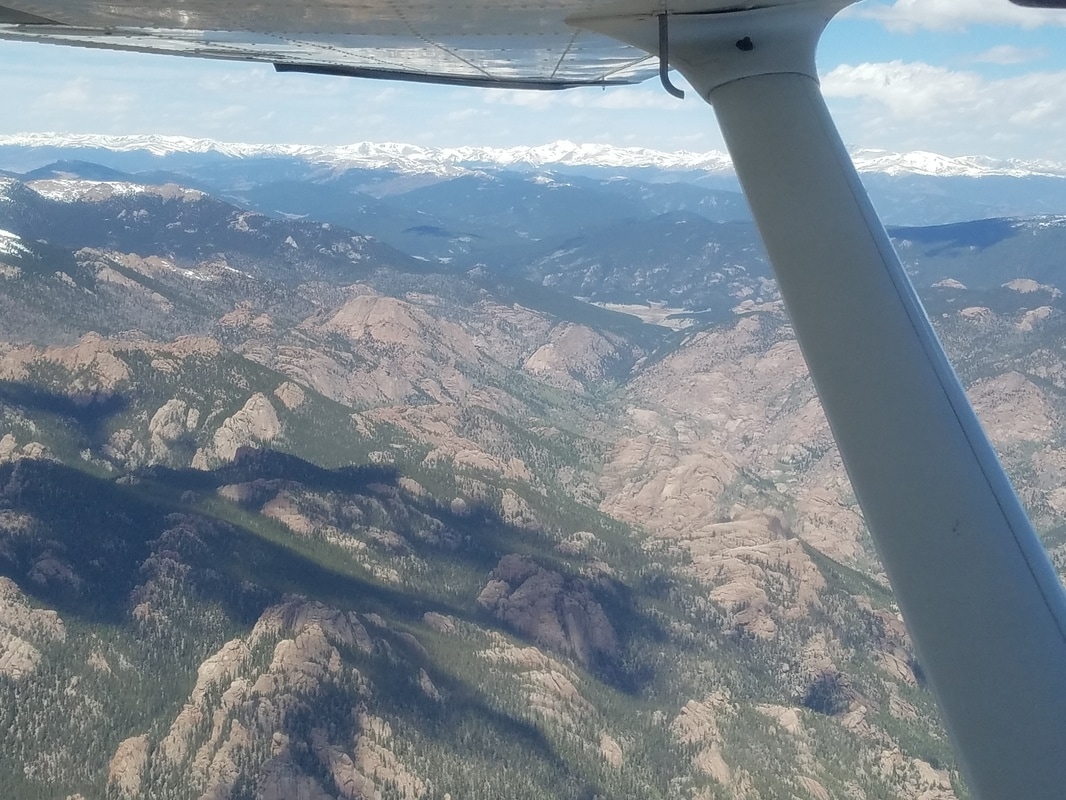 Once approaching Denver, the flight over Roxborough State Park (and having Chatfield State Park just to the north) was pretty neat, especially after having hiked all over the park the day prior. 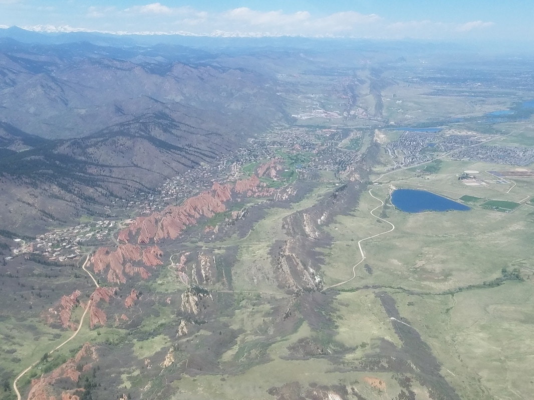 Lessons Learned
I really valued this training. Here are some lessons learned I will take with me: - Know your aircraft (not new but a good reminder nonetheless!) - Know your limitations and personal minimums (again, not new but a good reminder since it is especially critical in the mountains with very changing weather!) - Know the local area. Those mountains all look pretty similar after a little while. We have wonderful tools in the cockpit these days, like iPads, Google Earth, etc; however, it is very easy to confuse one pass for another, one canyon for another, one valley for another. On occasion, taking the wrong turn can put you in a canyon you can’t get out of or out climb. If you’re going to be doing true mountain flying (and I don’t mean flying over the mountains on a high performance aircraft with oxygen), I highly, highly suggest taking a local who knows the area forward and backward. Even if you fly the route a few times, the route can look different every time as the mountains change (snow vs no snow, lakes vs no lakes, etc) - Be careful with mountain passes. They are easily identified on sectionals but some mountain passes are more dangerous than taking a different route. Don’t always assume that mountain passes are “safe” for GA flying. - And, similarly, be careful assuming that flying over highways or prominent rivers are safe places to fly over. Some of these features are not easy to follow with sharp turns and tight areas. - The Colorado Department of Transportation (CODOT) – Division of Aeronautics installed and maintains 12 (with a 13th one in test mode) Automated Weather Observing Systems (AWOS) on critical mountain passes most vulnerable to weather-dependent aircraft accidents. These AWOS are extremely helpful as they provide mountain peak information otherwise not available. For More Information Here are a few good, free resources to learn more about mountain flying:
Credit Thanks, Tim Sale, for great instruction and pictures! Until next time :)
2 Comments
Tim Sale
10/26/2020 10:57:11 am
This blog has been my primary reference for Pilots that want to know about Mtn Flying for the past few years. My extreme THANX to you for having posted it and making it available.
Yasmina
10/26/2020 12:00:46 pm
Awww I'm glad to hear that. Since then, I've written (and I continue to write) other blogs about mountain flying in other parts of the country/world but there's nothing like mountain flying in CO =) Leave a Reply. |
BLOGS ON THIS PAGEAuthorYasmina Platt ArchivesCategories |
 RSS Feed
