|
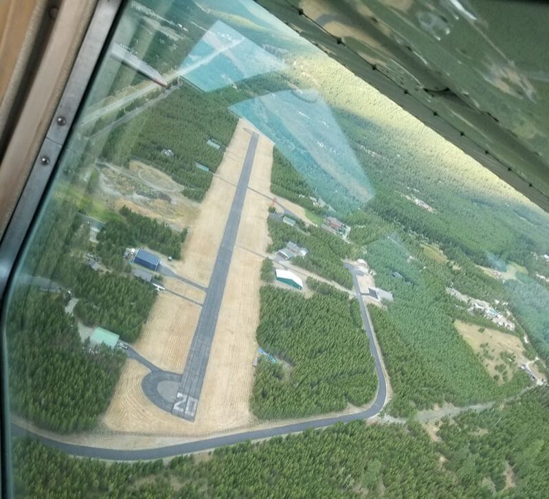
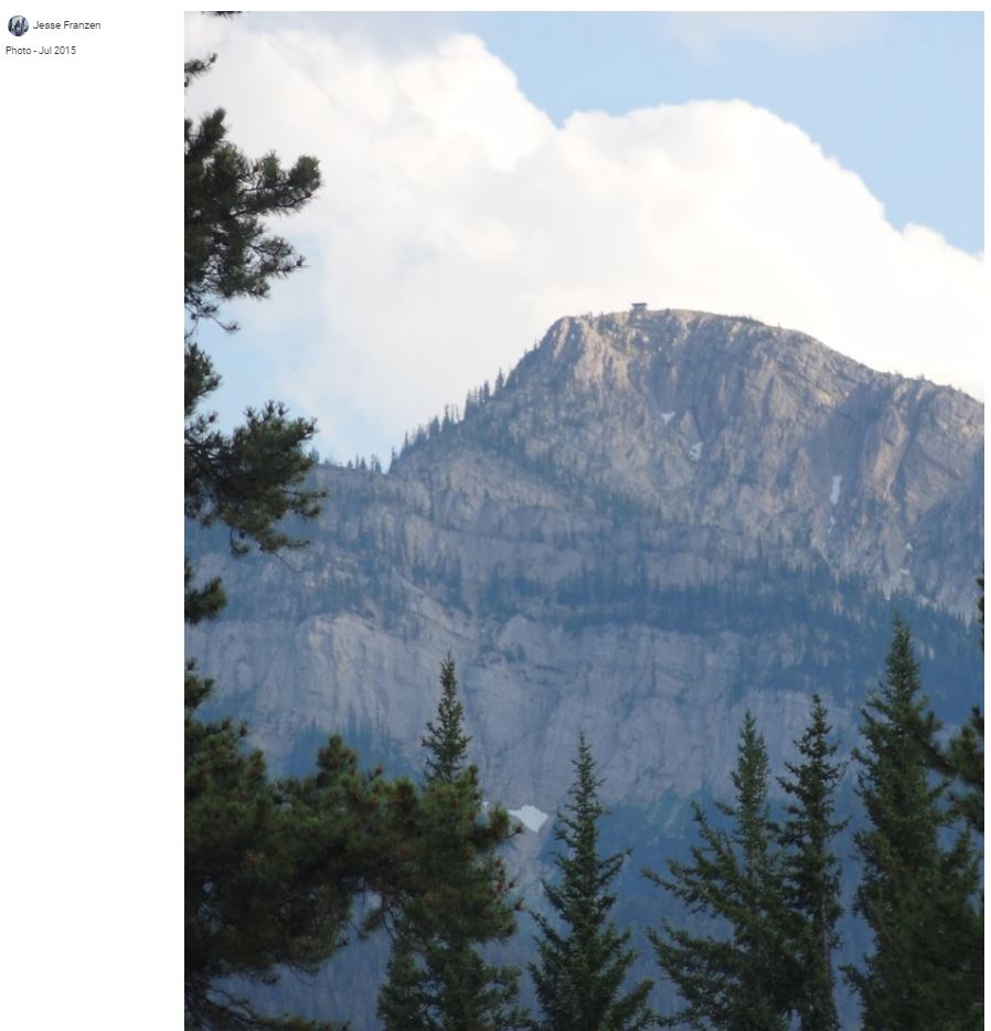
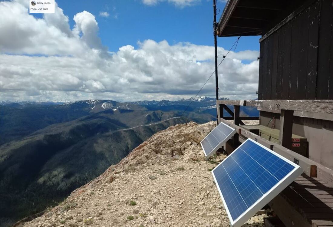
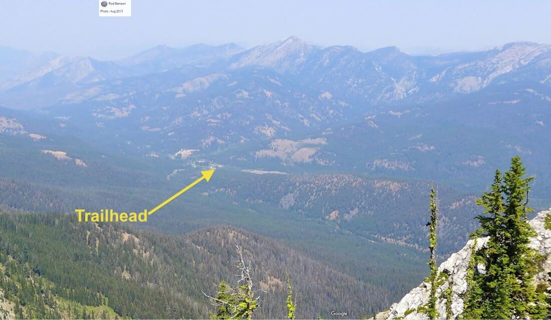
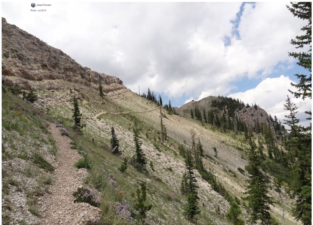
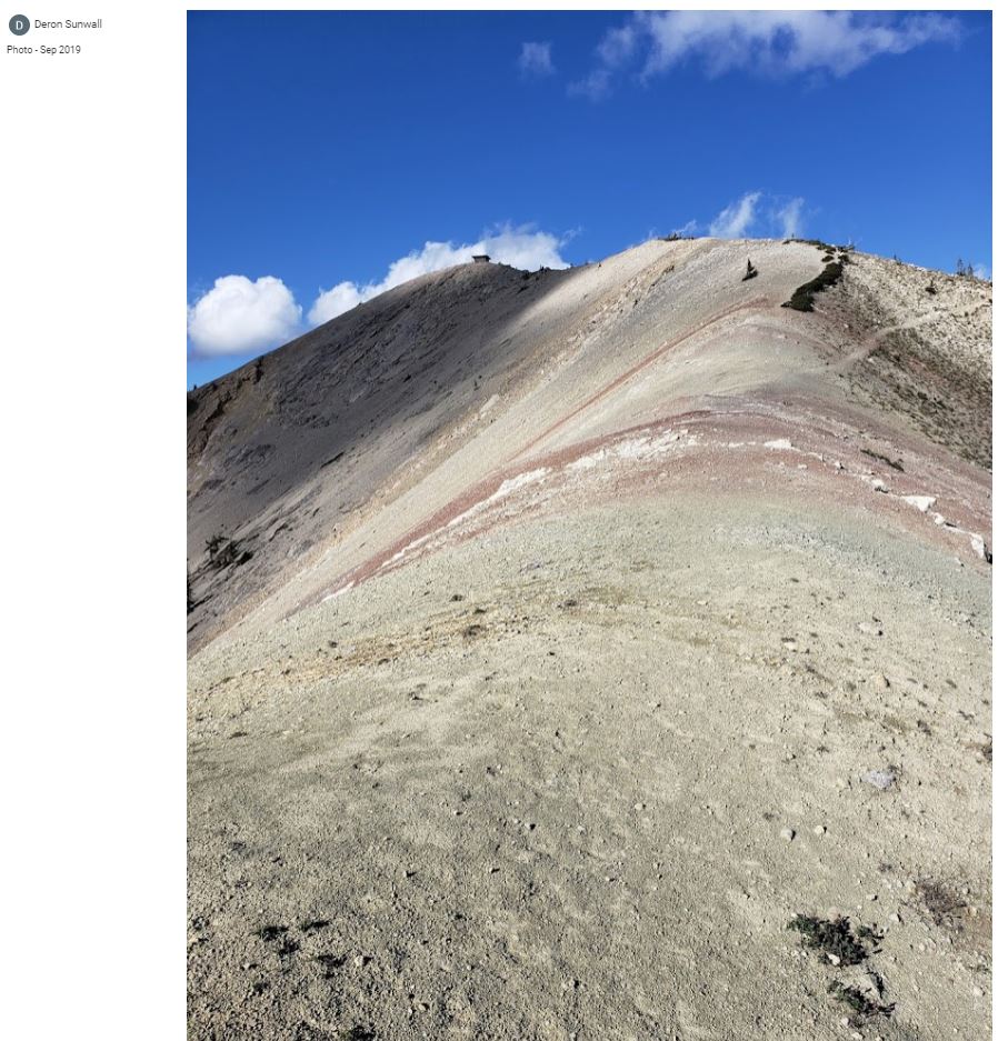
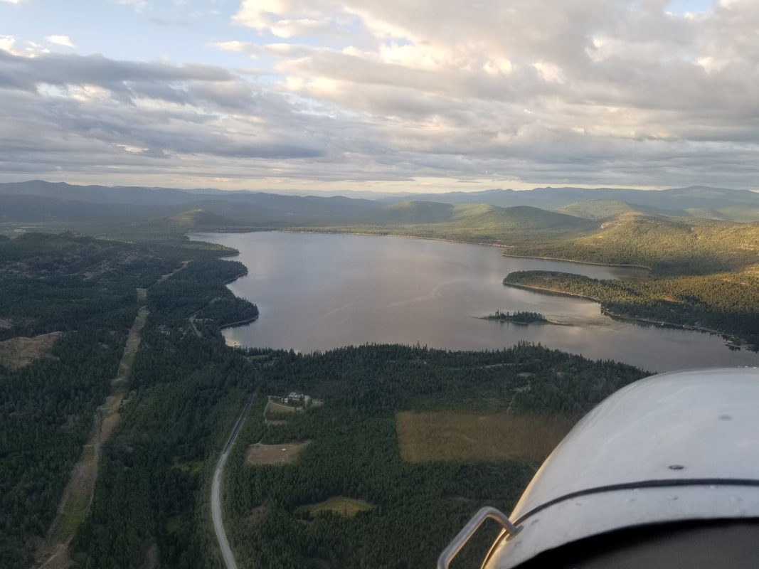
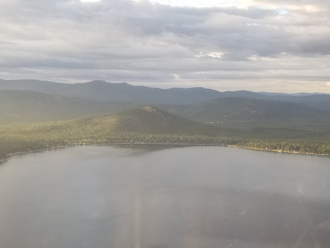
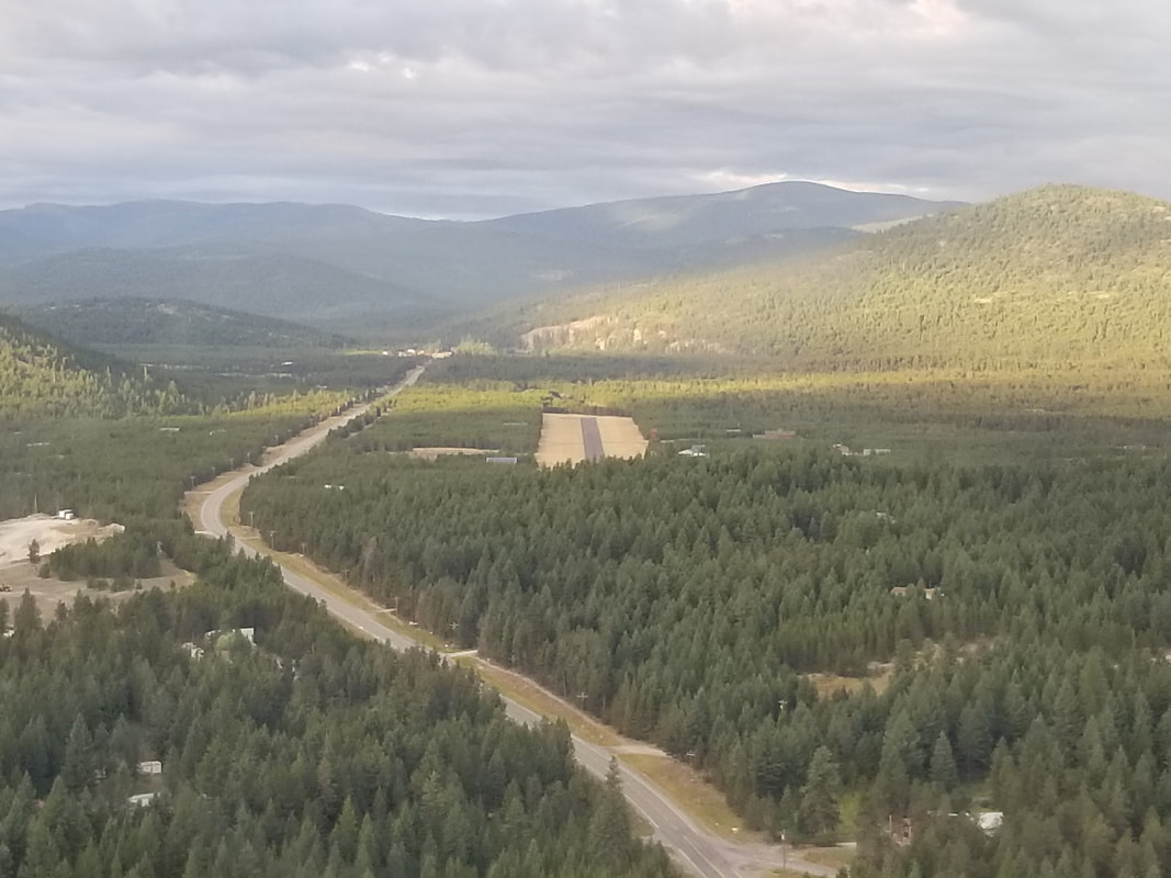
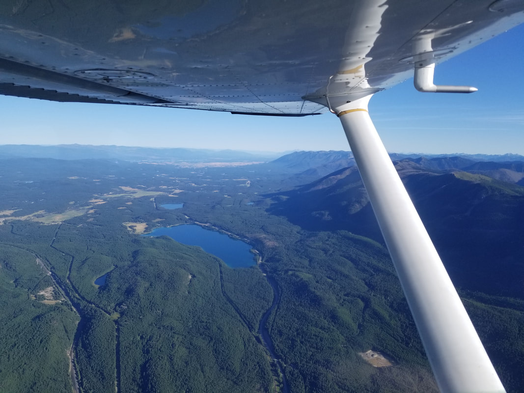
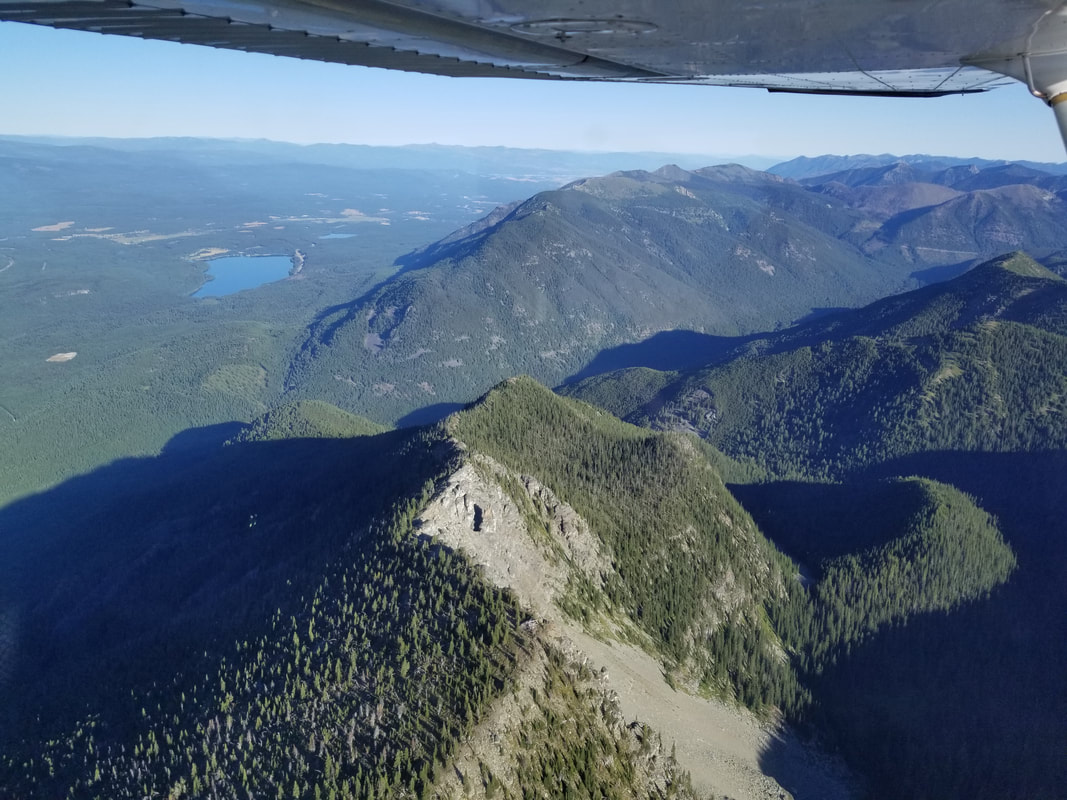
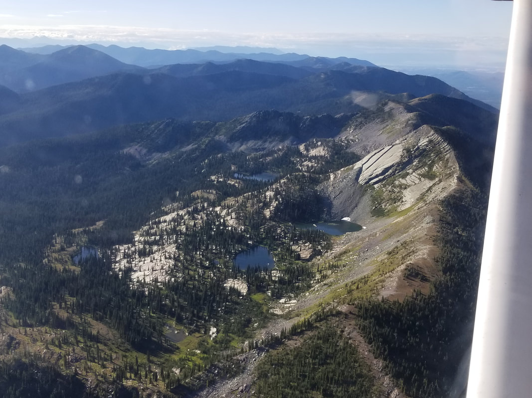
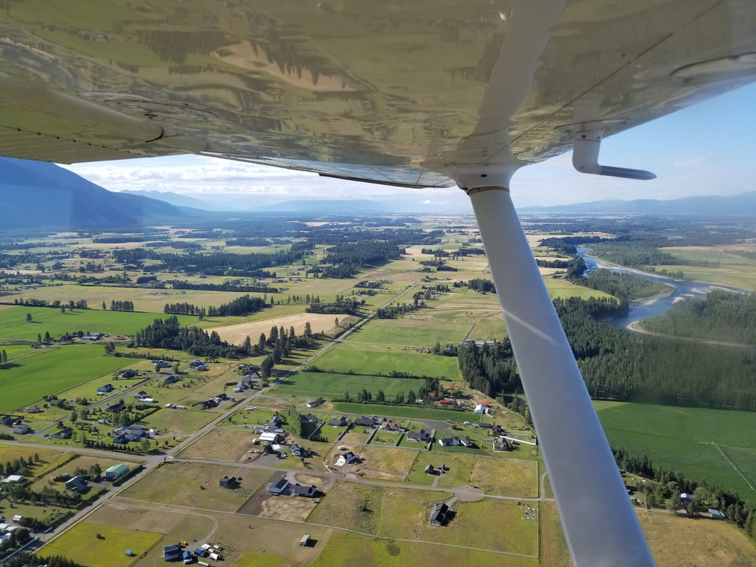
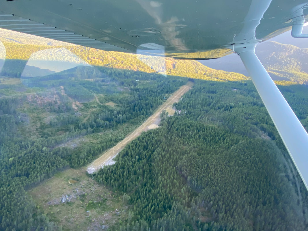
Summer is here! The mountains are calling, and we must go… fly them! I have a proposal for you. Let’s fly to Benchmark Airport (3U7), spend a couple of nights (different comfort levels identified), and enjoy some outdoor activities. Where is 3U7 you ask? Montana’s Lewis and Clark National Forest, 80 miles west of Great Falls. The Airport is circled with yellow highlighter in the two sectional images below. The Airport is owned and operated by the U.S. Forest Service and is only open in the summer. Runway 12/30 is a 6,000 x 100 ft paved runway that sits at 5,434 ft. It is important to take a look at the information in the Chart Supplement ahead of time to plan accordingly: 1) Mountains parallel east and west of the Airport, 2) the runway is subject to moderate to several crosswinds and turbulence, 3) Runway 30 is recommended for departures if conditions permit, 4) Runway 12 rises uphill 120 ft with rising terrain beyond, and 5) there are no services. 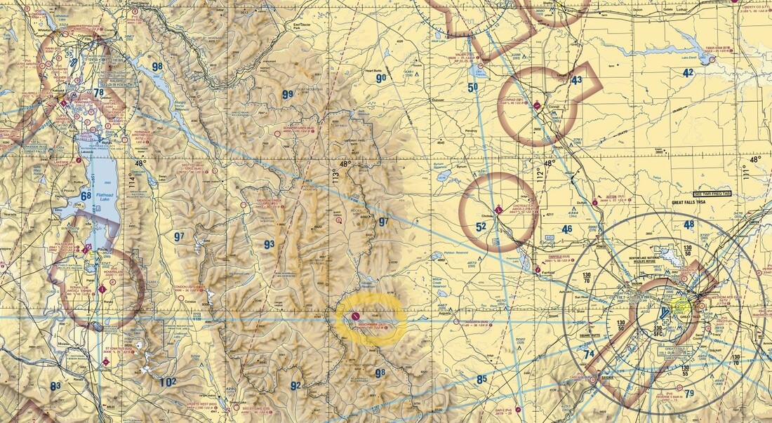 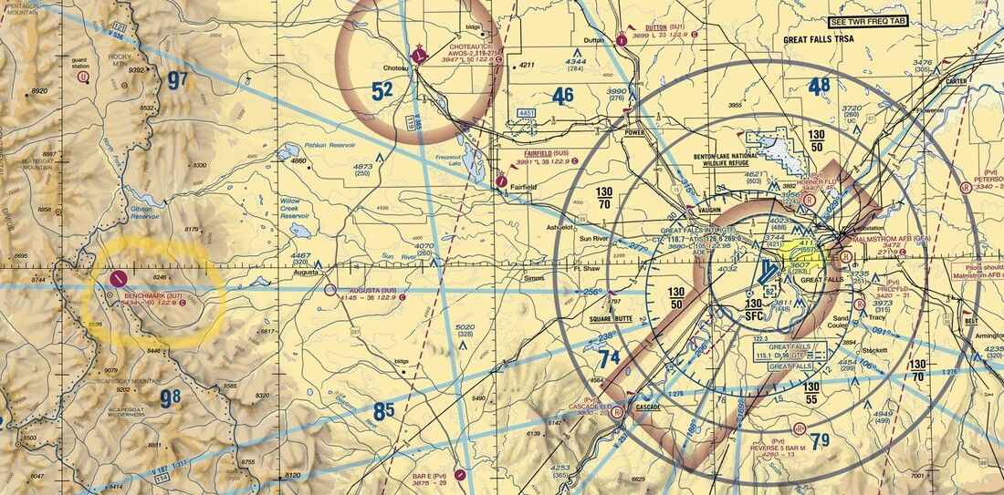 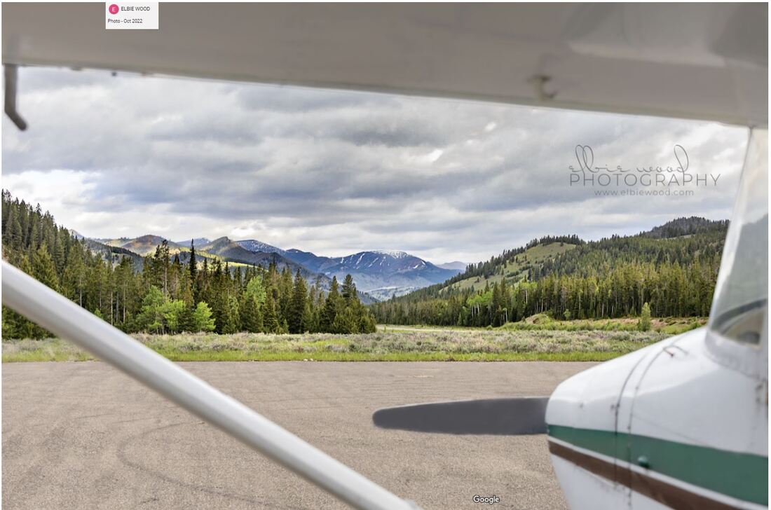 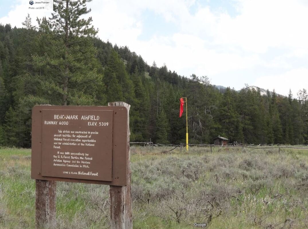 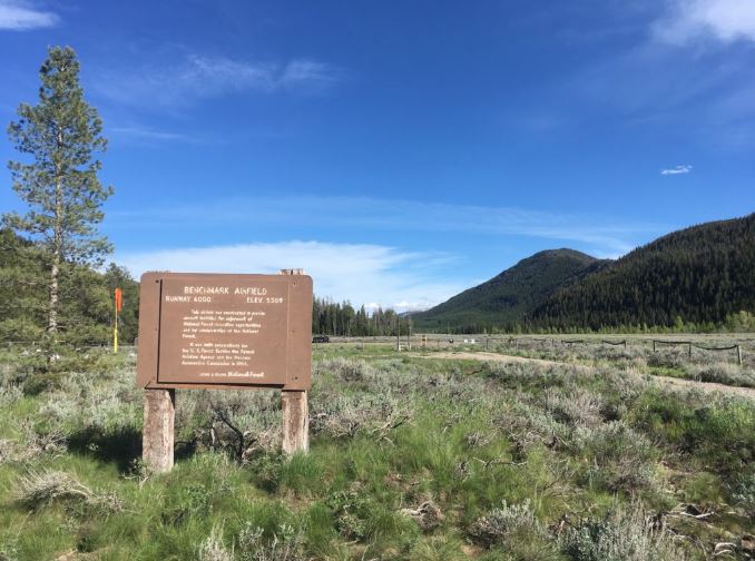 Want to camp out and watch the night sky? There are two campgrounds on the west side of the Airport: 1) Benchmark Campground on the northwest end that is often used by campers and 2) Van Deriet Campground or “the Fly-in Campground,” as it is also known, on the southwest end, with an aircraft parking area. There’s also a good chance you can camp by your aircraft, if you prefer. Prefer to stay in a cabin? Benchmark Wilderness Guest Ranch is within walking distance of the Airport. But, if you’re looking for something more private, rustic and off the grid, USFS’s Kenck Cabin is about 2.5 miles north of the Airport and may be perfect for you. 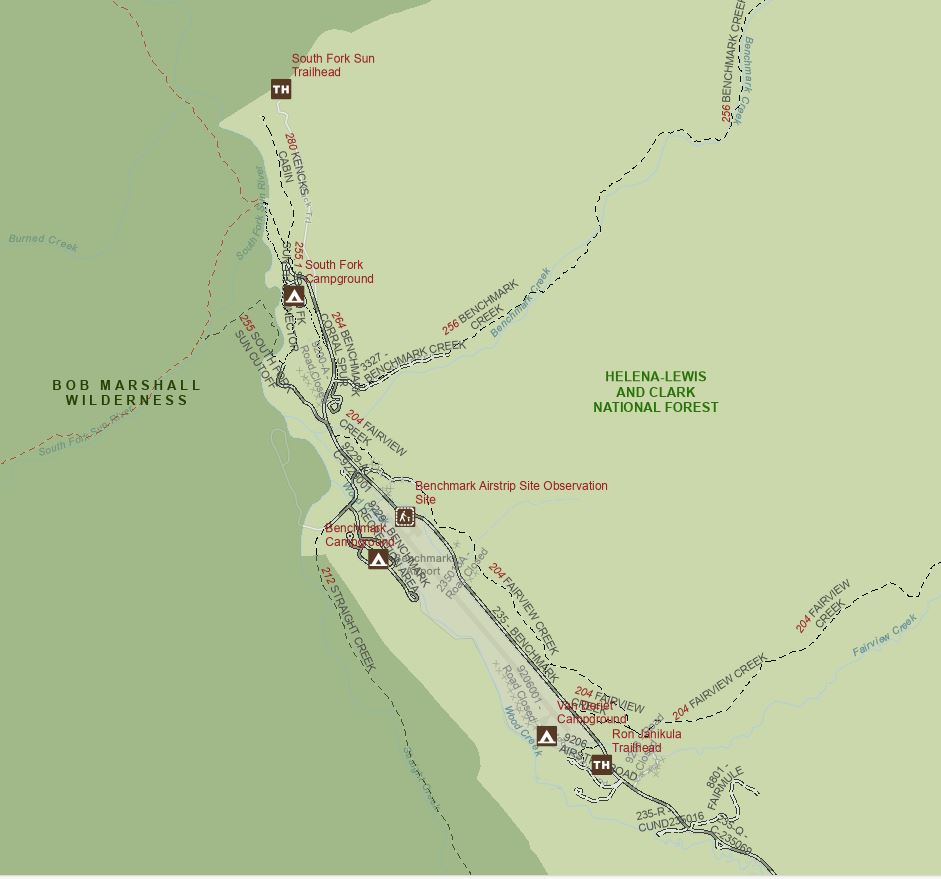 Source: U.S. Forest Service The outdoor activities are endless: Fishing, hiking, hunting, horse back riding, stargazing. You can find me hiking up to the Patrol Mountain Lookout in the adjacent Bob Marshall Wilderness by following Trail Number 213. It’s about 12 miles roundtrip with 2,845 ft of elevation gain from the Airport. It’s not an easy hike but the views and seeing the historic lookout is worth it! 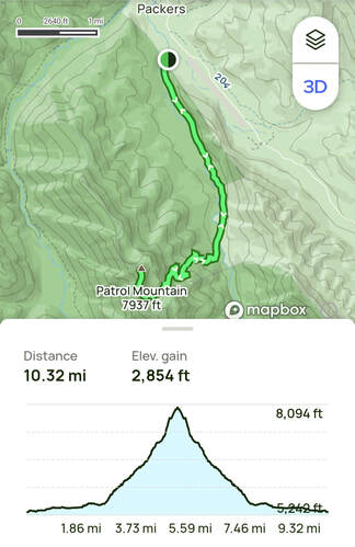 Source: All Trails.
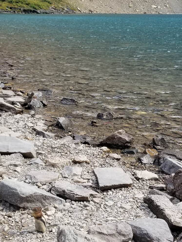
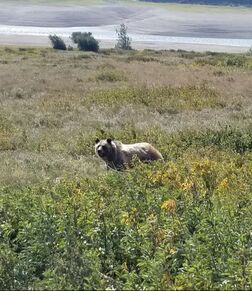
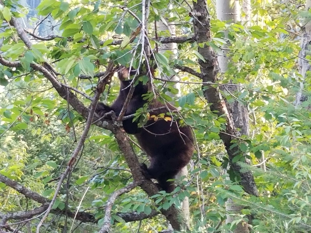
I also want to share some Montana travel tips to consider: Bring bear spray, suggest bringing a bottle of water with an integrated filter so you can refill at any stream of water, bring clothing for a mixture of weather conditions, and keep in mind all food must be out of sight in approved containers once onsite.
Have extra time to explore some more? Continue north towards Glacier National Park or other areas in Northwest Montana! Fly safe and fly often! (See if you can see the lookout from the air on your way in or out!)
0 Comments
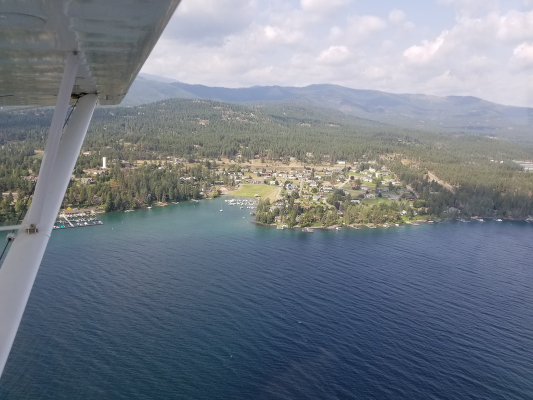
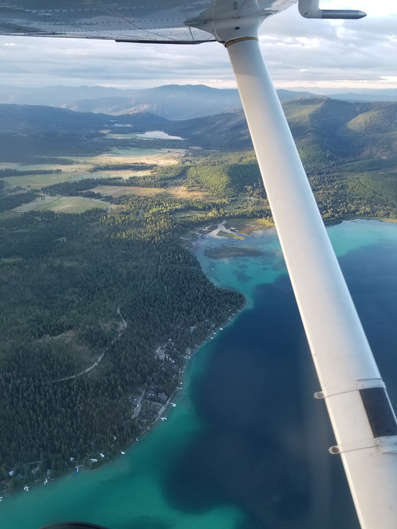
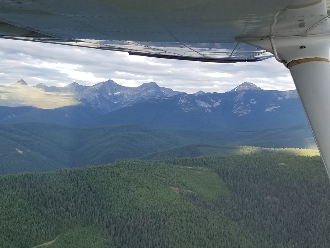
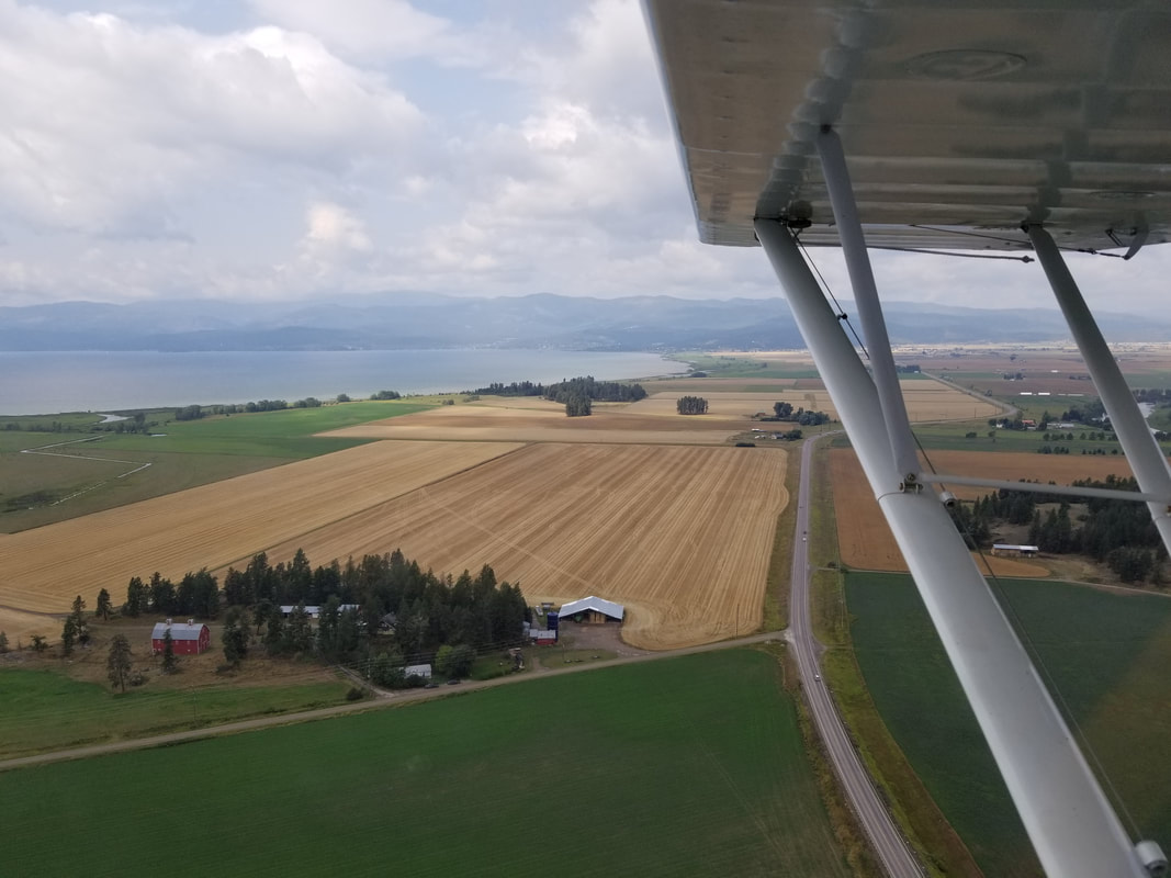
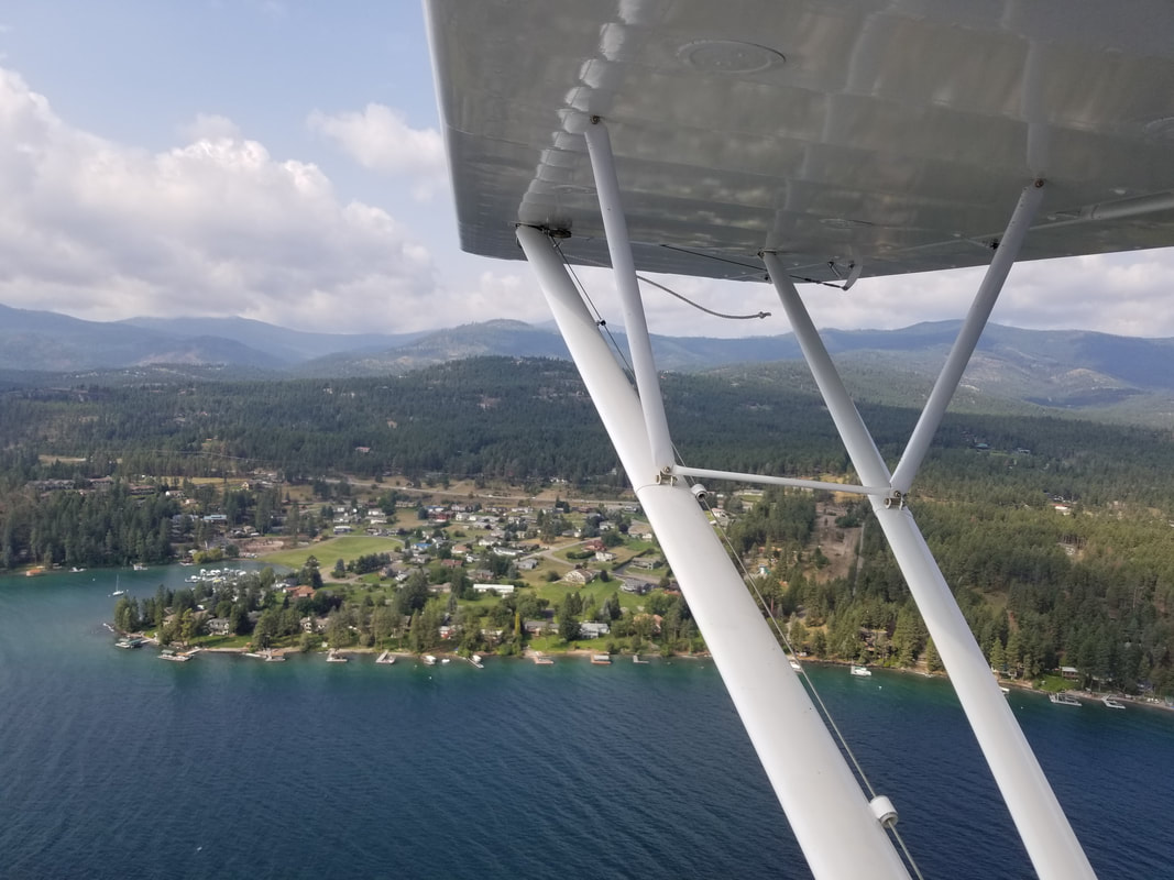
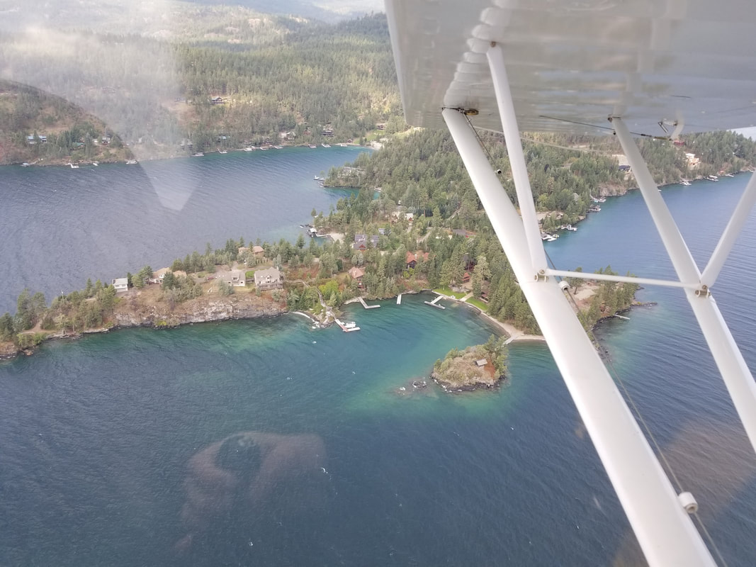
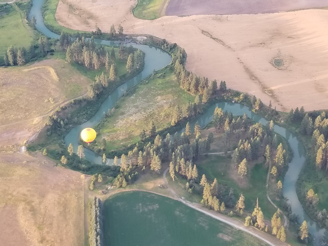
My favorite time of the year is coming! Summer is almost here (or here in Houston anyway!), the mountains are calling, and we must go… fly them! 2020 was the first time my husband Jared and I visited Montana and now it’s (like) an addiction. After spending a little over a month in neighboring Idaho, we spent another 1.5 months in NW Montana in 2021. The first year we left wishing we had done some seaplane flying in the area but the local seaplane company, Backcountry Flying Experience, was all booked up. Last year, we made sure to secure a few flights months before. NW Montana offers big open lake water, mountain lakes, numerous rivers, and advanced mountain flying. But, unfortunately, low visibility from both smoke and weather made us cancel on a couple of occasions and, even on the day that we flew, the weather limited us (due to clouds and wind which also translated into pretty choppy water). Regardless, I had a great time. I practiced some river flying and docking, we evaluated a lot of different areas for debris and other conditions, and we went aerial sightseeing over Flathead Lake. A "flying Yasmina" is a "happy Yasmina," no matter what! This Piper Super Cub PA-18 is the champ that let us take her on a joy ride but normally she’s quite the work horse. She spends all summers training pilots. 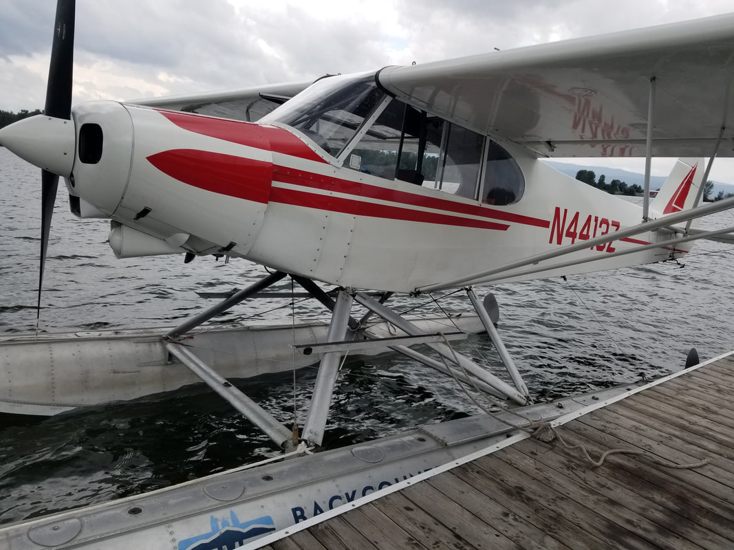 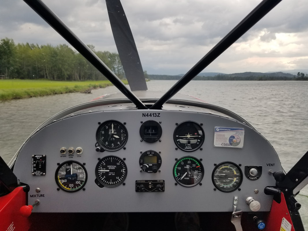 Backcountry operates from a nice lot on the banks of the Flathead River, just north of Bigfork. 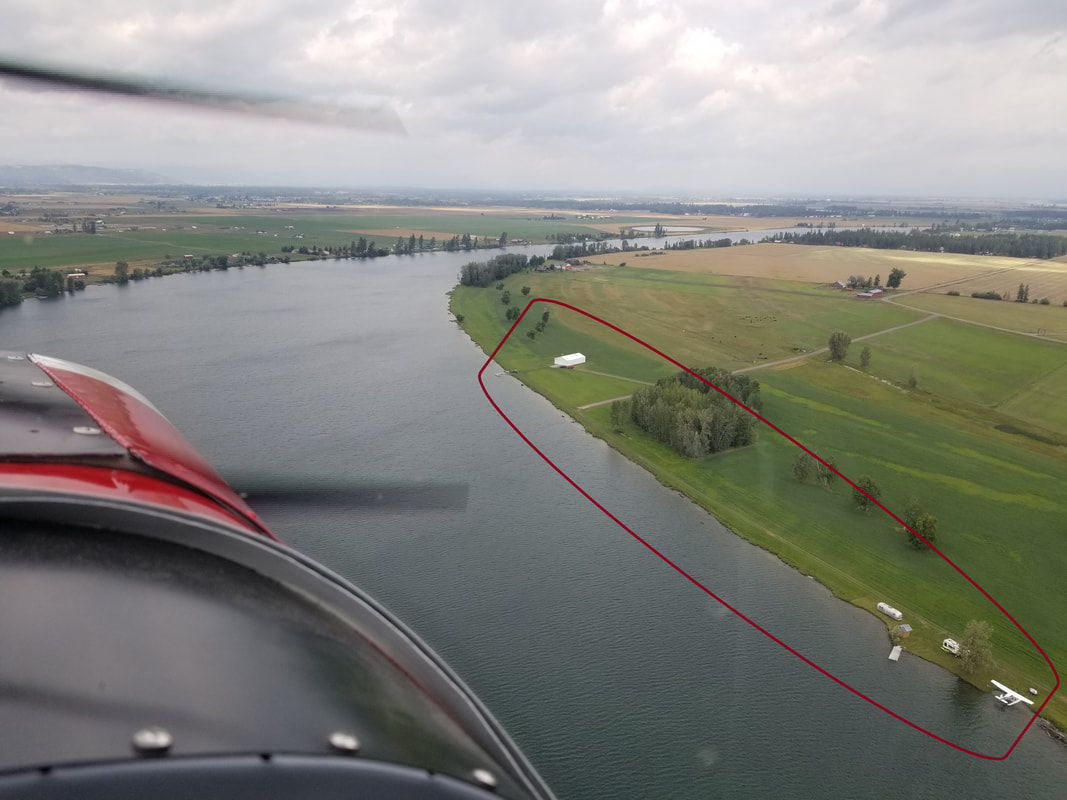 Bigfork is a cute town from the ground and from the air. It has been honored with flattering designations in many publications. It is a lovely, upscale, year-round resort village that is brimming with art galleries, fine restaurants, golf, high-end boutiques and live theater. 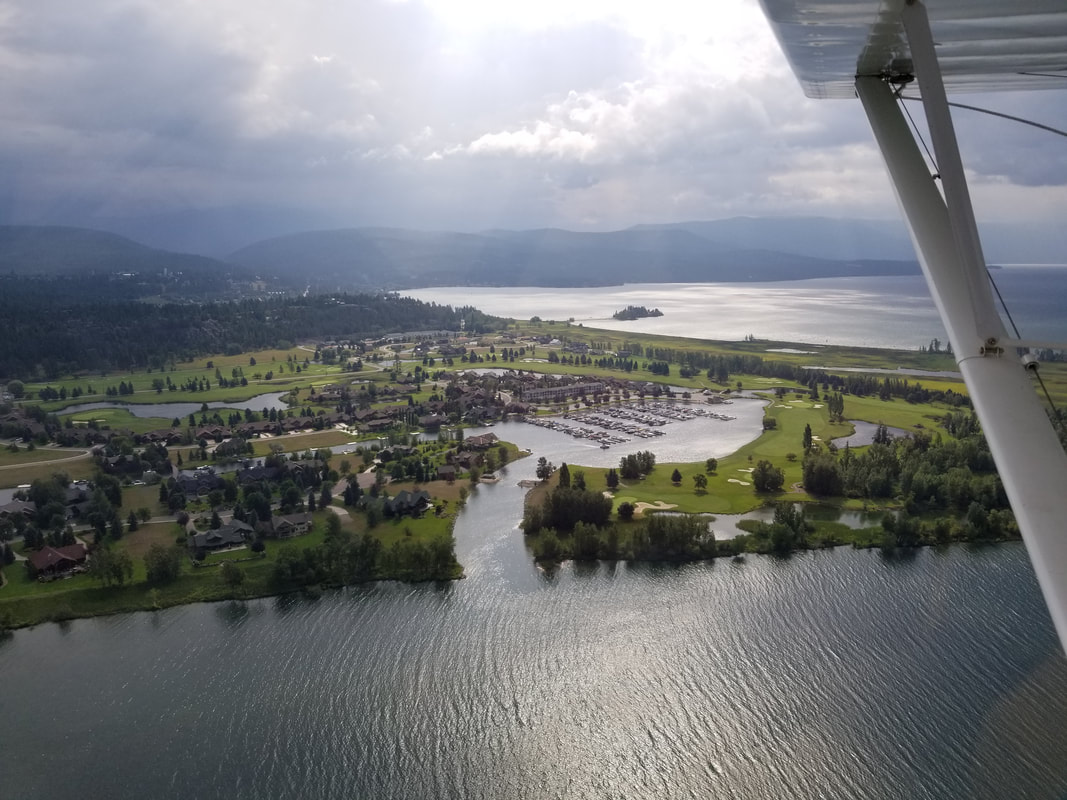 If these pictures don’t represent Montana and all of its beauty (outside of National Parks), I don’t know what does! The weather prevented us from seeing beyond the Flathead Valley but the Bob Marshall Wilderness, the Jewel Basin, Flathead National Forest, Flathead Lake and all the little rivers and creeks around were awesome to see.
 The mechanism to go up and down from this particular house to/from the lake was quite interesting and elaborate!
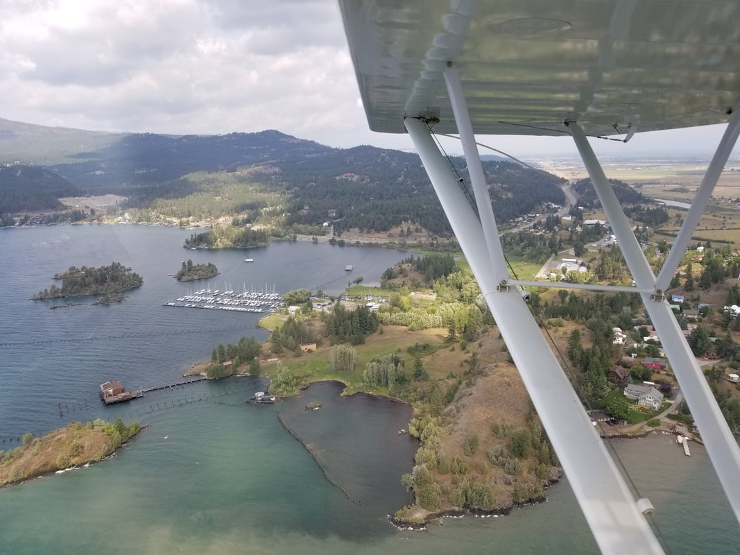
But I’d prefer to have access to Lakeside Airport (MT03) given the choice. It appears to have a nice 3,376 x 60 ft paved runway in a beautiful setting. MT03 is a private airport with prior permission and training required. It is essentially a “one way in, same way out” kind of an airport due to significant runway slope and rising terrain on the south end of the runway (as can be seen in the picture I took below). Landings should be done to the south (19) and departures (01) to the north. A low pass prior to landing is recommended to clear the runway of any sort of animal or wildlife. 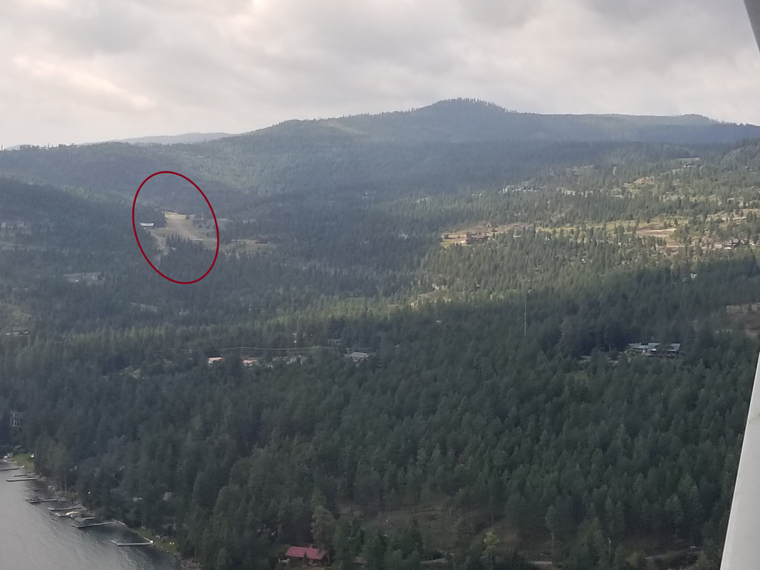 You know the drill... a good pilot is always looking for places to land should an emergency happen. A good seaplane pilot is always evaluating available water for obstacles, moving objects, and debris. There was definitely a lot of debris (big tree logs) on the north side of Flathead Lake. 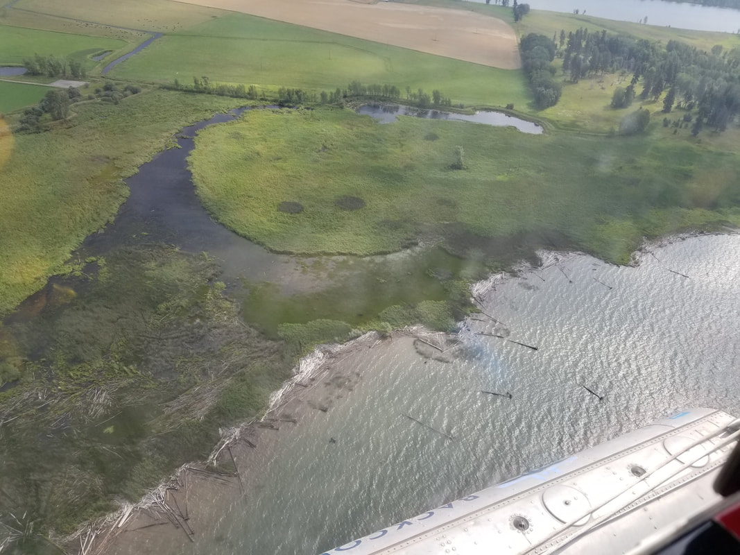 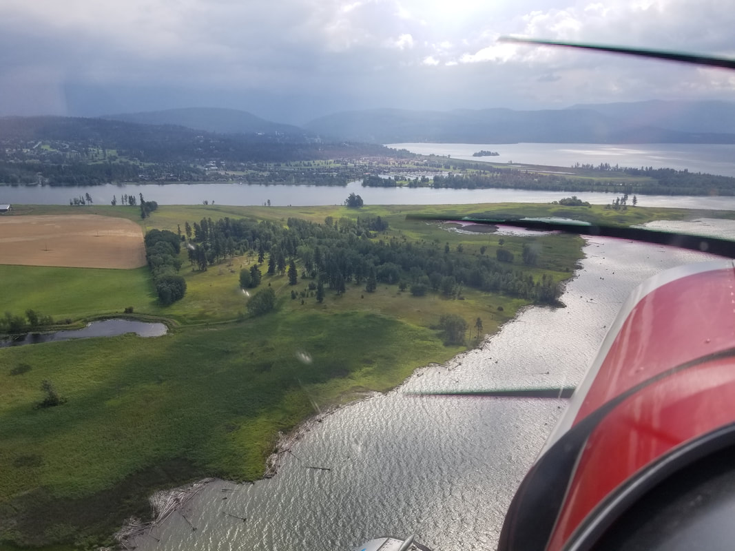 Splash safe and splash often!
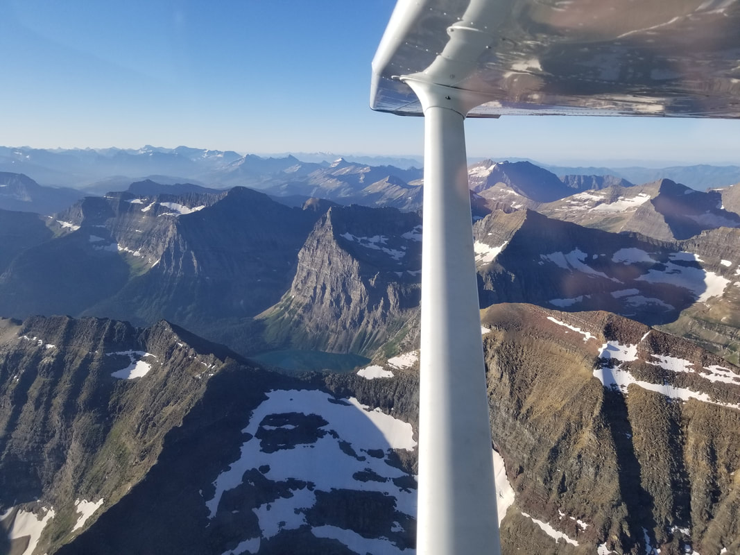
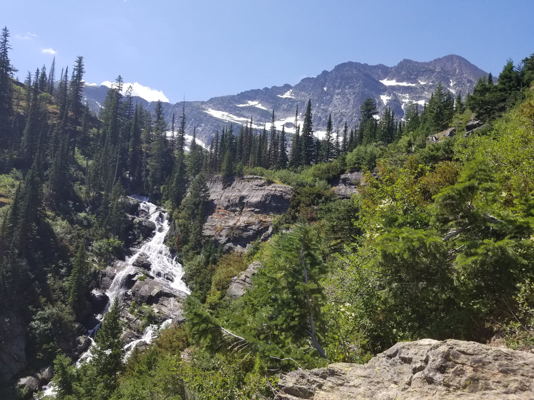
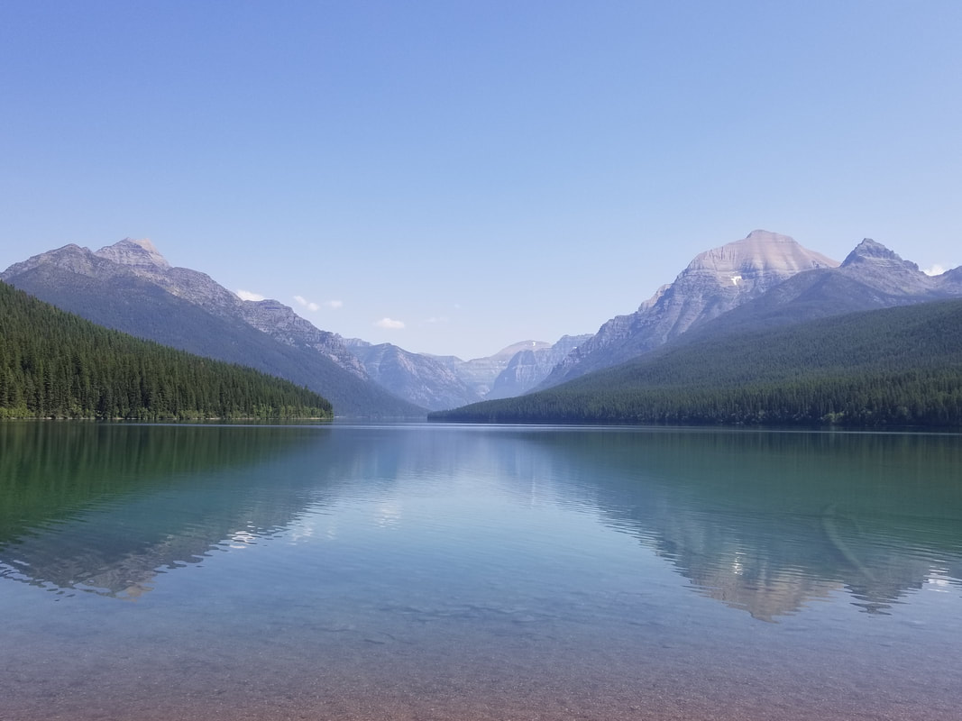
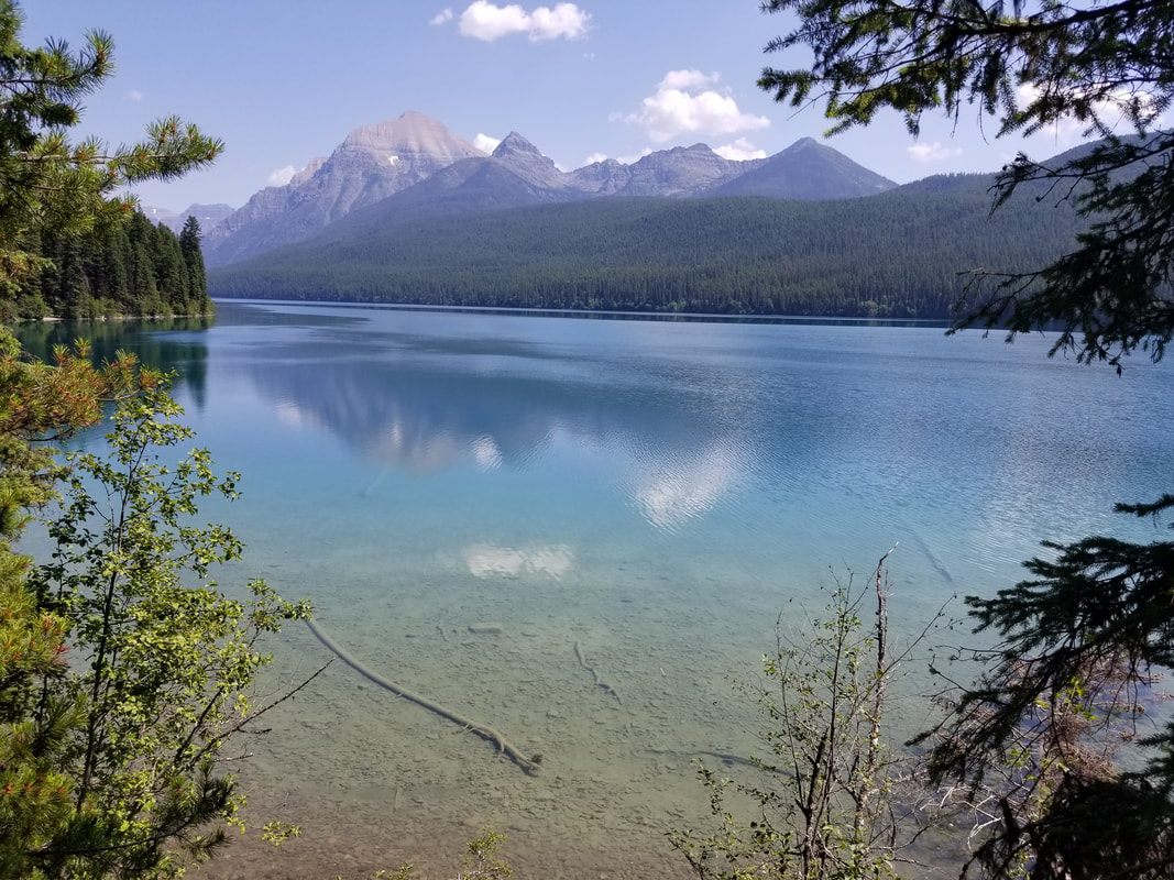
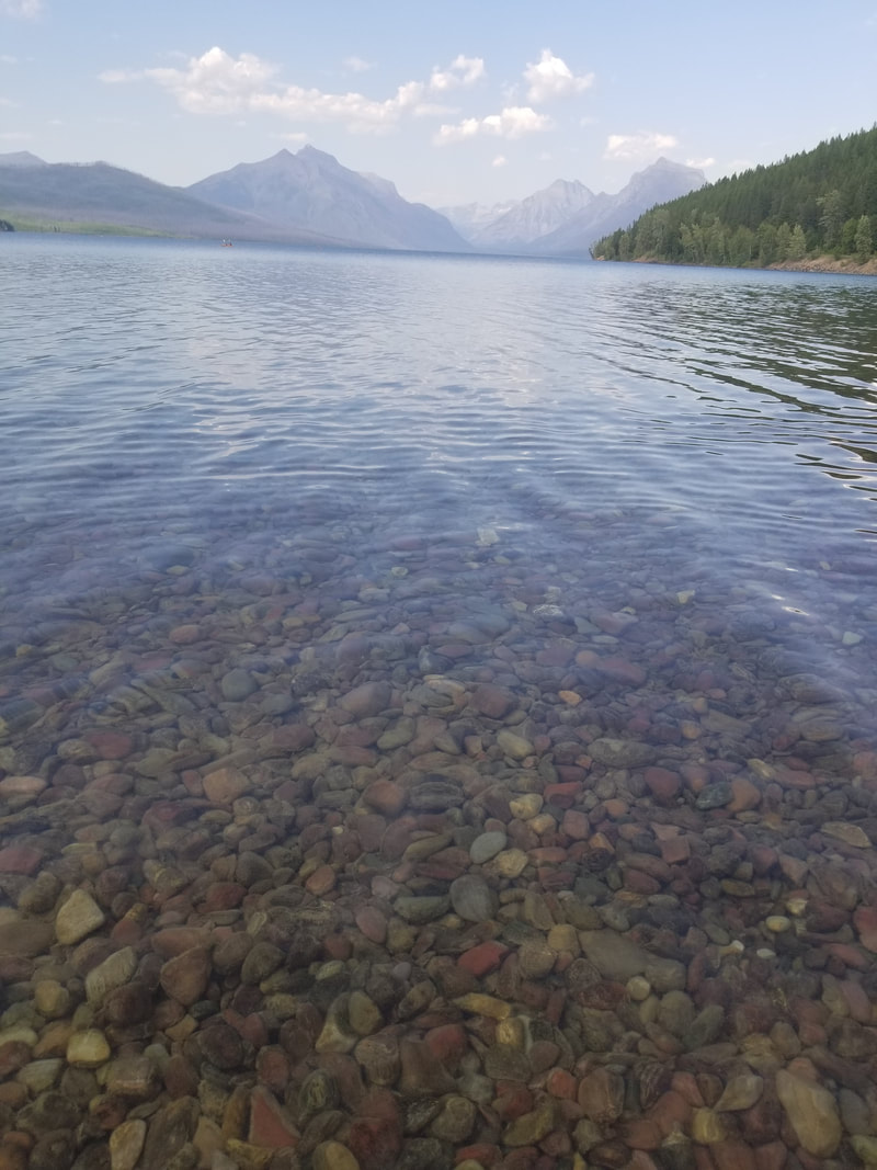
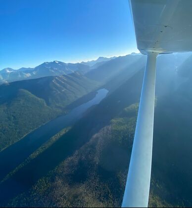
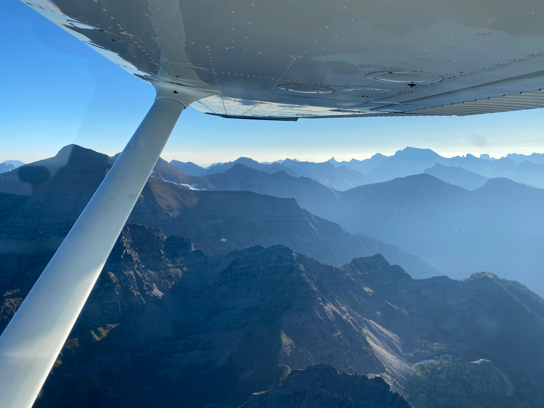
The mountains are calling and we must go… no matter how we get there! Although they are actually worth seeing from more than one perspective! The 3D view from an aircraft provides a fantastic big picture of the area: its historical topography, its bearings (situation awareness)… its grandiosity. It’s also a much easier way to visit; almost like viewing it from a couch. However, stepping foot on the trails feels like being a part of the mountains; an extension of them! Hiking through and over the mountains is a great feeling for me. I love the experience, being in nature, disconnecting from everyday life, the exercise, the challenge, the views, the smell, the ability to stop at any moment and, yes, the wild animals even though I prefer to see them from a good (safe) distance. Let’s use a few examples from Glacier National Park to explain further. (Note that some of the aerial and ground pictures are from two different summers.) I’ll start with Hidden Lake, one of Glacier’s easiest and most popular hikes from Logan Pass. 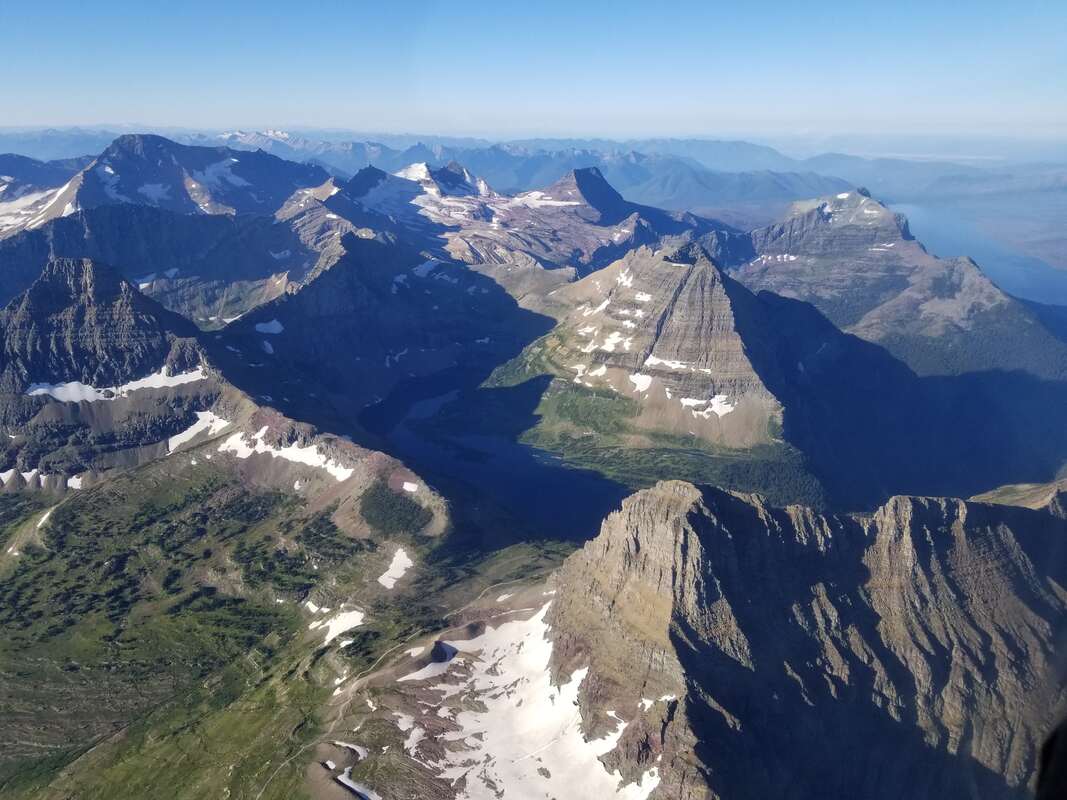 While one cannot see Logan Pass, you can picture it just south of the lower left corner of the picture. From there, one can follow the trail (partially paved and can be seen in the picture) to view Hidden Lake and its beautiful valley. The aerial view provides a great shot of it and its general area, including Sperry Glacier in the immediate distance. However, being on the trail allows you to be a part of the landscape. It puts you right in the middle of it all but does not provide views of the area beyond the valley. It’s also not uncommon for mountain goats to be enjoying this same beautiful area as hikers. Unfortunately for some though, this trail is often closed due to “bear activity.” In this case, it means bears chasing mountain goats up and down the valley, left and right of the trail. 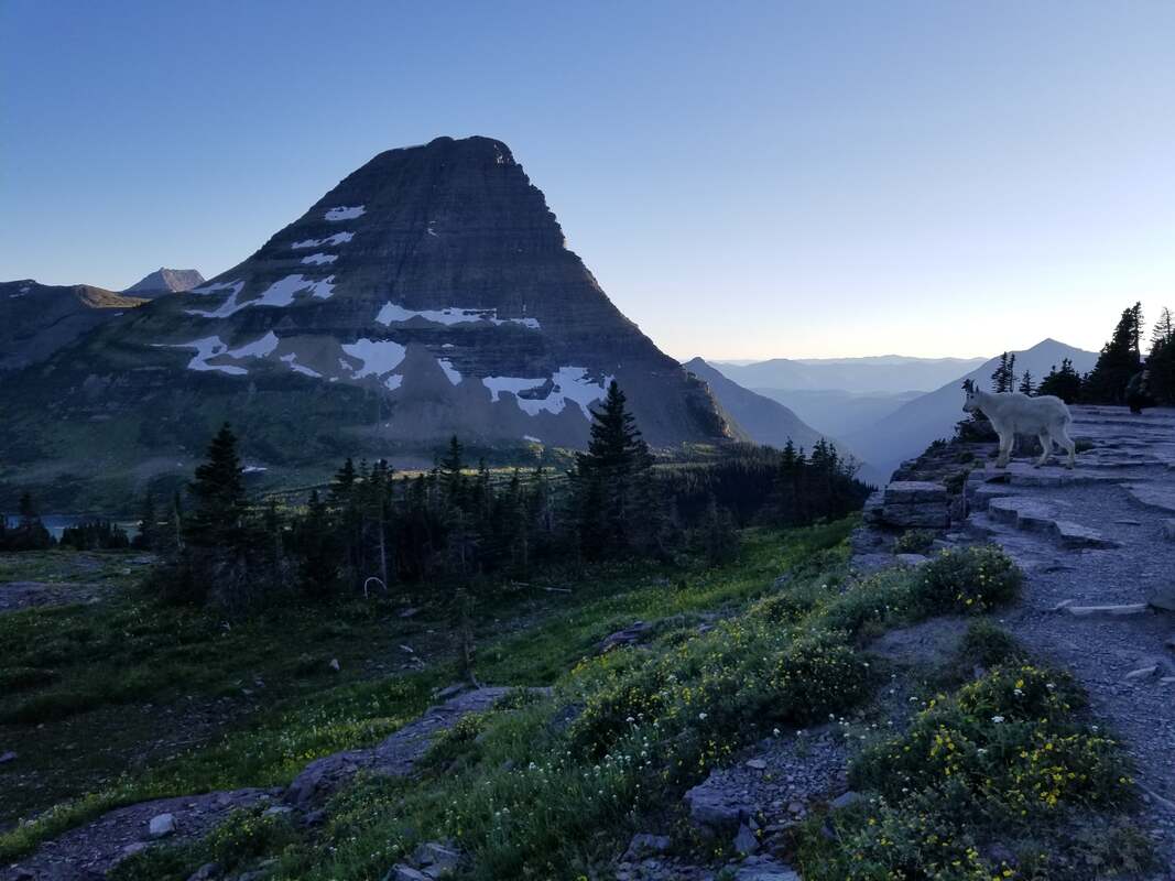 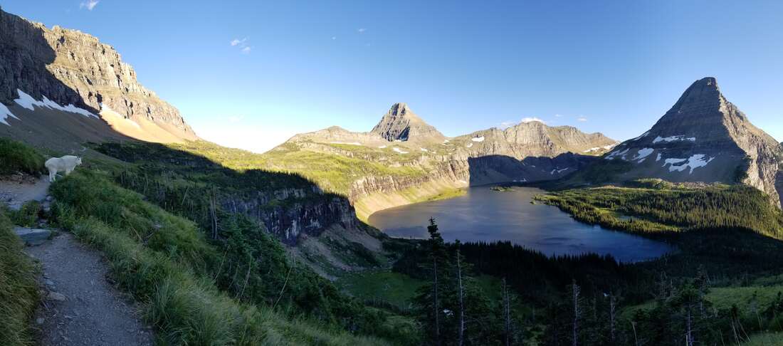 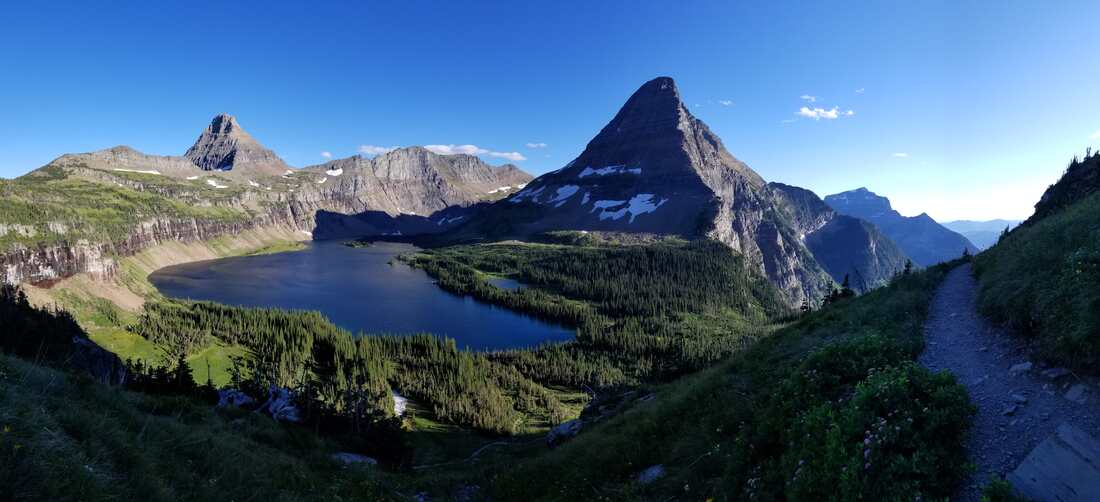 Continuing with famous trails… Grinnell Lake and Grinnell Glaciers are amongst visitor favorites. The hike to the lake is fairly easy, especially if shortened by taking a boat across Swiftcurrent Lake and another one (part of the same ticket) across Lake Josephine. But the hike to the glacier is moderate. Flying over the area clearly shows the difference between Grinnell Lake and Grinnell Glacier. Many first-time visitors question this because they think Grinnell Lake is the one on top, when it’s the one at the bottom. The lake up top is simply part of the glacier that is melting and receding. 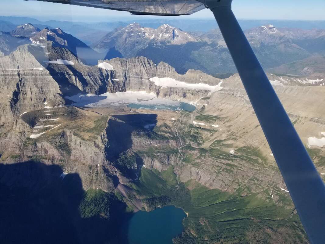  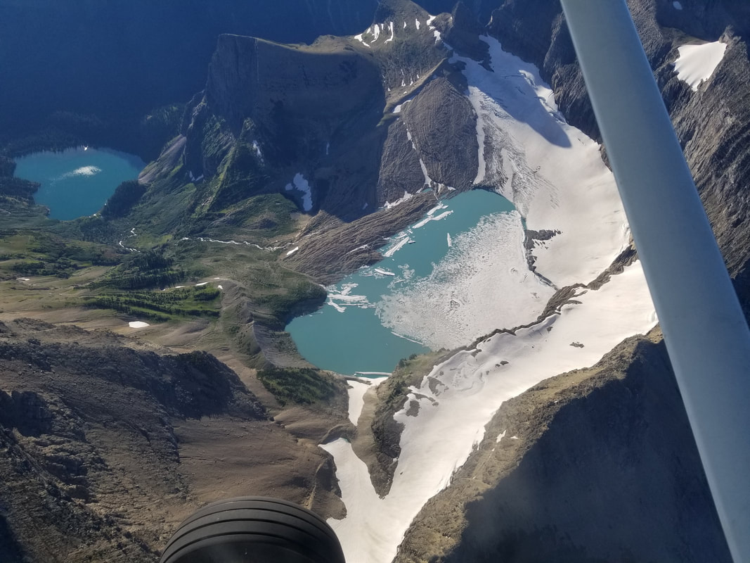 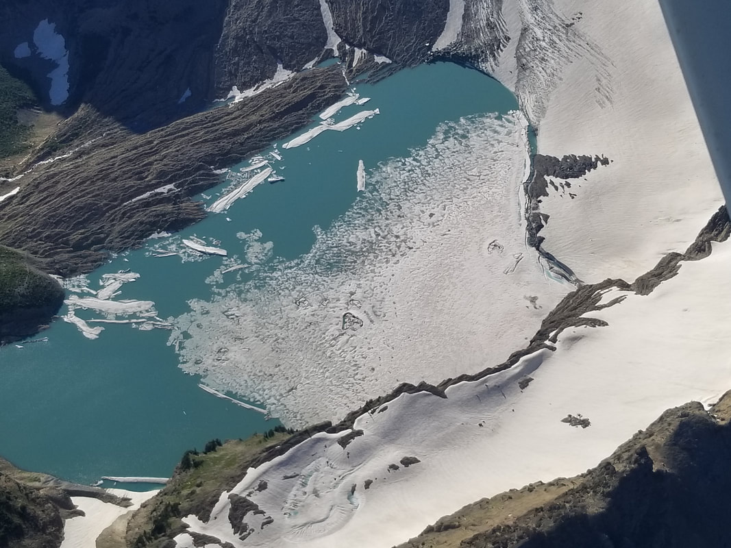 One of my first thoughts when hiking to the Glacier was that the waterfalls were not as evident from the air as they were from the ground. My second thought was that the Angel Wing (the mountain west of the waterfall) is much bigger in actuality than the flight portrayed (even with the shadow). I still would have liked to hike up to it, but it was pretty rainy and stormy when we arrived at the Glacier so it’s on the list again for a future trip. 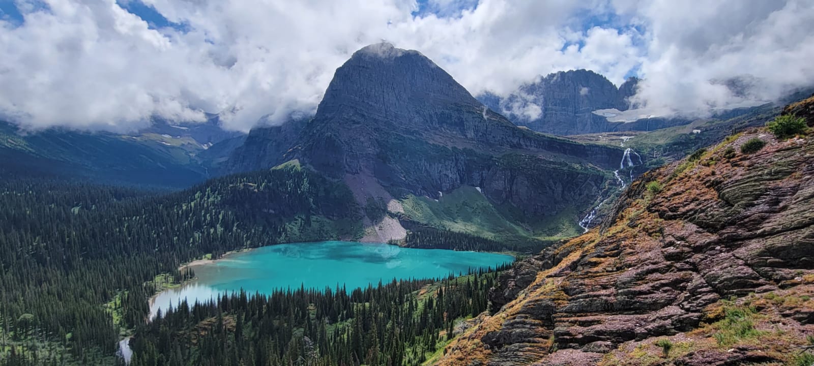 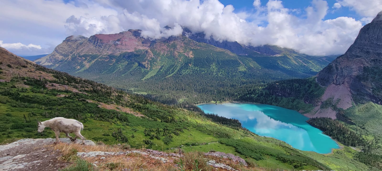 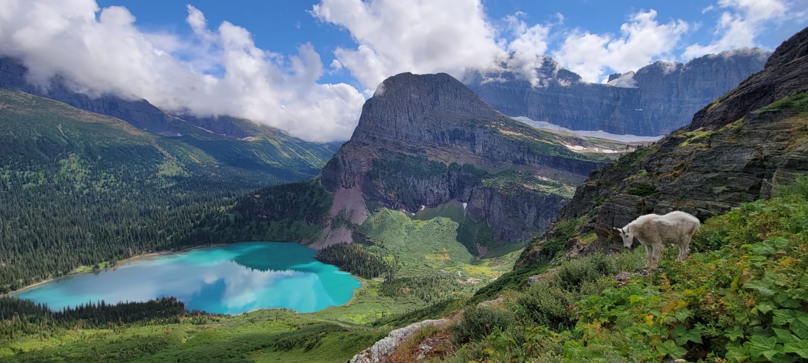 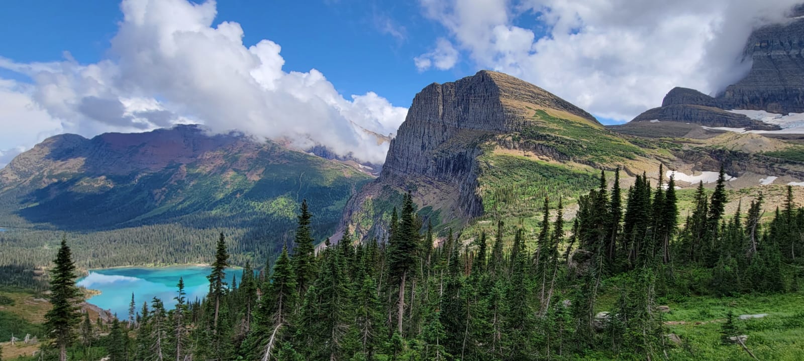  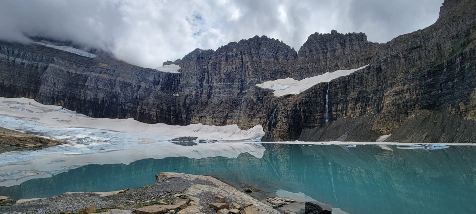 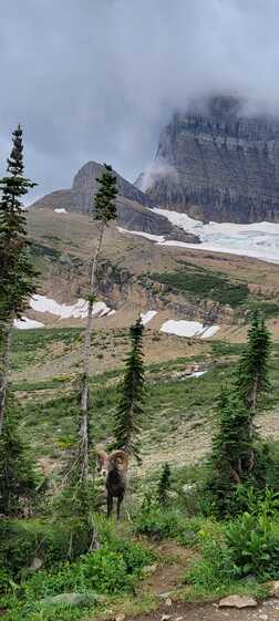 We could have never seen a ram this close or this good from any aircraft. Hiking directly to the Glacier isn’t the only way to view the Glacier from the ground. The Highline Trail, also from Logan Pass, has a steep Grinnell Lake Overlook side trail (which may be scary to those afraid of heights), giving hikers a completely different viewpoint. One can look down onto the Glacier. This is the longest of the hikes discussed but it’s also one of my favorites. 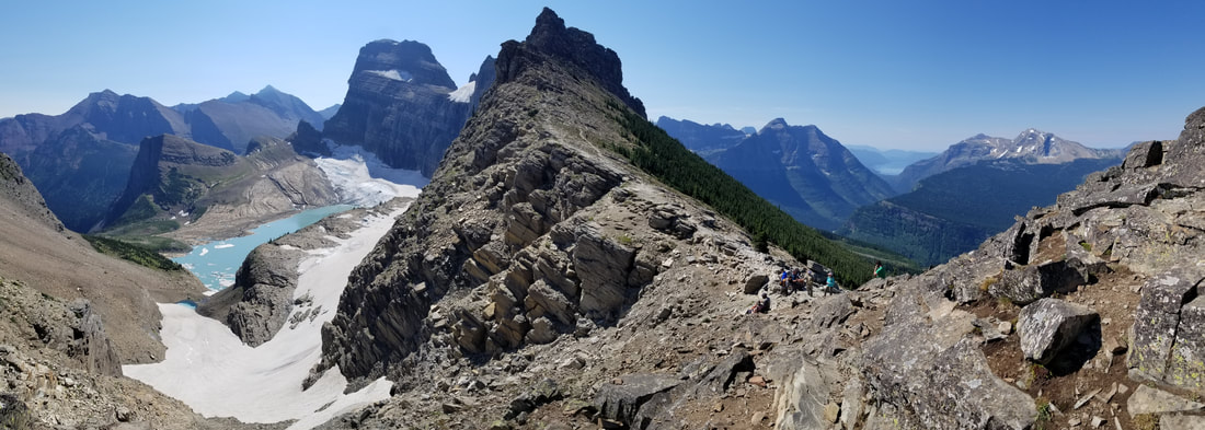 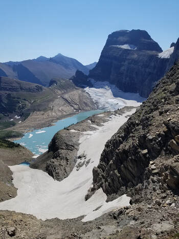 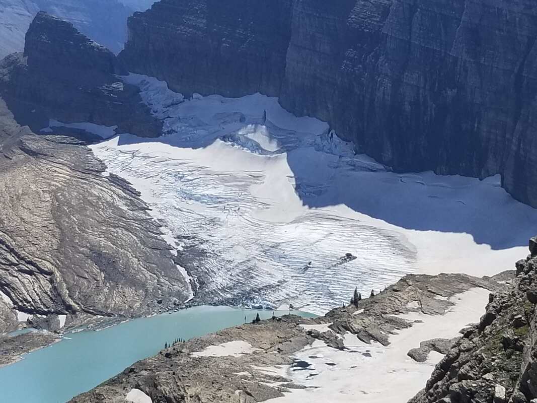 One of the reasons I enjoy flying over the mountains is to scout my next adventure. This was the case with Iceberg Lake. I loved the way the lake looked from the air, with its deep blue color and being surrounded by sheer glacier walls. 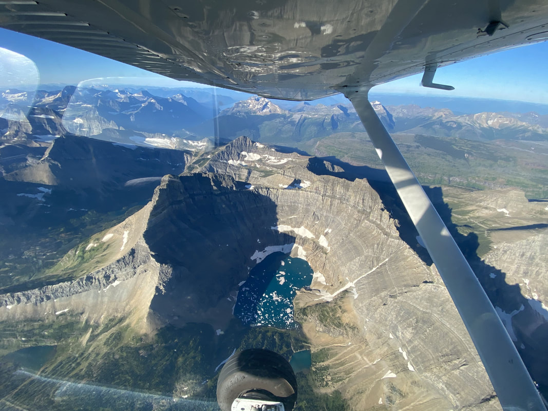 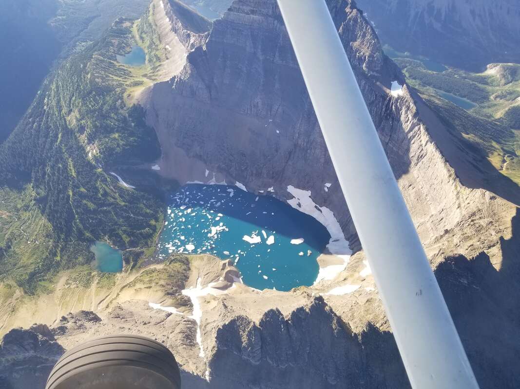  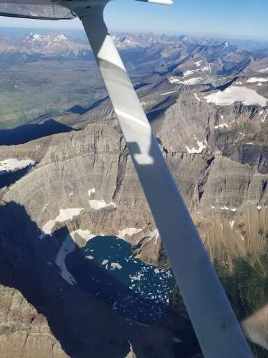 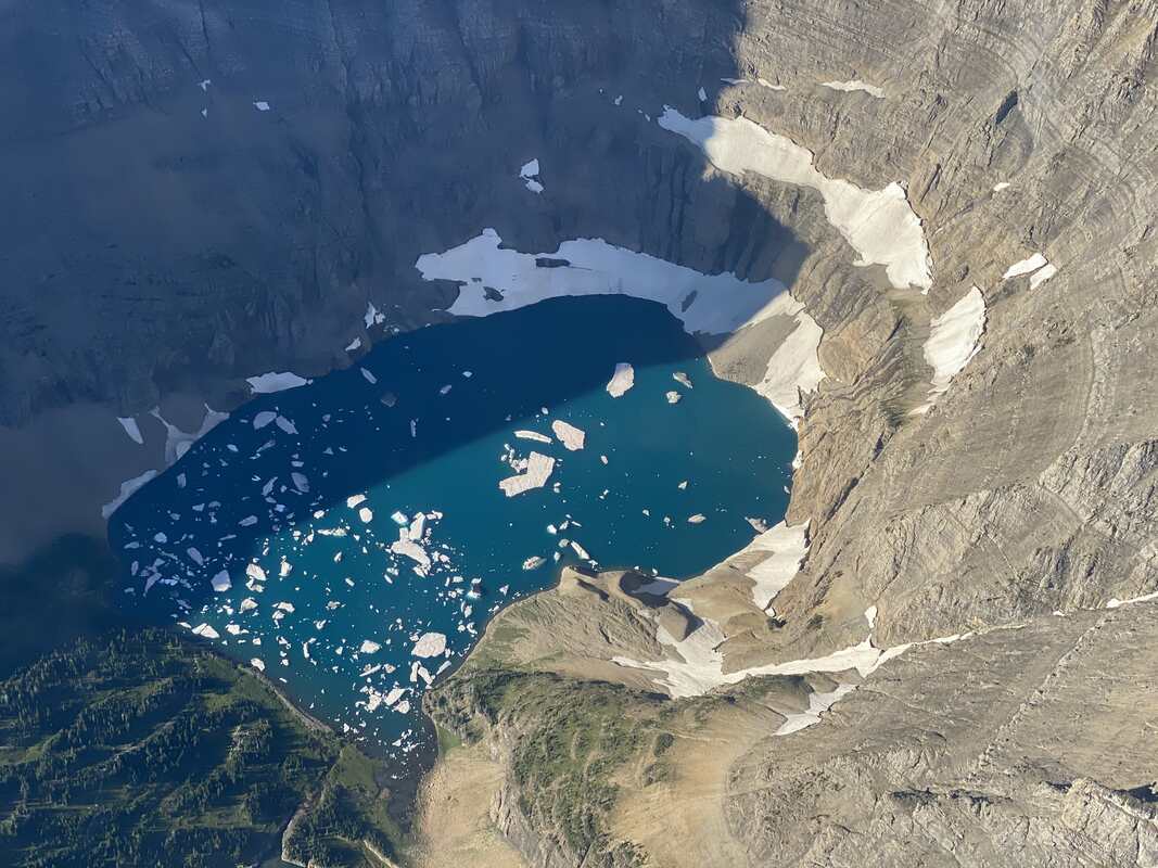 The sheer walls were honestly just as impressive, but in a different way, flying or hiking. Seeing their vertical nature from the air was impressive and seeing their rugged look up close from the trail was spectacular as well. My mom hiked it with me, making it even more special. It was a bit disappointing though that Iceberg Lake had no icebergs when we hiked it. 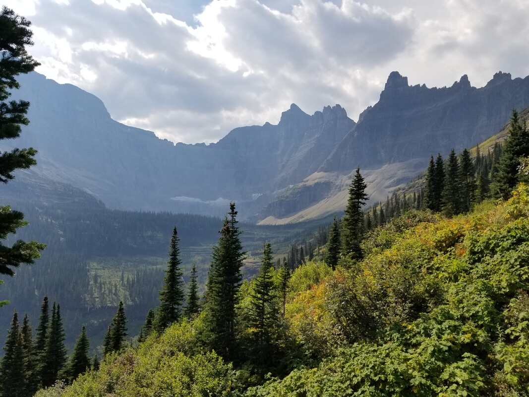 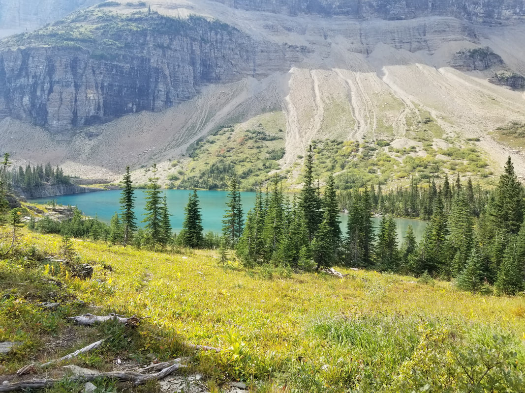 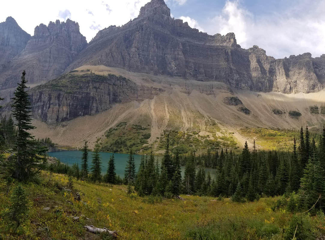 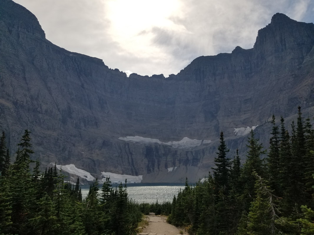 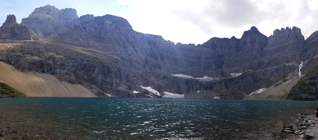
When I flew over Cracker Lake last year, it did not look as impressive to me as other lakes did, but it must have been because I flew too early in the day. The sun was not shining on its water yet and, as it turns out, Cracker Lake has the most beautiful water color of any lake I’ve visited or seen at GNP. It’s very different seeing it in the shade and the sun.  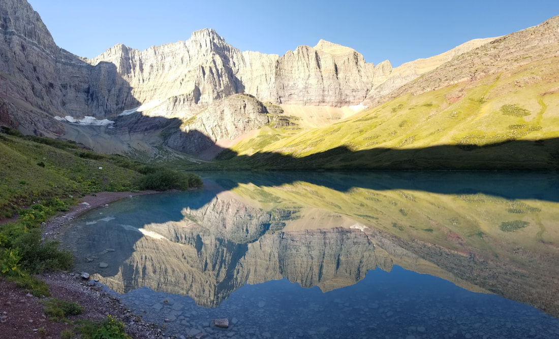 It was quite amazing to see the transition of water color on the lake as the sun rose up over the mountains. I had never seen anything quite like that before. 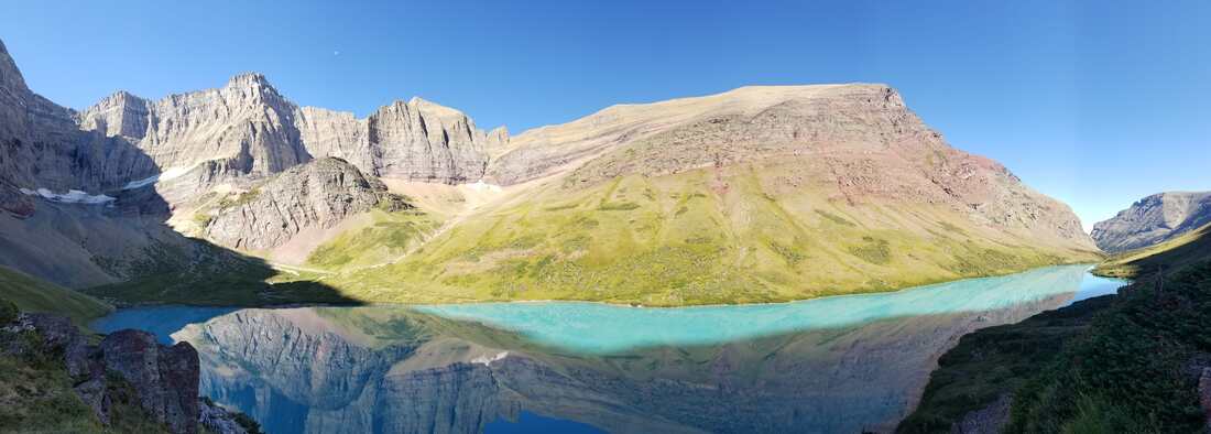 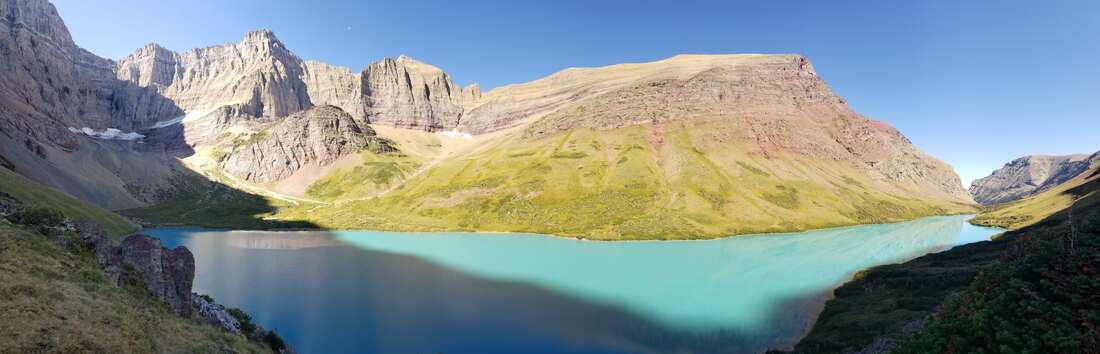 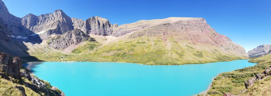 The details of things like the color of the rocks and the sediment in the water is something one cannot perceive from the air.  Glacier is also a great park to view moose, mountain goats (my favorite!), bighorn sheep, and bears of different types but it’s a bit hard to see them from an aircraft. 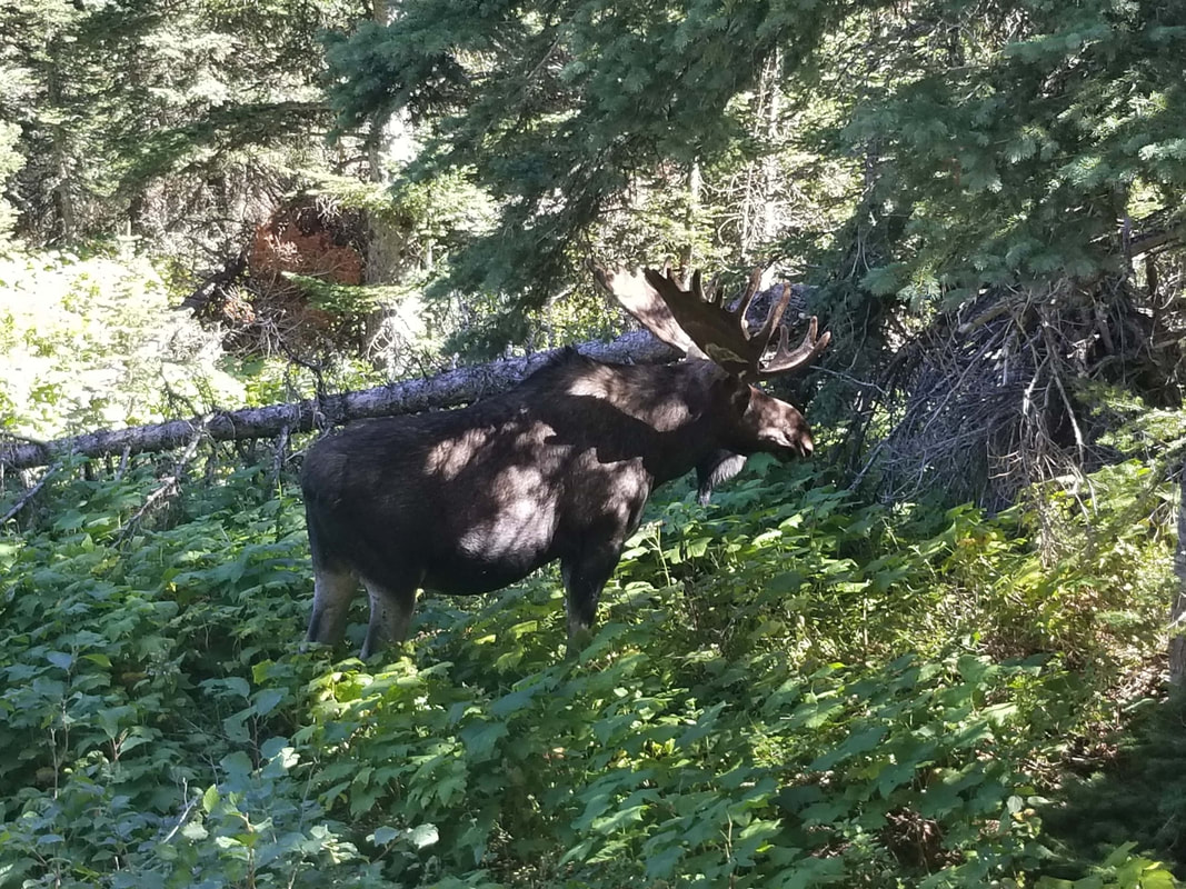
There’s no time to be bored in a world as beautiful as ours so get out and explore!
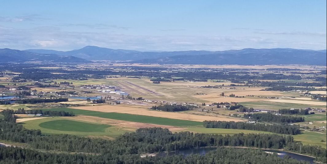
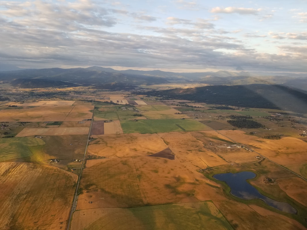
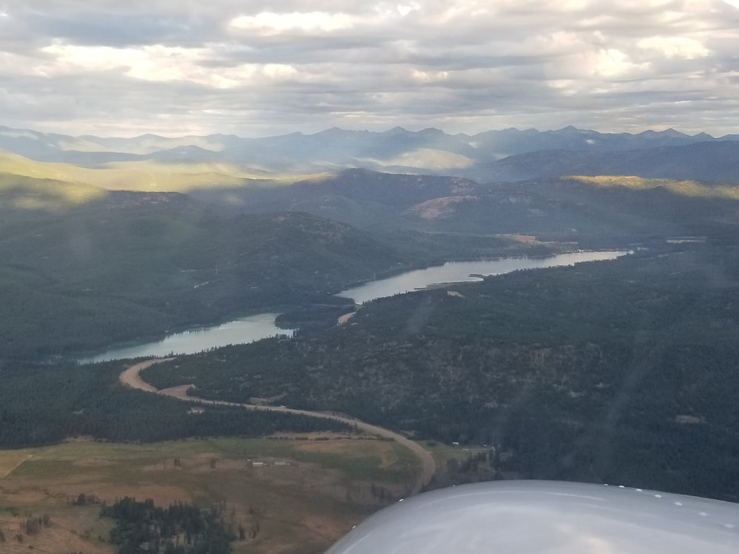
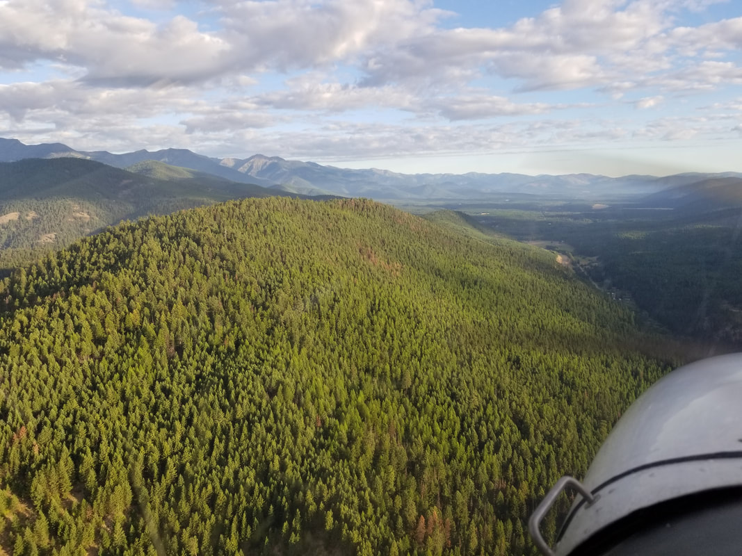
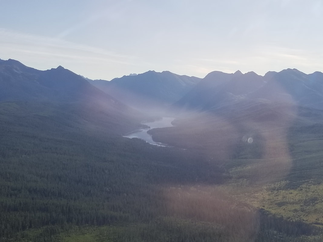
In addition to flying over Glacier National Park (GNP) this summer, I also had a chance to fly around a good portion of Northwest Montana. As always, the objectives were to enjoy the area from the air and visit some cool airports. This was the route I followed, counterclockwise. 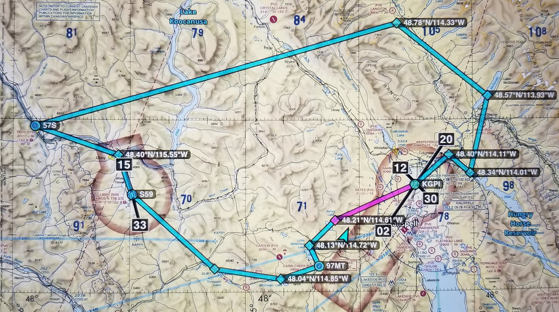 Source: ForeFlight
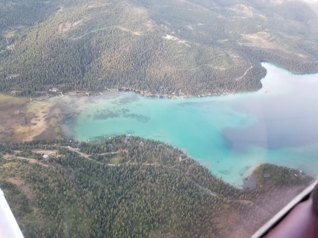
From Kalispell, we flew over Ashley Lake. Why? Because its water is as clear and beautiful as that of the Bahamas. While it does not look like much from the distance, its beauty really shows from above. So much so that my husband Jared also saw the lake from his commercial flight when he was coming back from a work trip. So, we decided to visit it via ground as well.
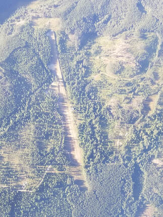
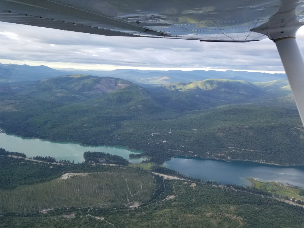
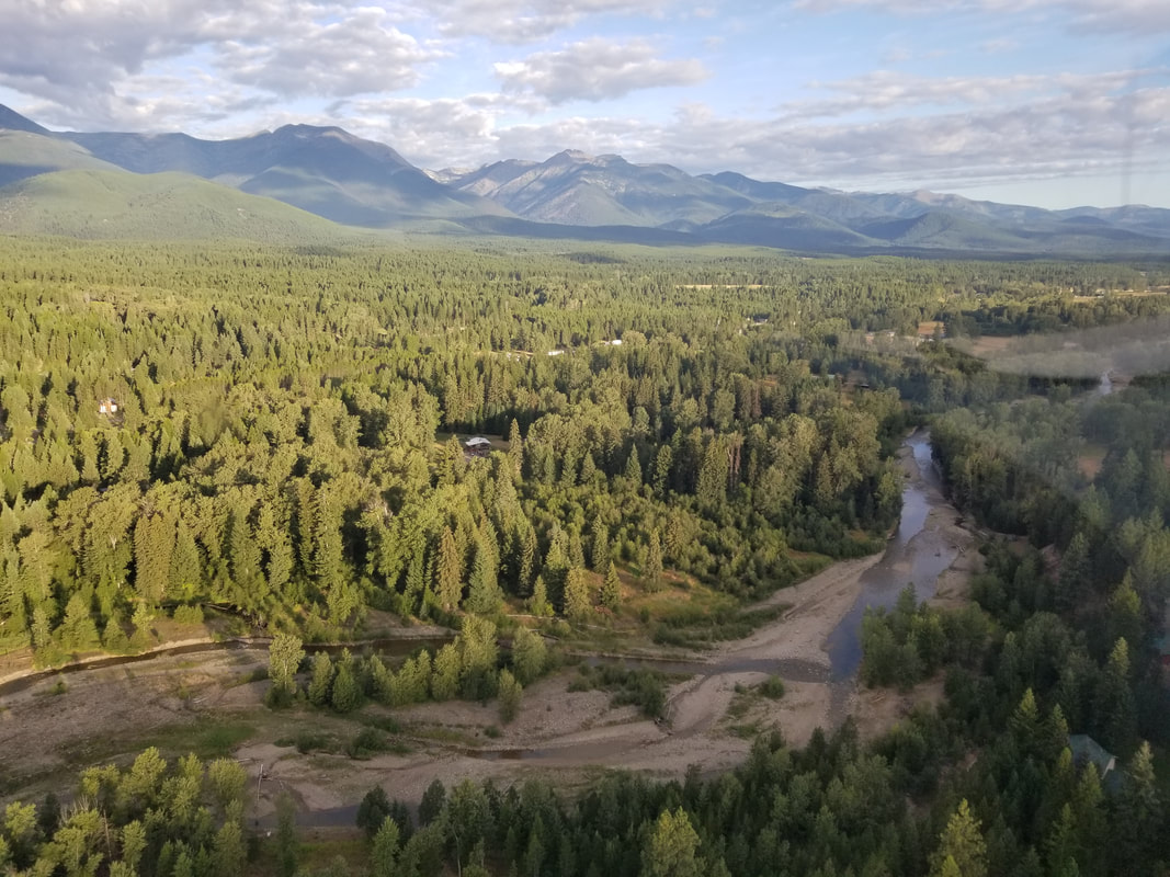
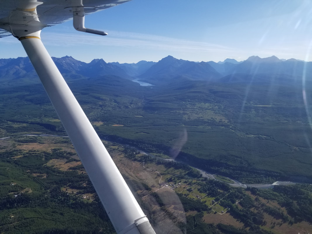
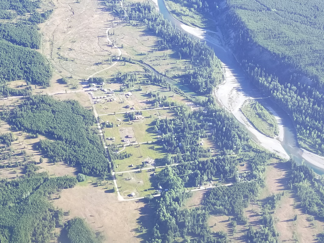
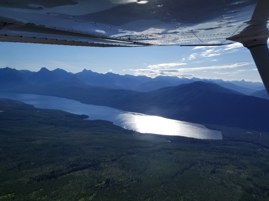
And from one lake to another… from Ashley to Little Bitterroot before landing at Cabin Creek (97MT, http://airnav.com/airport/97MT), the most challenging airport we found (considering we had to stick with paved runways) because of its interesting approach. 97MT is a privately owned, private use airport but thanks to my companion Logan Hutchin, we were able to touch down. Since the airstrip doesn’t have weather on the field, I opted for flying over to see what the wind sock was indicating. This also gave me an opportunity to check out the terrain around it. Since it’s a Prior Permission Required (PPR) airport, they don’t have to follow FAA design standards and, in fact, I couldn’t see the Runway 20 markings until I was almost over them. There is a hill with a house directly under final approach, so I flew left of the centerline until I was past it, before coming in for a full stop landing. Because the wind was fairly light, I chose to takeoff in the opposite direction, avoiding the same house again. Flying over Little Bitterroot Lake; 97MT is just on the other side of the hill in front of us:
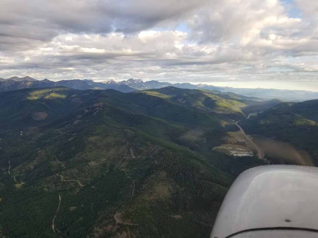
The takeoff put us over the highway. I followed it to McGregor Lake and Thompson Lakes and, from there, to Libby (S59). The flight to Libby was very enjoyable and the Airport was nice but there wasn’t anything extremely special about it.
The different water color in the Thompson lakes was interesting:
Flying IFR (I Follow Roads):
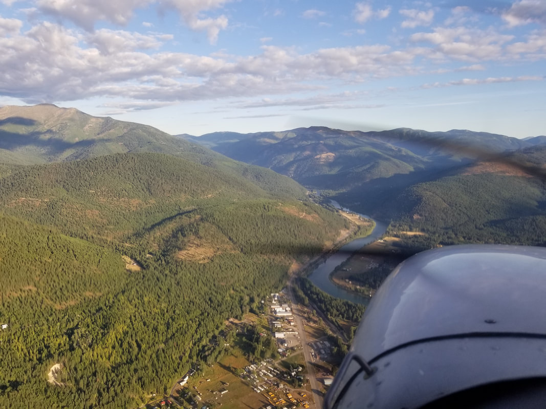
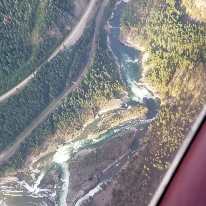
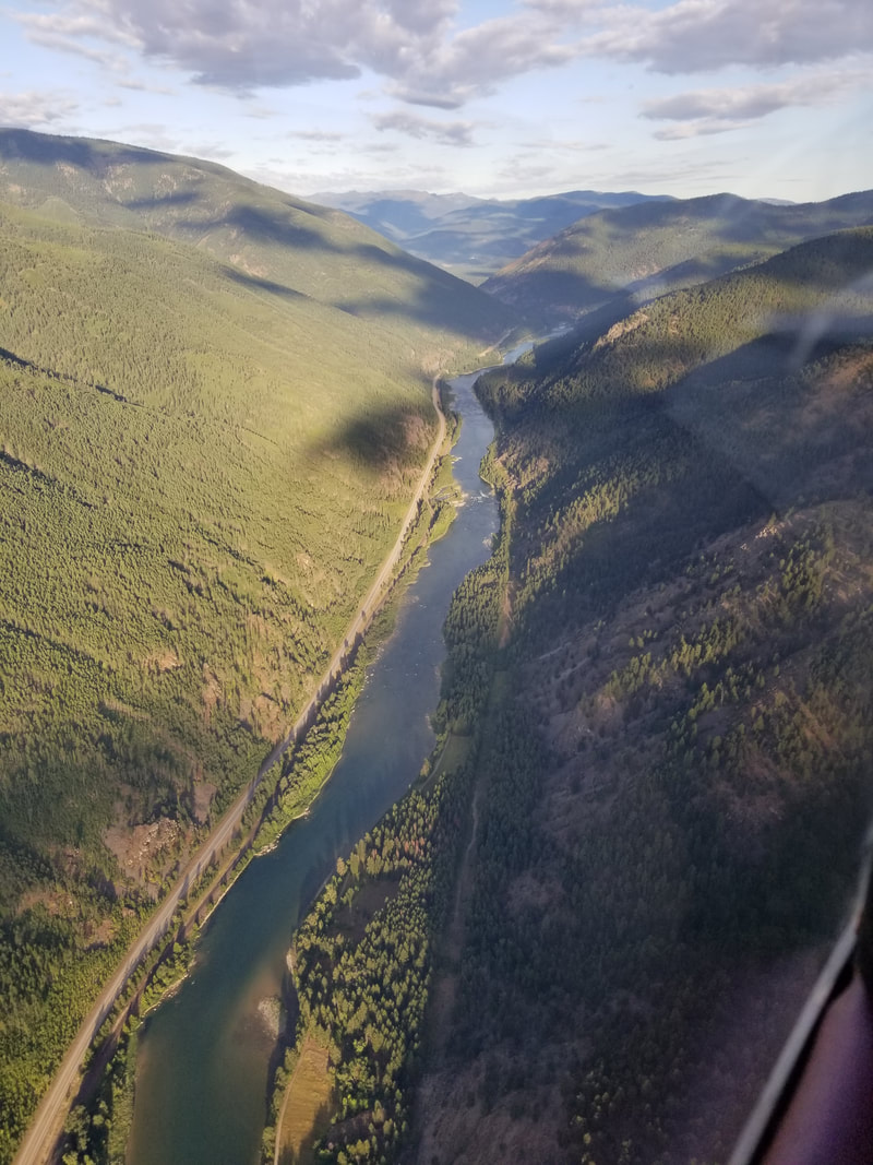
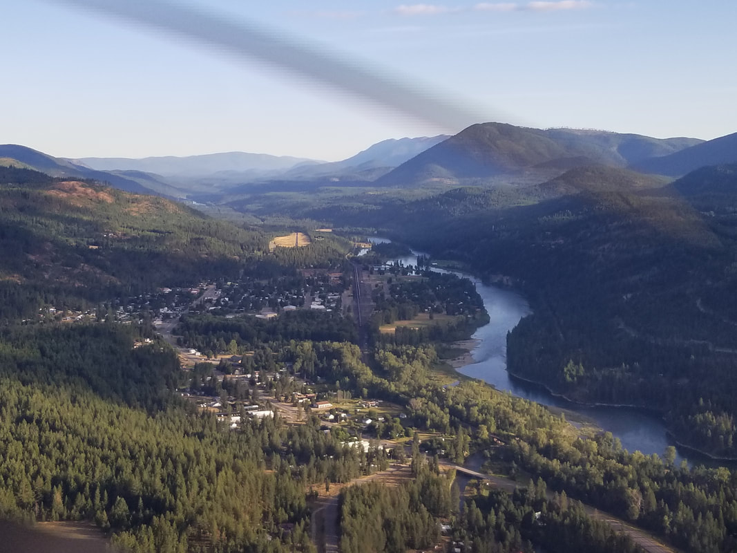
Troy (57S) was the next Airport to visit and what a beautiful setting it’s in! I basically followed the road, railroad track, and river to it.
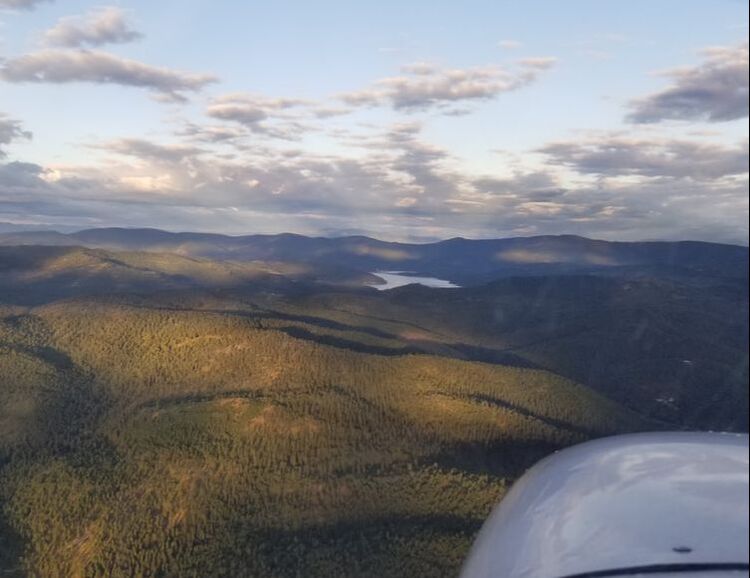
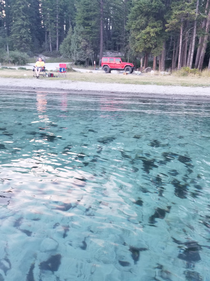
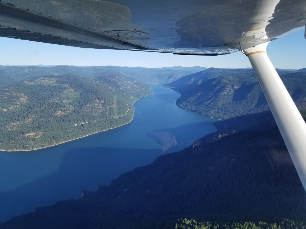
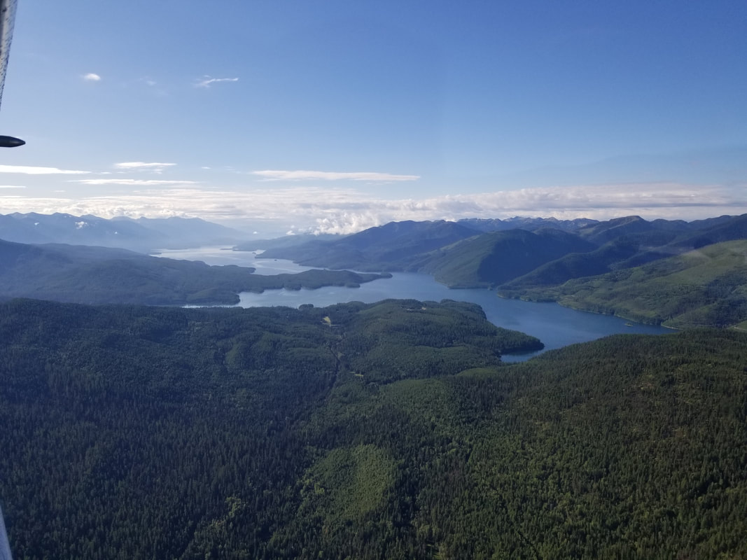
We checked out Lake Koocanusa on our return leg. You may already know Montana has a LOT of lakes but we had no idea. We had never been to a place with so many (mostly natural) lakes. Hubby and I were in the state for a month and we ended up swimming or kayaking in a different lake almost every day.
The Crystal Lakes before reaching Polebridge:
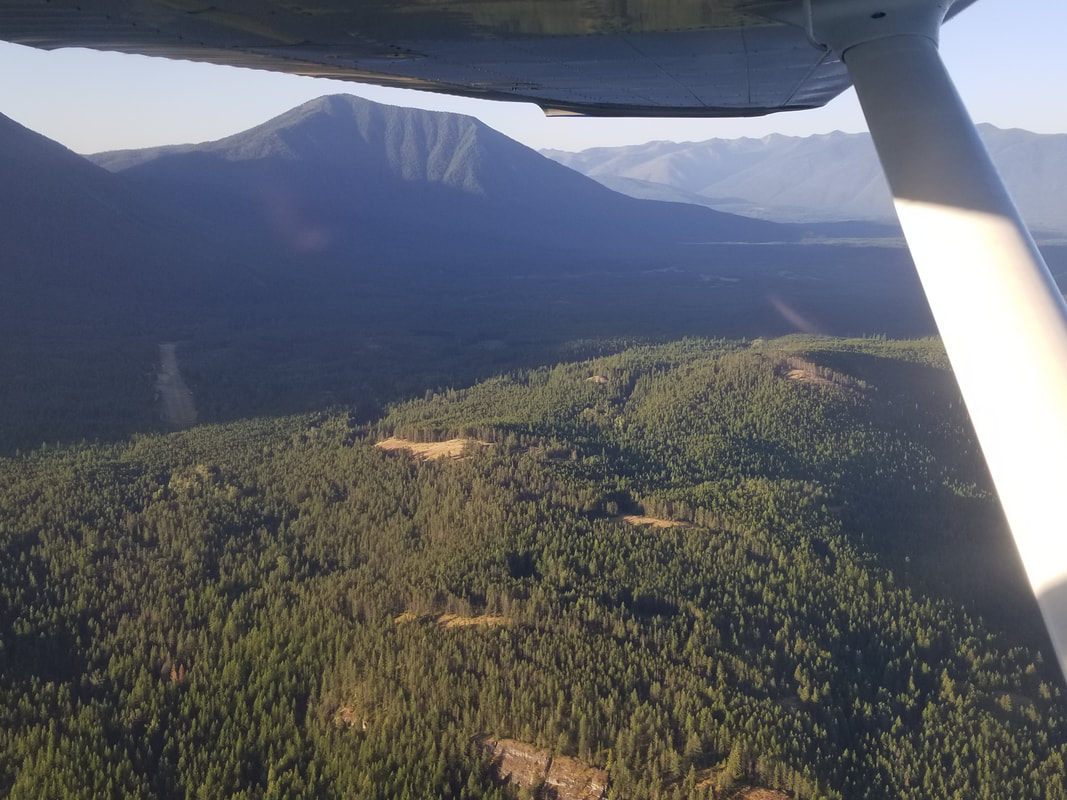
Overflying the Whitefish Range:
What Bowman Lake looks like from the ground (on another day, while hiking):
Polebridge, where one can buy yummy huckleberry bear claws at the Mercantile:
First Logging Lake on the left and then Lake McDonald, also on the left:
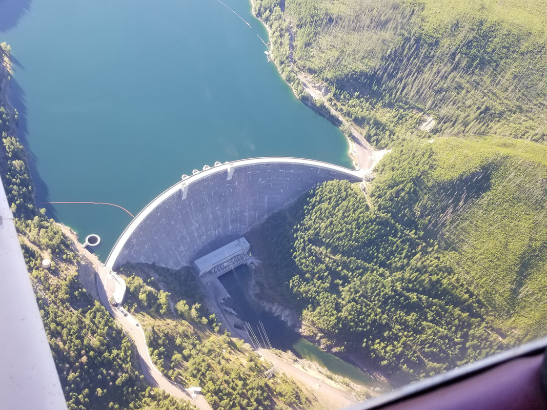
Hungry Horse Reservoir (left) and Dam (right):
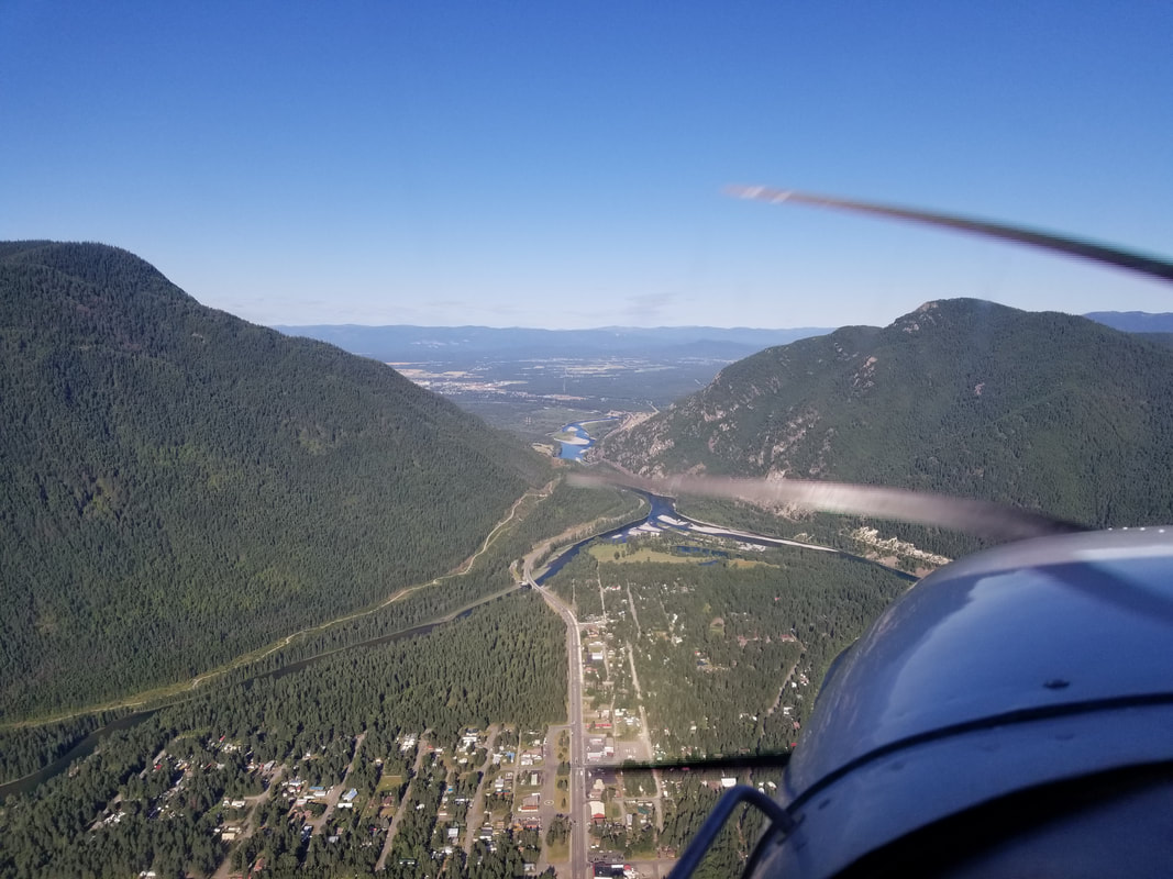
Boating around Hungry Horse is definitely a highly recommended side adventure while in the area:  Shooting through the Columbia Falls canyon (left), out of GNP and into the Flathead Valley (right):
Although they’re known for their “Big Sky”, they could also be known for their “Friendly Sky.” Go visit Montana!
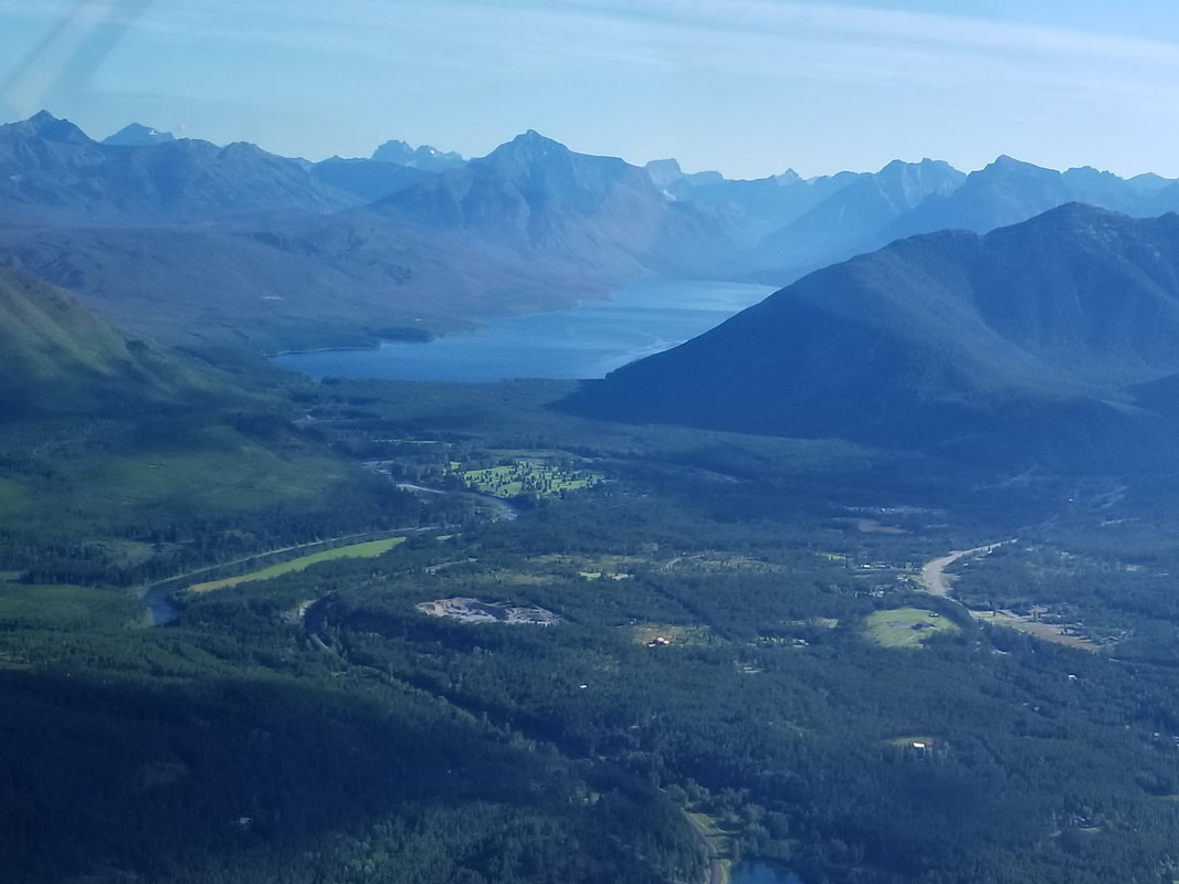
Fly safe and fly often! Glacier, Waterton Lakes, Banff, and Jasper National Parks have been on our “to visit” list for a long time. We took advantage of my work travel being cancelled, the fact that I always work remote, and that we felt RV traveling would be safe (even with COVID-19) since we would be bringing our wheels and home with us, to go on a road trip to Glacier NP even though the Canadian parks were off limit (the border was closed due to the pandemic). It was a great decision! Kalispell, Montana, was our “basecamp” for a month (late July to late August)! It was a very central location and the weather could not have been better. We got to enjoy all of our outdoor hobbies and travel the area well by foot, floats, wheels, and wings. The latter one is what I’m here to talk about. We haven’t pulled the trigger on towing a helicopter, an ultralight, a powered paraglider, or a Cub (with the wings folded) behind our Motorhome so, for now, I rent an aircraft in the areas we visit. (And, yes, in case you’re wondering, there are people pulling those aircraft behind RVs. That’s a discussion for another blog! 😉 I’m extremely jealous!) It was frustrating to learn that only one of the area flight schools allows landings on unpaved surfaces and that’s Backcountry Flying Experience. However, unfortunately for me and fortunately for them, they were already fully booked for the timeframe we were there when I called them. So, I flew twice with Glacier Jet Center and CFI Logan Hutchin out of Glacier Park International Airport (KGPI). One of the flights was exclusively focused around Glacier NP and that’s what I’m covering in this blog. It was a fantastic flight, especially since the east side of the park (where the majority of the glaciers are) was closed due to the virus and flying offered the only chance to see it in 2020. Some time ago, I wrote a blog about “flying to and over the National Parks” (https://airtrails.weebly.com/other/flying-to-national-parks). The advice in that blog is very much still applicable and what I lived by. While Glacier NP does not have its own airport, the area has multiple options and I checked out some of them:
 Source: Google Earth
 Source: Google Earth
 The next picture shows Glacier in the distance, after crossing the canyon from Kalispell. Lake McDonald can be seen in the distance. 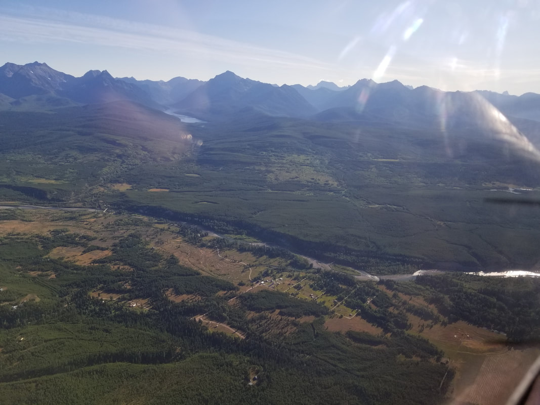 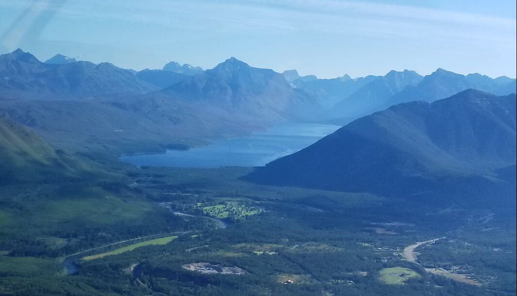 We continued by overflying 2MT1. As mentioned, the flight school I rented from does not allow landings at non-paved runways but I wanted to see what it looked like. It is important to note that, as the sun rose from the East in the early morning, the big mountains created a shadow on said airfield, making it a bit hard to find coming from the west, especially with a little bit of smoke in the air. The picture below, on the left shows the 1st glance of the mountain that we had once we dropped below the sun.
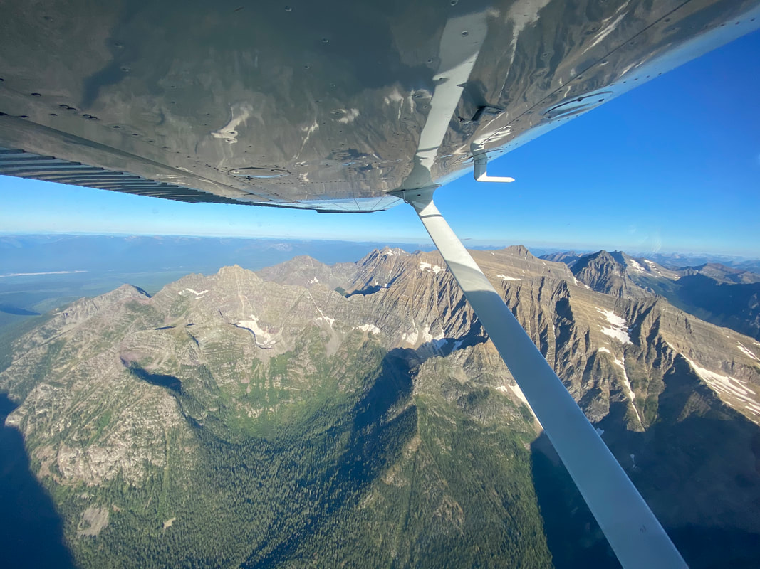
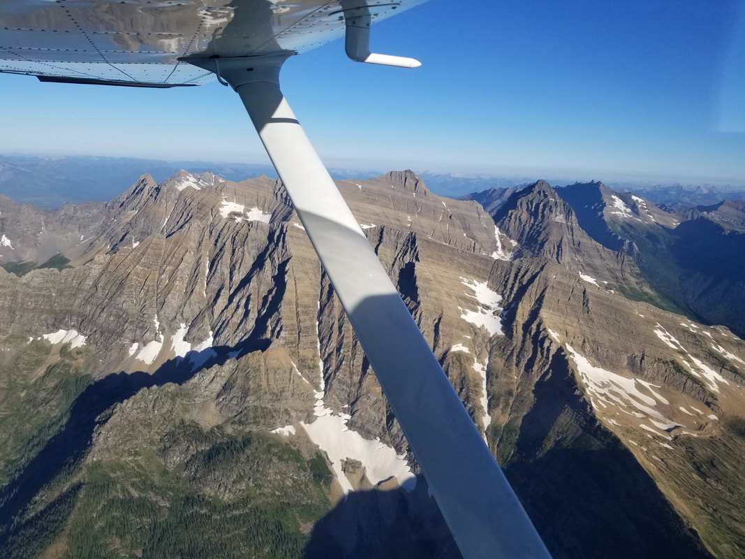
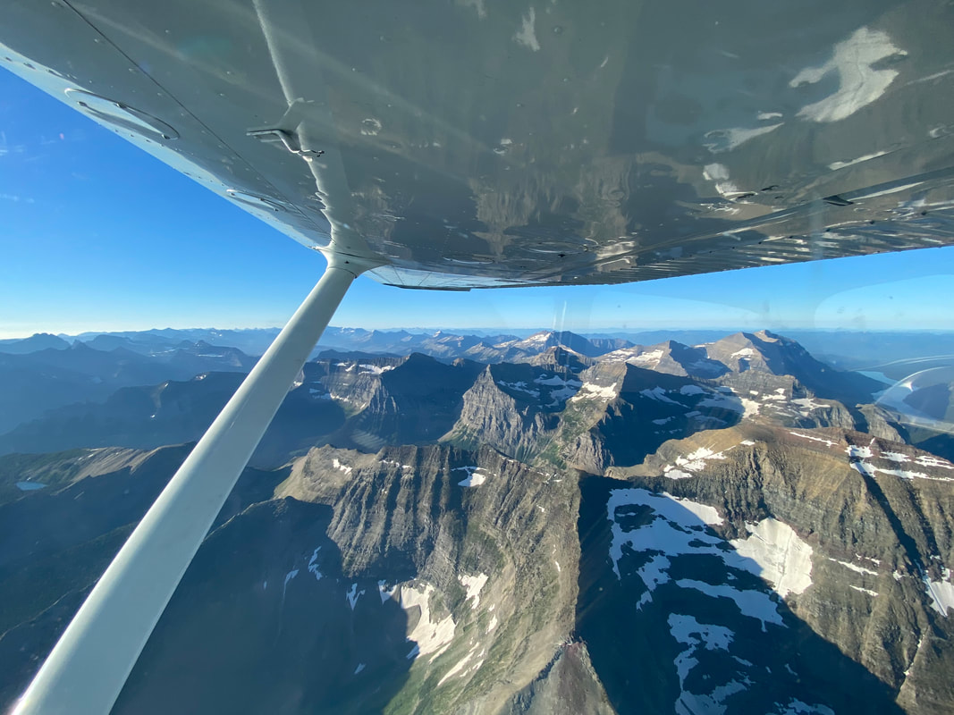
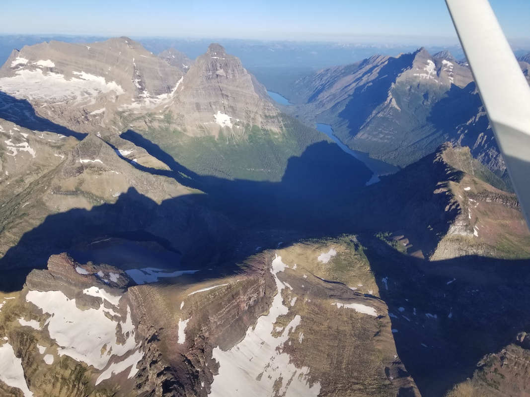
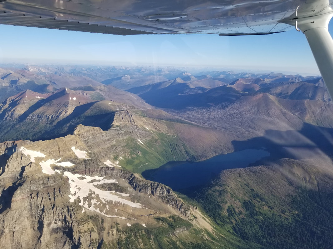
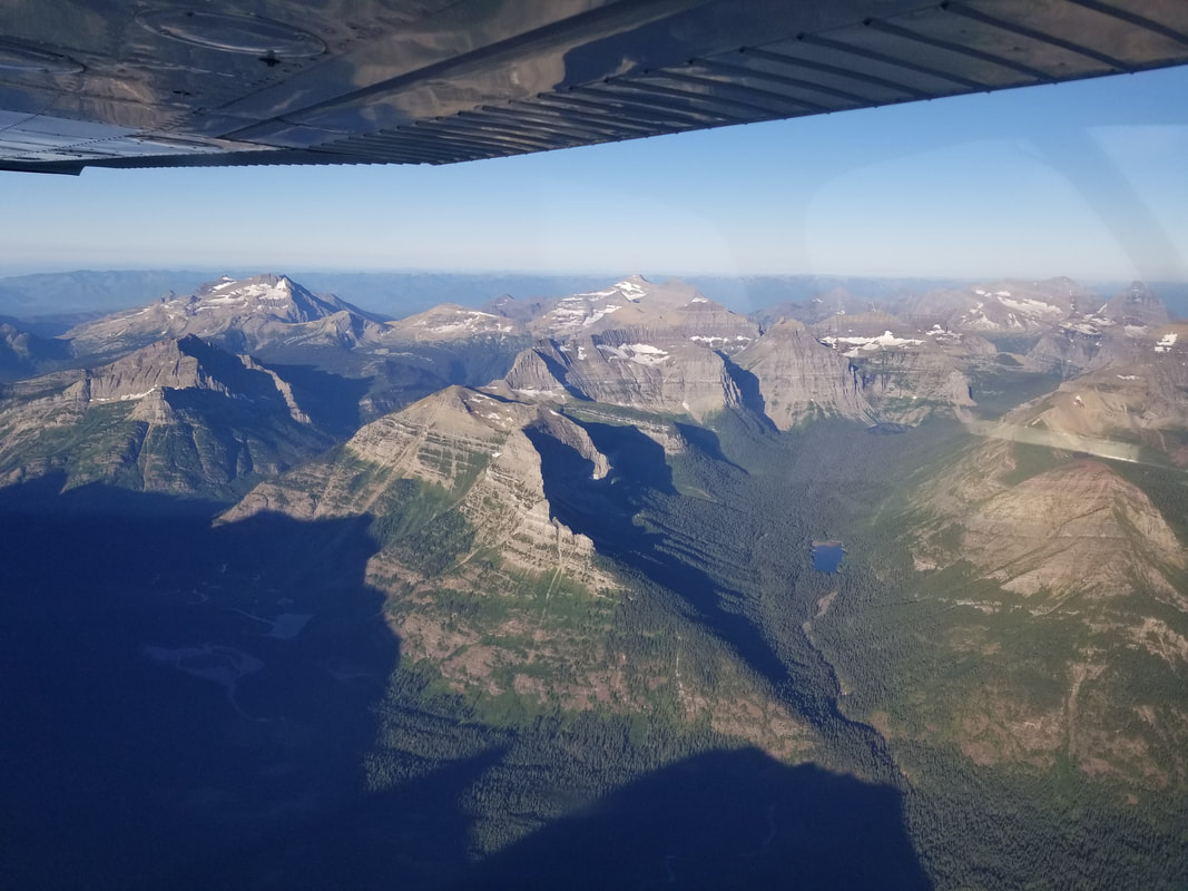
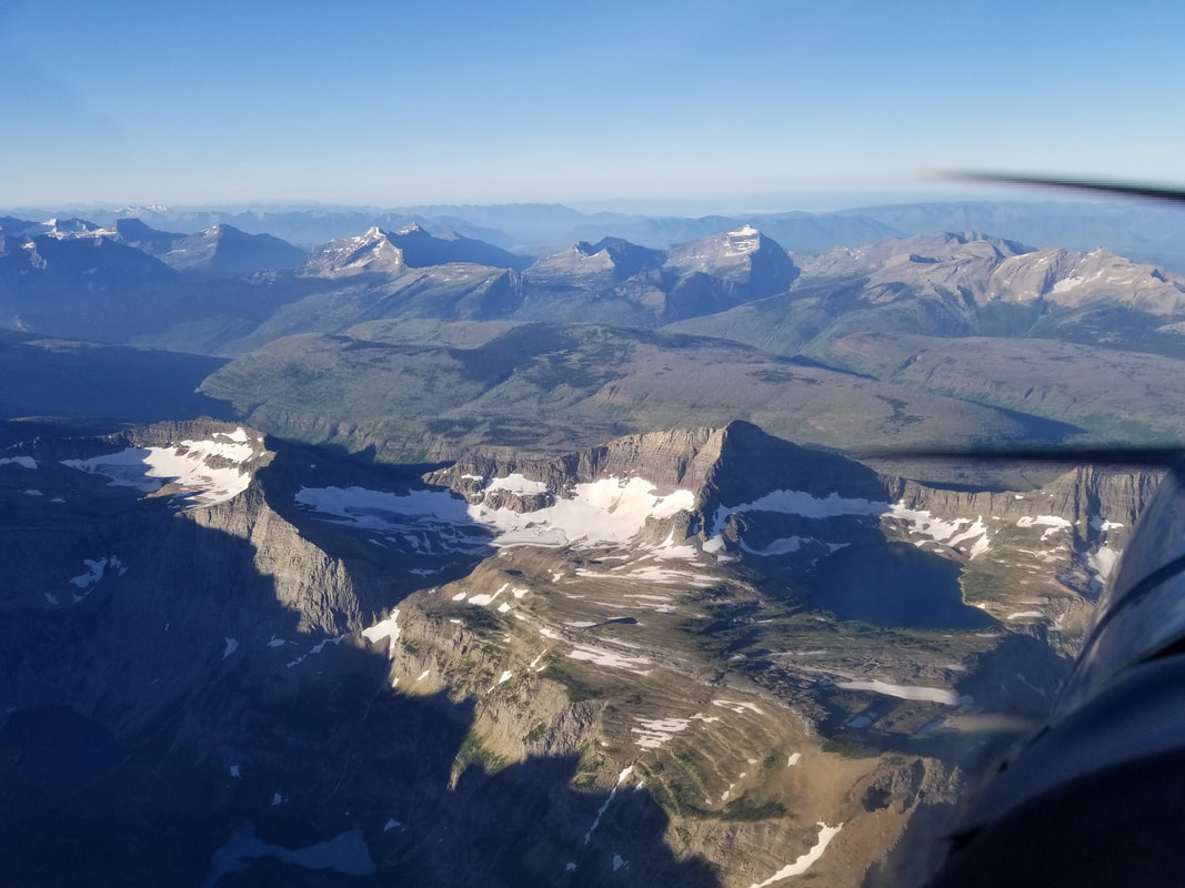
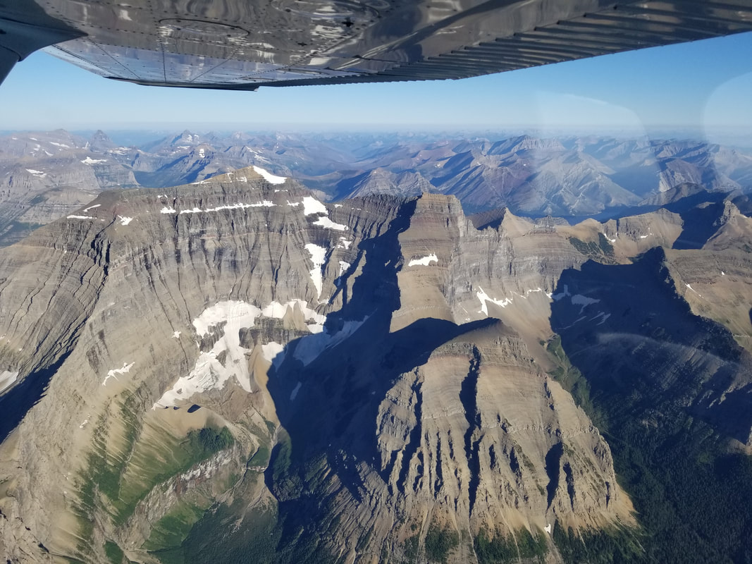
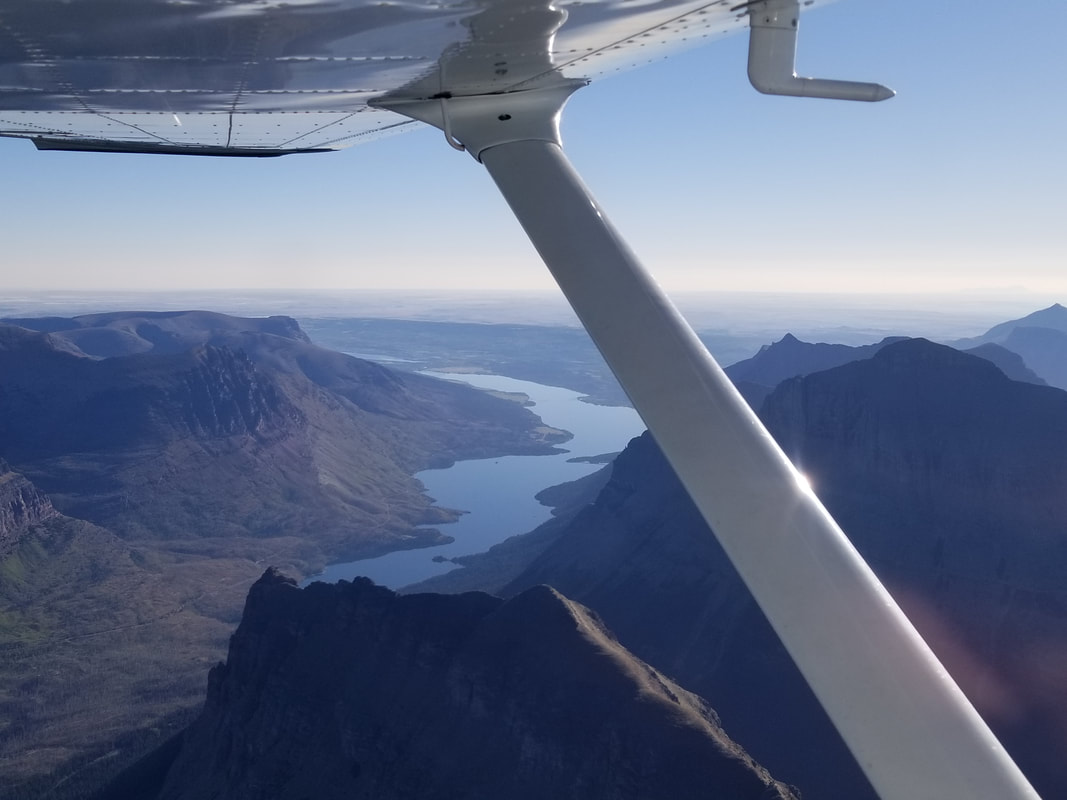
 From there, we flew all over Glacier NP. The route below is what we used as a start but we mostly applied dead reckoning once flying. I used a combination of the aviation sectional and the aerial to design this course as it was obviously easier to pinpoint the sights I wanted to see on the aerial map. I made sure though that I wasn't violating anything and complying with all airspace rules and the U.S./Canada border by looking at the aviation sectional. 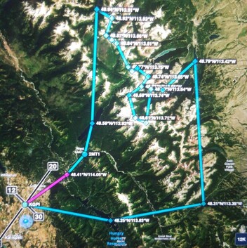 Source: ForeFlight Oh, the scenery! I think the rest of the blog will be more visual than text. The pictures speak for themselves. As far as altitude... Montana isn't Colorado. The top of the peaks are much friendlier. One can fly over most of them without a problem.
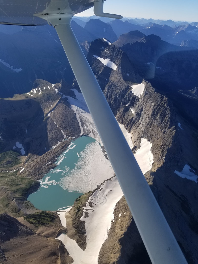
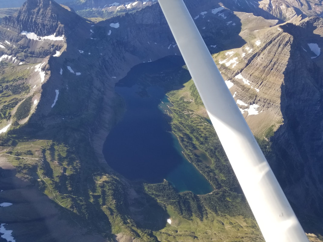
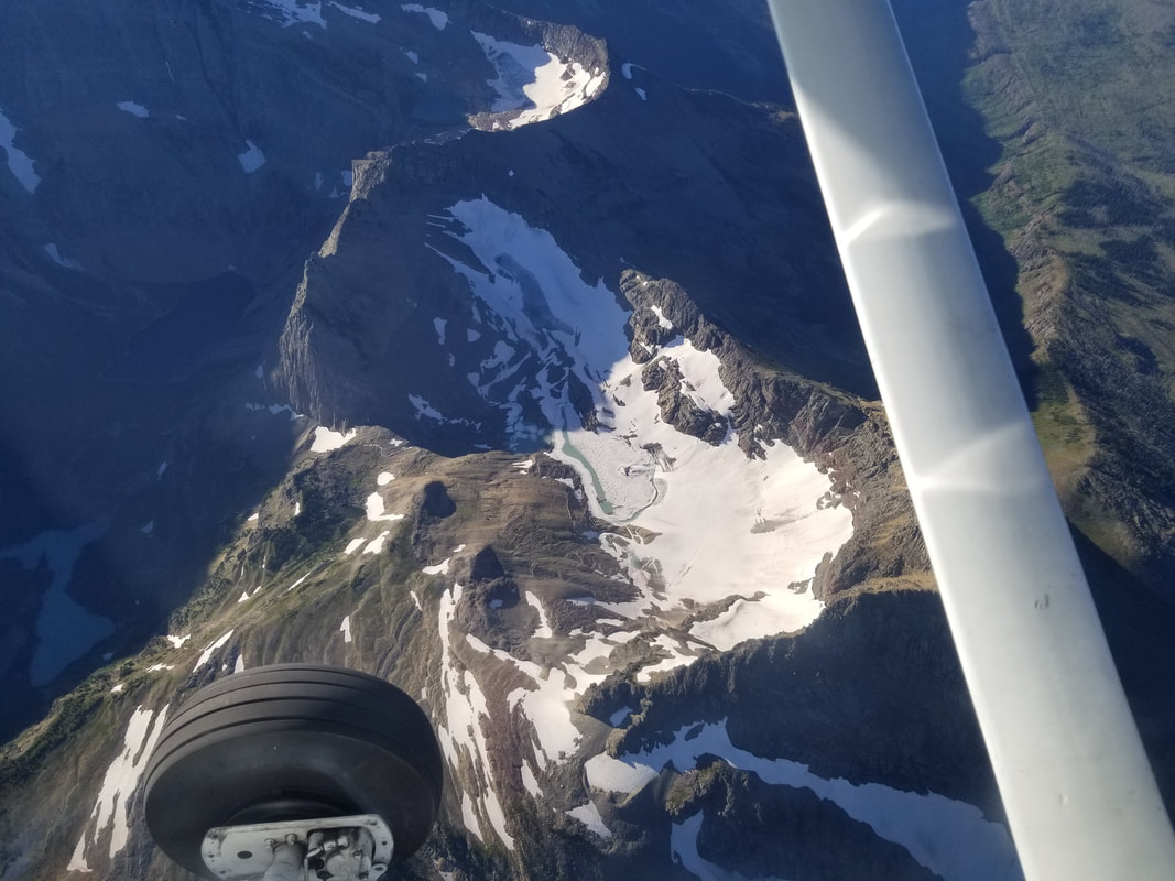 The pictures below are of Iceberg Lake, one of the places one can't visit this year due to covid 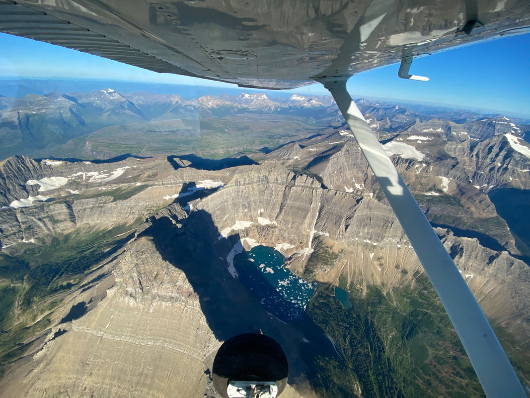 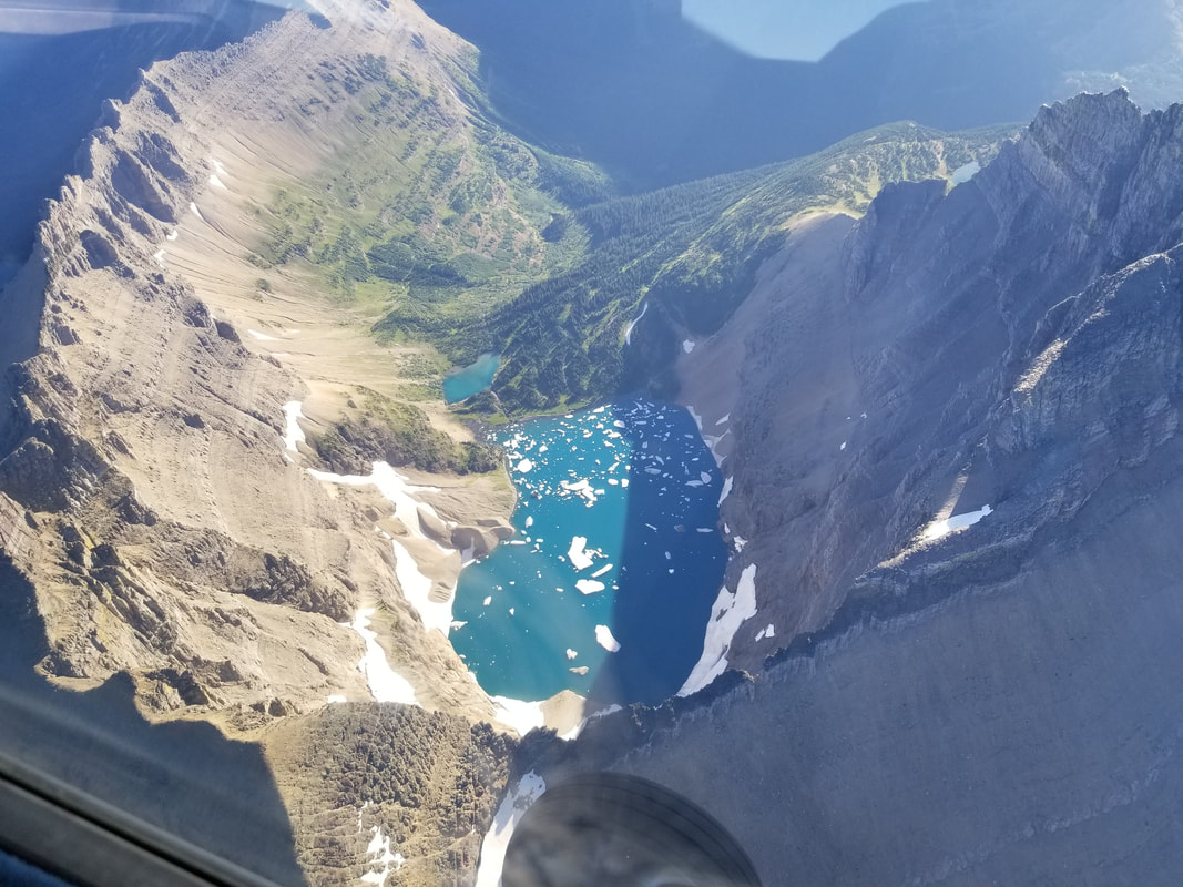 The pictures below are of Grinnell Glacier and Grinnell Lake, also one of the places one can't visit this year except from an overlook 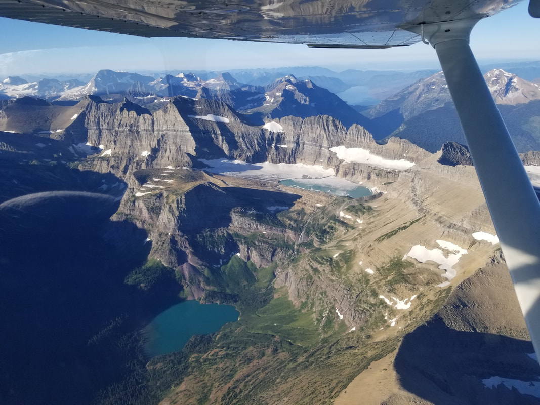
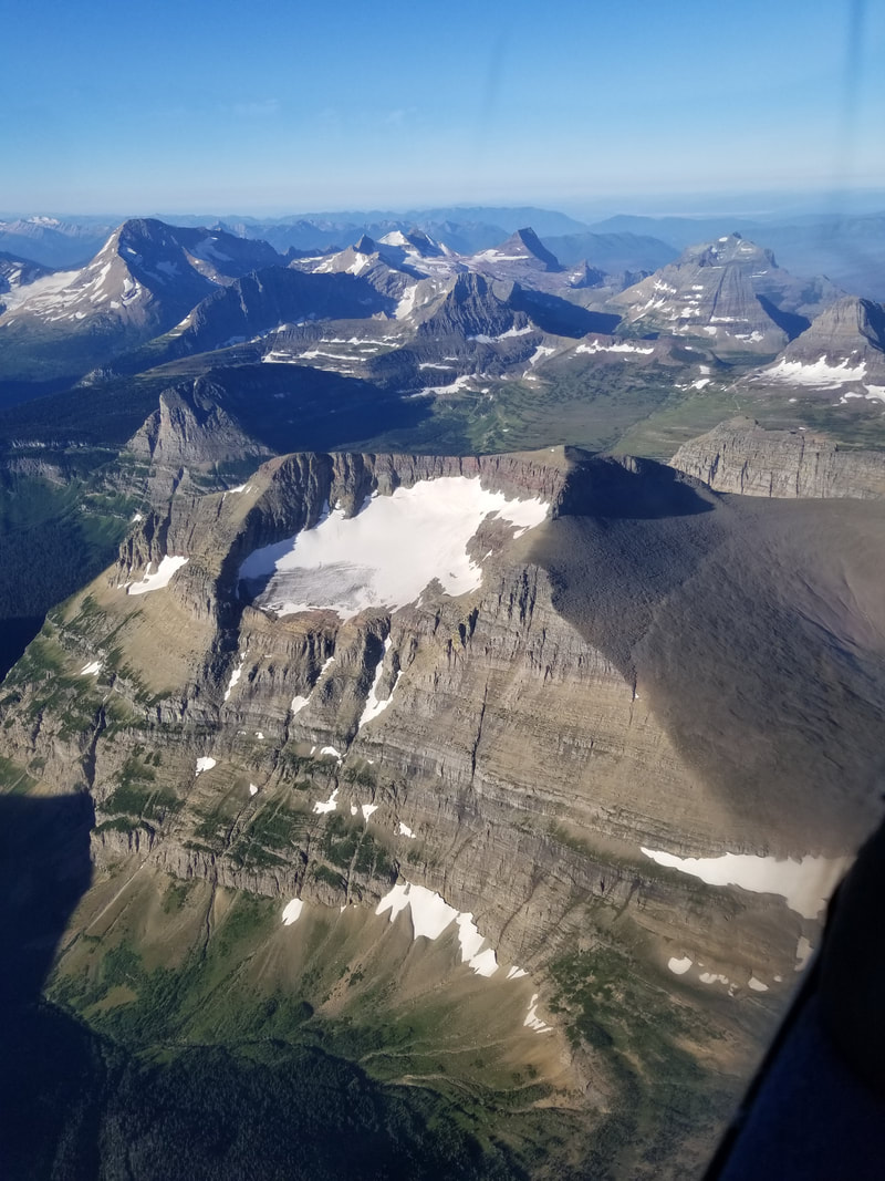
Approaching Hidden Lake, one of the most iconic places in Glacier NP, especially this summer since the trail has been closed, on and off, most summer due to bear activity (really, one Grizzly chasing mountain goats in between people)
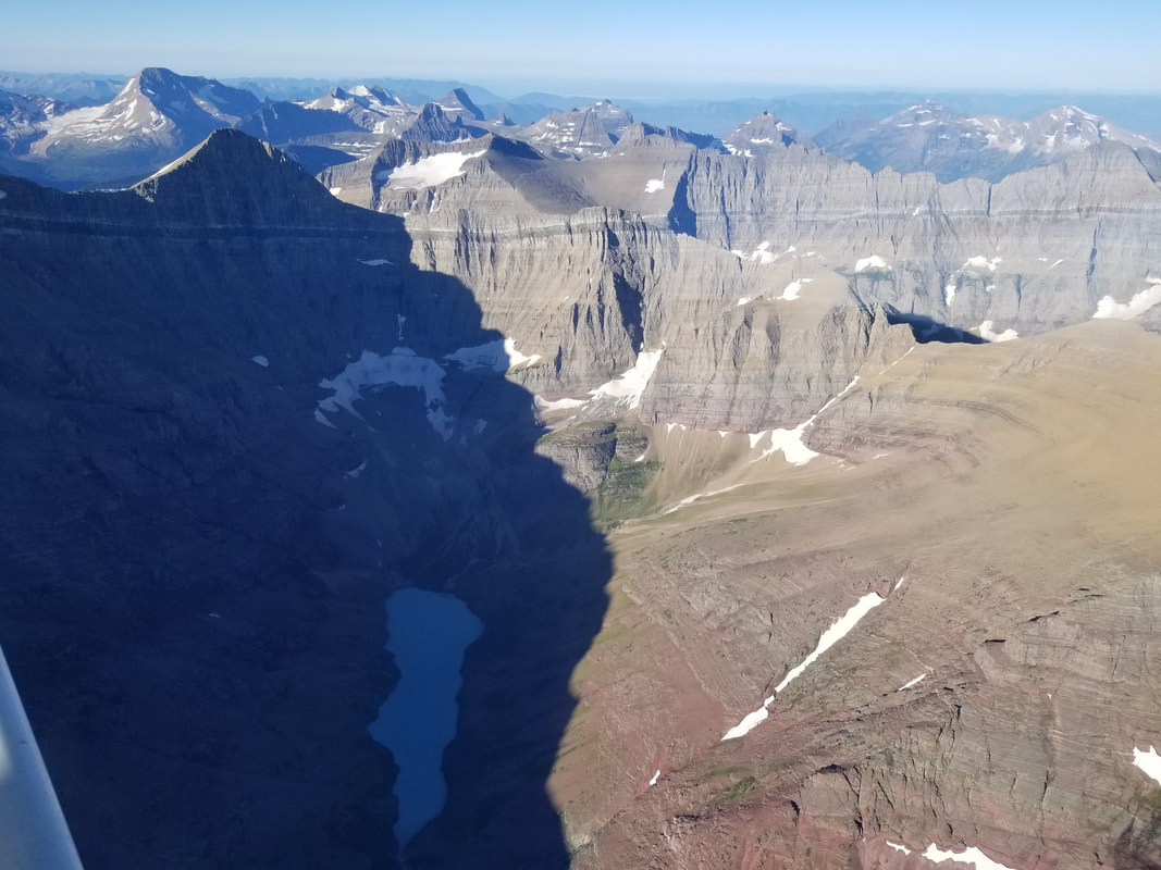
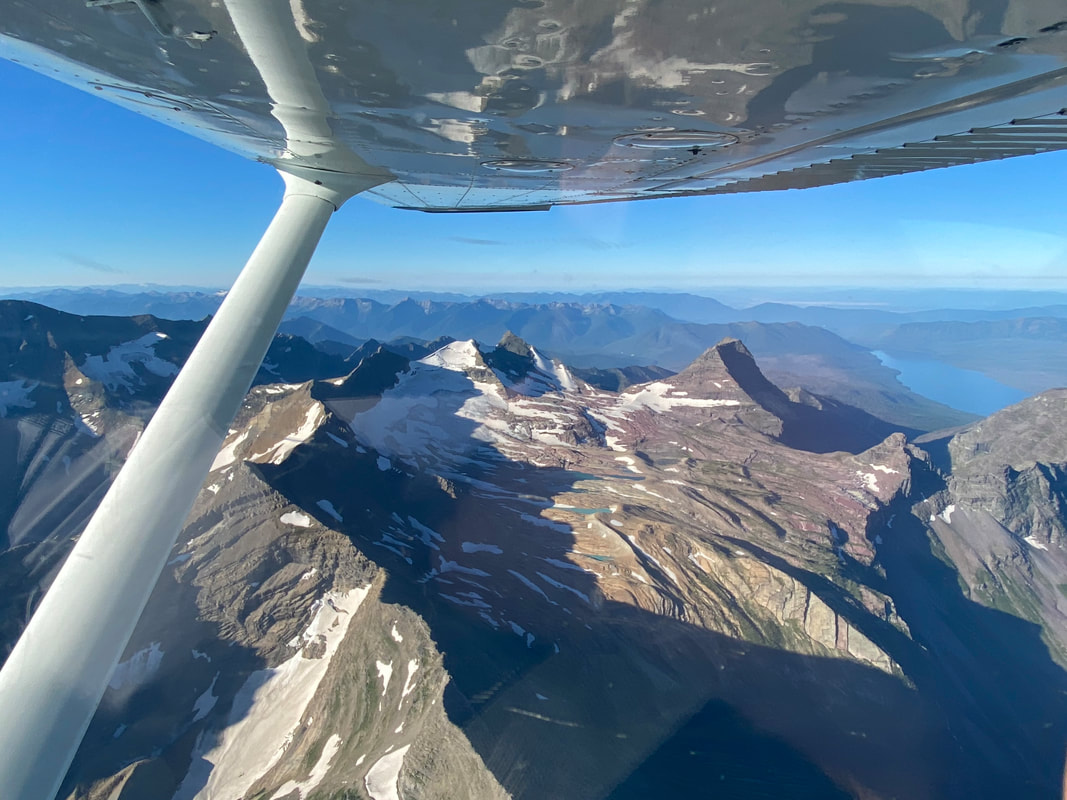
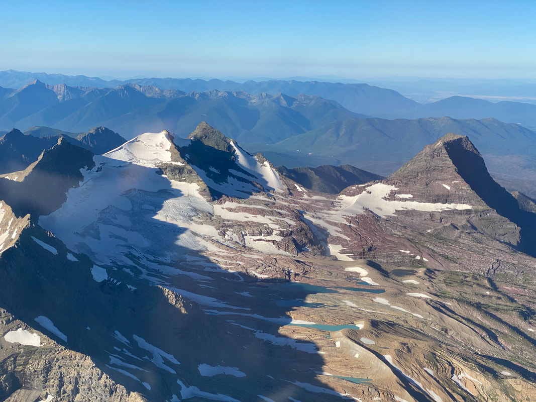
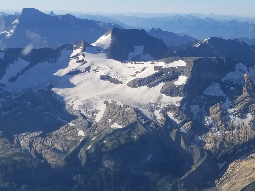
Sperry Glacier can be seen below with its iron filled mountains/rocks
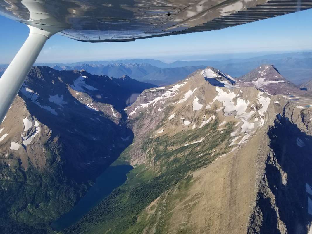
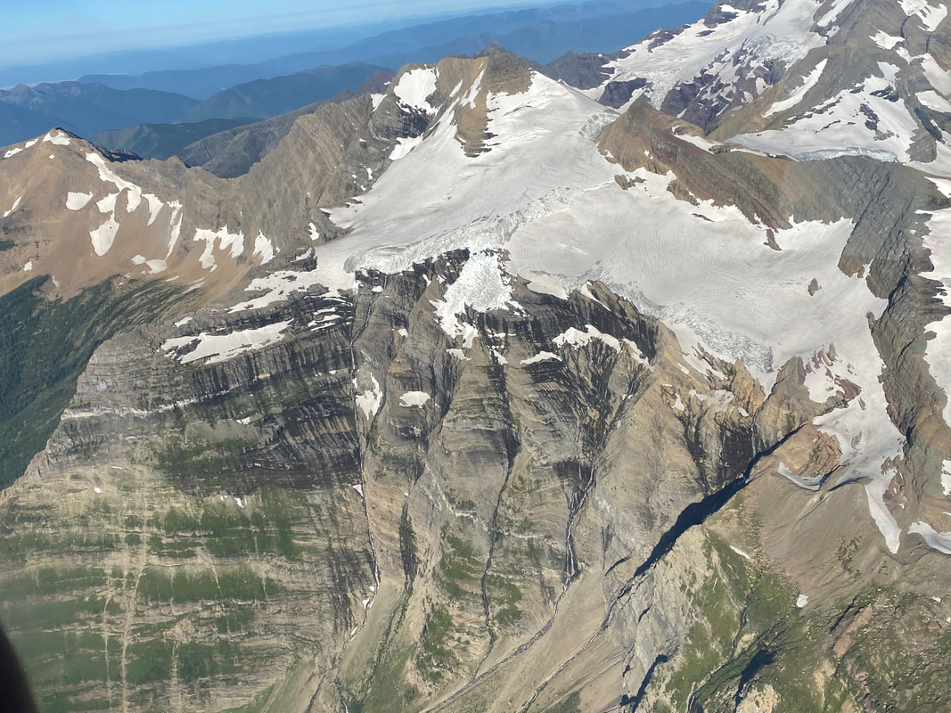
Jackson Glacier below (this is truly the only glacier most people can see while visiting Glacier NP; it can be seen from a pull-out at the Going-to-the-Sun Road) 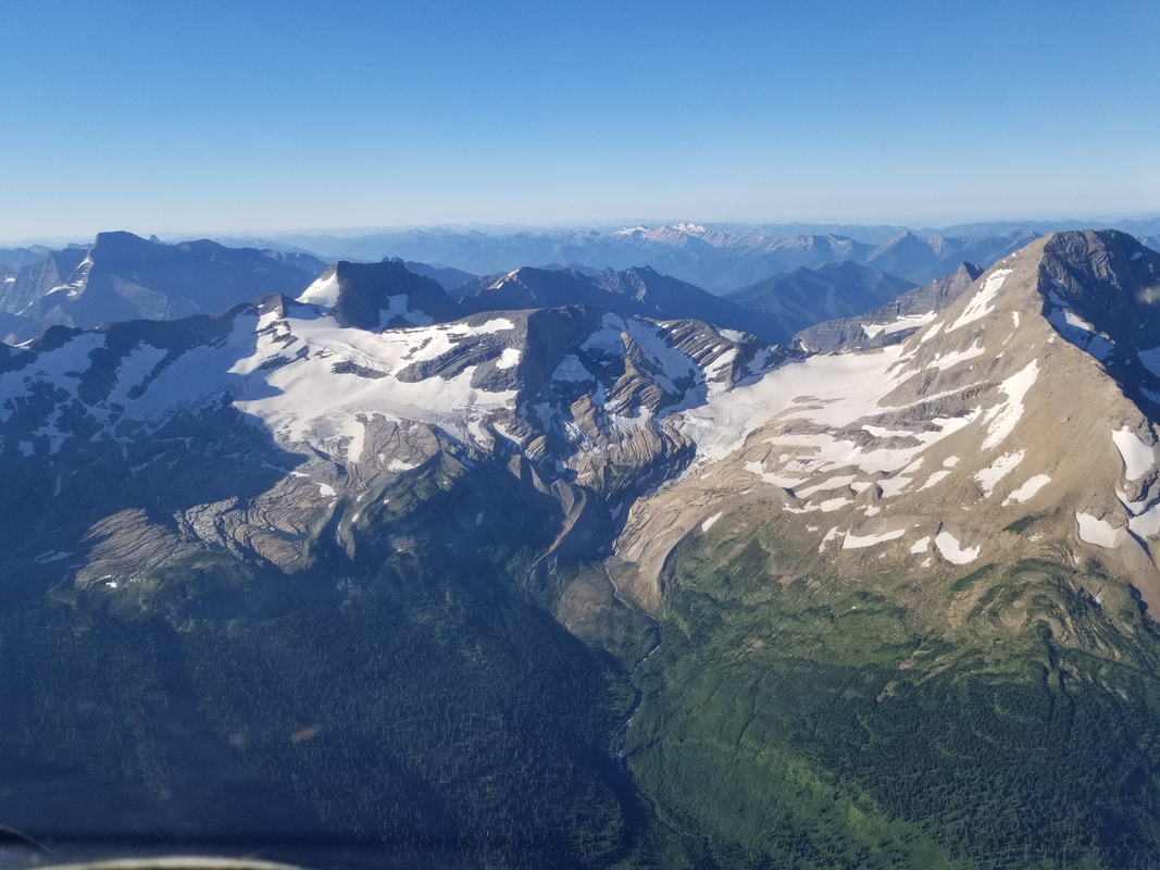
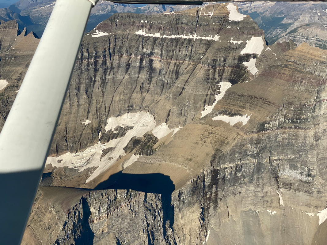
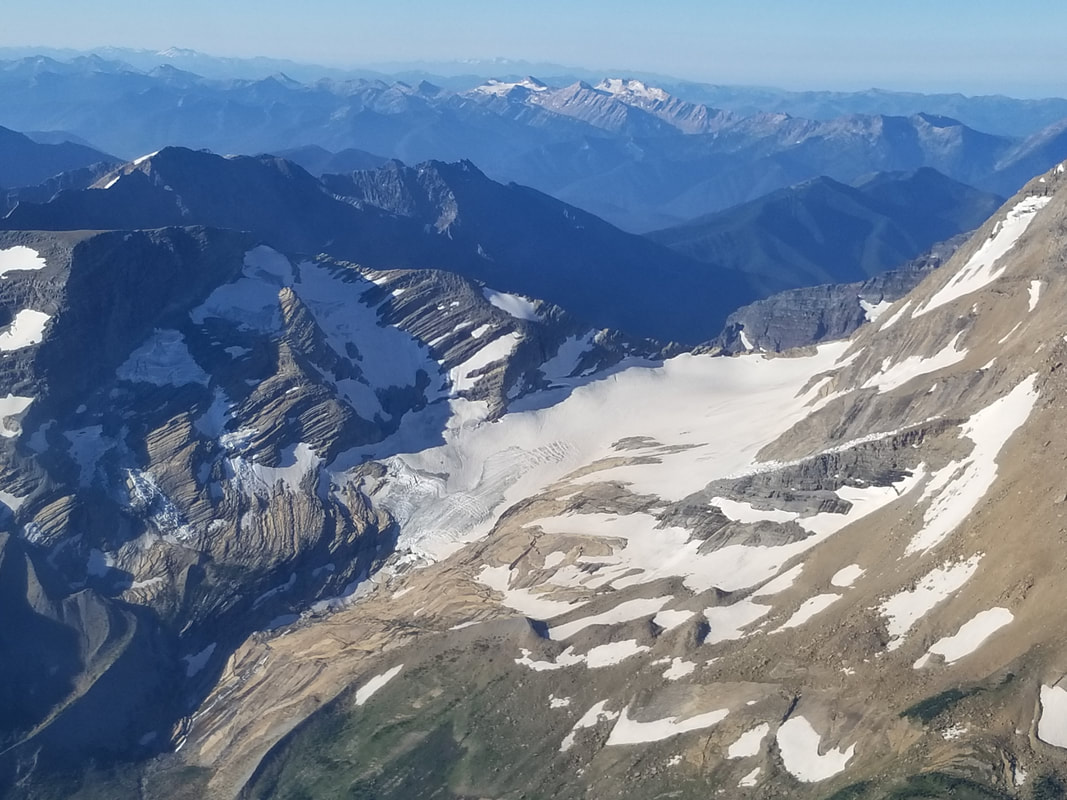
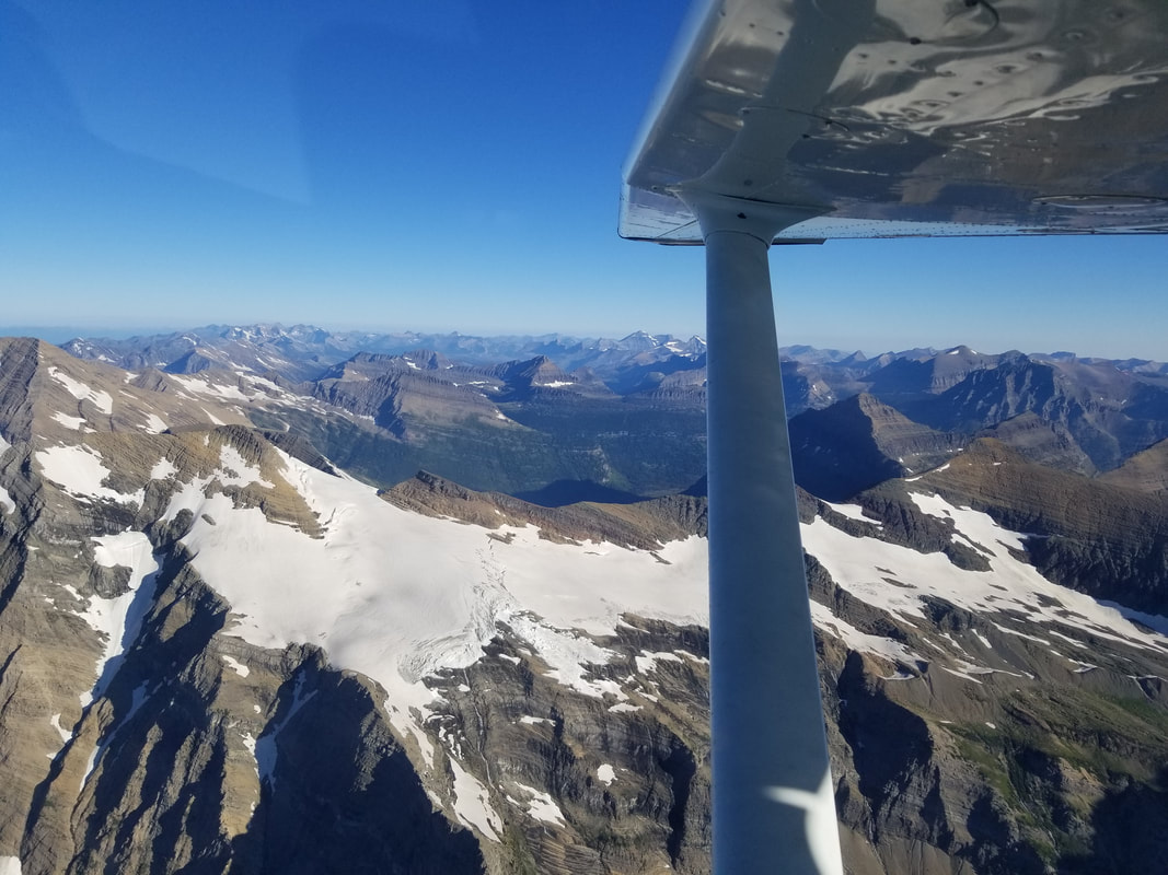
Blackfoot and Pumkpin Glaciers below
Time to visit some more of our National Landmarks - America's Treasures! Fly safe and fly often!
(Thanks to Logan Hutchin for taking some of the pictures above) |
BLOGS ON THIS PAGE
- Summer is made for flying and the great outdoors
- Splashing around Northwest Montana - Same Places, Different Perspectives... From the Air and From the Ground - Going-to-the-Sun Skyway - Flying Up in the "Big Sky" AuthorYasmina Platt Archives
December 2023
Categories |


 RSS Feed
