|
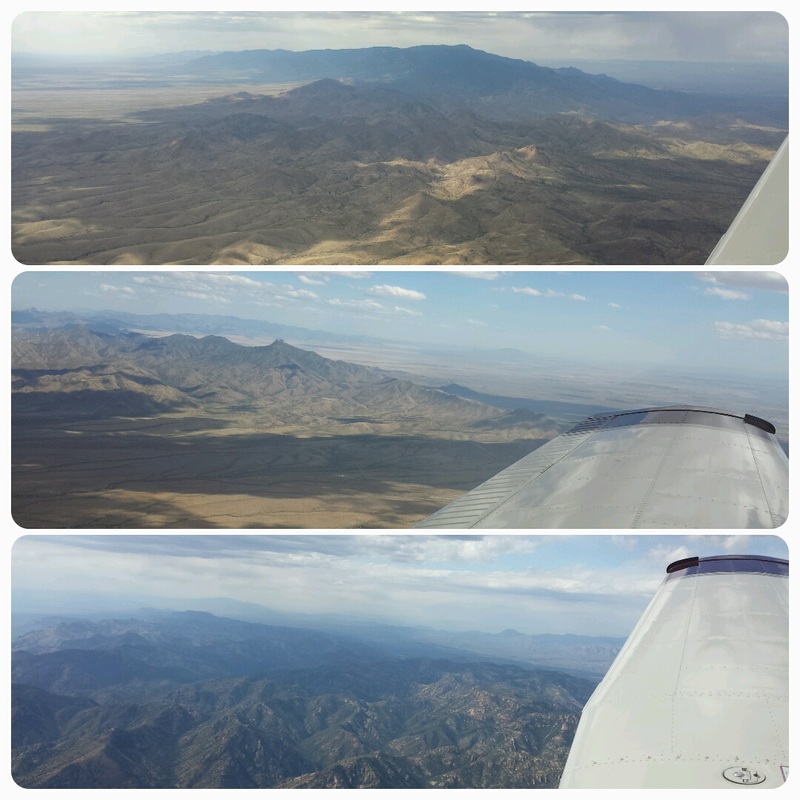
Written by the author, Yasmina Platt. Reprint from July 29, 2015, from AOPA's Views From the Region (VFR) blog: https://blog.aopa.org/vfr/?p=2254 My husband Jared and I had been looking forward to our “flying vacation” to the Bahamas at the end of May, 2015. However, when Staniel Cay (highlighted as a must stop by everybody we talked with) was suddenly closed on April 9th, we had to make a decision: A) continue with our plans without the Staniel Cay stop or B) change plans. As pilots, both Jared and I are used to changing plans or making plans “on the fly” so the decision was easy although disappointing: B) change plans and go to the Bahamas next year when Staniel Cay is open. So, where to go now? Well, we had been talking about heading west in 2016 so we just flip flopped our plans. And why west? Simple! We both love the mountains, wanted to fly into California’s Catalina Airport, and we had been wanting to visit the Sequoia and King Canyons National Parks but they are quite out of reach from major commercial airports. And, on May 18th, we embarked on our trip. Woohoo! This is the story of two pilots in love with each other and with flying =) (yeah, ok, that may be too cheesy! haha)  * I titled this blog “true flying vacation” because I see two ways of using aircraft on vacations: 1) You can use them as pure transportation to get you to your final destination (as an example, you can read my blog titled “Flying Vacation to the Florida Keys”) or 2) You can make flying the primary purpose of your vacation. We did the latter on this trip. Day 1: KIWS (West Houston Airport, TX) – KFST (Fort Stockton-Pecos County Airport, TX) – KLSB (Lordsburg Municipal Airport, NM) – KSDL (Scottsdale Airport, AZ) The first day was mostly a travel day that started a little later than expected due to weather (remember all the rain and flooding in Texas in May?) and a minor maintenance issue. 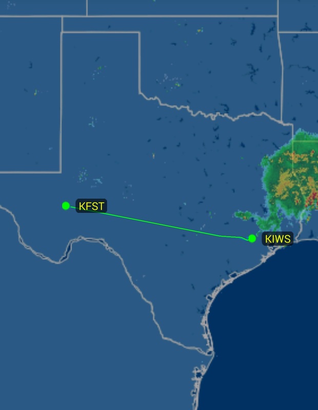  The first leg of the day was in and over clouds as well as over flat land but soon after Fort Stockton, the weather started to clear, the elevation started to rise, and the mountains started to appear in the distance, like the Guadalupe Mountains and its Signal Peak – the highest one in Texas. We actually saw the road we once drove on (and the CBP checkpoint we went through) from El Paso to Carlsbad Caverns. 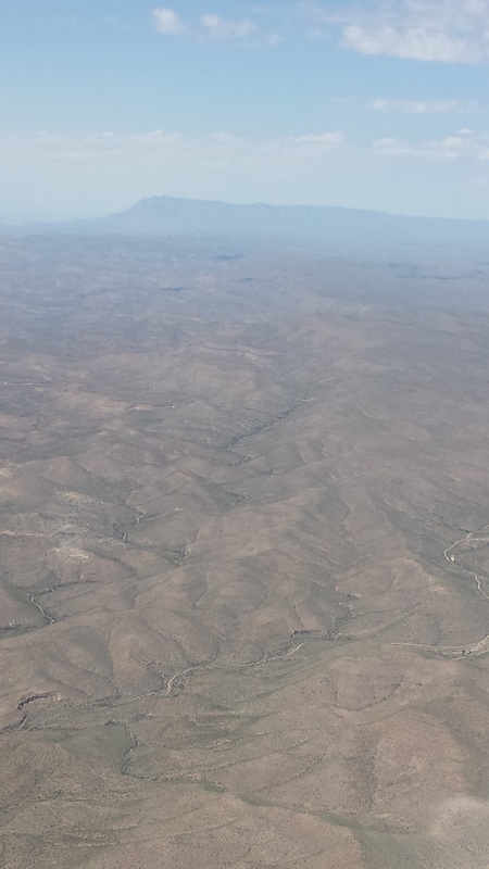 Guadalupe Mountains and Signal Peak By the time we got to El Paso, we had mountains on both sides of the airplane and I started snapping lots of pictures. This is also when actual flight planning started taking place as we had to consider:
 How about these gorgeous mountainous views! Nothing like seeing a 360-degree perspective from the air. 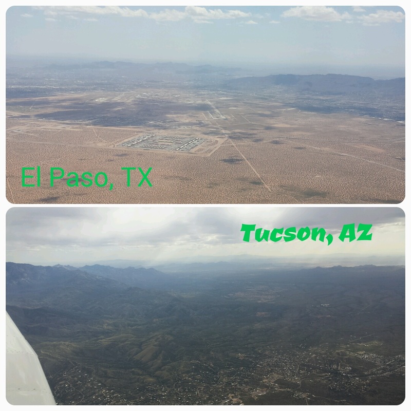 El Paso, TX and Tucson, AZ enroute to Scottsdale We had been to Phoenix on other occasions so we decided to stop in Scottsdale since we had never been. Air traffic control treated us to a nice view of the Phoenix Sky Harbor International Airport (KPHX) and downtown Phoenix. 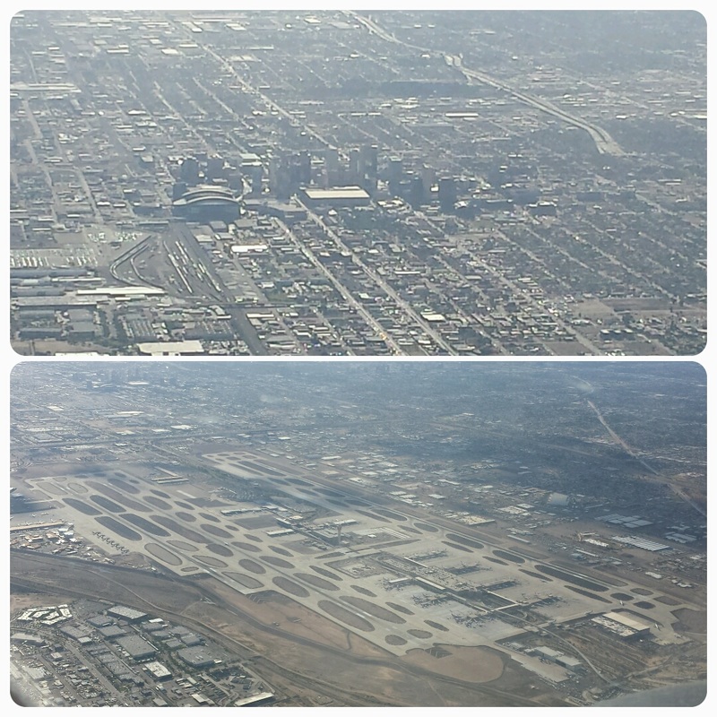 KPHX and downtown Phoenix Although we enjoyed the SDL airport and its surrounding mountains, neither one of us was very impressed with the city itself. We only found shops and chain restaurants – not anything we are interested in.  Left downwind for 21 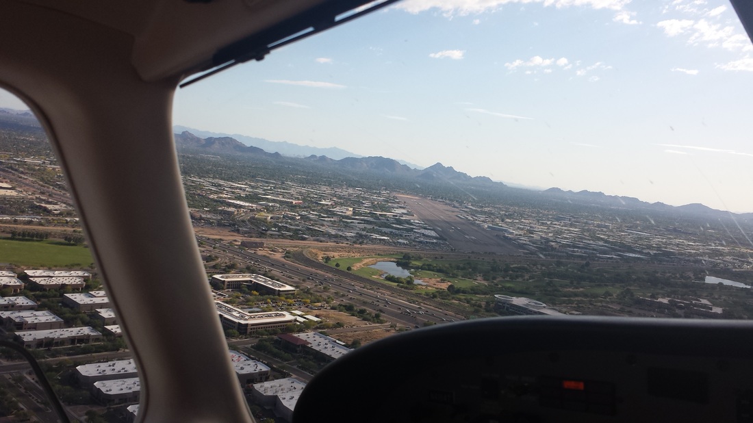 Base to final, runway 21 Day 2: KSDL (Scottsdale, AZ) – (KSEZ Sedona Airport, AZ) – KPRC (Ernest A Love Field Airport in Prescott, AZ) 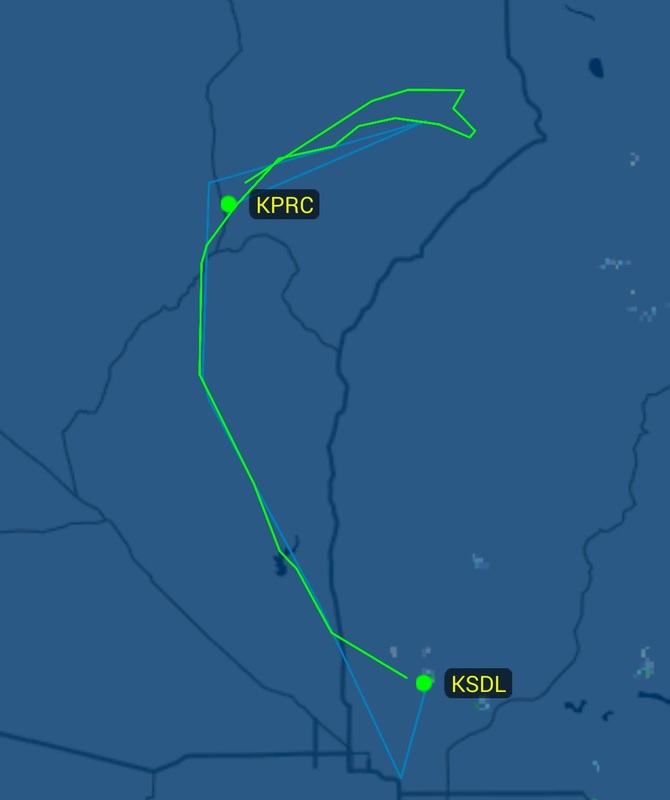 Sedona won the “best aerial views” category. The red rocks are absolutely drop dead gorgeous from the air. We had been to Sedona before but not to Prescott so, for the sake of time spent in Prescott, we did not land or stop at KSEZ but we did fly all around Sedona (as you can see on our radar track), taking it all in and identifying all familiar places from the air. 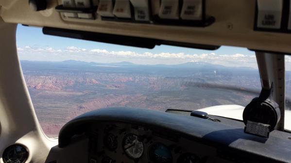 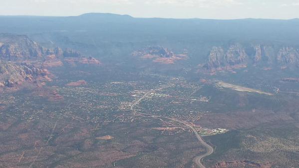 Sedona and KSEZ on the right General aviation is such a small world. Would you believe we ran into Josh Olson, Executive Director of Angel Flight West, at the FBO who had flown in from California to meet with a local hospital in Prescott? I love it! We then rented a car but really explored the area by foot and mountain bikes (and I must add… that was the toughest mountain biking we’ve done to date!) 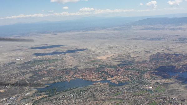 We really enjoying hiking around Prescott’s Watson Lake (on the right of the picture). Since we’re both alumni of Embry-Riddle Aeronautical University (ERAU), we also stopped at the University’s Prescott campus and saw their aircraft on the ramp at KPRC. In fact, several of them were flying while we were there. I also liked seeing AOPA’s Pilot Magazine in the lobby of the University’s Visitor Center. 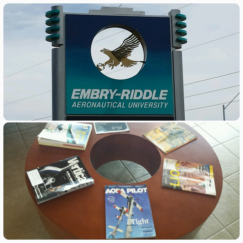 We didn’t get to do this (because we couldn’t bring the camping gear due to weight) but two friends recommended Payson, AZ (KPAN) for two reasons: 1) the Payson Airport Campground onsite and 2) the onsite Crosswinds Restaurant apparently has one of the “best fly-in pies” in the country. Marked for next time… Day 3: KPRC (Prescott, AZ) – KAJO (Corona Municipal Airport, CA) 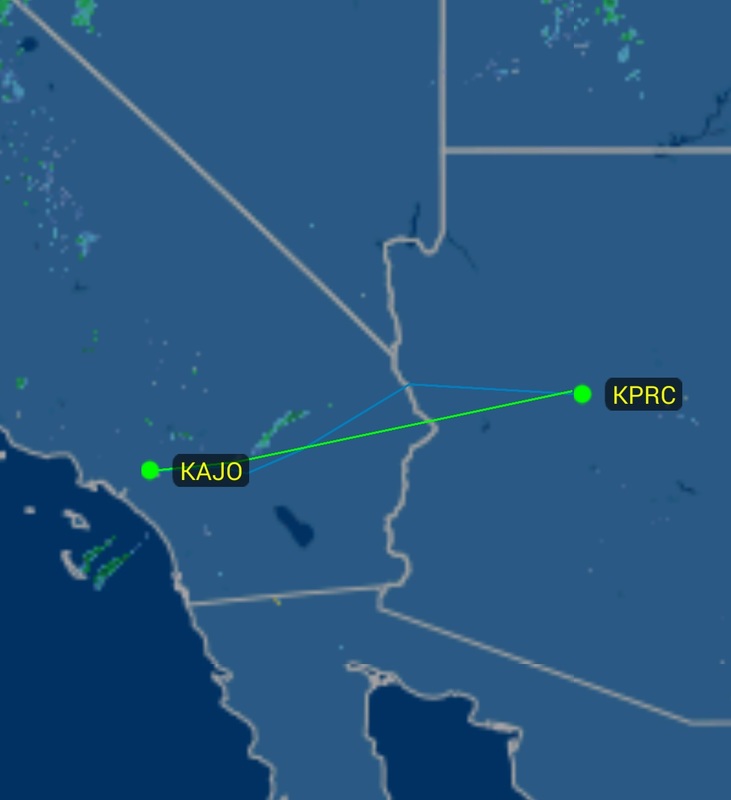 There are things you can only see from the air. This is one of them: 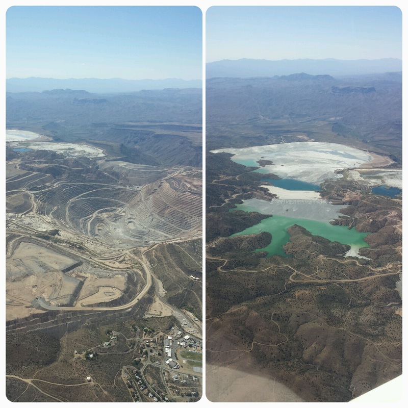 Near Bagdad, AZ 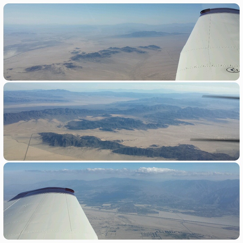 Joshua Tree National Park on our left, attractive desert all around us Someone correct me if I’m wrong but I think what we saw approaching the Los Angeles area was smog! 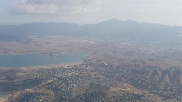 My husband Jared has family in Corona so we decided to drop in and visit with them for the night. It also happens that Corona is one of only few non-towered airports in the Los Angeles area. Nothing against towered airports but I appreciate non-towered airports with easier in and out and, normally, cheaper services/parking. Corona won “best overall airport” for the trip. It has a unique self-serve fuel station with a round owning and a cool area with benches (appropriately known as “The Bench”) to sit on, chat with local pilots and watch traffic coming and going. The airport is also in a nice setting with mountains nearby. 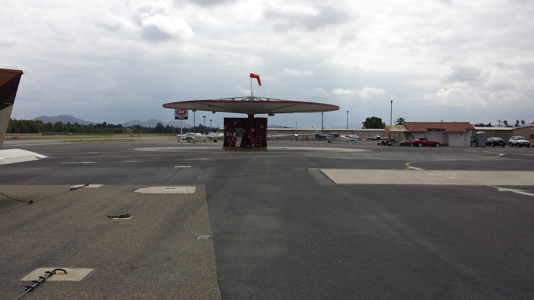 Unique self-serve fuel tanks in Corona 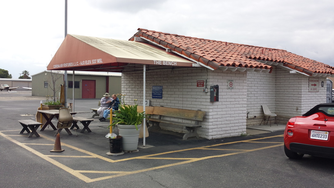 KAJO’s “The Bench” Day 4: KAJO (Corona, CA) – KAVX (Catalina Airport, CA) 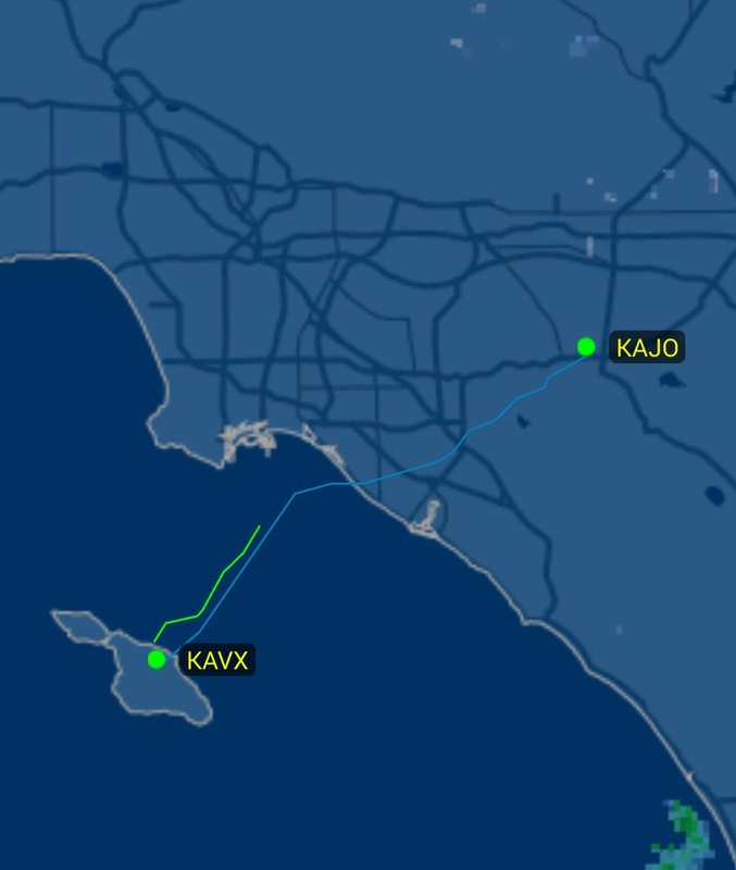 After navigating through Los Angeles’ challenging and busy Class B airspace and flying over Disneyland (on an IFR flight plan during their 60th anniversary), we approached California’s beautiful coastline. 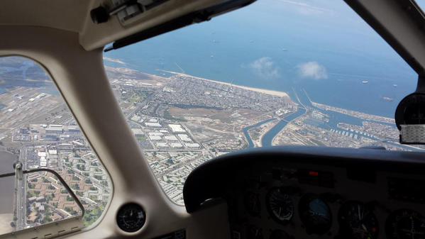 “The Airport in the Sky” won “coolest approach” for the trip. You’re probably not surprised about that if you’ve ever seen any pictures or videos of it, like this one. It was also a solid runner-up for “best overall airport” but we were just too happily surprised with Corona’s friendly feel. 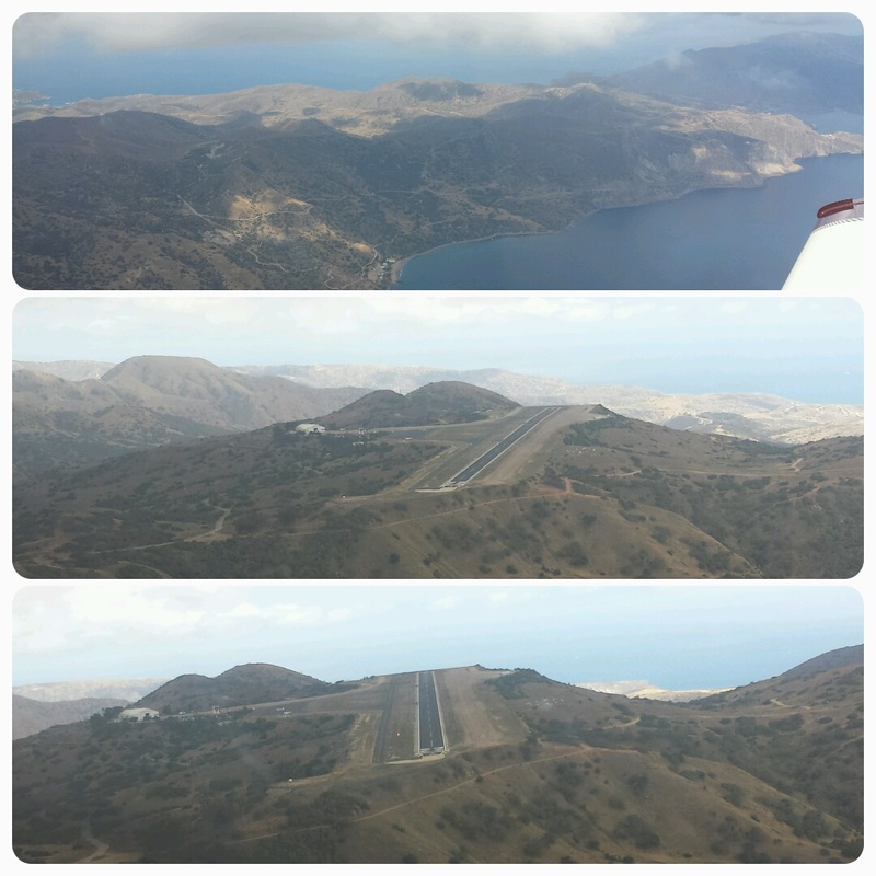 Just like everybody says… runway 22’s gradient goes up during the first 1,800’ of runway and the remaining 1,200’ is flat so, when on short final, you lose sight of the flat 1,200’ of runway. Your approach also seems higher than you really are due to the drop-off prior to the runway and rising runway. No problem though. If you are expecting those things, it is really not a problem at all. Catalina used to be frequented by seaplanes quite a bit and Avalon still has quite a bit of seaplane art around town. Pretty neat. And I learned that the first water to water flight (and also the longest and fastest overwater flight to that date) was flown by Glen L. Martin from Newport Beach, southwest of Santa Ana, to Santa Catalina Island on May 10th, 1912. 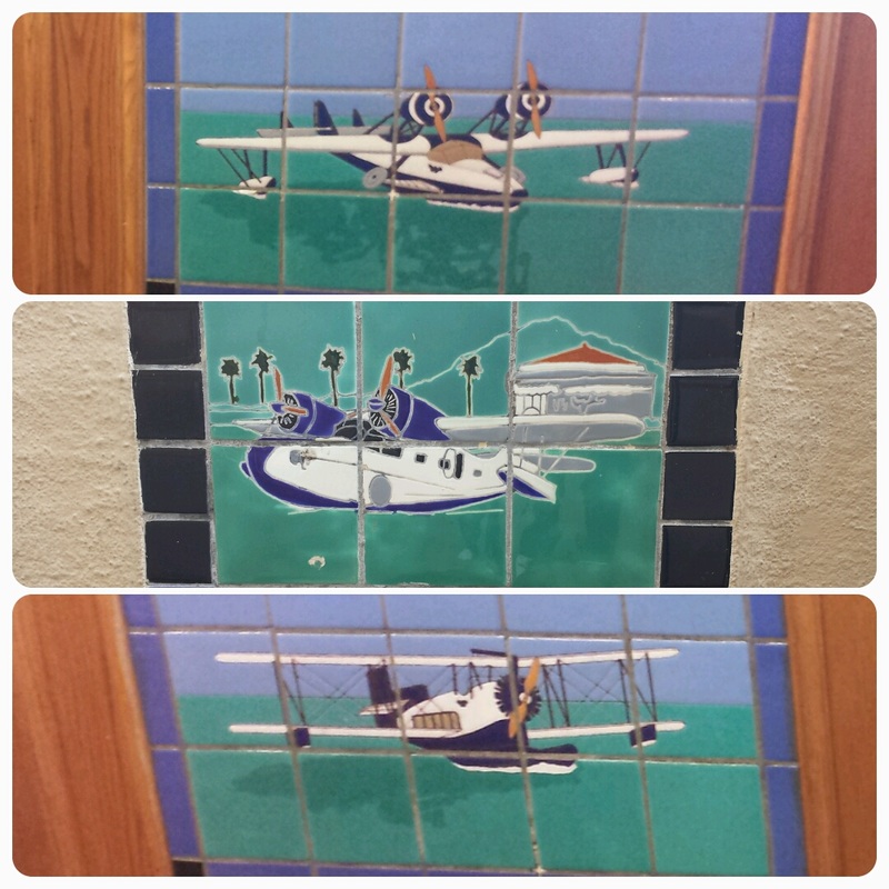 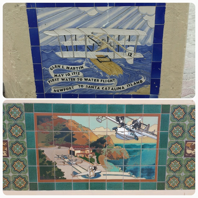 Day 5: Catalina, CA Would you believe we went scuba diving and the gear we rented was from the brand “Pilot?” Could it be more perfect? Very fitting. 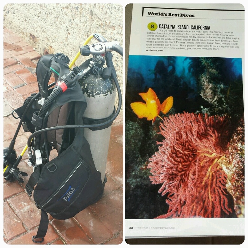 “Pilot” scuba gear We saw lots of beautiful garibaldi fish (as we understand it, the official marine state fish of California), a couple of crabs, a bat ray, several sea tars, and lots of other cool fish (some of which tried “attacking” us for food). 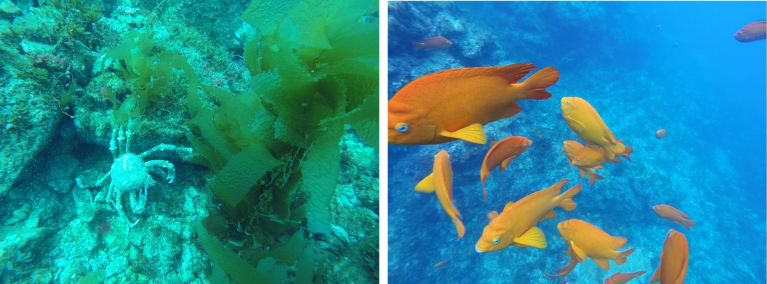 One of the crabs and garibaldi fish 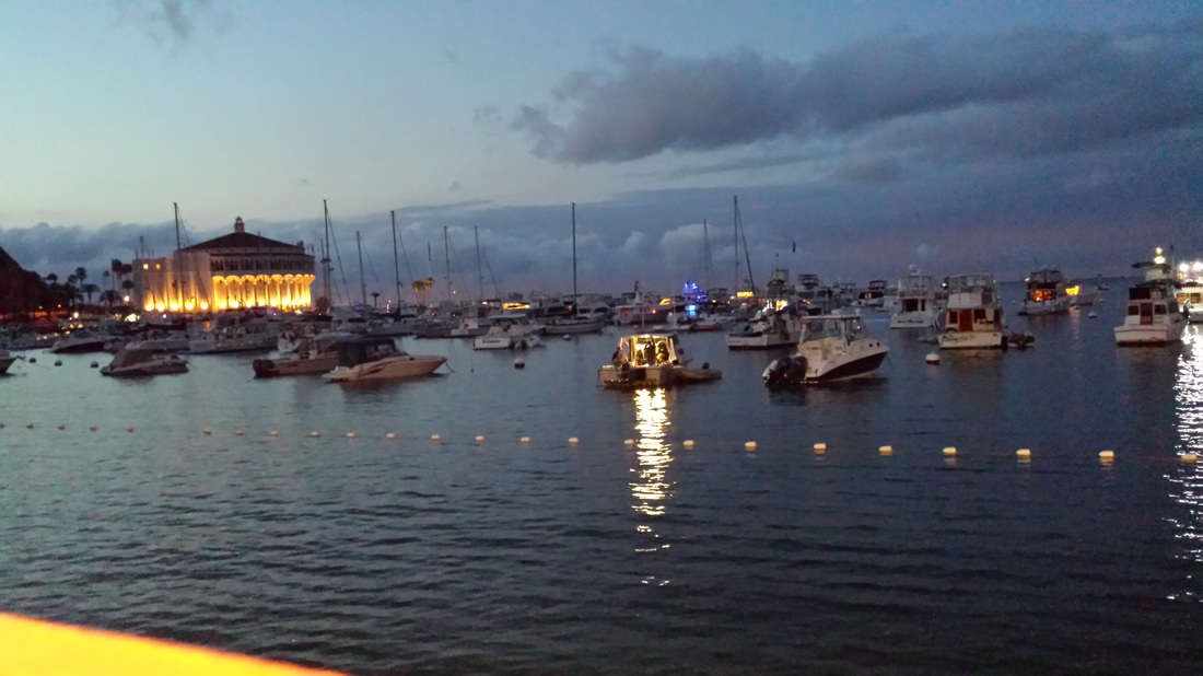 Avalon Bay Day 6: KAVX (Catalina, CA) – KBFL (Meadows Field Airport in Bakersfield, CA) – Sequoia National Park 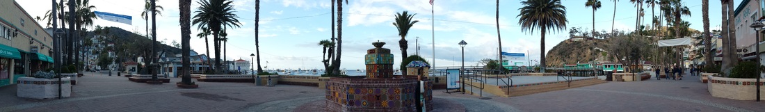 Avalon's panoramic This day represented, to me, a perfect example of the benefits of flying GA. We spent half a day relaxing in Catalina Island, had a famous buffalo burger (and bought some T-shirts and things) at the airport’s DC-3 Gifts and Grill, then flew less than two hours to Bakersfield (even though our initial plan was to fly to KVIS-Visala since it’s the closest airport to the park entrances but, since it was Memorial Day weekend, they were out of rental cars), and we were still able to spend a few hours in Sequoia’s National Park. That just can’t all be done within a day with any other mode of transportation: not by boat, not by car, not by airline, and not by any combination of those. 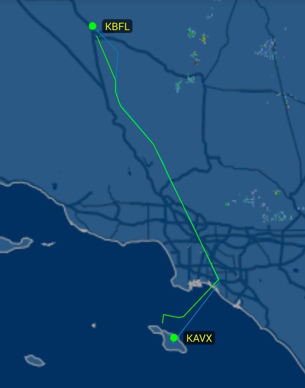 Google Maps tells me it “could not calculate directions from Santa Catalina Island to Sequoia National Park” even though it’s normally very good about considering several modes of transportation (car, bus, train, walking, airline, bike…) so here is what I gathered:
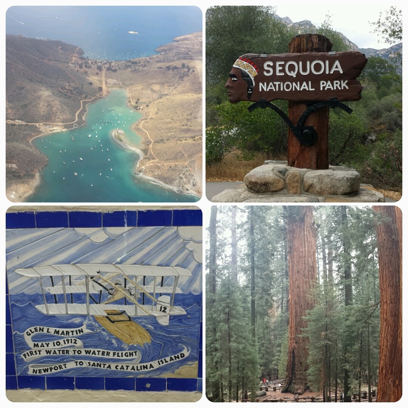 Left – Two Harbors in the morning; Right – Sequoia National Park in the afternoon Day 7: Sequoia and Kings Canyon National Parks Jared and I love visiting U.S. National Parks. They are absolutely treasures we need to help preserve. While I personally enjoyed Kings Canyon more than Sequoia (and only because I have a thing for canyons and we’ve been to Yosemite National Park before which also has sequoia trees), Day 7’s highlight was seeing wild brown bears (including cubs) up close and personal while walking around the Crescent Meadow trail. 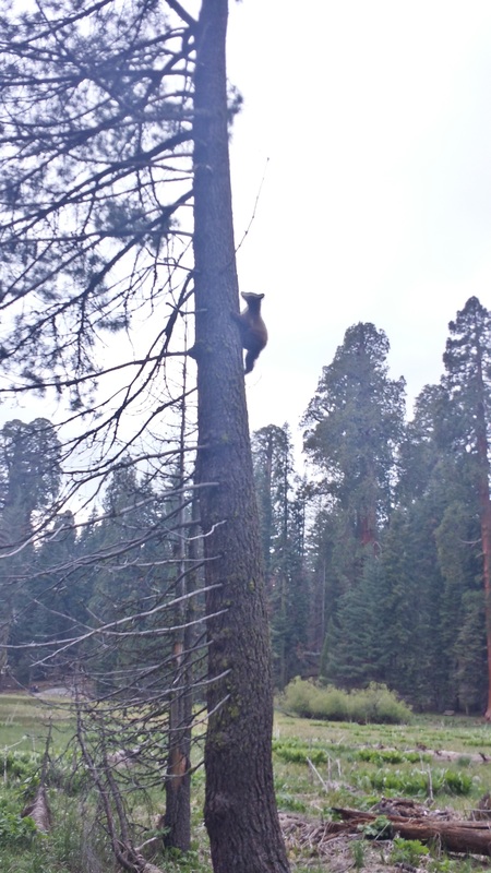 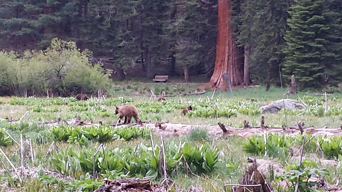 Day 8: KBFL (Bakersfield, CA) – KPSP (Palm Springs International Airport, CA) Does taking off from a displaced threshold count as an “off-rwy takeoff?” Bakersfield’s runway 30R has one 3,400′ long and the Archer was off the ground before reaching the runway threshold. 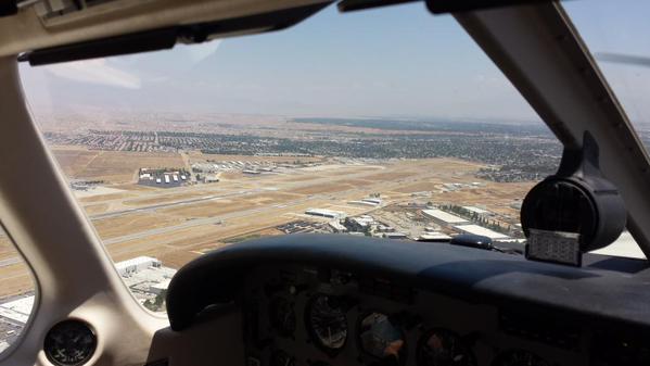 See the looooong displaced threshold? The flight from BFL to PSP was very, very pretty, seeing the Mojave Desert on our left, then LA covered with clouds to our right, and Morongo Valley on our descent. I really enjoyed it! It’s hard to say which leg was our top choice but this one was towards the top because of its variety of scenery. 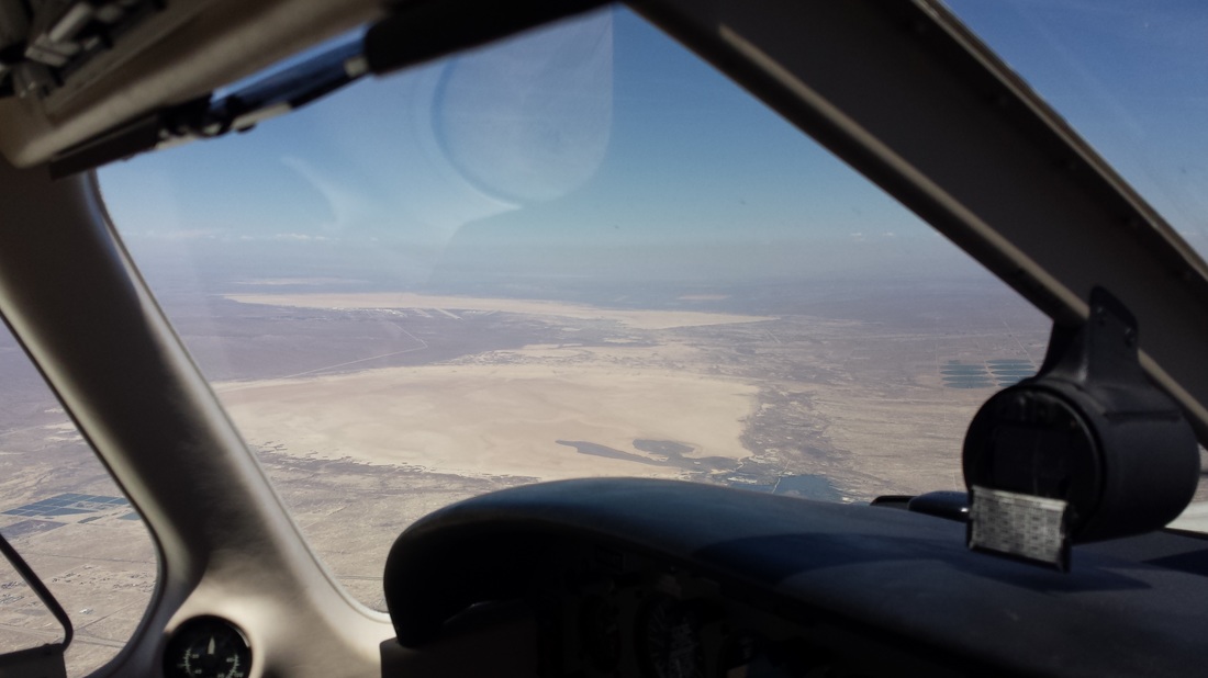 Mojave Desert with Rosamond Lake and Rogers Lake (dried lakes, that is) 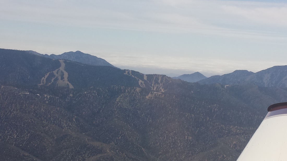 Los Angeles on the other side of the San Bernardino Mountains and ski resort 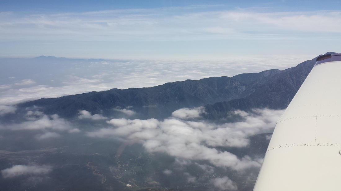 How could anybody not enjoy flying with views like this? Ahhhhh…… 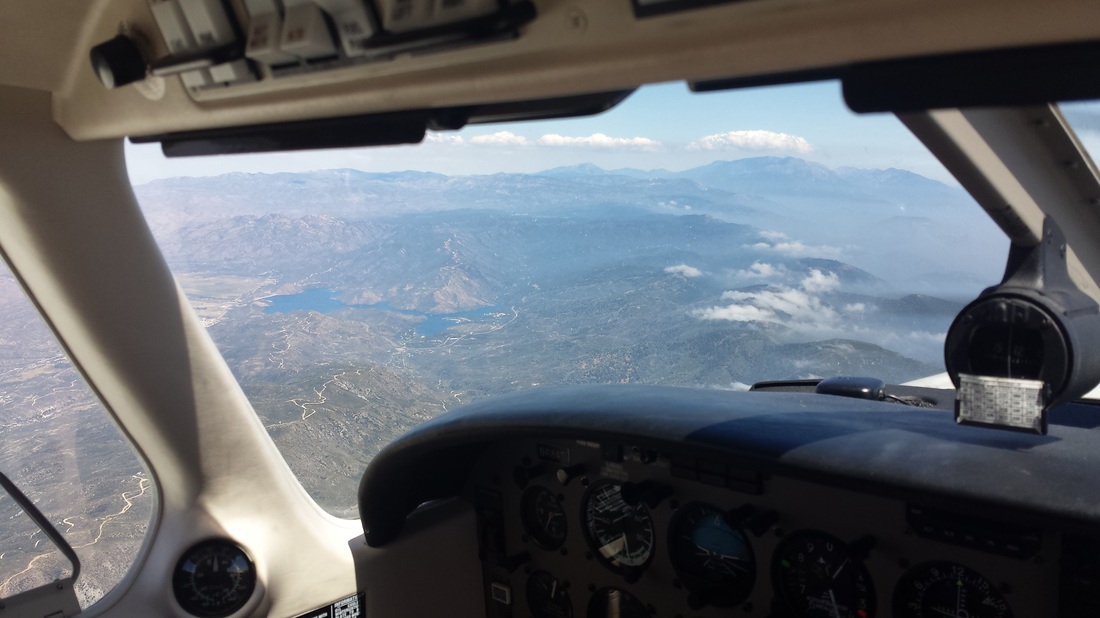 High altitude lakes in the Big Morongo Canyon Reserve area (and, yes! I love inside the cockpit pictures like this one because it shows exactly what we show! No zoom used!) 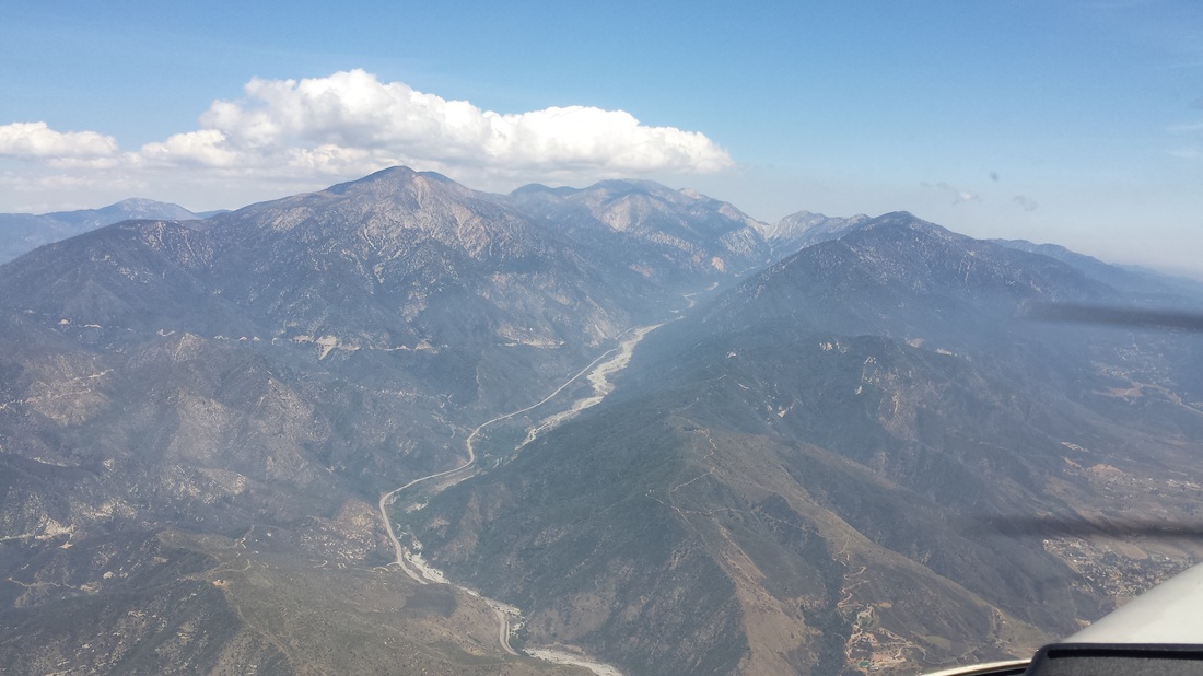 Big Morongo Canyon Preserve By chance, we planned to be in Palm Springs on Memorial Day but, because of that, we got lucky and got a chance to see the Palm Springs Air Museum’s Flower Drop while there. Each Memorial Day, the museum commemorates the important role of those who fought in World War II with a flower drop from the museum’s B-25 aircraft. Thousands of white and red carnations represent those who gave the greatest sacrifice — their lives — for their country. Here is a news story (with a video) from the same event in 2013. 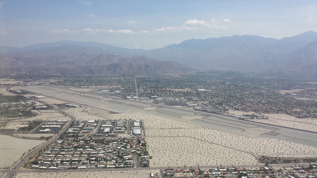 Downwind for Palm Springs’s runway 31R Day 9: KPSP (Palm Springs, CA) – KTUS (Tucson International Airport, AZ) 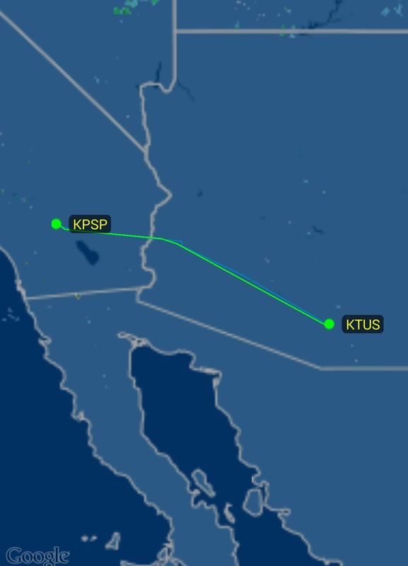 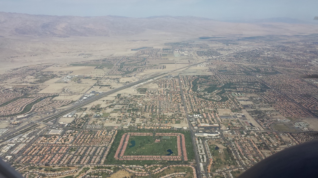 Leaving Palm Springs. Interesting seeing that well-defined green golf course community in the desert! We timed our flight from Palm Springs to Tucson to arrive around sunset. We were very happy we did. The sun’s color and shadows on the mountains around Tucson made our views fantastic even when it meant the sun was in my face on final. 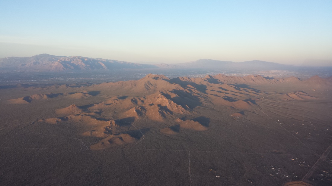 Approaching Tucson from the west 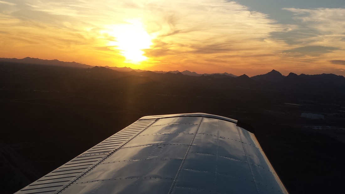 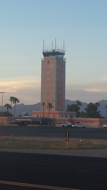 KTUS’ tower (I like the neon sign on the side!) Day 10: Tucson, AZ Different websites and forums said to visit the Pima Air and Space Museum bright and early to avoid the heat of the day and to obtain tickets for the Aerospace Maintenance and Regeneration Group (AMARG), better known as “aircraft boneyard,” tours so we did! We really enjoyed both the museum and the boneyard tour. My husband would say that the “coolest aviation visit/reference” we saw was TWA’s Constellation at the Pima museum because he is infatuated with Howard Hughes. 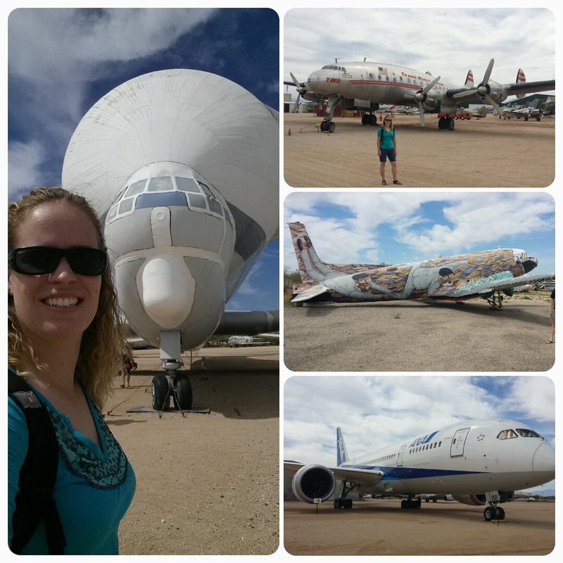 Davis-Monthan Air Force has “the largest aircraft boneyard in the world.” The area’s low humidity, rainfall of about 11″ annually, hard alkaline soil, and high altitude of 2,550 feet allows the aircraft to be naturally preserved for cannibalization or possible reuse. In addition, the geology of the desert allows aircraft to be moved around without having to pave (additional cost and maintenance) the storage areas. Davis-Monthan is the location of the 309th Aerospace Maintenance and Regeneration Group (AMARG), the sole aircraft boneyard and parts reclamation facility for all excess military and government aircraft. Aircraft from the Air Force, Navy, Marine Corps, Coast Guard, NASA and other government agencies are processed at AMARG. Another role of AMARG is to support the program that converts old fighter jets, such as the F-4 Phantom II and F-16, into aerial target drones. AMARG has more than 4,000 aircraft. 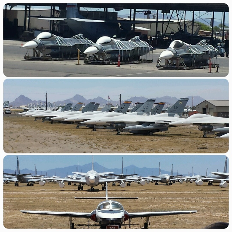 We had lunch at San Xavier’s mission, which also happened to be the “most historic” site we saw during the trip. And, in the afternoon, we took lots of water and headed to Sabino Canyon. Day 11: KTUS (Tucson, AZ) – KTCS (Truth or Consequences Municipal Airport, NM) We went ATVing through Box Canyon in the morning and the owner of the company was a pilot and an AOPA member. As you can see, we like keeping it in the family =)  On Day 10, we were left wondering where the surplus/retired non-military/non-government airplanes were stored in the area. Well, we found them! Pinal Airpark (KMZJ) is the answer. Several old airliners were parked there. 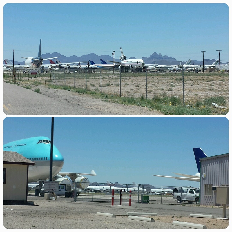 As we were doing our pre-flight in preparation for departure, a Piper Cherokee Six (below) taxied by with an inmate they were taking to a different jail. It was quite interesting to see two Sheriffs flying. I don’t often see uniformed cops flying GA aircraft. Most usually wear flight suits, not uniforms. It was a good reminder, yet again, of all the important uses GA has. 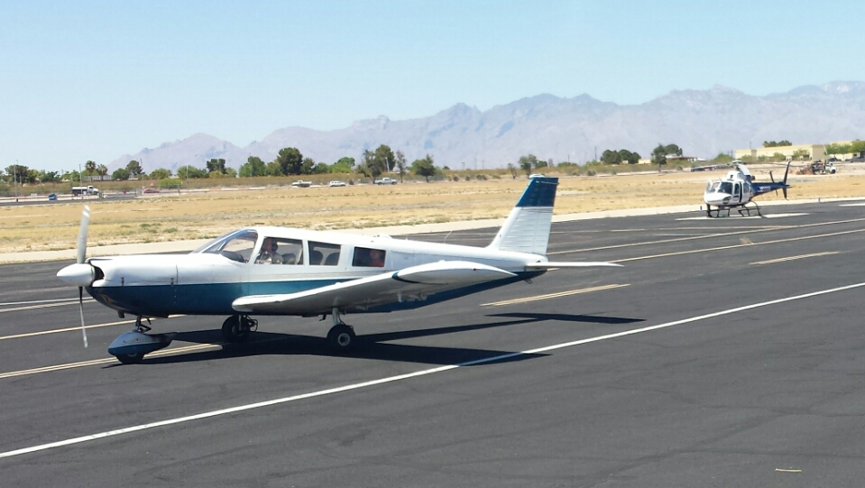 I filed Redington Pass as the first checkpoint from KTUS with hopes of them keeping it that way so we could fly right over the military boneyard at Davis Monthan AFB. Some people we talked with told us “good luck with that” when we asked them what the best way to fly over the boneyard was but I tell you what… they gave it to us and it was very, very cool to see all 4,000+ military aircraft in perfect formation with each other from the air. It was an impressive sight – even more so than from the ground. BTW – In case you are wondering (like I did)… no, they are not for sale to private individuals! :( 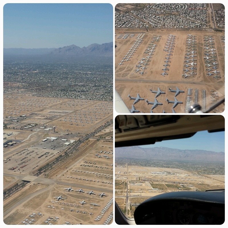 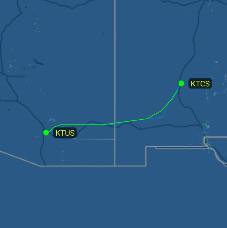 And… we arrived at TorC. While we experienced the highest density altitude at KLSB, KTCS won “highest airport” of all stops at 4,862 feet. In contrast, KAJO won “lowest airport” of all stops at 533 feet. Do you know the history behind the name “Truth or Consequences?” The town used to be called Hot Springs because, guess what, they have wonderful natural hot springs. Duh! We could not pass on that so, as soon as we dropped our bags at the hotel, we headed to Riverbend Hot Springs – definitely our trip’s “most relaxing” experience. I know this may sound surprising since Truth or Consequences was the smallest town we visited but we had the “best food” of the trip there at Bella Luca’s Italian restaurant. Day 12: KTCS (Truth or Consequences, NM) – (Spaceport America) – KPEQ (Pecos Municipal Airport, TX) – KIWS (West Houston, TX) And here is another small world instance. We borrowed the airport’s courtesy car overnight to get us to/from the airport and agreed to return it early in the morning because another pilot had called asking if she could use it for some business in town. Do you know who that ended up being? The one and only Cathy Myers, President of the NM Pilots Association =) Funny thing is… she wasn’t too surprised to see me… She knows I get around the region but she was glad to meet my husband though. No solo flying on this trip! 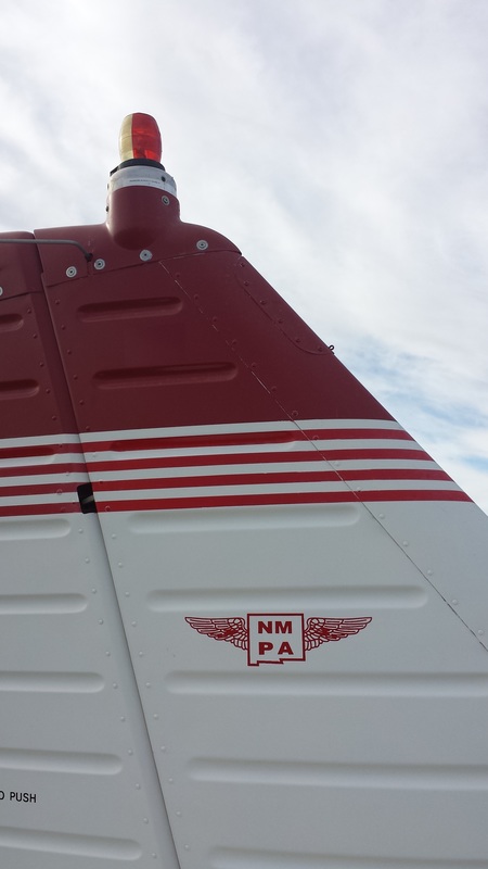 Tail of Cathy’s Piper Cherokee with NMPA’s logo ;) The main reason for visiting TorC was touring Spaceport America and visiting with its staff. Wondering what’s going on at the Spaceport? Here is a news article/video from July 29th. 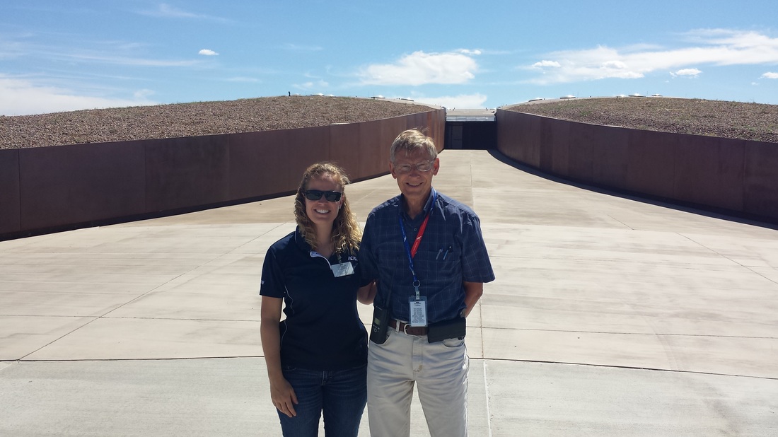 Bill Gutman with the Spaceport and I in front of the astronaut’s walkway We know many GA pilots are interested in flying in/out of the Spaceport so I met with their staff to offer some suggestions on how to organize more fly-ins, where to find helpful resources, how we can help, who else can help, etc. 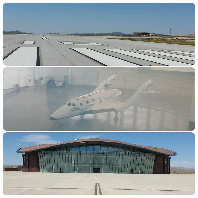 Spaceport America (and we actually saw a replica of SpaceShipOne inside Bakerfield’s terminal) The Spaceport now has a museum that opened up to the public on June 24th. One of the things they have is a fun G-Shock simulator where one can really experience centrifugal force. I had to try it to make sure it was safe ;) 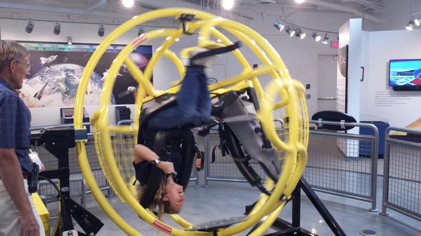 After the tour, we went back to the aircraft and began our flight back home, starting with a first leg to Pecos, TX with the worst turbulence of the trip. Did you know Pecos is home of the world’s first rodeo? We didn’t see one during this stop though. Even though we were not given permission to land at the Spaceport, we at least got lucky on departure and R-5111 C & D were inactive. We were able to fly close enough to the Spaceport to see it and take some aerial pics. 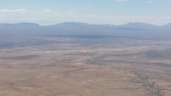 And, yes, we were back to crossing Texas. This time, we entertained ourselves by remembering the best parts of our trip by giving ratings to different parts of our trip. You read about the winners (with “best” this or “best” that) throughout the blog. That is purely our rating based on our experience – nothing else. Good or bad, lucky or not, we missed some really bad weather and floods back home in the Houston area while we were gone but we still saw lots of flooded areas all around. 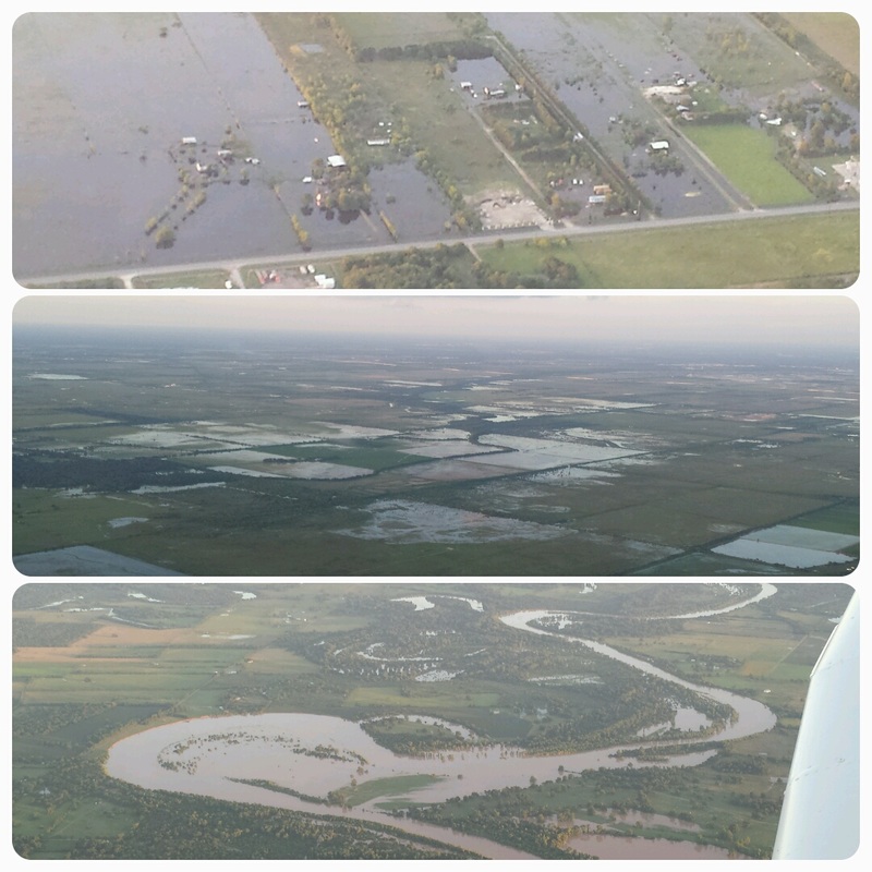 West Houston Other Throughout the trip, we saw lots of dirt runways perfect for tundra tires and other capable aircraft. 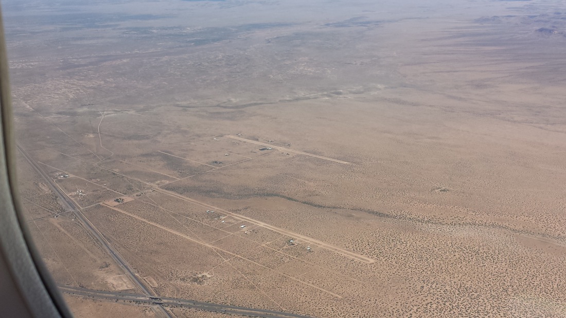 “Best beer” tried? Hangar 24’s IPA from their craft brewery in Redlands, California and, yes, we may be bias. If you don’t like it, you can blame Jared because I don’t drink beer.
And what’s one thing we learned on this trip that we need to plan for the future? Boating around Catalina Island. My husband won’t let me forget. Summary 12 days, 1 GA aircraft, 2 people, 4 states, 12 airports, 8 hotels, 6 cars, 1 ATV, 2 bikes, 2 scuba dives, more mountain flying and density altitude experience, great adventures, a number of hikes and walks, a couple of aviation-related visits, one work-related stop, perfect weather, wonderful laughs, lots of fun, beautiful sights… a lifetime memory! We’ll never forget this trip and we have decided we need to take a trip like this once a year. I encourage you to consider doing one yourself. It’s a completely different way of traveling: you have complete freedom, you get both aerial and ground views, you can get to hard-to-get-to-areas of the country, you can pack whatever you need, you can change destinations or change your routing along the way, you can challenge yourself with different types of flying experiences, you can do a variety of different things while you are gone, you see different types of airports and aviation museums along the way, you meet wonderful people, and the list goes on.
1 Comment
11/12/2019 03:02:20 am
I am so paranoid about getting mugged everytime I am in a new country. So I am happy that you felt safe. Maybe one of these days I can visit California Leave a Reply. |
BLOGS ON THIS PAGE- Light Winds, Hot Air, Color, Light, Shapes, Chile, Ohhh Ahhh... Ingredients for Balloon Fiesta!
- Pet-ro-glyphs in New Mexico - A Side Trip From the Grand Canyon You're Used to - 3rd Annual Backcountry Fly-in at the Beautiful Mystic Bluffs (NM56) Airstrip in New Mexico - New Mexico True Trails - Route 66 National Scenic Flyway - Texas, New Mexico, Arizona, and California in 12 Days AuthorYasmina Platt. Archives
October 2023
Categories |
 RSS Feed
