|
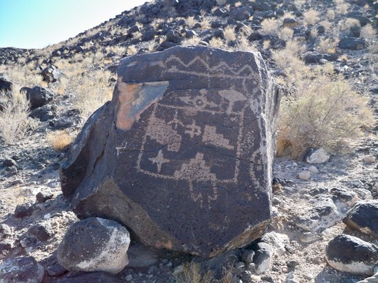
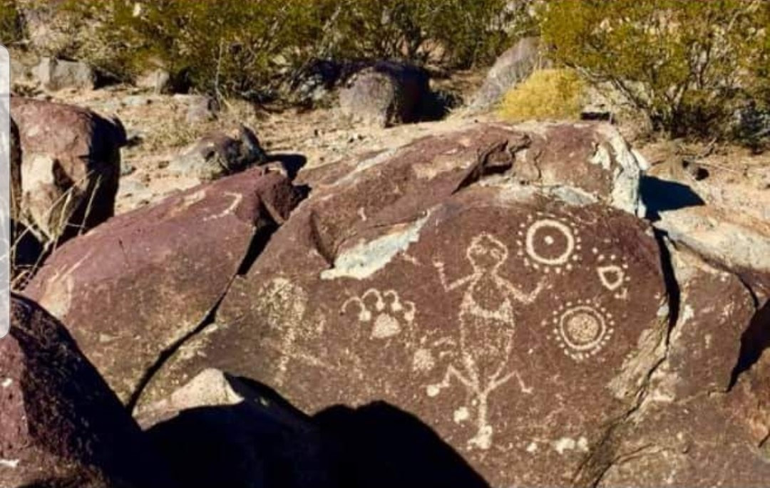
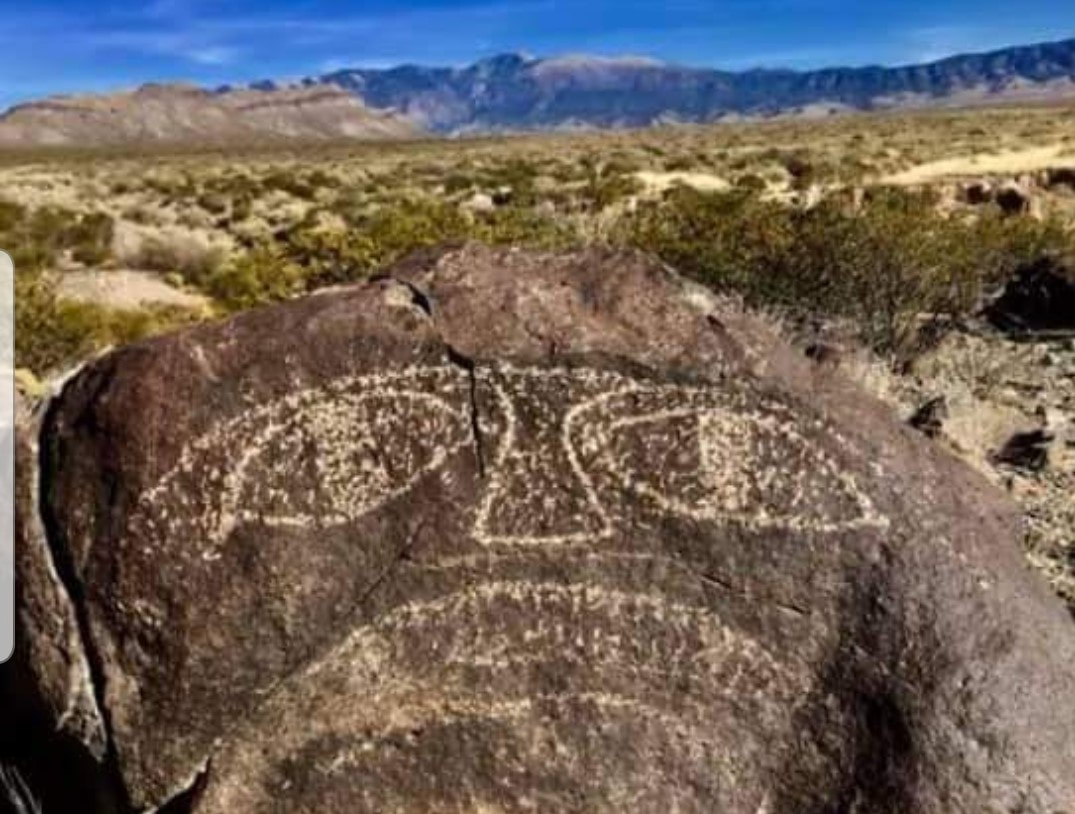
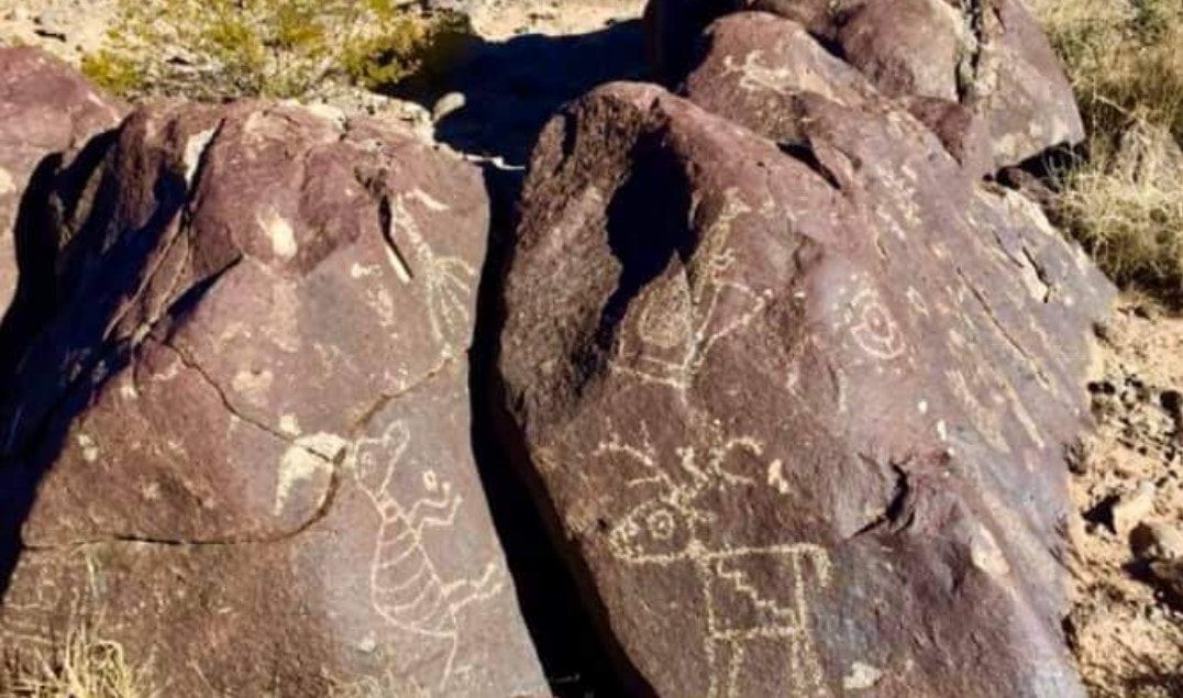
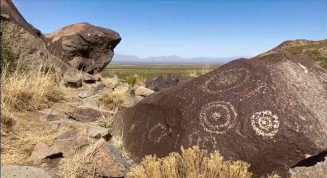
Petroglyphs are rock carvings (rock paintings are called pictographs). They are images created by removing part of a rock surface by incising, picking, carving, or abrading, as a form of rock art. In the U.S., most petroglyphs were carved by Native Americans. They often used a stone chisel and a hammerstone and often represent powerful cultural symbols that reflect the complex societies and religions of the tribes. Some of the petroglyph sites are fairly close to airstrips, making them easy for us to visit. This blog focuses on New Mexico but, certainly, other states (such as Utah, California, Nevada, or Arizona) have plenty as well. One of those sites is in Three Rivers. It is 35 minutes from the Carrizozo Municipal Airport (F37) or, if you happen to find out who owns the “Three Rivers Airport,” maybe you can fly directly in there and walk over (about 2 miles). Inhabitants of a nearby village made the Three Rivers petroglyphs over 600 years ago. Over 20,000 petroglyphs have been identified in the area. The people were of the Jornada Mogollon (hor-NAH-da-muggy-OWN) prehistoric Indian culture, of which there are no known modern descendants. Some of the petroglyphs depict the animals and plants they saw around them; others had religious meaning.
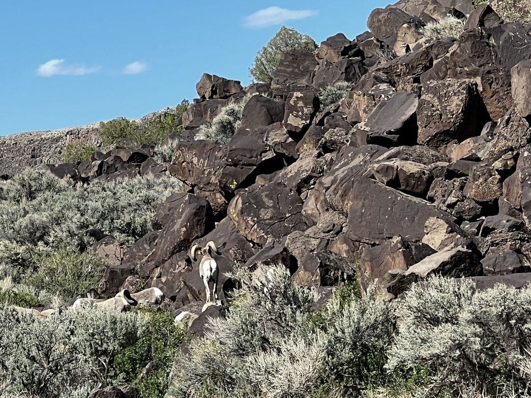
Another cool site is Albuquerque’s Petroglyph National Monument. The main part is about 15 minutes from the Double Eagle II Airport (KAEG). The three canyons to visit there are:
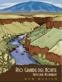
 However, the entrance to the Volcanoes Day Use Area is about a 5 min drive from KAEG. From there, you can visit the JA Volcano, the Black Volcano, and Vulcan. The day use area has a picnic area and a pit toilet. Please note this area is open to vehicles from 9 am to 5 pm (but one can walk to it after hours). 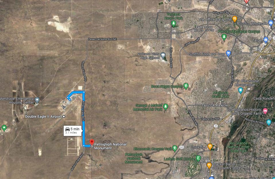 Credit: Google Earth. Crow Canyon, southeast of Farmington, contains the most extensive and well-known collection of 16th, 17th, and 18th century Navajo petroglyphs as well as ruins. The Aztec Municipal Airport (N19) or the Four Corners Regional Airport (KFMN) are closest. However, note that a high clearance, four-wheel drive vehicle is recommended to visit the site. 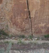 El Morro National Monument (El Morro National Monument (U.S. National Park Service) (nps.gov)) has many Spanish and Anglo inscriptions and pre-historical petroglyphs in addition to Ancestral Puebloan ruins and great views of the Zuni Mountains. The Grants-Milan Municipal Airport (KGNT) is the closest public airport but, with prior permission, you may also be able to fly into the very scenic Mystic Bluffs Airport (NM56). You can read more about it in this prior blog I wrote. 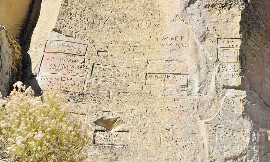 And, finally, the Rio Grande del Norte National Monument has petroglyphs as well. La Vista Trail, an easy 2.5-miles roundtrip, has plenty of petroglyphs and, if you time it correctly, you may even be able to go on a guided hike of it. The trailhead is on NM-567, about 0.5 miles west of the Taos Junction Bridge, which is 25 minutes from the Taos Regional Airport (KSKX).
History defines where we came from! Go see it for yourself! Fly safe and fly often!
0 Comments
Leave a Reply. |
BLOGS ON THIS PAGE- Light Winds, Hot Air, Color, Light, Shapes, Chile, Ohhh Ahhh... Ingredients for Balloon Fiesta!
- Pet-ro-glyphs in New Mexico - A Side Trip From the Grand Canyon You're Used to - 3rd Annual Backcountry Fly-in at the Beautiful Mystic Bluffs (NM56) Airstrip in New Mexico - New Mexico True Trails - Route 66 National Scenic Flyway - Texas, New Mexico, Arizona, and California in 12 Days AuthorYasmina Platt. Archives
October 2023
Categories |
 RSS Feed
