|
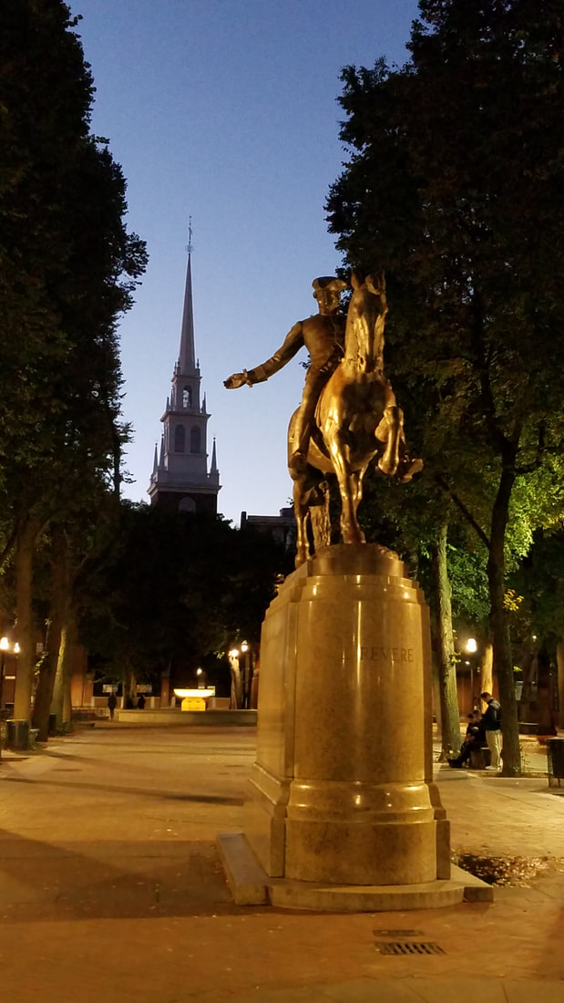
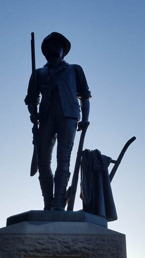
During a trip to Boston (to teach a Rusty Pilots seminar for AOPA), I had the chance to travel back in time while visiting the Minute Man National Historical Park (https://www.nps.gov/mima/index.htm). I also stopped at a couple of nearby airports. You all already know it… I love it when I can combine aviation with the National Park System (NPS). You may remember (possibly from your High School or College history class) hearing about the Minute Men, Lexington Green, Concord’s North Bridge, or the Battle Road. All of this is linked to Massachusetts and the start of the American Revolution. On April 19, 1775, nearly 4,000 Colonists fought against 700 British soldiers, forcing the British out of the area along the “Battle Road,” from Concord to Boston. The details of the battles, how the militia and Minute Men were formed, how they operated, etc are interesting.
Following this successful day for the colonists, on July 2 of that year, George Washington took charge of this army. Later, on March 17, 1776, British troops evacuated Boston. In MA, the fighting was over but the war for Independence had only begun. If you want to learn more about it, you can read https://en.wikipedia.org/wiki/Minutemen.
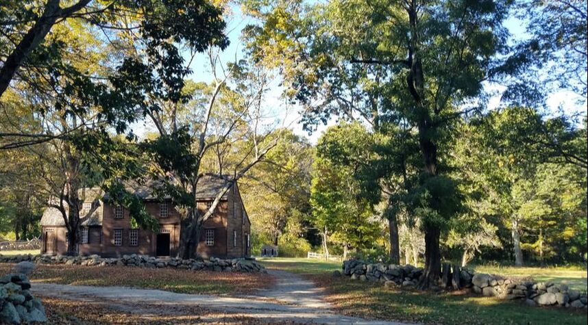
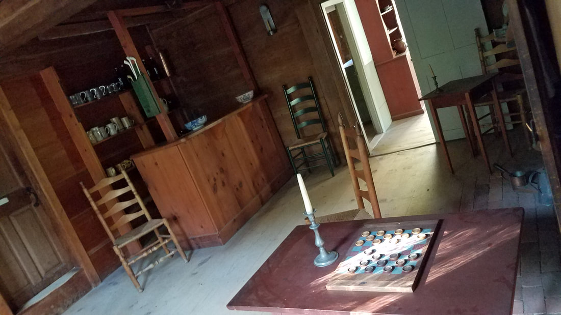
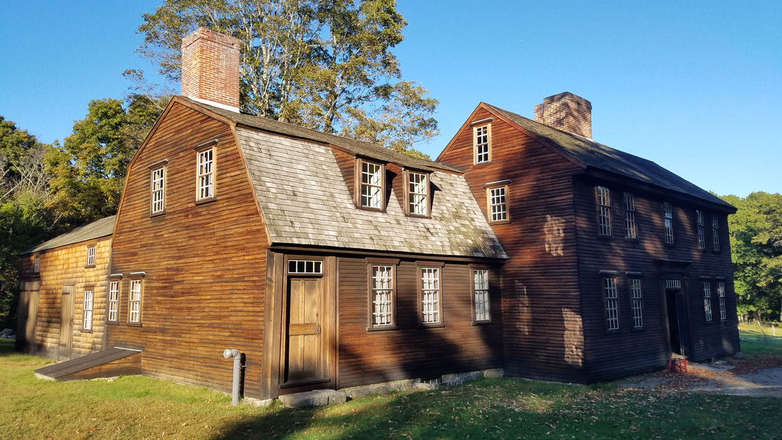
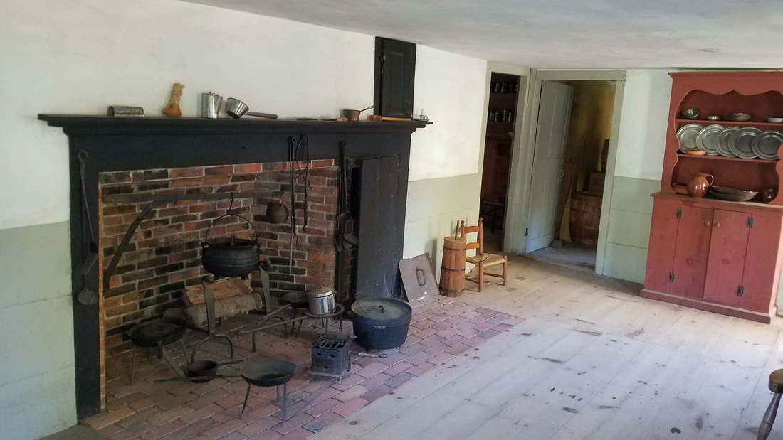
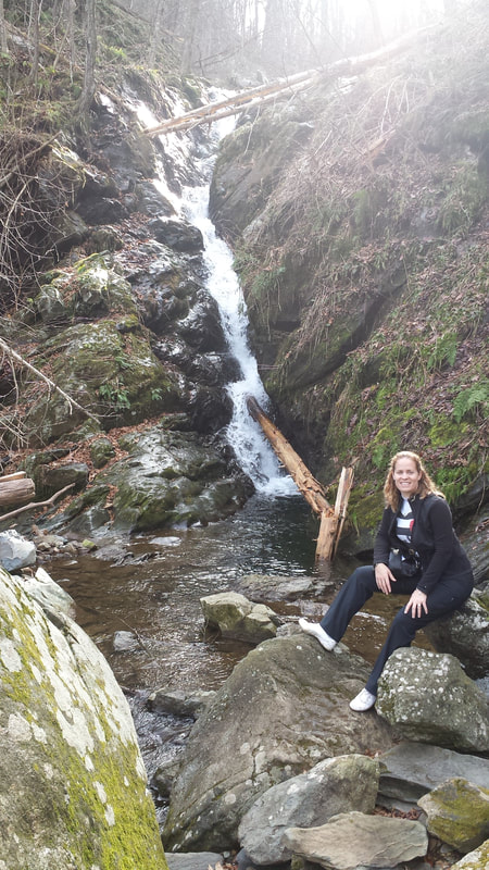
Minute Man National Historical Park preserves sites where Colonial militia men and British soldiers clashed on April 19, 1775. They also schedule quite a few reenactments and exhibitions throughout the year. 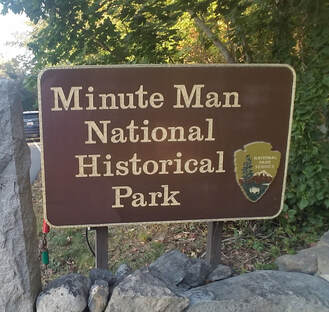 Laurence G Hanscom Field Airport (KBED) (http://www.airnav.com/airport/KBED) is a very convenient airport to fly into to visit the park. They are so close, the Airport might as well be part of the park… One can walk/hike, ride a bike, or even jog (for those overachievers out there!) from any of the Fixed Base Operators (FBOs). You can also take one of the FBO courtesy cars and drive over. 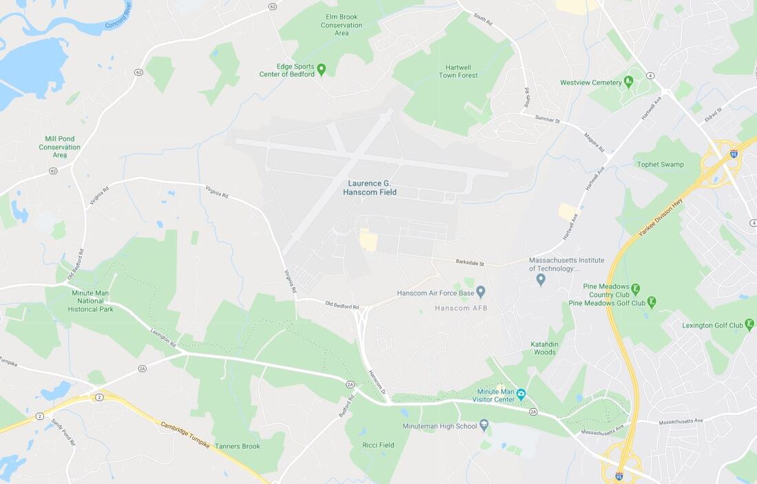 Source: Google Maps The park has a number of trails. You can walk from one end of it to the other, using trails, while taking in all that history has to offer: battle sites, agricultural fields, colonial homes and taverns, forests, fragile wetlands, and historic landmarks. Portions of the trails are on Battle Road where the British column marched; other sections follow stone walls and farm lanes traversed by the Colonists. One of those taverns one can visit is Hartwell Tavern. Once home to the Hartwell family, this setting evokes the story of families who lived along the Battle Road on April 19, 1775. 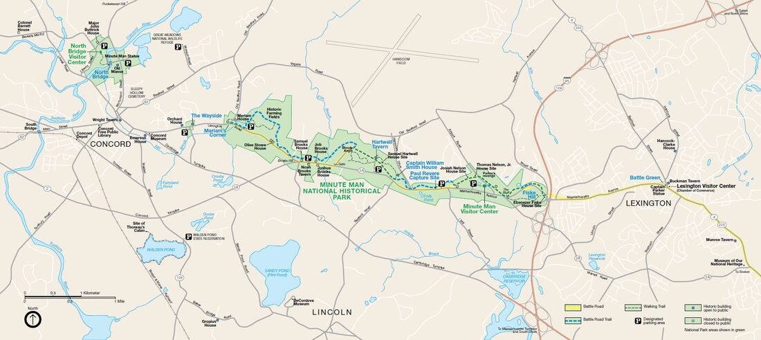 Source: National Park Service
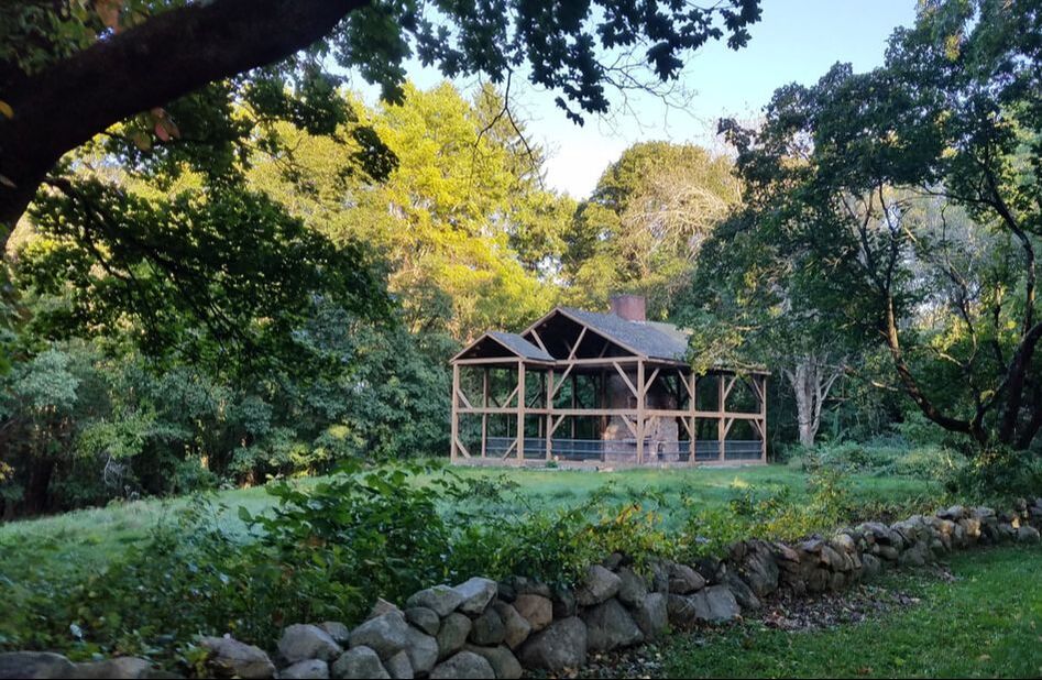
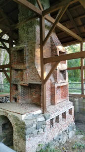
I also particularly enjoyed seeing Samuel Hartwell's old house near the tavern. It was cool to see the ruins, with the middle chimney structure is great shape.
And, if hiking is not “your thing” or you’re short on time, you can always take one of the Liberty Ride Trolley Tours: https://www.tourlexington.us/liberty-ride-trolley-tours. By this point, both you and your plane are probably hungry. My suggestion is to make a quick flight over to Minute Man Air Field (6B6) (https://www.airnav.com/airport/6B6) for gas and a wonderful meal at Nancy's Air Field Café. This restaurant is not your typical “$100 hamburger” type joint. The concept is much more gourmet – farm to table – so, as such, some of their menu items are seasonal! You can get a burger (heck, you can even get a lamb burger!), if you wish, but they also offer much more elaborate platters.  Source: SkyVector 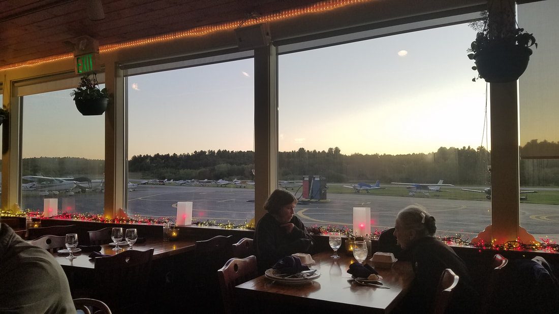 Go exercise your freedom to fly! Fly safe and fly often!
0 Comments
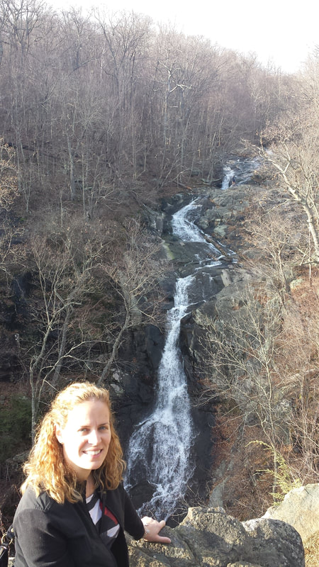
The article I recently wrote about the Grand Canyon Caverns (https://airtrails.weebly.com/southwest-az-ca-nm-ut/a-side-trip-from-the-grand-canyon-youre-used-to) reminded me of a memorable trip my then boyfriend Jared and I took back in 2007 when I was an intern at AOPA’s Headquarters in Frederick, Maryland. The flight took us from AOPA’s home airport (Frederick Municipal or KFDK) to Luray in Virginia. 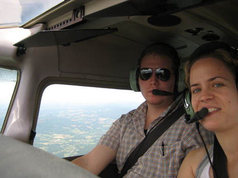 Oh, boy, do we look young! The town of Luray is close to Shenandoah National Park’s Thornton Gap Entrance Station and has the “Largest and Most Popular Caverns in Eastern U.S.,” or that is the claim of Luray Caverns (https://luraycaverns.com). I do not know what they consider “Eastern U.S.” in this case but I know that Mammoth Cave National Park preserves the world’s largest known cave system with more than 400 miles explored. However, I can tell you that, having been to both, Luray is much more picturesque and impressive than Mammoth even though the latter one is part of the National Park System (NPS). 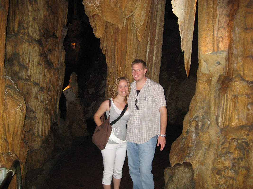 Visiting Luray Caverns You know what else is cool about Luray Caverns? You can fly into the local airport – Luray Caverns Airport (KLUA) (https://www.airnav.com/airport/KLUA) – and the caverns are only one mile away. The Airport used to be owned by the same people as the caverns so they used to offer ground transportation but the Airport was apparently sold in 2017 and they stopped that service. However, walking to them or catching a taxi are still good options even though you will need a rental car if you want to get to the mountains. Across the caverns, you can also see the “Singing Tower” (pictured below) from 1937. It has a carillon of 47 bells and gives regular “musical architecture recitals.” Other activities are also offered now that were not offered when I was there last time: a rope adventure course, a garden maze, a couple of museums, etc. 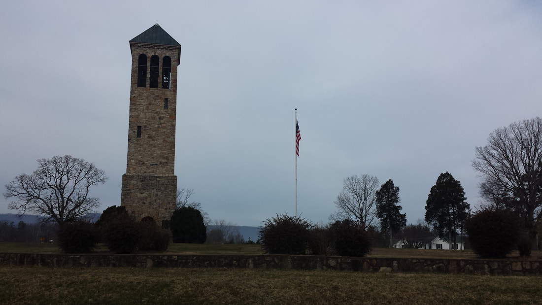 And, if you know me, you know I am a big fan of National Parks. I visit one or two every year and I eventually want to visit them all. I have been to Shenandoah National Park (https://www.nps.gov/shen/index.htm) twice but I could go many more times and still not hike all trails, see all overlooks, etc. It is a very long but narrow park (as shown in the map below) with over 500 miles of trails and 75 scenic overlooks, all along the 105-mile long Skyline Drive that runs from Waynesboro to Front Royal. And, not only that, but this is the kind of park that looks different in all four seasons. 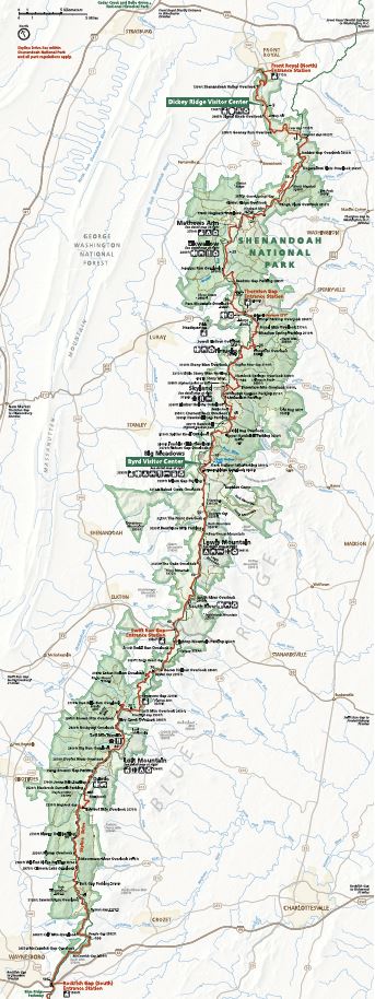 Source: NPS 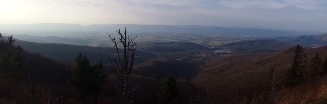
I have never been to Luray’s Rescue Zoo (https://lurayzoo.com) but it sounds interesting as well. They rescue retired zoo animals, unwanted pets, confiscations, and, sadly, abused animals at times. It looks like it is within walking distance of the caverns. Luray says the drive to the area is “half the fun.” Well, I have also flown there and I can tell you… the flight IS half the fun. As the sectional chart below shows, the Airport is tucked in between the National Park and another little mountain range (I believe it is part of the Blue Ridge mountain system as well). To keep traffic away from town (two miles east of the Airport) and based on an “airport airspace analysis determination,” the single runway airport has a left pattern to Runway 04 and a right pattern to Runway 22. That puts you fairly close (for non-mountain flyers, anyway) to the mountain range west of the area, making it a scenic descent, approach, and landing. The pictures below can give you an idea. 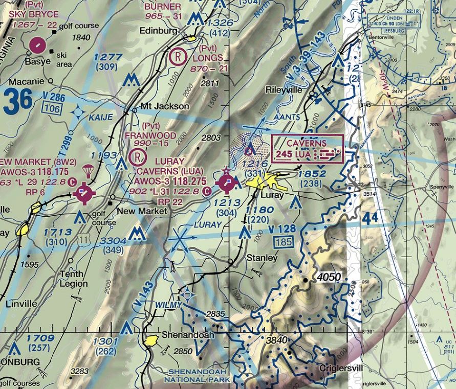 Source: VFRmap.com 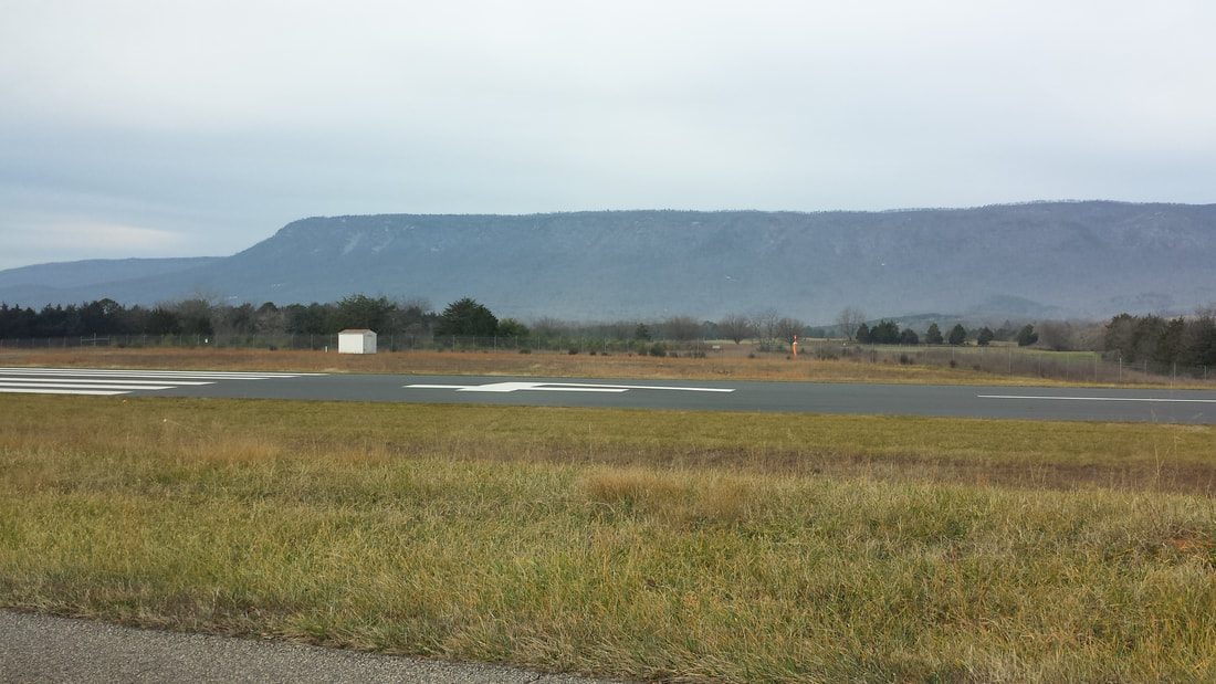  You know the drill… fly safe and fly often! Tell me about your favorite flying destinations via https://airtrails.weebly.com/about-and-contact.html.
|
BLOGS ON THIS PAGE
- Massachusetts - The Birth of America... the Birth of Freedom - Luray, VA - Flying There is Half the Fun! AuthorYasmina Platt ArchivesCategories |
 RSS Feed
