|
Even though biking has, traditionally, been one of the most unsafe activities I’ve engaged in, I still love it and practice it often. I do enjoy a good route on a bike, especially to spend a day out and about. However, I try to look for bike lanes or trails (and avoid public roads) as much as possible. San Antonio, Texas is a great city for just that: a day trip to get some exercise, soak in a little history, and/or have some good food. You can three-wheel (fly your airplane) your two-wheel (with your bicycle) into town via the cute and historic Stinson Municipal Airport (KSSF). The Airport is proud to be the second oldest General Aviation airport (after College Park) in continuous operation in the country. In 2015, Stinson celebrated its 100-year anniversary. 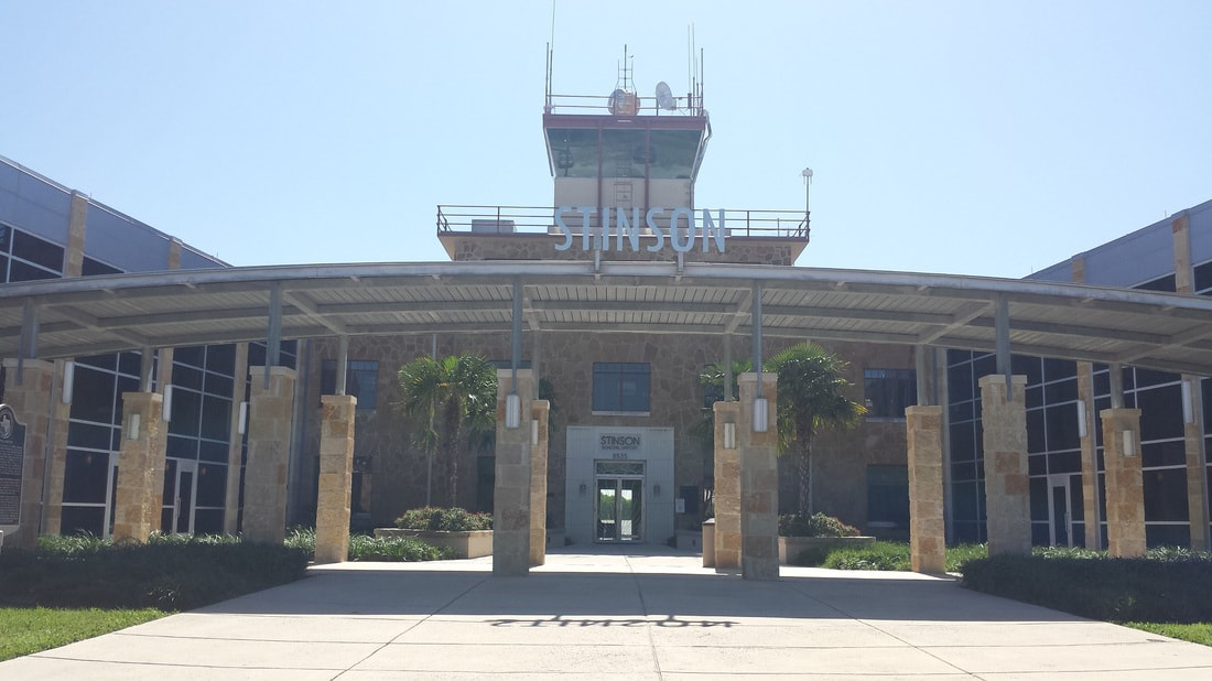 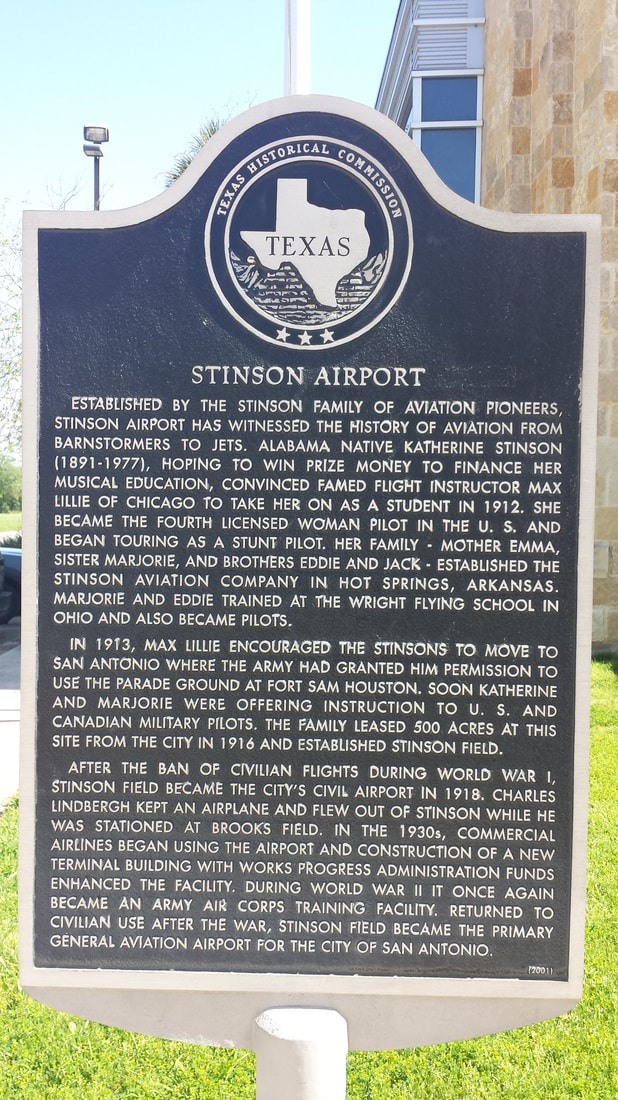 While Google Maps’ biking option is certainly a good tool to use to get around, the City of San Antonio has developed some helpful biking trail maps. From Stinson, one should start with the Mission Trail Out & Back one. The 20-mile trail (from end to end) encompasses four Spanish Colonial missions built along the San Antonio River to house Spanish missionaries and local Coahuiltecan Indians beginning in the 1720s. This trail is almost entirely on bicycle paths. Since the City opted (for some reason I don’t understand) not to show their wonderful airport on the map, I have modified it here to show it to you in relation to the established biking trails. 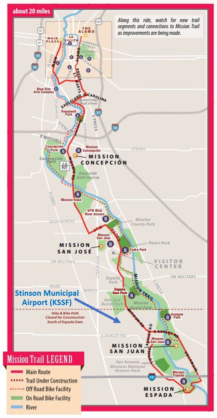 Two of the four missions are south of Stinson and the other two are north of the Airport. Each mission is about 2.5 miles from the next and, along with the Alamo, these missions have collectively been designated the first UNESCO World Heritage Site in Texas. Depending on how much time you have, how many miles you want to ride, and/or what other activities you want to indulge in (such as walking the riverwalk, golfing, picnic, kayaking, or eating at a restaurant), one can design different routes. The Mission Trail, to the north, joins in with downtown San Antonio and four other established bike routes (though not entirely on bike lanes or paths):
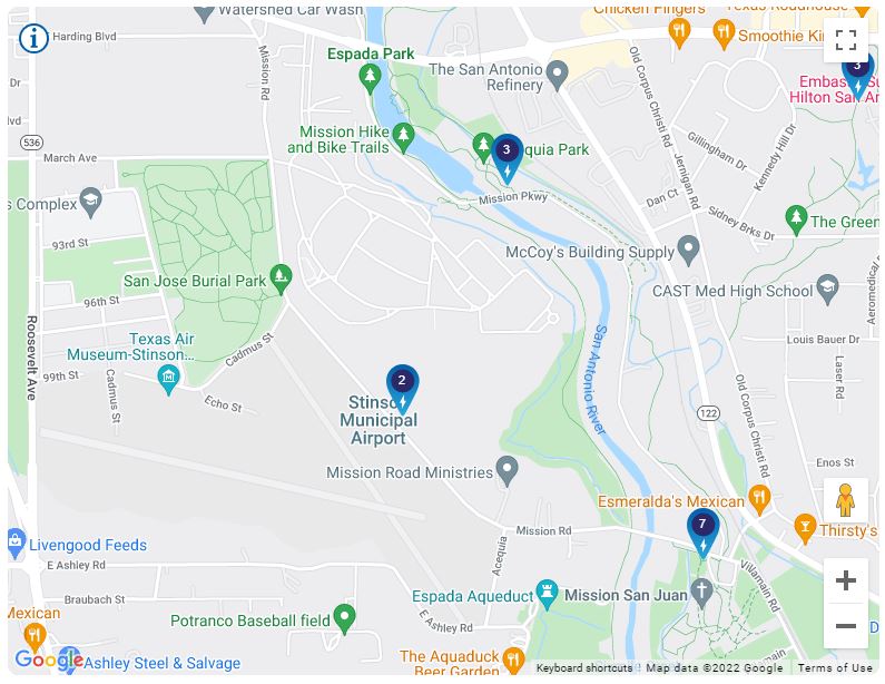
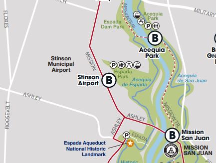
The 4-page map in this link may provide the most amount of detailed information about the San Antonio River Walk Hike/Bike/Paddle paths. This map also provides other trail variations, from Stinson. 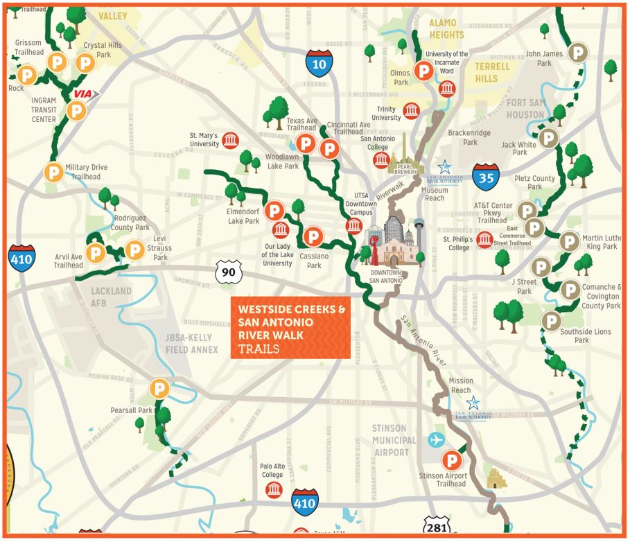 For more information about downtown bike lanes and parking racks, refer to the map below. 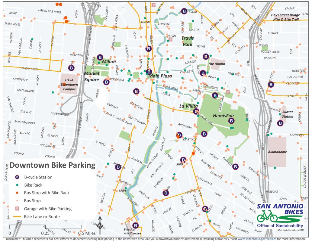 If you cannot bring your bicycle in your airplane (due to lack of space or weight and balance, for example), there’s nothing to worry about. KSSF has a convenient BCycle rental station at 8535 Mission Road, immediately in front of the FBO. If, for whatever reason that station is out of bicycles, there are two others (Acequia Park and Mission San Juan) within a mile. All three stations have both classic bikes and electric bikes for those longer rides.
There are many great restaurants along all of the trails mentioned but especially in downtown, along the riverwalk, and in the Pearl Brewery complex. However, keep in mind Stinson has a restaurant at the old terminal, too. It’s called Gate One. Fly and bike, safe and often! (Fellow pilot Bruce Bream has a wonderful listing of many airports, by state, with bike lanes nearby on his website: www.rovingbits.com/FlyBike/FlyBike.html)
0 Comments
|
BLOGS ON THIS PAGE- Biking from Stinson Airport
- The Queen City of the Gulf - Galveston, TX - That Old Frio River - The Texas Air Trail - Visiting the Lone Star State! - Combining Flight Training with Tourism... a Trip to the Big Bend Area in Texas - Ox Hunting Ranch in the Texas Hill Country - The $100 Hamburger Run: A Plane Ride With the Works AuthorYasmina Platt. Archives
May 2022
Categories |
 RSS Feed
