|
Written by the author, Yasmina Platt. Reprint from June 29, 2016, from AOPA's Views From the Region (VFR) blog: https://blog.aopa.org/aopa/2016/06/29/new-mexico-true-trails-route-66-national-scenic-flyway/  The legendary Route 66 National Scenic Byway, connecting Chicago with Santa Monica, enters New Mexico across a vast, sunlit prairie before meandering through rocky outcrops, quiet streams and adobe villages. Along the route, the high desert landscape is both austere and sublime, its red-hued cliffs dropping off into immense llanos or pine-wooded hills and valleys. Motels and 1950s diners with restored neon signs line portions of the Route 66. This “Scenic Flyway” is a flying version of the famous National Scenic Byway as designated by the U.S. Secretary of Transportation. The National Forest and the National Parks Service have considerable land holdings in New Mexico and along historic Route 66. They include hiking trails, campgrounds, monuments, picnic areas, and scenic roadways. One unique and historic part of this Scenic Flyway is the 1920’s air corridor across New Mexico that generally followed the Santa Fe Railroad tracks to Gallup, and on into Arizona. By 1929, this route became part of the Midcontinental coast-to-coast airway, developed for passenger service by the fledgling Transcontinental Air Transport (TAT) company, with Charles Lindbergh as the head of its technical advisory team. In an era before radar, pilots depended solely on ground-based landmarks and road maps for guidance. The first airway navigation system was developed in the mid-1920s for airmail service, initially by the Lighthouse Service of the Department of Commerce. On the early mail routes, these sites, with 51-foot beacon towers, were spaced every 10-15 miles for night navigation. For daytime flight, the design included concrete arrows at airway beacon sites. Federal emergency landing fields were also located every 40-50 miles as terrain would allow. Soon, airline mergers and new radio navigational aids led to realignment of the TAT airway route, with several of its concrete day arrows left behind on lonely hilltops. Dating from 1932, there are two arrows at auxiliary airfields plus eight more at isolated airway beacon sites across New Mexico, from Texas to the Arizona border (a few others are now gone). This route will take you over some of those TAT arrows and you will also have a chance to visit one of those restored beacon sites in person. The Cibola County Historical Society / Western New Mexico Aviation Heritage Museum provided the names and locations (with exact coordinates) of the identified and still existing beacons and arrows in this document and some of them are also included below. The following figures help give you a visual of the proposed route and stops. Figure 1. Route Overview 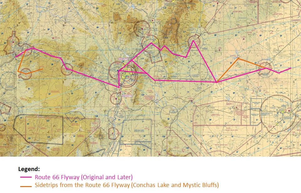 Figure 2. First Half of the Route (East to West) (see reference to locations in Figure 4) 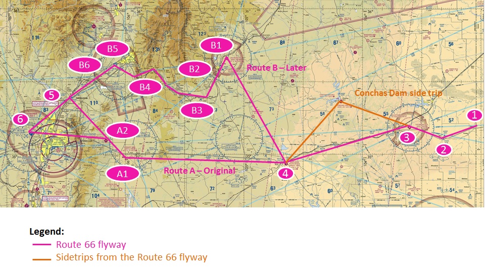 Figure 3. Second Half of the Route (East to West) (see reference to locations in Figure 4) 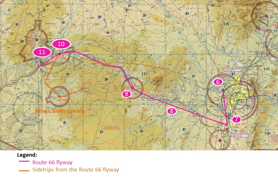 Figure 4. References to Locations on Previous Sectionals 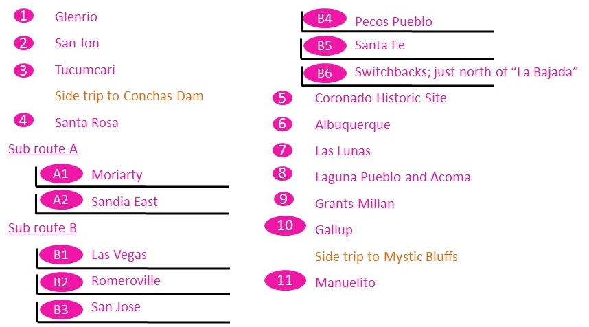 Or, for easier reference, you can view the route in a screenshot of ForeFlight. Figure 5. Route on ForeFlight 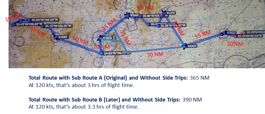 Source: ForeFlight Keep in mind some of these airports may not offer fuel. Please plan accordingly! You may also want to pack a set of tie downs for your aircraft. If you decide to do part or the entire route and use social media, we would love for you to use #Route66 as a hashtag. Fly safe, fly often! Enjoy this Scenic Flyway! Legend A few symbols have been added throughout the route to make it easy for readers to identify the facilities and activities each airport/area has at a quick glance. Figure 6. Symbol Legend 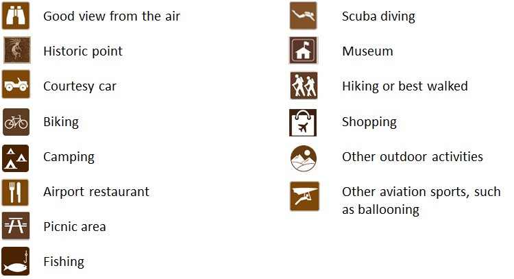 Flight Planning Resources Always remember to use current charts and always check notams prior to departure. Google Earth may be a great tool for you to become familiar with the location of certain things, especially TAT arrows, before embarking on your flight. However, keep in mind Google Earth images may not always be recent. This is an example of the format you should use in Google to enter coordinates: 35° 03’ 22.28” N, 106° 47’ 39.86” W. If using ForeFlight for flight planning and as your Electronic Flight Bag (EFB) in the aircraft, this is an example of the format you should use to enter coordinates: N35032228/W106473986 (same coordinates as above but with a pretty different format). Also remember that ForeFlight has different map features that may be helpful to you as you are looking for landmarks in addition to the typical “U.S. VFR sectional” or “U.S. IFR (low)” we use, such as:
Safety Resources It is always good to review best practices and tips when flying around mountains. Subjects like density altitude, turbulence, or terrain really become a player in this type of flying. Here are some resources on the topics:
If you have never flown around mountains, you may also want to consider taking a “mountain flying” course. The New Mexico Pilots Association (NMPA) offers one every year, normally in September, in Santa Fe. Most locals fly early in the morning on hot summer days. Route (east to west) (from Texas to Arizona)
 Due to construction over the years, it is unclear if there was ever a Transcontinental Air Transport (TAT) arrow at the Tucumcari airfield; however, Clovis was the terminal and transfer between planes and trains. The beacons between Clovis and Albuquerque were relocated to the Amarillo-Tucumcari-ABQ alignment when the plane-train service ended in 1930-31 and the four-course range (radio beam) was established. Except for airfields, no concrete arrows were built that late. Tucumcari, a city airfield, apparently did not have one on the new route, while the two isolated Civil Aeronautics Authority (CAA) fields did have arrows on the 1932 Los Angeles-Amarillo Airway airfields, numbered as Cuervo LA-A 81B and Anton Chico LA-A 78A. This is similar to the 1929-1930 southern border airway, which has arrows only at landing fields. The Cuervo CAA Intermediate Airfield (you can still see the runway marker circle) and associated arrow (site LA-A Site 81B) can be found at 35° 06’ 25.32” N, 104° 24’ 29.09” W. Figure 7. General location of the Cuervo CAA Intermediate Airfield and Arrow 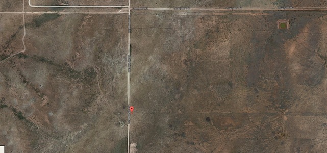 Source: Google Earth Figure 8. Arrow and Runway Marker Circle at the Cuervo CAA Intermediate Airfield 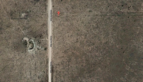 Source: Google Earth As an anecdote, nearby Conchas Lake Seaplane Base (E61) is the only seaplane base in the state. There is also a 4,800 ft airstrip near the shore of the man-made reservoir. From the Pilot Getaways magazine, Fall of 2000: “The large lake you see in the middle of New Mexico’s barren desert is not a mirage. Camping, fishing, hiking, and tranquility are the best aspects of Lake Conchas. Enjoying a 15-mile long lake after a short flight is a wonderful treat for pilots in a land-locked state.” 4. Santa Rosa (KSXU)  Land on part of the original Route 66! Santa Rosa’s runway 08 is an old stretch of Route 66. In the mid-90s, a group of volunteers painted a Route 66 logo on the centerline of the runway; however, with post resurfacing and runway work, unfortunately that logo was covered. The original, pre-1937 alignment of Route 66 ran south of Interstate 40. However, it cannot be followed now because part of the road is on private land and another section is now part of the runway at the Route 66 Municipal Airport. The post-1937 alignment follows US Hwy 54 and the I-40 Business Loop. The picture below shows the alignment of the runway with the main road though town and the old roadbed beyond the airport to the east. Figure 9. Santa Rosa Airport and Surroundings 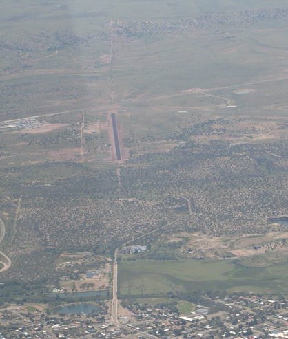 Source: Dick Perry Santa Rosa’s main attraction is unique: the Blue Hole, an 80-foot-wide, 80-foot-deep artesian well filled with water so crystal-clear that it draws scuba divers from all over the western states to practice their underwater techniques here. The water of the Blue Hole, at around 61°F, is too cold for casual swimming but, in the summer heat, it’s a great place to cool your heels. The Blue Hole is well signed at the end of Blue Hole Road, a half mile south of old Route 66; for purists, Blue Hole Road is old, old Route 66, since it formed the early (pre-1937) alignment of the Mother Road across Santa Rosa, the rest of which is used as a runway at the city’s airport. East of here, running along the south side of I-40, one of the oldest stretches of Route 66 is only partly paved and best done in a 4WD or on a mountain bike. Here you get an indelible sense of what travel was like in the very early days, when less than half of the route’s 2,400-odd miles were paved. The arrow at the Anton Chico CAA Intermediate Airfield (site LA-A Site 78A) can be found at 35° 08’ 9.10” N, 105° 05’ 5.15” W. Figure 10. General location of the arrow at the Anton Chico CAA Intermediate Airfield 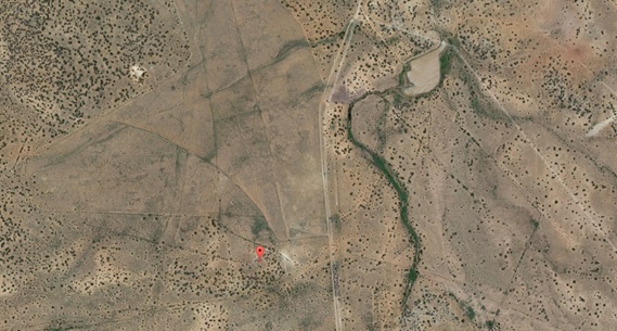 Source: Google Earth Figure 11. Arrow at the Anton Chico CAA Intermediate Airfield 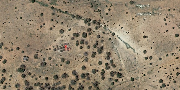 Source: Google Earth Sub route A – Original Route A1. Moriarty (0E0)  The Moriarty airport has a CAA beacon tower and station house from the 1932-64’s Otto airfield. Moriarty boasts some of the finest year round soaring conditions in the United States, including 15 knot thermals to 22,000 ft, mountain wave to 34,000 ft, and orographic lift off the Manzano, Sandia, Ortiz, and Sangre de Cristo mountain ranges. Many flights in excess of 300 miles are recorded each year. Whether you are novice or an expert glider pilot, either one of these groups would be happy to show you around:
Gliding is such a big part of Moriarty that they also have a museum dedicated to soaring – the U.S. Southwest Soaring Museum. A2. Sandia East (1N1). In the route as a fly over point only; however, feel free to stop in. To KAEG via Tijeras (VFR checkpoint) OR via the Pumping Station (VFR checkpoint) Sub route B – Later Route B1. Las Vegas (KLVS) The now-retired Southwest Aviator magazine wrote a nice story on Las Vegas, New Mexico back in March/April of 2004 covering its tourist appeal as well as its aviation history. While most of its information still applies, keep in mind it is from 2001 so some of the phone numbers and airport information, for example, may be different now. The Santa Fe Trail travels from Las Vegas to Santa Fe via San Miguel del Vado, Pecos Ruins and Glorieta Pass. B2. Romeroville. In the route as a fly over point only. B3. San Jose. In the route as a fly over point only. B4. Pecos Pueblo.  The Pecos National Historical Monument has visually stunning ruins and was one of the largest of all pueblos just prior to the arrival of the Spaniards. B5. Santa Fe (KSAF)  Santa Fe sits at the base of soaring Sangre de Cristo Mountains in central New Mexico. Founded as a Spanish colony in 1610, Santa Fe embodies a rich history and a melding of Native American, Spanish, Hispanic, and European cultures. It is renowned for its pueblo-style architecture, colorful markets, traditional and contemporary art, amazing cuisine, and unparalleled outdoor adventures. Santa Fe is ranked as the #1 Cultural Getaway by Travel+Leisure, Best High Altitude City by National Geographic, and Reader’s Choice Best Shopping Cities in the World by Condé Nast Traveler. From the Pilot Getaways magazine, Fall of 2001: “Something magical in the light of Santa Fe has attracted a vibrant artistic community to this town on a New Mexico plateau. Here pueblo Indians continue their traditional lifestyle while a modern culture thrives. Exotic and beautiful, it is a place you should explore on foot, wandering the Farmers Market and galleries. Fall is the perfect time to avoid the crowds and enjoy the changing landscape.” “Santa Fe Municipal Airport (KSAF) – with its charming terminal building, new-Mexican flair café, and exceptional Fixed Base Operators (FBOs) – is the gateway to a world-class, must stop destination along the Route 66 Flyway.” – Cameron Humphres, Santa Fe’s Airport Manager. With all that it has to offer and 320 sunny days per year, Santa Fe is a magical, exuberant, colorful, world-class destination. Come see for yourself why Santa Fe is known as “The City Different.” There are many things to see and do in its historic downtown. For more information, visit: http://santafe.org/. And, while in Santa Fe, you may want to visit the “Oblique Views: Archaeology, Photography, and Time” exhibit at the Museum of Indian Arts & Culture. It tells the story of the Southwest through the aerial photographs of Charles and Anne Lindbergh and Adriel Heisey. B6. Switchback Hills at “La Bajada” Hill  La Bajada Hill is considered the dividing point between the Rio Arriba (upper river) and Rio Abajo (lower river). Travelers on the Camino Real could take this route to reach Santa Fe, which became part of Route 66’s pre-1938 alignment. Barely 1.5 miles long through though volcanic rock, the old road on La Bajada Hill included 23 hairpin turns and was famous for overturned wagons and boiling radiators. It was so steep that gravity-fed tanks had to take it in reverse. In 1932, a new road up the escarpment was laid out slightly to the east and later widened into I-25. La Bajada means “the descent.” Figure 12. Switchback Hills  Source: Elizabeth Hunke 5. Coronado Historic Site (along Rio Grande River)  The Coronado Historic Site is an archaeological dig in the 1930s uncovered the foundations and several Kivas (one restored that visitors can descent into). The views along the Rio Grande and of the Sandia, Jemez and Sangre de Cristo mountains from the site are spectacular. There is campground available. 6. Albuquerque (KAEG)  Gemit Paulsen said it well in the intro of the “Albuquerque – An Exciting Blend of Cultures” article he wrote for the Southwest Aviation magazine: “Four centuries of history can’t be wrong. Abundant natural beauty, a year-round mild climate, and the subtle blending of the many cultures that comprise its history make Albuquerque, New Mexico an exciting destination well worth exploring.” Two aviation magazines covered Albuquerque’s “to do’s” and history well:
The Matador Network lists “The Luz Trail” as “one of New Mexico’s Most Spectacular Hikes.” It is an incredibly popular but difficult trail. Found on the west face of the Sandia Mountains, right on the edge of Albuquerque, La Luz Trail climbs eight miles to either the crest of Sandia Peak or over to the Sandia Peak Tramway. It is a rough hike intended for the fit, gaining nearly 4,000 feet on an impressively steep grade, and for most of the year the dry air will literally suck the moisture from your body. Take plenty of water with you. One of the best things about this climb is the experience of crossing multiple climatic zone and ecotones, which means rapid flora and fauna changes as you gain elevation. Oh, and then there’s the view. Not only is the city below impressive, you get to see all the surrounding mountains from up high: Mount Taylor to the west, the Sierra Ladrones in the south, and the snow-covered Sangre de Cristo mountains to the north. The Double Eagle II Airport (KAEG) has an on-site restaurant, the Bombing Range Café, with wonderful views of the airfield. The old Southwest Aviator magazine did astory on it back in 2004 when it was called The Prop Wash Café. Want to camp? You may do so at the Enchanted Trails campground close to KAEG. Albuquerque features more than 400 miles of on-street bicycle facilities and multi-use trails. The Paseo de la Mesa Trail runs right by the Double Eagle II airport. And, of course, you can always create your own route. Here is one that stopped at the Double Eagle II airport a group under the New Mexico Touring Society organized on February 6, 2016. The Petroglyph National Monument is a nationally protected 17 mile escarpment left from volcano activity hundreds of thousands of years ago. There are over 15,000 petroglyphs created sometime between 1300 and 1600. This is a good place for hiking. Albuquerque has both a downtown and an Old Town (historic downtown). For more information on things to see and do there, visit: http://www.visitalbuquerque.org/. Most people associate Albuquerque with balloons and rightfully so as the city has a long standing history with the aeronautical activity:
West of Albuquerque, several arrows remain from the 1929 TAT Midcontinental Airway route; however, these gray TAT concrete arrows can be difficult to spot on the desert floor. The first arrow site is Beacon TAT 76 (9-Mile-Hill Beacon LA-A 68) at 35° 03’ 22.28” N, 106° 47’ 39.86” W. It is on the mesa just south of I-40. Note, this site is under KABQ’s Class C airspace and just south of KAEG’s Class D airspace. Figure 13. General Location of TAT Site 76  Source: Google Earth Figure 14. Arrow at TAT Site 76  Source: Google Earth The Rio Puerco Valley Beacon is TAT Site 75 and can be found at 35° 01’ 49.75” N, 106° 58’ 34.53” W. It is just north of Interstate 40 and east of a dirt road, soon after flying over the Route 66 Casino Hotel and Travel Center. Figure 15. General location of TAT Site 75  Source: Google Earth Figure 16. Arrow at TAT Site 75 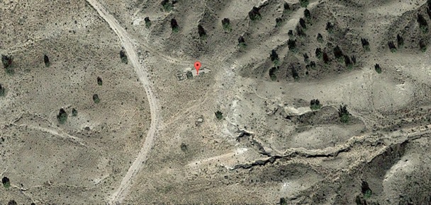 Source: Google Earth 7. Las Lunas  TAT Site 74 is on a low mesa rim. The easy-to-see visible feature to help you find it is the junction of I-40 and NM Hwy 6, about a mile west of the arrow. The coordinates are 34° 59’ 05.13” N, 107° 08’ 56.22” W. Figure 17. General location of TAT Site 74 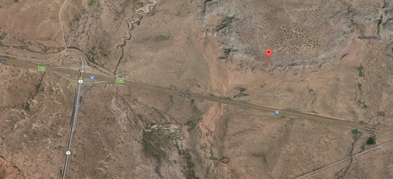 Source: Google Earth Figure 18. Arrow at TAT Site 74 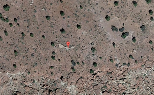 Source: Google Earth 8. Laguna Pueblo and Acoma  To respect Native American culture, please avoid low flying over Laguna and Acoma (also known as Sky City). Laguna Pueblo is the largest Keresan-speaking pueblo. Historians believe the ancestors of the pueblo have occupied the Laguna homelands since at least A.D. 1300. For more information, visit: https://www.newmexico.org/laguna-pueblo/ andhttp://www.lagunapueblo-nsn.gov/. Acoma, believed to have been established in the 12th century or even earlier, was chosen in part because of its defensive position against raiders. It is regarded as the oldest continuously inhabited community in the United States. Both the mission and pueblo have been designated as a Registered National Historical Landmarks. For more information (including tour information), visit:https://www.newmexico.org/acoma-pueblo/ andhttp://www.acomaskycity.org/home.html. Enroute to Grants-Millan (KGNT) From Laguna Pueblo  Two miles northwest of Seama, TAT Site 72 (also called Seama Mesa) sits south of Flower Mountain, not far from Interstate 40. The coordinates are 35° 02’ 55.4” N, 107° 32’ 46.1” W. Figure 19. Location of TAT Site 72 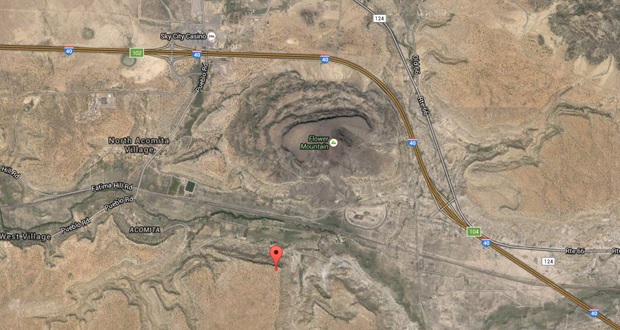 Source: Google Earth TAT Site 71 (also called Anzac Mesa) is located on a small mesa above the lava flows in the valley of the Rio San Jose, Rte. 66, and the Santa Fe tracks. This arrow was a key turning point to follow the TAT airway and railroad west to Gallup. It is a mile northwest of the abandoned Acomita Intermediate Airfield (1932-52) and its radio range navigational site. The coordinates are 35° 03’ 39.73” N, 107° 43’ 31.53” W. Figure 20. General Location of TAT Site 71 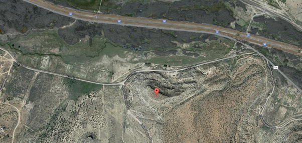 Source: Google Earth Figure 21. Arrow at TAT Site 71 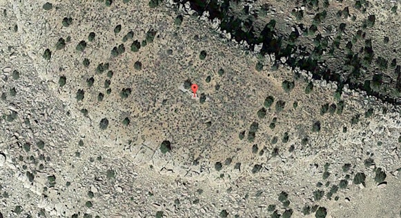 Source: Google Earth 9. Grants-Millan (KGNT)  The Western New Mexico Aviation Heritage Museum at the KGNT airport honors those pioneer aviators who crossed the West along the 1929-era Los Angeles-to-Amarillo segment of the Transcontinental Air Transport (TAT) route. You can see Beacon LA-A 62, complete with a painted tower and corresponding generator shack, at the museum. El Malpais National Monument was formed by millions of years of volcanic activity. The lava flows have created a unique, beautiful and eerie landscape. The 115,000 acre monument is also known for its archaeological sites. The Matador Network lists the “Zuni-Acoma Trail” as “one of New Mexico’s Most Spectacular Hikes.” “For over 1,000 years, the pueblos of Zuni and Acoma were connected by a 75-mile trail traversing some of the roughest territory in the Southwest. Today, eight miles of this ancient trail remain in El Malpais National Monument, and it is still peppered with the rock cairns, and ceramic debris left by the region’s original inhabitants. For experienced hikers, eight relatively flat miles may seem like a walk in the park. But be warned: This is a serious adventure that will take about six hours one way. The Zuni-Acoma Trail crawls over rugged lava flows and frequently disappears — it’s marked in many places by nothing more than simple rock cairns. Located 16 miles south of Interstate 40, the western trailhead begins on NM-53. The eastern trailhead can be found on NM-117. Carry plenty of water, wear solid, reliable boots, and above all…enjoy.” Enroute to Gallup (KGUP) from Grants-Millan (KGNT)  TAT Site 69 (also called Prewitt) was another key turning point for TAT to follow the Santa Fe Railroad route up toward the Continental Divide and Beacon TAT-68. This may have been a 75-foot tower. The coordinates are 35° 21’ 45.25” N, 108° 02’ 45.70” W. Figure 22. General location of TAT Site 69 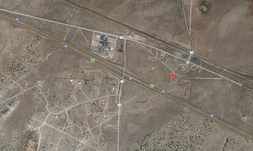 Source: Google Earth Figure 23. Arrow at TAT Site 69 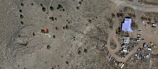 Source: Google Earth TAT Site 68 (also called Continental Divide) may be hard to spot due to several adjacent structures, and the vegetation growth around the tower site. The coordinates are 35° 25’ 36.67” N, 108° 18’ 11.60” W. Figure 24. General location of TAT Site 68 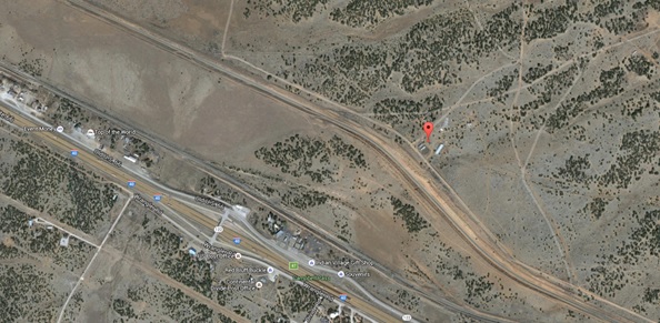 Source: Google Earth Figure 25. Arrow at TAT Site 68 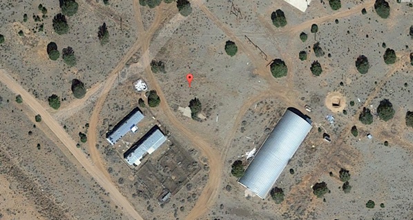 Source: Google Earth TAT Site 67 (also called ChurchRock Rd / Ft Wingate) is the last confirmed TAT arrow in western New Mexico, although another is rumored to have been just west of Gallup. At this beacon site, right next to Old Route 66, the generator shed was destroyed when I-40 was constructed. The coordinates are 35° 31’ 45.83” N, 108° 36’ 23.10” W. Figure 26. General location of TAT Site 67 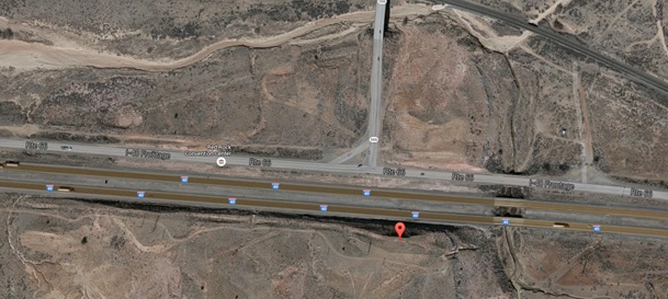 Source: Google Earth Figure 27. Arrow at TAT Site 67 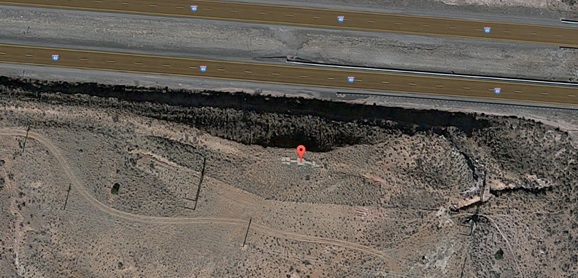 Source: Google Earth 10. Gallup (KGUP) 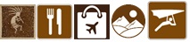 Gallup is known for its trading posts where one can buy and sell Native American jewelry, clothing, pottery, carvings, art, etc. From the Pilot Getaways magazine, November/December 2010: “Gallup is often called the Indian Capital of the World, and if you love Native American arts, you will absolutely love this place. Indian artists from the Navajo, Zuni, Acoma, Laguna, and Santo Domingo Pueblos bring their finest creations to the authentic trading posts here. Step inside one of these trading posts and be blown away by the sheer quantity of turquoise, pottery, and rugs. As Technical Editor Crista V. Worthy explains, the staff will be happy to give you a tour into their vaults where many Indians store their most precious possessions. You can buy with confidence, knowing exactly where and by whom a piece of jewelry was made, and perhaps even learn a bit about the artists themselves. Downtown Gallup bustles with local activity and diversity. Savor authentic Southwestern cuisine at low prices. Visit the historic El Rancho Hotel with its Western and film memorabilia, and then take a few side trips. The countryside is loaded with national monuments, including the fantastic Chaco Culture National Historical Park. Make a visit to the nearby Zuni Pueblo and meet local artists in their studios. December brings the Red Rock Balloon Rally, with upwards of 200 hot air balloons filling the skies, as well as parades, dancing, and other activities. In August, come for the Intertribal Ceremonial, where Indians from tribes all over the U.S. converge to show off their finest clothes, dances, jewelry, and other arts.” Pilot Getaways’ Spring of 1999 magazine mentions flying into Gallup Municipal Airport (KGUP). “Following the interstate keeps aircraft away from rough terrain. Gallup Municipal Airport (GUP) is stretched out along the south side of Route 66, about a mile south of Interstate 40. For VFR arrivals from either east or west, it is easy to find; simply follow the interstate and look for a runway parallel to your flight path. If you’re having difficulty spotting the airport, look for Highway 666, one of the few major highways branching off towards the north, just east of the airport. Flying in the pattern at GUP is deceiving because the terrain underneath the pattern is higher than the airport elevation of 6,469 feet; you will tend to be high when coming in for landings. Be aware that there may be substantial loss of performance due to the elevation and high temperature.” KGUP has an on-site restaurant called Badlands Grill. They are known for their steaks. Side Trip to Ramah  Mystic Bluffs (NM56) is a privately owned, private use airport (except for one weekend a year when everybody is invited to their annual fly-in/camp-out) so remember to ask for permission prior to landing and operate at your own risk. However, even if not landing, it is still a very beautiful area to explore from the air. A reliable waterhole hidden at the base of a sandstone bluff made, El Morro (the headland) National Monument was a popular campsite for hundreds of years. All of New Mexico provides wonderful hiking opportunities; however, water is scarce in certain areas. Depending on the season and year, you can hike to waterfalls and find canoeing opportunities around Ramah. Refer to another blog under "Southwest (CA, AZ, NM)" titled "3rd Annual Backcountry Fly-in at the Beautiful Mystic Bluffs (NM56) Airstrip in New Mexico" for more information and pictures of NM56. 11. Manuelito. In the route as a fly over point only. Have Additional Time and Coming From or Going To the East/Northeast?  The AOPA Central Southwest Regional Page covering NM, TX, LA, OK, AR, KS, MO, NE and IA has a blog on “friendly airports and helipads” with a list of those that have an on-site restaurant, aviation museum, camping, and/or aircraft viewing area, etc that you may consider stopping at on your way to/from the Route 66. Sources for Additional Information The New Mexico Department of Tourism has a link with information and a video about the “Route 66 National Scenic Byway” on their website. The New Mexico Route 66 Association has a wonderful website with all the information you can possibly need regarding Route 66 as it travels through New Mexico. Not sure how exactly you are going to get around once on the ground at some of these locations? Looking for ways to bring a bike or canoe with you? Take a look atthis blog I recently published for some ideas. People and Organizations to Thank Several people and organizations have contributed information to the creation of this Flyway. Their knowledge, time, and efforts for the benefit of all pilots and passengers are highly appreciated:
A Route 66 Air Tour has been organized for February 16-19, 2018. FMI and to register, visit: http://dot.state.nm.us/content/dam/nmdot/Aviation/aviation_newsletter_12_19_17_online.pdf and http://eaa179.org/route-66-tour/
0 Comments
Leave a Reply. |
BLOGS ON THIS PAGE- Light Winds, Hot Air, Color, Light, Shapes, Chile, Ohhh Ahhh... Ingredients for Balloon Fiesta!
- Pet-ro-glyphs in New Mexico - A Side Trip From the Grand Canyon You're Used to - 3rd Annual Backcountry Fly-in at the Beautiful Mystic Bluffs (NM56) Airstrip in New Mexico - New Mexico True Trails - Route 66 National Scenic Flyway - Texas, New Mexico, Arizona, and California in 12 Days AuthorYasmina Platt. Archives
October 2023
Categories |
 RSS Feed
