|
Written by the author, Yasmina Platt. Reprint from January 13, 2015, from AOPA's Views From the Region (VFR) blog: https://blog.aopa.org/vfr/?p=2007 Joey Colleran, AOPA’s Director of the Airport Support Network (ASN) program, and I recently embarked on a training flight to the Big Bend area in “Far West Texas.” Joey is a private pilot who was looking to get current and proficient while learning about mountain and instrument flying. I was her lucky flight instructor for the trip. The Big Bend area and forecasted weather provided us with all the characteristics we were looking for, it is a jewel of a place, and it’s hard to get to any other way. And, yes, it also allowed us to do some sightseeing by joining a river trip down the Rio Grande, separating the U.S. and Mexico. I guess we can say that the Big Bend area spans from Presidio, north to Marfa and Alpine, and east to Marathon before heading south to the east edge of the national park that borders Mexico. The area is home to Big Bend Ranch State Park and Big Bend National Park, one of only two national parks in Texas (and one of only 15 Texas areas recognized by the NPS – National Park System). The area offers many exciting activities, from simple sightseeing to more adventurous activities like rafting or horseback riding. The Brewster County Tourism Council says that getting to the area “can be half the fun” and I happen to agree 100% if you fly GA. =) The closest commercial airports are in Midland/Odessa (235 miles from the national park) and El Paso (330 miles away) and services (such as hospitals, full groceries stores, etc) are also considerably far so general aviation is the best way to get around. General Aviation has also been creating jobs and saving lives in this remote area. TxDOT-Aviation’s recent article explains what airport improvements to the Presidio Lely International Airport (KPRS) are doing for the region. So, the day after Christmas, we departed Austin (where she currently resides) heading west, then southwest. A cold front was moving in from New Mexico which created strong headwinds for us, preventing us from seeing anything over 80 kts groundspeed and forcing us to stop at Kimble County Airport (KJCT) in Junction for fuel. However, that same weather did provide us with some good IFR/IMC training conditions for half the trip and great VFR and aerial sightseeing conditions for the last part of the route. 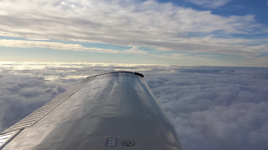 VFR on top during the first part of the trip, giving us the opportunity for an actual GPS approach into KJCT for fuel 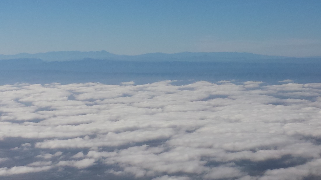 The clouds started to break around the Del Rio area, giving us great views of the Sierra del Carmen Mountains in Mexico 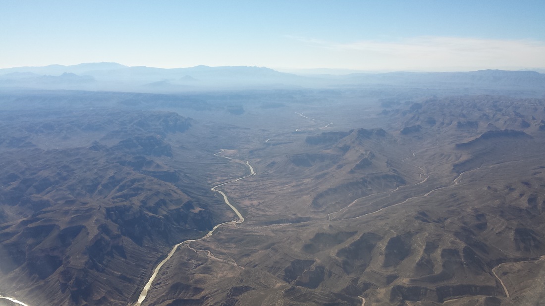 The U.S.-Mexico border, easily identified by the Rio Grande We then hugged the U.S-Mexico border before heading southwest, where we also lost contact with ATC controllers (Albuquerque Center), cancelled our IFR flight plan, and continued VFR. If you want to use navigation equipment in addition to piloting and good-ole dead reckoning to help you stay out of Mexican airspace, Terrell County Airport (6R6) is a good one to use. 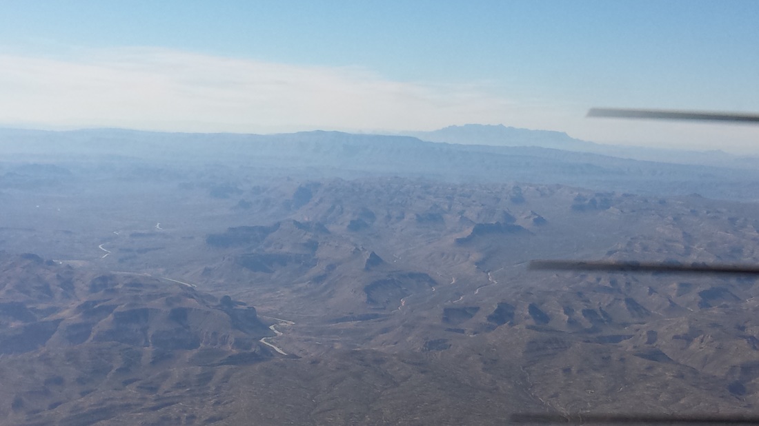 Getting closer to the Big Bend area and starting to see pretty mountainous terrain, including the Chisos Mountains. At this point, we started to discuss the risks of mountain flying, high terrain, high density altitude, etc. We soon started to see those remote, private, backcountry strips we had identified on the sectional as potential emergency landing fields. Some of those were dirt, gravel, or a combination of things. 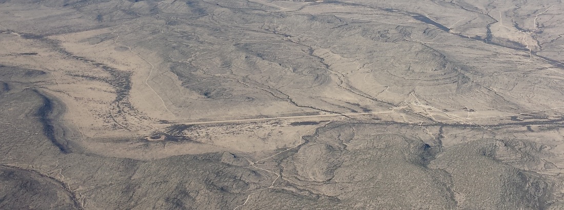 This one here is Stovall Ranch Nr 4 Airport (6TX9). 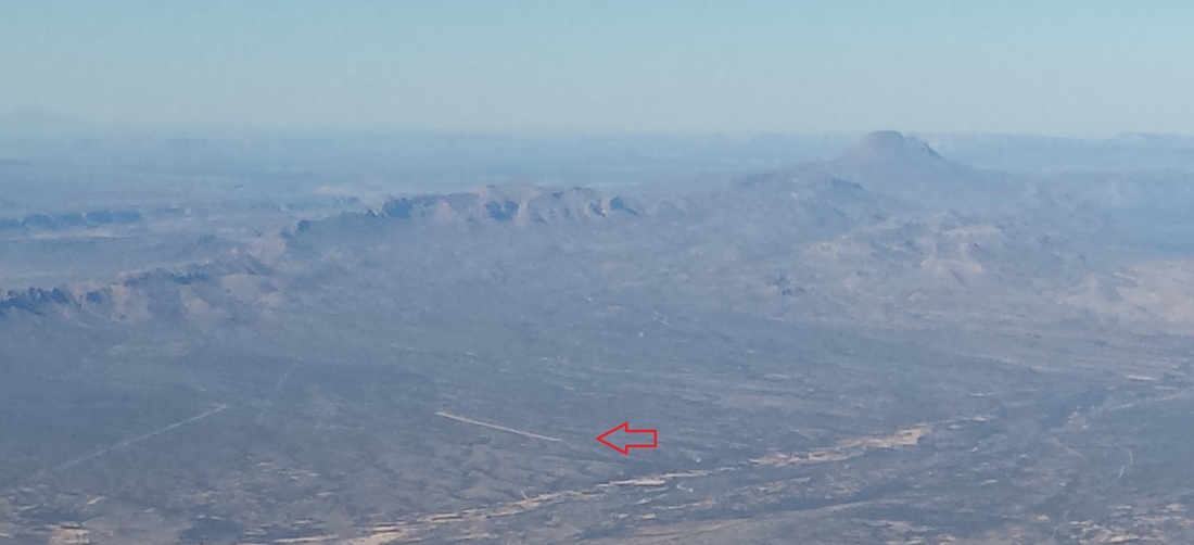 This is a picture of Persimmon Gap Ranch Airport (TA64) in the distance. Notice it is a bit uphill. 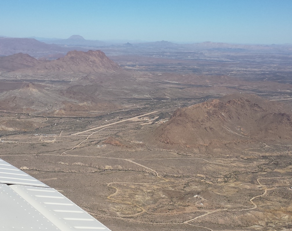 The picture above shows Terlingua Ranch Airport (1E2) although it is very far from the town of Terlingua itself. This looks like a fun and challenging place to fly in and out of. 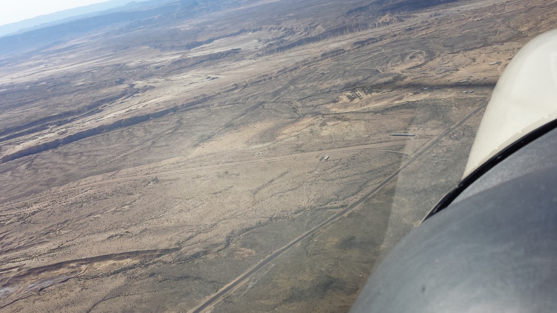 The dirt strip C. Fulcher Ranch Airport (3TE8) is in the picture above. Since we only stayed in the area one night given our busy schedules, we decided it was best for us to stay in Lajitas, located between the two parks. The Lajitas Golf and Spa Resort has its own private airport with fuel called Lajitas International Airport (89TE) and offers complementary transportation to and from the hotel and airport. They also have a few rental Jeeps for their customers. 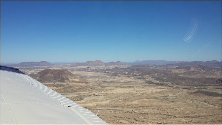 Crossing over the town of Terlingua, just east of Lajitas 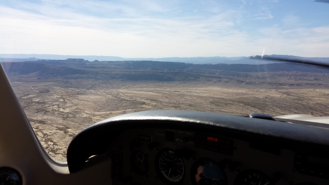 Entering left downwind for 7 at 89TE 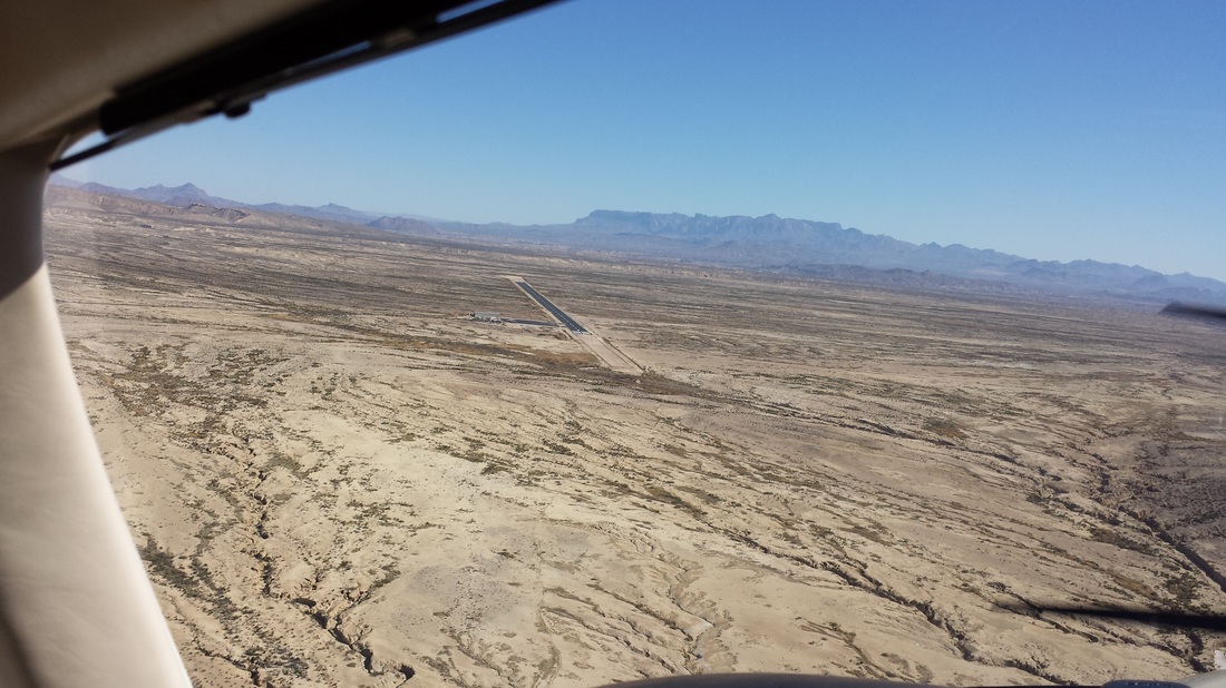 Turning final for runway 7, which was shortened recently (we initially thought it was being lengthened) We had a very pleasant experience at 89TE; Clayton Choate, the airport manager, was very nice and helpful. He can be reached at (432) 424-3544. However, if you enjoy camping, hiking, etc, Big Bend Ranch State Park Airport (3T9), which is less than 20 NM away, may be a better option for you. Joey and I love that kind of thing but this trip’s mission was more about flight training for us than tourism and adventure. The state owned airport also offers complementary transportation to and from their park and the airport but they do not have fuel onsite. Barrett Durst is the person in charge of 3T9 and he can be reached at (432) 358-4444, ext. 224. Both of these airports are “private use only” so pilots are required to call ahead and receive permission to land from the respective airport managers. During that time, they will advise you of operational procedures, frequencies, airport notams, fuel availability, etc. 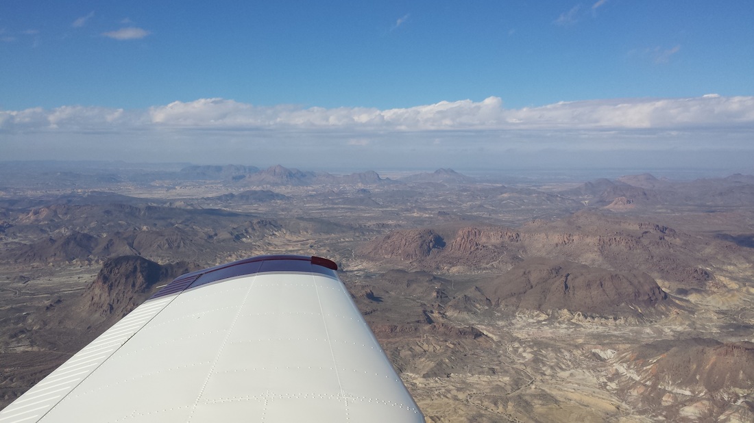 Our flight back was mostly overcast once we left the Big Bend area so we could not do too much aerial sightseeing. 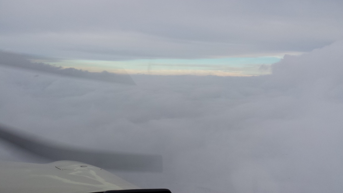 However, our scenery was still beautiful…
A lot of people, including native Texas and longtime Texas residents, have never been to Big Bend due to its remote location and inaccessibility and several pilots and AOPA members looking to do for some backcountry/mountain/recreational flying have asked me about this trip so I thought I’d write a blog about it. I encourage all of you to try it for yourself. If you are looking for other places to visit in different parts of Texas or the Central Southwest Region, the “friendly airports” blog I wrote about a year ago may also be helpful to you.
0 Comments
Leave a Reply. |
BLOGS ON THIS PAGE- Biking from Stinson Airport
- The Queen City of the Gulf - Galveston, TX - That Old Frio River - The Texas Air Trail - Visiting the Lone Star State! - Combining Flight Training with Tourism... a Trip to the Big Bend Area in Texas - Ox Hunting Ranch in the Texas Hill Country - The $100 Hamburger Run: A Plane Ride With the Works AuthorYasmina Platt. Archives
May 2022
Categories |
 RSS Feed
