|
(This blog was originally written on Oct 24, 2018) You may have noticed that the Beehive State, Utah, is pushing a strong tourism campaign. They have good reasons to. The state has sooo much to offer; they truly have something for everybody. And I really like their tag line – Life Elevated®. Everybody likes to be elevated when the word means “exalted, joyful.” Then, some of us (including you since you are reading this blog) like to feel elevated when the word has a physical meaning: “raised up, especially above the ground or above the normal level.” So, Life Elevated® to me means a “lifted life,” a life full of happiness, excitement, traveling, adventures, flying, etc. And I like the sound of all of that. My husband and I recently visited Southern Utah as part of a wonderful trip to celebrate our 10th wedding anniversary and we can attest that "Life Elevated®" does mean all of that I mentioned. Even though this was a ground based trip where we did a lot of hiking, canyoning, camping, biking, Jeeping, etc, I couldn’t resist and had to get airborne. After calling multiple instructors, I finally found one (Joey) with Aviation Services Group at the St George Regional Airport (KSGU) who squeezed me into his schedule to get a checkout in their C-172. St George is a good hub; it’s “a stone’s throw” from all kind of places and activities but one can be in the area for weeks and not see and do everything on the bucket list. So, one good way to cover a lot of ground in a short amount of time is to fly over it all! During our 1.8 hour flight, we saw all the towns around it, several state parks, multiple wilderness areas, other important (man-made and natural) features and, of course, the majestic Zion National Park (NP). We also landed at the Mesquite (67L) airport in addition to KSGU. 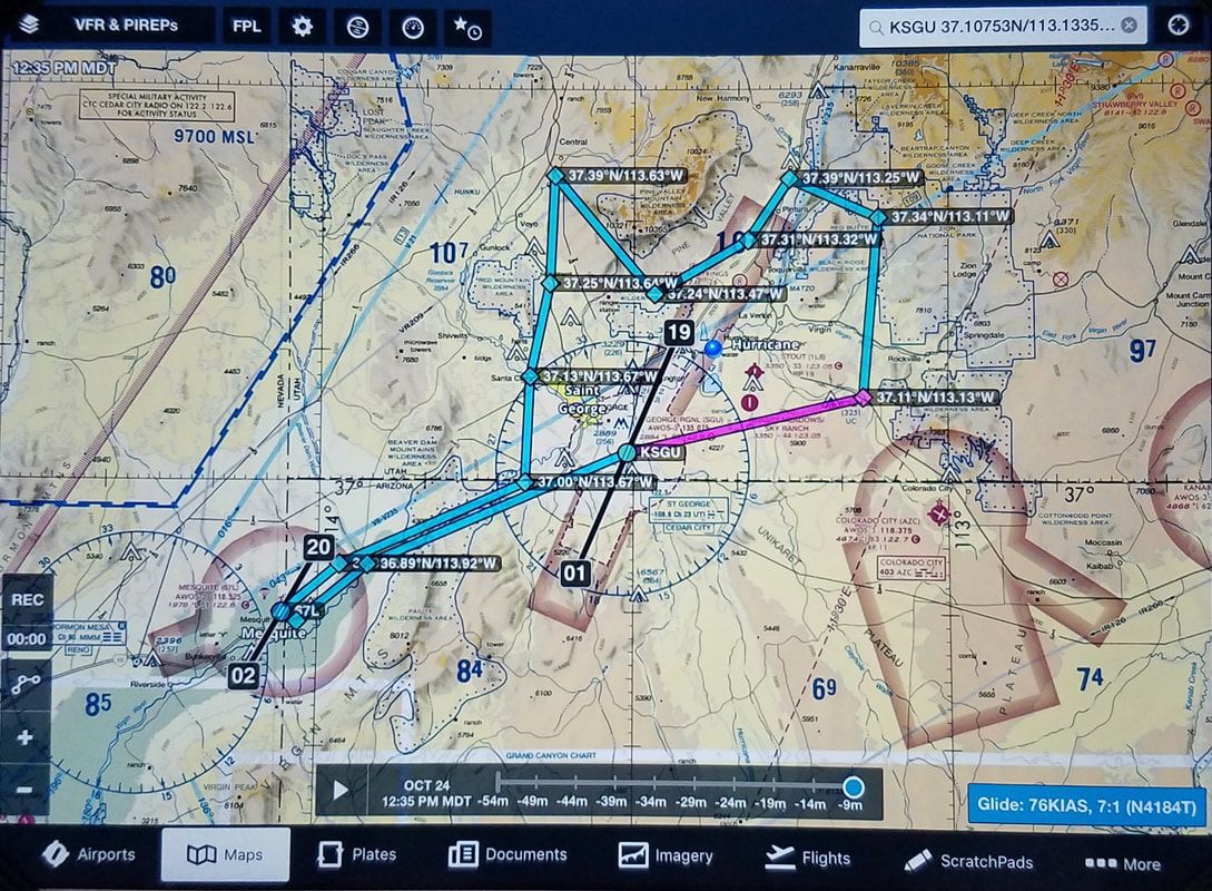 This is the approximate track we flew Source: ForeFlight A previous blog I wrote, Flying to National Parks (https://airtrails.weebly.com/other/flying-to-national-parks), shares with good tips for things to consider when flying over and around federal, protected land. The most basic is… fly at least 2,000 feet over as suggested by Advisory Circular 91-36D, VFR Flight Near Noise-Sensitive Areas (https://www.faa.gov/documentLibrary/media/Advisory_Circular/AC_91-36D.pdf).
Soon after departing KSGU, we could see Sand Hollow State Park (the area with the orange sand and lake on the second picture), a favorite for us to go Jeeping. 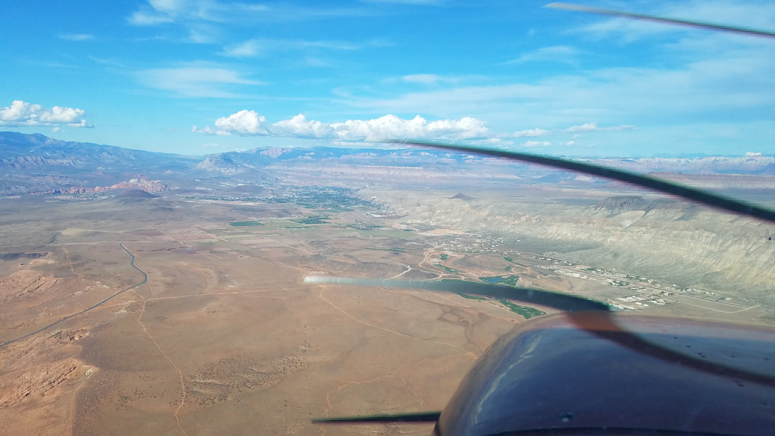 Can you spot private airstrip community Grassy Meadows/Sky Ranch (UT47) and Stout Airport (1L8) in Hurricane? We did not land at either but Joey told me Stout is a bit sporty with their higher elevation and shorter runway that has a higher middle section, making it impossible for pilots on one side of the runway to see the opposite end.
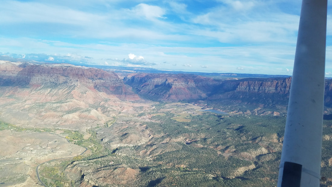
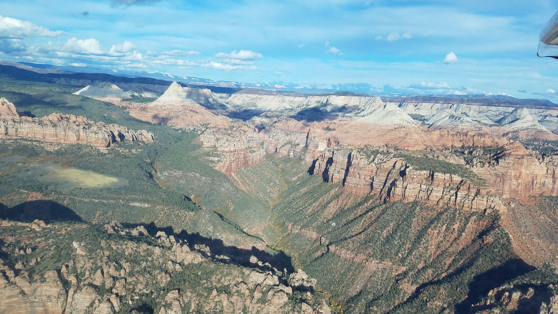
That road you see in both of these pictures is Highway 9, the Zion to Mt Carmel Highway 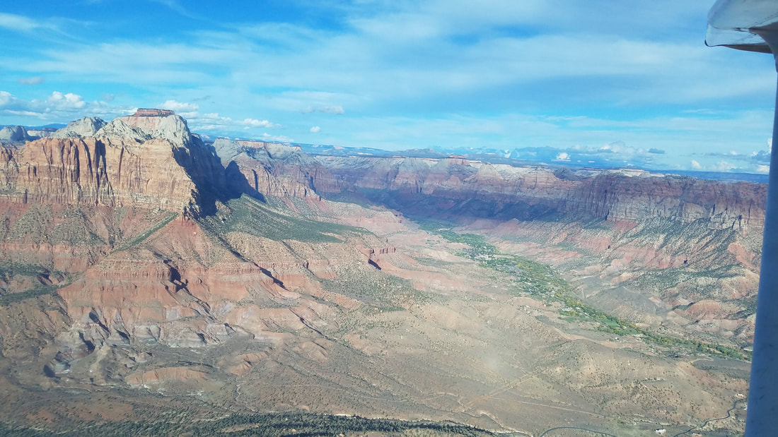 The beautiful town of Springdale in the green area with Zion surrounding it
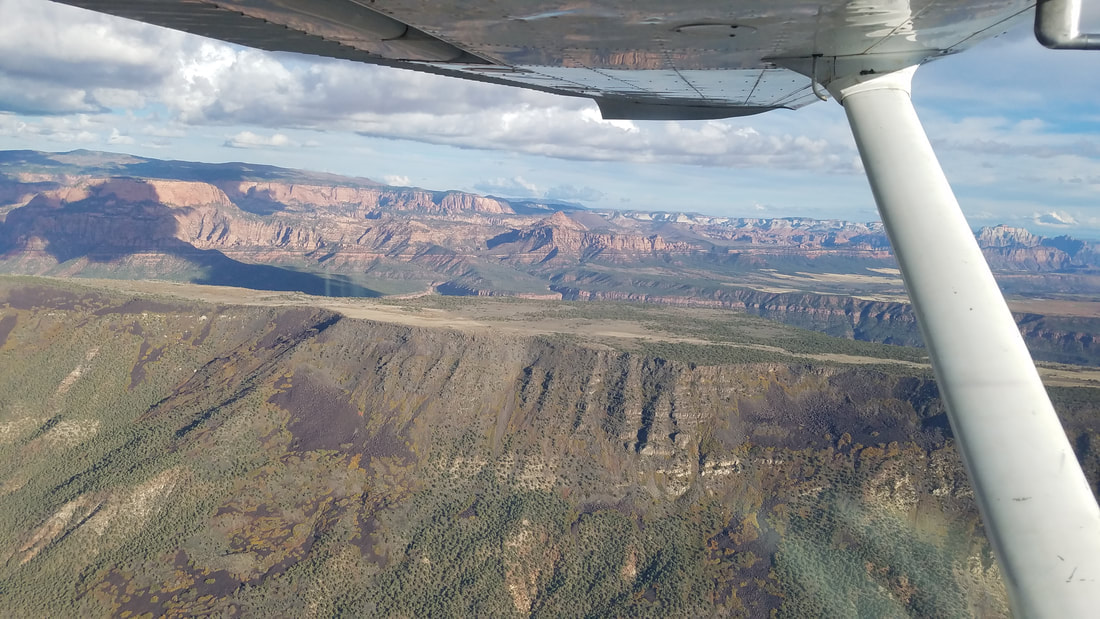
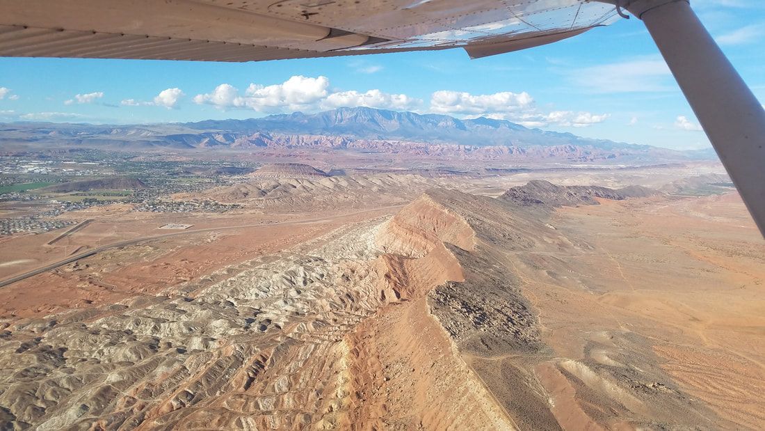
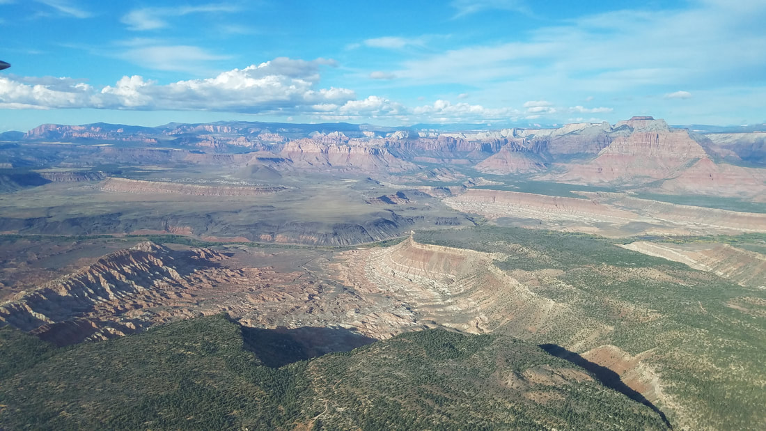
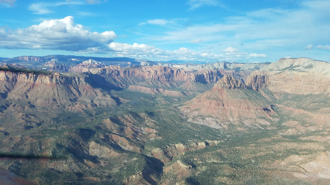
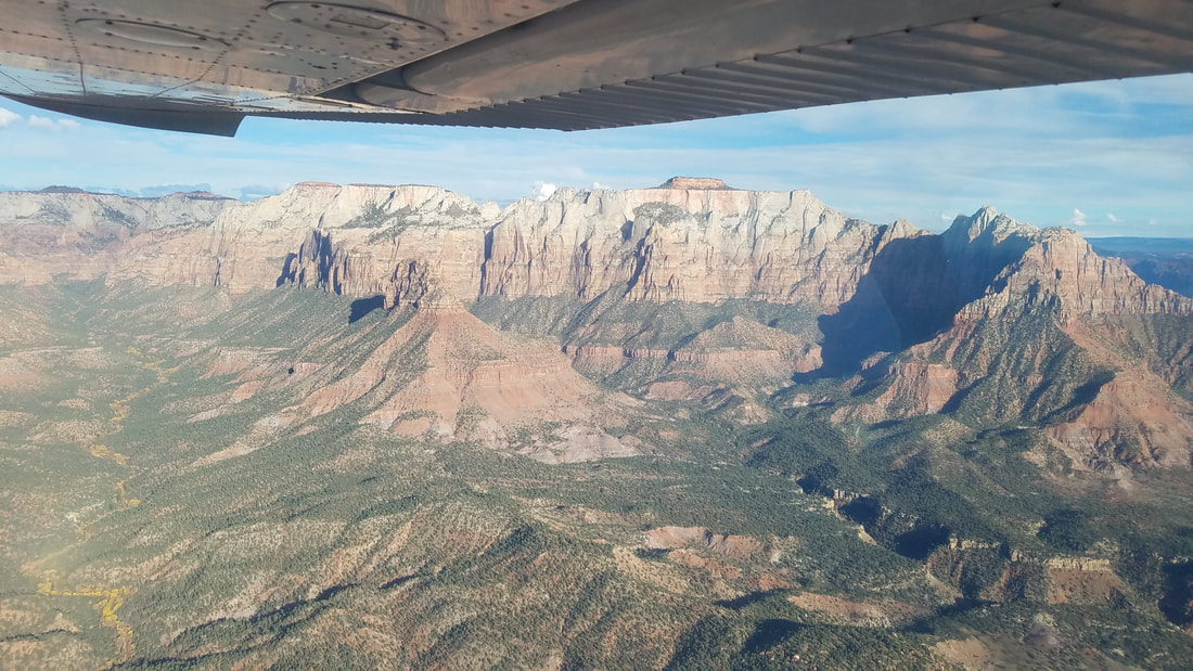
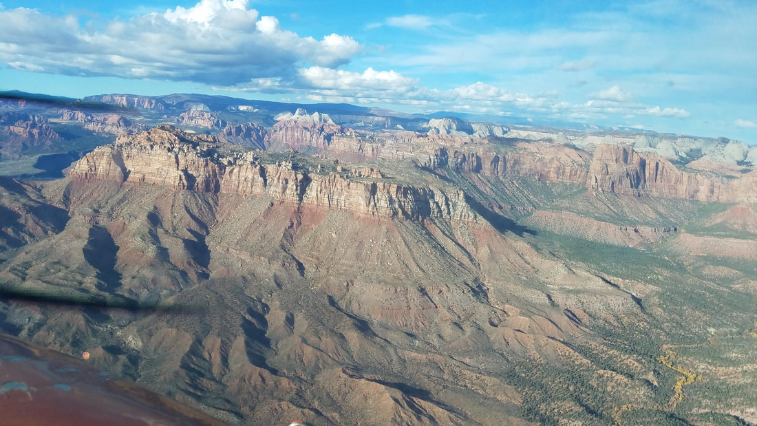
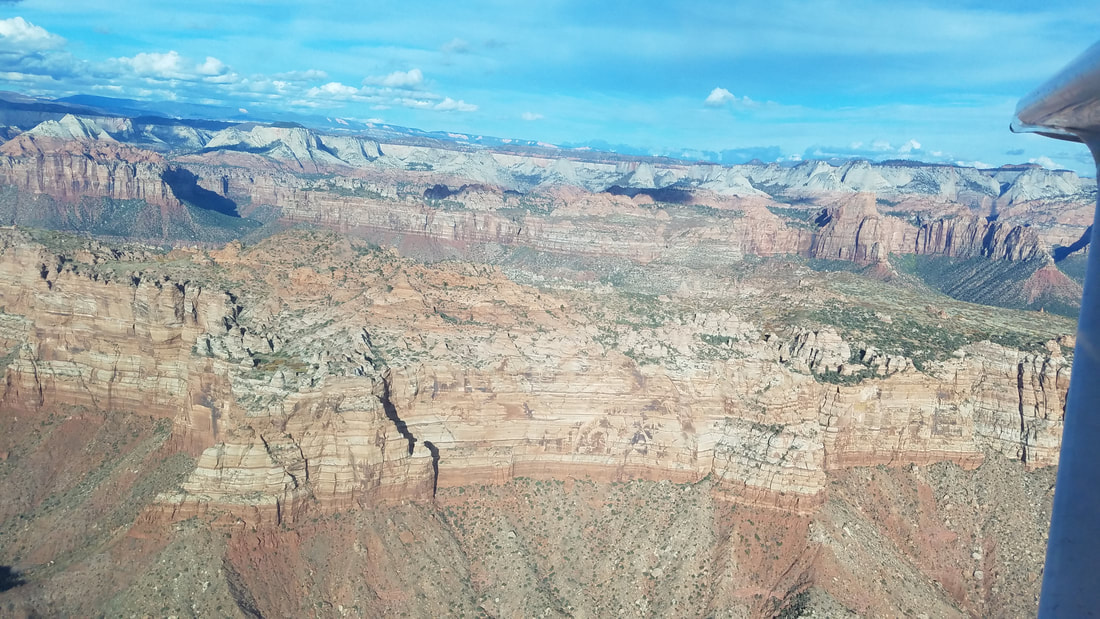
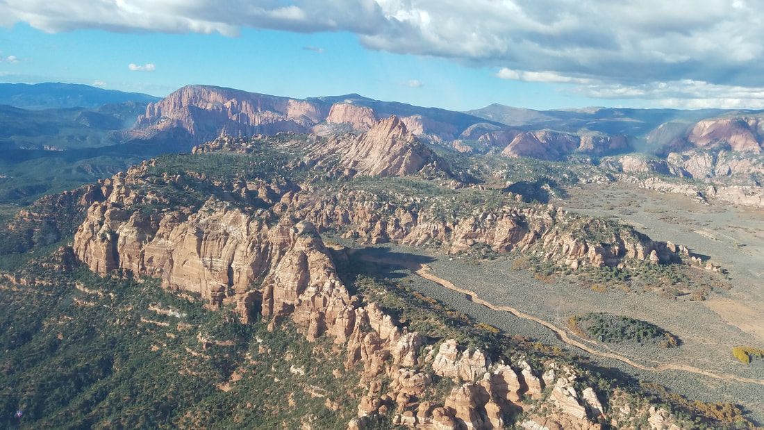
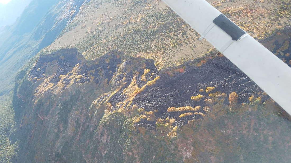
 All pictures of Zion (and little bit beyond) because, well, I just couldn't get enough of its beauty. The second to last picture almost looks like Bryce Canyon NP instead. 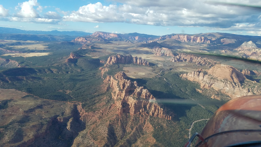 The second "pile" of canyons/rock structures is Lambs Knoll, a great area for climbing and canyoneering/canyoning (of which we took great advantage of). While it is not technically in NP land, it is in Bureau of Land Management (BLM) land, on Kolob Road.
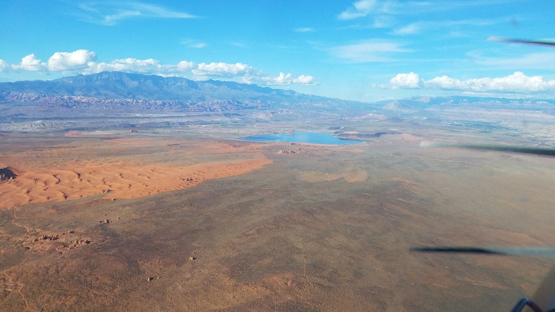
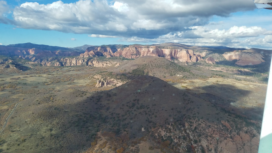
 Believe or not, those two "bumps" on the first picture are volcanoes. Thankfully, they are either dormant or extinct volcanoes. However, you can see dried up lava on the second and third pictures from the time when it was active. It is pretty impressive to see the lava amongst the rest of the landscape, especially with the pretty fall colors. 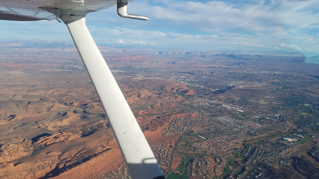 Here is a picture of St George as we were flying by Snow Canyon State Park. Unfortunately, we could not see much of this state park because the combination of the sunset and the terrain to the west kept the park mostly in the shade, making it hard to see. You may also spot two airports in this picture. Well, the first one (in a mesa) is the old, now closed airport. The one further out is KSGU. One has to be careful (and trust the instruments) when looking for the arrival airport to ensure a successful landing at the right airport. 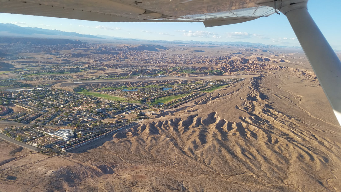 This is the gorgeous Mesquite (67L) airport, across the border in Nevada. The instructor wanted us to come here because it was a challenging airport but I did not find the challenge, just its beauty. 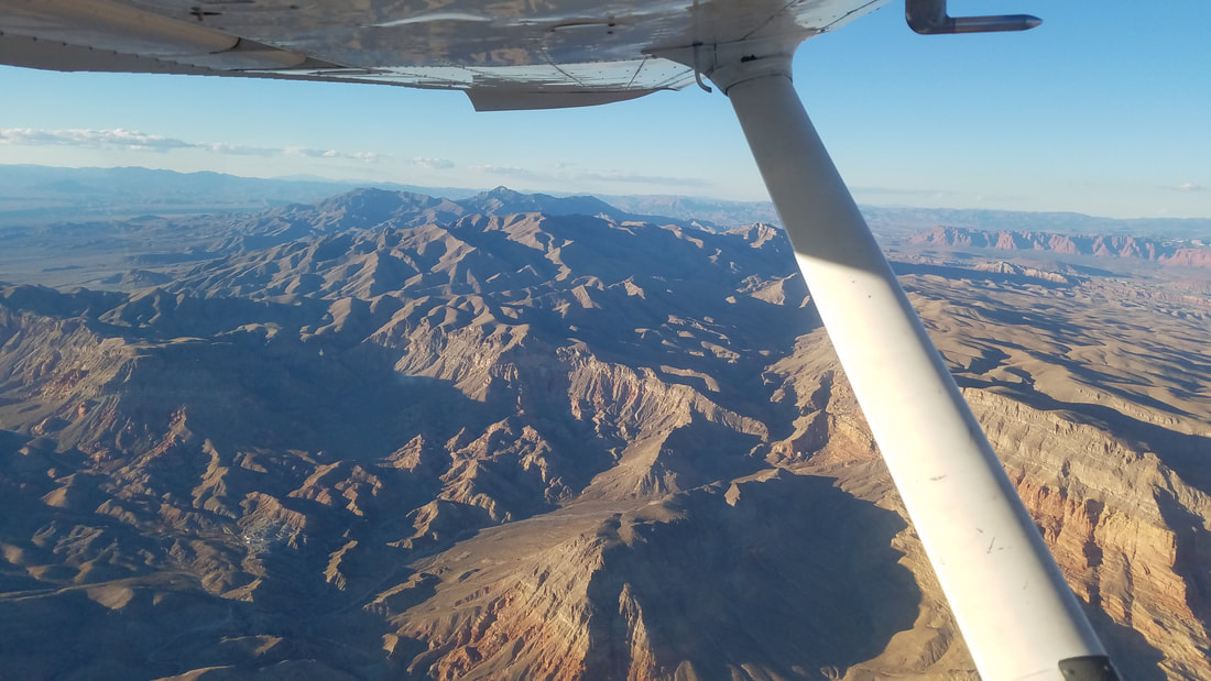 Now with the sun behind us, the sunset showcased some beautiful mountains on our return flight from Mesquite to St George 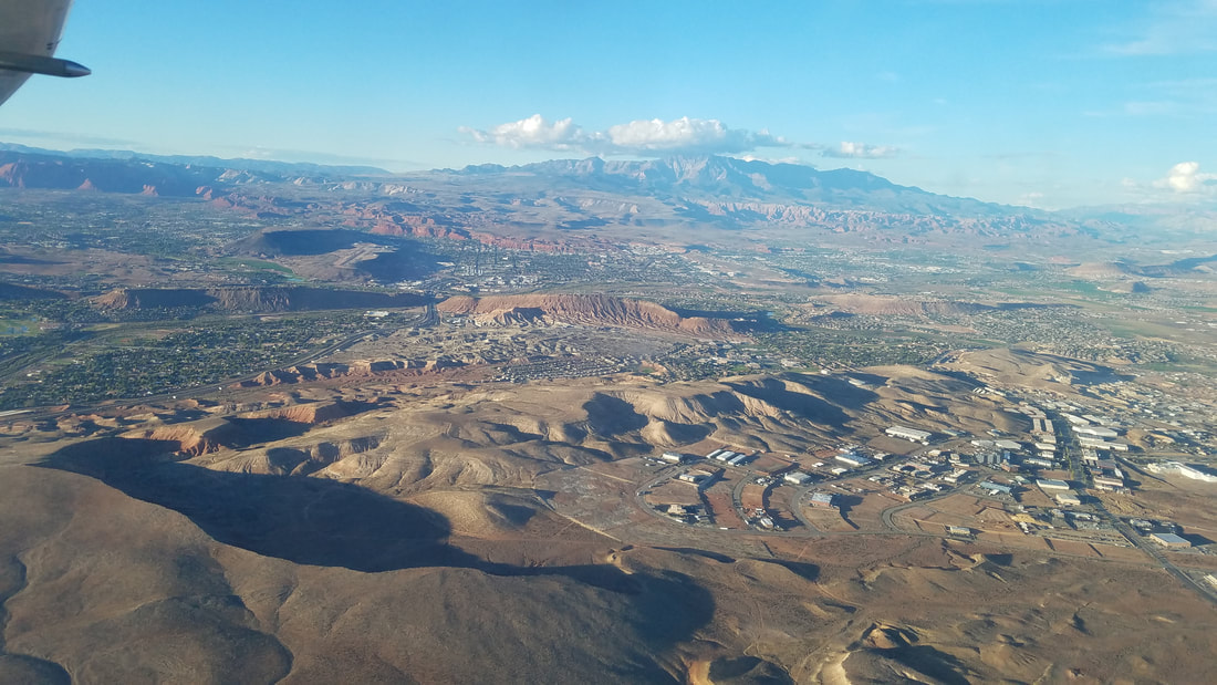 Here is another look at the town of St George (and its surrounding neighbors) and the old airport 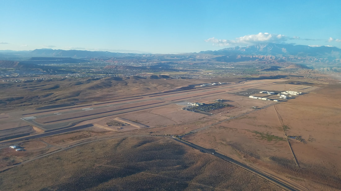 Turning left downwind for Runway 19, back at KSGU While at KSGU, one can visit the Western Sky Aviation Warbird Museum (http://www.westernskywarbirds.org/) as well, open Wednesday through Saturday, from 10 am to 4 pm.
Visit multiple airports and aviation museums in Utah, participate in the "Fly Utah" challenge, and earn prices (decals, hats, patches, and even a flight jacket!). Learn more at https://www.udot.utah.gov/main/f?p=100:pg:0:::1:T,V:5115. So, there, elevate your life, visit Utah! The tourism website, www.visitutah.com, has fantastic resources for non-flying related things.
0 Comments
Leave a Reply. |
BLOGS ON THIS PAGE
- Experience Moab 360
- Richfield - One of the Best Places to Paraglide in Utah - Be-Utah-Ful! Backcountry Flying in Utah - Different Aircraft for Different Missions, SLC Style - Life Elevated® - Not Just Utah's Tourism Tag Line AuthorYasmina Platt ArchivesCategories |
 RSS Feed
